Neatsville, Kentucky
| Neatsville | |
|---|---|
| Unincorporated community | |
 Neatsville Location within the state of Kentucky  Neatsville Neatsville (the US) | |
| Coordinates: 37°11′50″N 85°7′32″W / 37.19722°N 85.12556°WCoordinates: 37°11′50″N 85°7′32″W / 37.19722°N 85.12556°W | |
| Country | United States |
| State | Kentucky |
| County | Adair |
| Elevation | 705 ft (215 m) |
| Time zone | UTC-6 (Central (CST)) |
| • Summer (DST) | UTC-5 (CDT) |
| ZIP code | 42728 |
| GNIS feature ID | 508677 |
Neatsville is an unincorporated community in Adair County, Kentucky, United States. It is located at the junction of Kentucky Route 206 and Kentucky Route 76.[1] Its elevation is 705 feet (215 m).[2] For unknown reasons, the town's name was spelled as Neetsville from 1876 until 1886, when the town's post office closed.[2][3] In its earlier times from around the 1810s to 1900, Neatsville progressively grew to eventually become a well-established, incorporated town. It has been relocated twice through the years, once due to flooding circa 1900–1902, which decimated the town, and once in the 1960s when the Green River was impounded to make way for the Green River Reservoir.
History
Various sources and accounts have referred to Neatsville as a village, as a postal village, as a hamlet and as a town at different times of its history.[3][lower-alpha 1][5][6]
The community was settled in the early 1800s by the Neats, with Randolph Neat being the first to acquire land there.[1][3] As it expanded, the community grew through the years to have several stores, a hotel, a doctor's office, mills, a sawmill, distilleries, a saloon, a salt works, a cooper shop, a carding machine and a Masonic Lodge.[1][5][lower-alpha 2][6][8][9] It was incorporated as a town on February 23, 1847.[5] Its post office was established on March 13, 1844, and closed in 1886.[3] In 1848 the town's population was estimated to be around 50, and in 1876 the town's population was estimated at 60.[10][11] The Masonic Lodge was relocated to Pellyton in 1917.[5]
Neatsville has four cemeteries: Benjamin Evans Graveyard, Evans Cemetery, Tabernacle Cemetery (also known as Old Neatsville Cemetery) and Workman Cemetery.[12][13]
Relocations
Sometime circa 1900–1902, a significant flood decimated the town, which necessitated for it to be moved from the north bank to the south bank of the Green River, at which time the former location was abandoned.[3][5][8] Erosion had occurred in the foundations of the buildings in the former location due to the flooding.[8] A 1916 local account of the town's former site after the flooding characterized it as "nearly obliterated" and "in ruins".[9] Neatsville was later again relocated to its present location sometime in the 1960s, when the Green River was impounded to enable the creation of the Green River Reservoir.[3]
Notes
References
- 1 2 3 Allison, V.R. (1972). Methodist History of Adair County Kentucky: 1782-1969. Monroe County Press. p. 355. Retrieved September 22, 2018.
- 1 2 U.S. Geological Survey Geographic Names Information System: Neatsville, Kentucky
- 1 2 3 4 5 6 Rennick, R.M. (2013). Kentucky Place Names. University Press of Kentucky. p. 373. ISBN 978-0-8131-4401-6. Retrieved September 22, 2018.
- ↑ Dunkle, G.M.K.; Greenwald, M.W. (1997). Diary of George McKinney Dunkle: August 25, 1862 to November 29, 1864 : 112th Regiment Illinois Volunteers, Company D. M.T. Pub. p. 42. Retrieved September 22, 2018.
- 1 2 3 4 5 Grant, Susie (March 2, 2014). "Neatsville: Once bustling town was incorporated for a time". Columbia Magazine. Retrieved September 22, 2018.
- 1 2 Baldwin, T.; Thomas, J. (1854). A New and Complete Gazetteer of the United States: Giving a Full and Comprehensive Review of the Present Condition, Industry, and Resources of the American Confederacy ... 19th-century legal treatises. Lippincott, Grambo & Company. p. 763. Retrieved September 22, 2018.
- ↑ Kentucky. General Assembly. Senate (1867). Journal of the Senate of the Commonwealth of Kentucky. p. 151. Retrieved September 22, 2018.
- 1 2 3 Patton, P.W. (1990). A History of the Christian Churches in Adair County, Kentucky. P.W. Patton. p. 102. Retrieved September 22, 2018.
- 1 2 "Local Adair Co., KY history: Neatsville remembered". Columbia Magazine. October 18, 2010. Retrieved September 22, 2018.
- ↑ Collins, L. (1848). Historical Sketches of Kentucky. L. Collins. p. 165. Retrieved September 22, 2018.
- ↑ R.L. Polk & Co (1876). Kentucky State Gazetteer and Business Directory. R.L. Polk & Company. p. 409. Retrieved September 22, 2018.
- ↑ "Cemeteries in Neatsville, Kentucky". Find A Grave. Retrieved September 22, 2018.
- ↑ "Tabernacle Cemetery in Neatsville, Kentucky". Find A Grave Cemetery. May 12, 2005. Retrieved September 22, 2018.
Municipalities and communities of Adair County, Kentucky, United States | ||
|---|---|---|
| City | 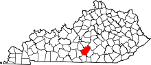 | |
| Unincorporated communities |
| |
| Footnotes | ‡This populated place also has portions in an adjacent county or counties. | |