Gentrys Mill, Kentucky
| Gentrys Mill | |
|---|---|
| Unincorporated community | |
 Gentrys Mill Location within the state of Kentucky  Gentrys Mill Gentrys Mill (the US) | |
| Coordinates: 37°5′5″N 85°9′13″W / 37.08472°N 85.15361°WCoordinates: 37°5′5″N 85°9′13″W / 37.08472°N 85.15361°W | |
| Country | United States |
| State | Kentucky |
| County | Adair |
| Elevation | 863 ft (263 m) |
| Time zone | UTC-6 (Central (CST)) |
| • Summer (DST) | UTC-5 (CDT) |
| GNIS feature ID | 508079 |
Gentrys Mill is an unincorporated community in Adair County, Kentucky, United States. Its elevation is 863 feet (263 m).[1]
References
Municipalities and communities of Adair County, Kentucky, United States | ||
|---|---|---|
| City | 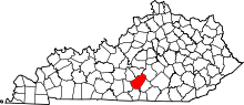 | |
| Unincorporated communities |
| |
| Footnotes | ‡This populated place also has portions in an adjacent county or counties. | |
This article is issued from
Wikipedia.
The text is licensed under Creative Commons - Attribution - Sharealike.
Additional terms may apply for the media files.