Crocus, Kentucky
| Crocus | |
|---|---|
| Unincorporated community | |
 Crocus Location within the state of Kentucky  Crocus Crocus (the US) | |
| Coordinates: 36°58′50″N 85°12′39″W / 36.98056°N 85.21083°WCoordinates: 36°58′50″N 85°12′39″W / 36.98056°N 85.21083°W | |
| Country | United States |
| State | Kentucky |
| County | Adair and Russell |
| Elevation | 988 ft (301 m) |
| Time zone | UTC-6 (Central (CST)) |
| • Summer (DST) | UTC-5 (CDT) |
| GNIS feature ID | 507785 |
Crocus is an unincorporated community in Adair and Russell counties in the U.S. state of Kentucky. Its elevation is 988 feet (301 m).[1]
The community, first established in 1840, possibly received its name from the wild crocuses growing along the nearby creek.[2]
References
- ↑ U.S. Geological Survey Geographic Names Information System: Crocus, Kentucky
- ↑ Rennick, Robert M. (1987). Kentucky Place Names. University Press of Kentucky. p. 73. Retrieved 2013-04-28.
Municipalities and communities of Adair County, Kentucky, United States | ||
|---|---|---|
| City | 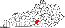 | |
| Unincorporated communities |
| |
| Footnotes | ‡This populated place also has portions in an adjacent county or counties. | |
Municipalities and communities of Russell County, Kentucky, United States | ||
|---|---|---|
| Cities | 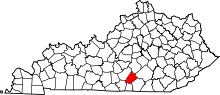 | |
| Unincorporated communities | ||
| Ghost town | ||
| Footnotes |
| |
This article is issued from
Wikipedia.
The text is licensed under Creative Commons - Attribution - Sharealike.
Additional terms may apply for the media files.