Neal, Kansas
| Neal, Kansas | |
|---|---|
| Unincorporated community | |
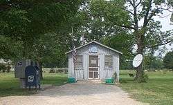 Post Office in Neal, 2012 | |
 Neal, Kansas Location within the state of Kansas  Neal, Kansas Neal, Kansas (the US) | |
| Coordinates: 37°50′3″N 96°4′49″W / 37.83417°N 96.08028°WCoordinates: 37°50′3″N 96°4′49″W / 37.83417°N 96.08028°W | |
| Country | United States |
| State | Kansas |
| County | Greenwood |
| Time zone | UTC-6 (Central (CST)) |
| • Summer (DST) | UTC-5 (CDT) |
| ZIP codes | 66863 |
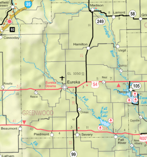
Map of Greenwood County from KDOT (map legend)
Neal is an unincorporated community in eastern Greenwood County, Kansas, United States. It lies along U.S. Route 54 east of the city of Eureka, the county seat of Greenwood County.[1] Its elevation is 961 feet (293 m), and it is located at 37°50′3″N 96°4′49″W / 37.83417°N 96.08028°W (37.8341990, -96.0802724).[2] Although Neal is unincorporated, it has a post office, with the ZIP code of 66863.[3] The first post office in Neal was established in 1882.[4]
Neal was named for a minor official of the Missouri Pacific Railroad.[5]
References
- ↑ Rand McNally. The Road Atlas '08. Chicago: Rand McNally, 2008, p. 41.
- ↑ Geographic Names Information System Feature Detail Report, Geographic Names Information System, 1978-10-13. Accessed 2008-04-28.
- ↑ Zip Code Lookup
- ↑ "Kansas Post Offices, 1828-1961 (archive)". Kansas Historical Society. Archived from the original on October 9, 2013. Retrieved 10 June 2014.
- ↑ Kansas Place-Names, John Rydjord, University of Oklahoma Press, 1972, p. 460 ISBN 0-8061-0994-7
Municipalities and communities of Greenwood County, Kansas, United States | ||
|---|---|---|
| Cities | 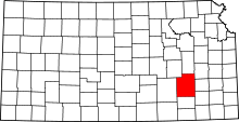 | |
| Unincorporated communities | ||
| Ghost towns | ||
| Townships | ||
This article is issued from
Wikipedia.
The text is licensed under Creative Commons - Attribution - Sharealike.
Additional terms may apply for the media files.