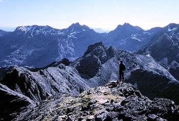
National scenic area (Scotland)

A national scenic area (NSA) is a conservation designation used in Scotland, and administered by Scottish Natural Heritage. The designation’s purpose is to identify areas of exceptional scenery and to ensure its protection from inappropriate development. There are currently 40 national scenic areas (NSAs) in Scotland, covering 13% of the land area of Scotland.[1] The areas protected by the designation are considered to represent the type of scenic beauty "popularly associated with Scotland and for which it is renowned".[2] As such they tend to be mainly found in the remote, mountainous areas of Scotland,[1] with an SNH review in 1997 noting a potential weakness of national scenic areas was that the original selection placed undue emphasis on the mountainous parts of Scotland.[3] National scenic areas do however also cover seascapes, with approximately 26% of the total area protected by the designation being marine.[4]
National scenic areas are designated by the IUCN as Category V Protected Landscapes, the same international category as Scotland's two national parks.[1] Within the United Kingdom the NSA designation is regarded as being equivalent to the Areas of Outstanding Natural Beauty (AONBs) of England and Wales.[1]
The designation is primarily concerned with scenic qualities, although areas designated as a national scenic area may well have other special qualities, for example related to culture, history, archaeology, geology or wildlife. Areas with such qualities may be protected via other designations (e.g. national nature reserve) that overlap with the NSA designation.[5]
History
Following the Second World War, the Labour government passed the National Parks and Access to the Countryside Act 1949, which led to the creation of ten national parks in England and Wales between 1951 and 1957, although no parks were created in Scotland. A committee, chaired by Sir Douglas Ramsay, was however established to consider preservation of the landscape in Scotland. The report, published in 1945 proposed that five areas (Loch Lomond & the Trossachs, the Cairngorms, Glen Coe-Ben Nevis-Black Mount, Wester Ross and Glen Strathfarrar-Glen Affric-Glen Cannich) should be receive a level of protection.[6] Accordingly, the government designated these areas as "national park direction areas", giving powers for planning decisions taken by local authorities to be reviewed by central government. Following a further review of landscape protection in 1978, additional areas were identified for protection, and in 1981 the direction areas were replaced by the national scenic area designation, which were based on the 1978 recommendations.[3]
SNH reviewed the national scenic areas between November 2007 and March 2009 in an attempt to identify the qualities that makes the scenery of each NSA so special,[5] however no formal review into the number and extent has been undertaken since the original report. The current national scenic areas, which therefore remain as originally mapped in 1978, were redesignated under legislation in 2010.[7] Despite calls from bodies such as the John Muir Trust[8] for the protection to be extended to other areas to protect landscape and support tourism the Scottish Government has stated that it has no plans to designate further areas, although in September 2017 the Scottish Parliament’s Public Petitions Committee asked the government to explain why it is not reviewing the NSAs.[8]
Operation

There is no equivalent to a national park authority for national scenic areas, rather it is a designation to provide an additional level of protection to specified areas. For developments that would ordinarily require only local authority planning permission the Scottish Government must be informed if advice from Scottish Natural Heritage is ignored.[9] Additionally, there are some classes of development that would not normally require planning permission to proceed when located outwith a national scenic area, but which are subject to controls within them. These developments include the erection of agricultural and forestry buildings over 12 m high, the construction of vehicle tracks for agriculture or forestry purposes (unless forming part of an approved scheme), and local authority roadworks outside present road boundaries costing more than £100,000.[9]
Local authorities can produce a management strategy for each of the NSA within its territory. This strategy defines the area's special qualities and identifies the actions needed to safeguard them. As of 2018, only the three national scenic areas within Dumfries and Galloway have current management strategies .[10]
Public acccess to all land in Scotland is governed by the Land Reform (Scotland) Act 2003, which grants the public a right of responsible access to most land (and water) for activities such as walking, camping, cycling, canoeing, swimming and climbing; this right applies to land regardless of ownership or whether or not it is in a designated or protected area such as an NSA, providing it is exercised responsibly (as defined by the Scottish Outdoor Access Code).[11]
List of national scenic areas
There are forty national scenic areas at present.[12]
|
See also
References
- 1 2 3 4 "National Scenic Areas". Scottish Natural Heritage. Retrieved 2018-01-17.
- ↑ "Countryside and Landscape in Scotland - National Scenic Areas". Scottish Government. 2017-07-04. Retrieved 2018-01-31.
- 1 2 "National Scenic Areas Review" (PDF). SNH. 1997. Retrieved 2018-02-05.
- 1 2 3 4 5 "National Scenic Areas - Maps". SNH. 2010-12-20. Retrieved 2018-01-24.
- 1 2 "The special qualities of the National Scenic Areas" (PDF). Scottish Natural Heritage. 2010. Retrieved 2018-01-24.
- ↑ "History Leading to the Cairngorms National Park". Cairngorms National Park Authority. Retrieved 2018-01-15.
- ↑ "National Scenic Areas: background, guidance and policy". SNH. Retrieved 2018-01-31.
- 1 2 "National Scenic Areas debated in Scottish Parliament". John Muir Trust. 2017-09-21. Retrieved 2018-01-30.
- 1 2 "Development management and National Scenic Areas". SNH. 2017. Retrieved 2018-01-23.
- ↑ "National Scenic Areas (NSAs)". Dumfries and Galloway council. 2017-12-08. Retrieved 2018-01-24.
- ↑ "Scottish Outdoor Access Code" (PDF). Scottish Natural Heritage. 2005. Retrieved 2018-01-16.
- ↑ "National Scenic Areas Scotland's finest landscapes" (PDF). SNH. December 2010. Retrieved 2018-01-21.