National Register of Historic Places listings in Shawnee County, Kansas
Location of Shawnee County in Kansas
This is a list of the National Register of Historic Places listings in Shawnee County, Kansas.
This is intended to be a complete list of the properties and districts on the National Register of Historic Places in Shawnee County, Kansas, United States. The locations of National Register properties and districts for which the latitude and longitude coordinates are included below, may be seen in a map.[1]
There are 83 properties and districts listed on the National Register in the county, including 1 National Historic Landmark. Another property was once listed but has been removed.
- This National Park Service list is complete through NPS recent listings posted October 4, 2018.[2]
Current listings
| [3] | Name on the Register[4] | Image | Date listed[5] | Location | City or town | Description |
|---|---|---|---|---|---|---|
| 1 | Morton Albaugh House | 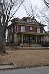 |
April 28, 2004 (#04000366) |
1331 SW. Harrison St. 39°02′31″N 95°40′53″W / 39.041944°N 95.681389°W |
Topeka | |
| 2 | Solomon A. Alt House | 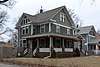 |
March 23, 2005 (#05000202) |
1335 SW. College Ave. 39°02′34″N 95°42′01″W / 39.042778°N 95.700278°W |
Topeka | |
| 3 | Anton-Woodring House | August 23, 1991 (#91001088) |
1011 Cambridge Ave. 39°03′03″N 95°43′27″W / 39.050833°N 95.724167°W |
Topeka | ||
| 4 | ATSF Motive Power Building | 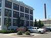 |
January 20, 2012 (#11001034) |
1001 NE Atchison Ave. 39°03′23″N 95°39′27″W / 39.056297°N 95.657536°W |
Topeka | |
| 5 | Blacksmith Creek Bridge | 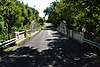 |
March 10, 1983 (#83000441) |
West of Topeka 39°03′03″N 95°50′37″W / 39.050712°N 95.843581°W |
Topeka | |
| 6 | Bowker House | 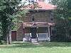 |
March 15, 2007 (#07000139) |
1200 SE. Quincy 39°02′33″N 95°40′30″W / 39.0425°N 95.675°W |
Topeka | |
| 7 | Brown v. Board of Education National Historic Site | October 26, 1992 (#01000156) |
424 S. Kansas Ave. Suite 220 39°03′15″N 95°40′20″W / 39.054183°N 95.672222°W |
Topeka | ||
| 8 | Casson Building | 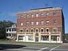 |
September 14, 2018 (#100002972) |
603 SW Topeka Blvd. 39°03′11″N 95°40′45″W / 39.0530°N 95.6792°W |
Topeka | |
| 9 | Cedar Crest | 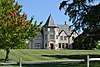 |
May 6, 1982 (#82002672) |
Cedar Crest Rd. 39°03′56″N 95°44′44″W / 39.065556°N 95.745556°W |
Topeka | |
| 10 | Central Motor and Finance Corporation Building | 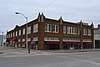 |
February 19, 1982 (#82002673) |
222 W. 7th St. 39°03′02″N 95°40′23″W / 39.050556°N 95.673056°W |
Topeka | |
| 11 | Central National Bank | 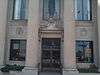 |
July 19, 1976 (#76000841) |
701-703 Kansas Ave. 39°03′00″N 95°40′26″W / 39.05°N 95.673889°W |
Topeka | Contributing site of the South Kansas Avenue Commercial Historic District. |
| 12 | Church of the Assumption and Rectory | 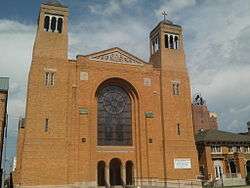 |
July 2, 2008 (#08000607) |
204 SW. 8th St. 39°02′57″N 95°40′34″W / 39.049167°N 95.676111°W |
Topeka | |
| 13 | Church of the Assumption Historic District | July 7, 2015 (#15000384) |
204 and 212 SW. 8th Ave. and 735 Jackson St. 39°03′00″N 95°40′34″W / 39.050000°N 95.676111°W |
Topeka | ||
| 14 | Church of the Holy Name | 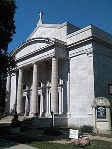 |
January 20, 2012 (#11001035) |
1110 SW 10th Ave. 39°02′59″N 95°41′25″W / 39.049769°N 95.690414°W |
Topeka | |
| 15 | College Avenue Historic District |  |
April 18, 2007 (#07000321) |
College Ave. between Huntoon St. and 17th St. 39°02′26″N 95°42′01″W / 39.040519°N 95.700375°W |
Topeka | |
| 16 | Columbian Building | 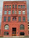 |
September 5, 1975 (#75000722) |
112-114 W. 6th St. 39°03′08″N 95°40′26″W / 39.052222°N 95.673889°W |
Topeka | |
| 17 | Constitution Hall-Topeka | 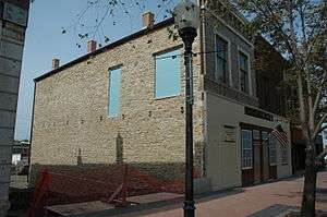 |
July 15, 2008 (#08000669) |
429 S. Kansas Ave. 39°03′15″N 95°40′20″W / 39.054167°N 95.672222°W |
Topeka | |
| 18 | Crawford Building | 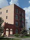 |
August 22, 1975 (#75000723) |
501 Jackson St. 39°03′12″N 95°40′26″W / 39.053333°N 95.673889°W |
Topeka | |
| 19 | Nelson Antrim Crawford House |  |
October 4, 2017 (#100001707) |
2202 SW. 17th St. 39°02′13″N 95°42′18″W / 39.036968°N 95.70512°W |
Topeka | |
| 20 | William T. and Delora Crosby House |  |
October 6, 2011 (#11000729) |
1109 SW Topeka Blvd. 39°02′45″N 95°40′58″W / 39.045833°N 95.682778°W |
Topeka | |
| 21 | Curtis Junior High School |  |
October 22, 2001 (#01001126) |
316 NW. Grant St. 39°04′26″N 95°40′00″W / 39.073810°N 95.666583°W |
Topeka | |
| 22 | Charles Curtis House |  |
January 25, 1973 (#73000778) |
1101 Topeka Ave. 39°02′45″N 95°40′55″W / 39.045833°N 95.681944°W |
Topeka | |
| 23 | Davies Building | 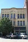 |
September 15, 1977 (#77000597) |
725-727 Kansas Ave. 39°02′58″N 95°40′27″W / 39.049444°N 95.674167°W |
Topeka | Contributing site of the South Kansas Avenue Commercial Historic District. |
| 24 | Devon Apartments | 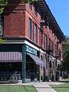 |
June 27, 2002 (#02000683) |
800-808 W. 12th St. 39°02′46″N 95°41′11″W / 39.046111°N 95.686389°W |
Topeka | |
| 25 | Dillon House |  |
December 27, 2006 (#06001171) |
404 W. 9th St. 39°02′55″N 95°40′46″W / 39.048611°N 95.679444°W |
Topeka | |
| 26 | East Topeka Junior High School | 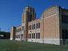 |
January 14, 2004 (#03001397) |
1210 E. 8th St. 39°02′42″N 95°39′36″W / 39.045°N 95.66°W |
Topeka | |
| 27 | England Farm | 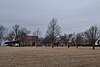 |
May 7, 1982 (#82002674) |
4619 SE. 37th St. 38°59′58″N 95°35′27″W / 38.999444°N 95.590833°W |
Topeka | |
| 28 | Fire Station No. 2-Topeka | 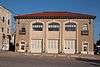 |
July 3, 2002 (#02000715) |
719-723 Van Buren 39°03′07″N 95°40′35″W / 39.051944°N 95.676389°W |
Topeka | |
| 29 | Gem Building | 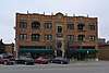 |
November 1, 2006 (#06000964) |
506-510 SW. 10th Ave. 39°02′58″N 95°40′54″W / 39.049444°N 95.681667°W |
Topeka | |
| 30 | Giles-Nellis House | 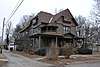 |
April 28, 1992 (#92000432) |
915 SW. Munson 39°02′50″N 95°41′15″W / 39.047222°N 95.6875°W |
Topeka | Contributing site for the Holliday Park Historic District I. |
| 31 | Gordon Building | 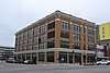 |
October 20, 2010 (#10000846) |
900, 902, and 904 S. Kansas Ave. 39°02′49″N 95°40′30″W / 39.047°N 95.675°W |
Topeka | Turn-of-the-20th-century classical revival furniture warehouse significant in Topeka's commercial history[6]. Contributing site of the South Kansas Avenue Commercial Historic District. |
| 32 | Hard Chief's Village | June 22, 2007 (#07000610) |
Southern side of the Kansas River, west of its confluence with Mission Creek[7] 39°04′24″N 95°51′40″W / 39.073333°N 95.861°W |
Silver Lake | ||
| 33 | John C. Harmon House | 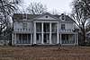 |
January 20, 2012 (#11001036) |
915 SW Buchanan 39°03′04″N 95°41′30″W / 39.051181°N 95.691764°W |
Topeka | |
| 34 | Hicks Block | 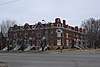 |
November 9, 1977 (#77000598) |
600 W. 6th Ave. 39°03′14″N 95°40′48″W / 39.053889°N 95.68°W |
Topeka | |
| 35 | Holliday Park Historic District I |  |
November 17, 2002 (#02001308) |
Roughly bounded by 10th Ave. and Taylor, Polk, Huntoon, Clay and Fillmore Sts. 39°02′45″N 95°41′12″W / 39.045917°N 95.686558°W |
Topeka | |
| 36 | Holliday Park Historic District II | 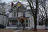 |
November 15, 2002 (#02001309) |
1009, 1015, 1019,1021,1025, 1031, 1035 SW Fillmore St. 39°02′55″N 95°41′20″W / 39.048547°N 95.688992°W |
Topeka | |
| 37 | Hopkins House | 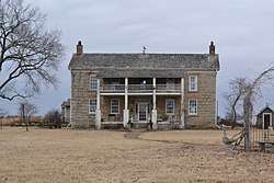 |
January 16, 2009 (#08001353) |
6033 SE. U.S. Route 40 39°02′39″N 95°33′23″W / 39.044167°N 95.556389°W |
Tecumseh | |
| 38 | Hughes Conoco Service Station | 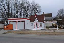 |
July 5, 2011 (#11000411) |
400 SW. Taylor St. 39°03′25″N 95°40′54″W / 39.056944°N 95.681667°W |
Topeka | |
| 39 | Jayhawk Hotel, Theater and Walk |  |
March 11, 1982 (#82002675) |
700 Jackson Ave. 39°03′01″N 95°40′29″W / 39.050278°N 95.674722°W |
Topeka | Contributing site of the South Kansas Avenue Commercial Historic District. |
| 40 | Kansas State Capitol | 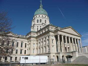 |
September 3, 1971 (#71000330) |
Bounded by 8th and 10th Aves. and Jackson and Harrison Sts. 39°02′54″N 95°40′39″W / 39.048333°N 95.6775°W |
Topeka | |
| 41 | Fred and Cora Luttjohann House | 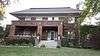 |
February 20, 2004 (#03001384) |
2053 S. Kansas Ave. 39°01′53″N 95°40′45″W / 39.031444°N 95.679278°W |
Topeka | |
| 42 | Horace G. Lyons House | 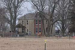 |
August 1, 1984 (#84001241) |
4831 SE. 61st St. 38°57′21″N 95°35′02″W / 38.955833°N 95.583889°W |
Berryton | |
| 43 | Masonic Grand Lodge Building | 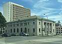 |
October 8, 2014 (#14000833) |
320 SW. 8th Ave. 39°03′00″N 95°40′42″W / 39.0501°N 95.6784°W |
Topeka | |
| 44 | McCauley Bridge | 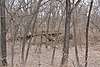 |
July 2, 1985 (#85001427) |
0.5 miles south of Auburn 38°53′49″N 95°48′53″W / 38.896944°N 95.814722°W |
Auburn | |
| 45 | Memorial Building | 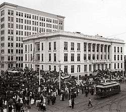 |
July 17, 1975 (#75000724) |
120 W. 10th Ave. 39°02′47″N 95°40′34″W / 39.046389°N 95.676111°W |
Topeka | Contributing site of the South Kansas Avenue Commercial Historic District. |
| 46 | Menninger Clinic Building | 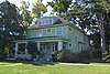 |
February 13, 1975 (#75000725) |
3535 W. 6th Ave. 39°03′30″N 95°43′14″W / 39.058333°N 95.720556°W |
Topeka | |
| 47 | Mill Block Historic District | 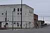 |
July 7, 2015 (#15000385) |
101-129 N. Kansas Ave. 39°03′34″N 95°40′14″W / 39.0595°N 95.6705°W |
Topeka | |
| 48 | Morgan House | 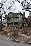 |
April 28, 2004 (#04000367) |
1335 SW. Harrison St. 39°02′30″N 95°40′53″W / 39.041667°N 95.681389°W |
Topeka | |
| 49 | North Topeka Baptist Church |  |
January 18, 2011 (#10001137) |
123 NW Gordon. 39°04′09″N 95°39′59″W / 39.069167°N 95.666389°W |
Topeka | |
| 50 | Old German-American State Bank |  |
April 30, 1980 (#80001475) |
435 Kansas Ave. 39°03′12″N 95°40′22″W / 39.053359°N 95.672853°W |
Topeka | |
| 51 | Pottawatomie Baptist Mission Building |  |
September 3, 1971 (#71001089) |
Off W. 6th St., 0.5 mile west of Wanamaker Rd.; also on Urish Rd., 0.3 miles north of 10th St. 39°03′21″N 95°46′31″W / 39.055833°N 95.775278°W |
Topeka | Urish Road location represents a boundary increase |
| 52 | Potwin Place Historic District |  |
May 1, 1980 (#80001476) |
Roughly bounded by Elmwood, Grove, Broadmoor, and Willow Sts. 39°03′43″N 95°41′38″W / 39.061944°N 95.693889°W |
Topeka | |
| 53 | John and Mary Ritchie House | 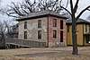 |
December 29, 2015 (#15000939) |
1116 SE. Madison St. 39°02′34″N 95°40′20″W / 39.042740°N 95.672355°W |
Topeka | |
| 54 | Ross Row Houses | 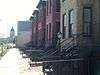 |
November 5, 1998 (#98001329) |
513, 515, 517, 517½, 519, and 521 Van Buren St. 39°03′12″N 95°40′34″W / 39.053333°N 95.676°W |
Topeka | |
| 55 | Sage Inn | 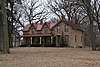 |
October 8, 1976 (#76000840) |
57th St. and Douglas Rd. 38°57′53″N 95°56′17″W / 38.964722°N 95.938056°W |
Dover | |
| 56 | St. John African Methodist Episcopal Church | 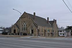 |
August 16, 2008 (#08000987) |
701 SW. Topeka Boulevard 39°03′06″N 95°40′47″W / 39.051667°N 95.679722°W |
Topeka | |
| 57 | St. John's Lutheran School | 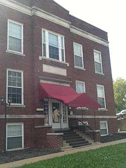 |
January 3, 1985 (#85000014) |
315 W. 4th St. 39°03′19″N 95°40′32″W / 39.055278°N 95.675556°W |
Topeka | |
| 58 | St. Joseph's Catholic Church | .jpg) |
February 24, 1971 (#71000331) |
235 Van Buren St. 39°03′24″N 95°40′29″W / 39.056667°N 95.674722°W |
Topeka | |
| 59 | Santa Fe Hospital |  |
October 11, 2016 (#16000708) |
600 SE Madison St. 39°03′01″N 95°40′09″W / 39.050183°N 95.669217°W |
Topeka | |
| 60 | John Sargent House |  |
July 28, 1995 (#95000930) |
225 SW. Clay St. 39°03′38″N 95°41′08″W / 39.060556°N 95.685556°W |
Topeka | |
| 61 | Security Benefit Association Hospital Building |  |
November 30, 2005 (#05001341) |
5800 SW. 6th, 5 miles northwest on private road 39°03′45″N 95°45′27″W / 39.0625°N 95.7575°W |
Topeka | |
| 62 | Senate and Curtis Court Apartments Historic District | 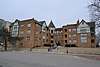 |
December 29, 2015 (#15000940) |
900-914 SW. Tyler St. 39°02′56″N 95°40′57″W / 39.048832°N 95.682510°W |
Topeka | |
| 63 | Shiloh Baptist Church | .jpg) |
June 29, 2018 (#100002629) |
1201 SW Buchanan St. 39°02′45″N 95°41′33″W / 39.0457°N 95.6924°W |
Topeka | |
| 64 | J.A. Shoemaker House | 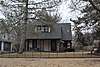 |
January 22, 2009 (#08001354) |
1434 SW. Plass Ave. 39°02′27″N 95°42′17″W / 39.040808°N 95.704619°W |
Topeka | |
| 65 | South Kansas Avenue Commercial Historic District | 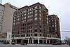 |
July 7, 2015 (#15000386) |
Roughly bounded by 6th and 10th Aves. and SW. Jackson and SE. Quincy Sts. 39°02′56″N 95°40′29″W / 39.0489°N 95.6746°W |
Topeka | |
| 66 | Sumner Elementary School and Monroe Elementary School | 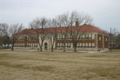 |
May 4, 1987 (#87001283) |
330 Western Ave. and 1515 Monroe St. 39°03′29″N 95°40′56″W / 39.058056°N 95.682222°W |
Topeka | |
| 67 | Thacher Building | 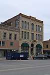 |
March 31, 1975 (#75000726) |
110 E. 8th St. 39°02′56″N 95°40′24″W / 39.048889°N 95.673333°W |
Topeka | Contributing site of the South Kansas Avenue Commercial Historic District |
| 68 | Thomas Arch Bridge | 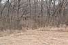 |
May 10, 1990 (#90000746) |
Junction of Wanamaker Rd. and 105th St. across the Wakarusa River 38°52′30″N 95°45′41″W / 38.875°N 95.761389°W |
Auburn | |
| 69 | Topeka Cemetery Historic District | 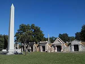 |
April 25, 2001 (#01000409) |
1601 E. 10th St. 39°02′30″N 95°39′17″W / 39.041667°N 95.654722°W |
Topeka | Boundary increase and renaming October 4, 2017. |
| 70 | Topeka Council of Colored Women's Clubs Building | 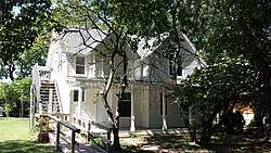 |
December 30, 2009 (#09001169) |
1149 SW. Lincoln 39°02′51″N 95°41′38″W / 39.047633°N 95.694008°W |
Topeka | |
| 71 | Topeka High School | 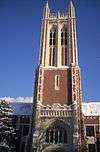 |
June 9, 2005 (#05000550) |
800 SW. 10th Ave. 39°03′03″N 95°41′08″W / 39.050833°N 95.685556°W |
Topeka | |
| 72 | Union Pacific Railroad Passenger Depot | 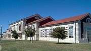 |
October 1, 2002 (#02000492) |
701 N. Kansas Ave. 39°03′58″N 95°40′10″W / 39.066111°N 95.669444°W |
Topeka | |
| 73 | Uniontown Cemetery | 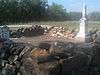 |
May 17, 2010 (#10000263) |
NW Douglas Rd. 39°05′05″N 95°56′15″W / 39.084661°N 95.937522°W |
Willard | |
| 74 | United States Post Office and Court House | 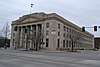 |
March 3, 2015 (#15000046) |
424 S. Kansas Ave. 39°03′13″N 95°40′21″W / 39.0535°N 95.6724°W |
Topeka | |
| 75 | Tinkham Veale Building | 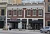 |
January 11, 2006 (#05001511) |
909-911 S. Kansas Ave. 39°02′49″N 95°40′32″W / 39.046944°N 95.675556°W |
Topeka | Contributing site of the South Kansas Avenue Commercial Historic District |
| 76 | Wakarusa Hotel | 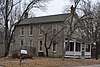 |
April 26, 1979 (#79000955) |
Main St. 38°53′05″N 95°41′46″W / 38.884722°N 95.696111°W |
Wakarusa | |
| 77 | Ward-Meade House | 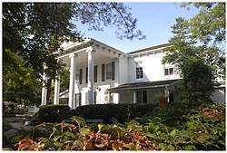 |
November 12, 1975 (#75000727) |
124 N. Fillmore 39°03′49″N 95°40′54″W / 39.063611°N 95.681667°W |
Topeka | |
| 78 | Washburn University Carnegie Library Building | 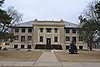 |
June 25, 1987 (#87000972) |
Off 17th St. and Washburn Ave. 39°02′08″N 95°42′03″W / 39.035556°N 95.700833°W |
Topeka | |
| 79 | Wea Creek Bowstring Arch Truss Bridge | 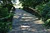 |
May 9, 2003 (#03000363) |
Grounds of the Kansas State Historical Society, 6425 SE. 6th Ave. 39°03′21″N 95°46′40″W / 39.055833°N 95.777778°W |
Topeka | |
| 80 | Westminster Presbyterian Church | 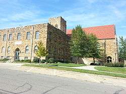 |
May 19, 2004 (#04000453) |
1275 Boswell Ave. 39°02′37″N 95°42′08″W / 39.043611°N 95.702222°W |
Topeka | |
| 81 | Willits House | 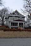 |
June 2, 1997 (#97000463) |
1035 SW. Fillmore 39°02′53″N 95°41′27″W / 39.048056°N 95.690833°W |
Topeka | Contributing site of the Holliday Park Historic District II. |
| 82 | Woman's Club Building | 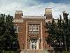 |
February 19, 1982 (#82002676) |
420 W. 9th St. 39°02′45″N 95°40′32″W / 39.045833°N 95.675556°W |
Topeka | |
| 83 | Chester B. Woodward House | 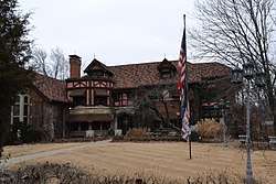 |
June 25, 1992 (#92000817) |
1272 SW. Fillmore St. 39°02′36″N 95°41′17″W / 39.043333°N 95.688056°W |
Topeka |
Former listing
| [3] | Name on the Register | Image | Date listed | Date removed | Location | City or town | Summary |
|---|---|---|---|---|---|---|---|
| 1 | Grand Opera House | November 28, 1980 (#80001474) | April 3, 1986 | 615 Jackson St. |
Topeka |
See also
| Wikimedia Commons has media related to National Register of Historic Places in Shawnee County, Kansas. |
References
- ↑ The latitude and longitude information provided in this table was derived originally from the National Register Information System, which has been found to be fairly accurate for about 99% of listings. For about 1% of NRIS original coordinates, experience has shown that one or both coordinates are typos or otherwise extremely far off; some corrections may have been made. A more subtle problem causes many locations to be off by up to 150 yards, depending on location in the country: most NRIS coordinates were derived from tracing out latitude and longitudes from USGS topographical quadrant maps created under the North American Datum of 1927, which differs from the current, highly accurate WGS84 GPS system used by most on-line maps. Chicago is about right, but NRIS longitudes in Washington are higher by about 4.5 seconds, and are lower by about 2.0 seconds in Maine. Latitudes differ by about 1.0 second in Florida. Some locations in this table may have been corrected to current GPS standards.
- ↑ "National Register of Historic Places: Weekly List Actions". National Park Service, United States Department of the Interior. Retrieved on October 4, 2018.
- 1 2 Numbers represent an ordering by significant words. Various colorings, defined here, differentiate National Historic Landmarks and historic districts from other NRHP buildings, structures, sites or objects.
- ↑ National Park Service (2009-03-13). "National Register Information System". National Register of Historic Places. National Park Service.
- ↑ The eight-digit number below each date is the number assigned to each location in the National Register Information System database, which can be viewed by clicking the number.
- ↑ Biles, Jan (January 29, 2011). "Updating historical Kansas Avenue". The Topeka Capital-Journal. Retrieved January 30, 2011.
- ↑ Dixon, Benjamin Y. "Furthering Their Own Demise: How Kansa Indian Death Customs Accelerated Their Depopulation". Ethnohistory 54.3 (2007): 473-508: 482.


Municipalities and communities of Shawnee County, Kansas, United States | ||
|---|---|---|
| Cities | | |
| CDP | ||
| Unincorporated communities | ||
| Ghost town | ||
| Townships | ||
| Footnotes | ‡This populated place also has portions in an adjacent county or counties | |
This article is issued from
Wikipedia.
The text is licensed under Creative Commons - Attribution - Sharealike.
Additional terms may apply for the media files.