| [3] |
Name on the Register[4] |
Image |
Date listed[5] |
Location |
Township |
Description |
|---|
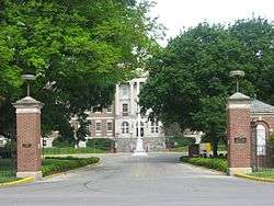
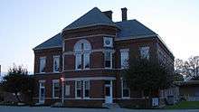
| 1 |
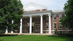
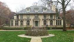
Administration Building, Indiana Central University |
|
March 15, 1984
(#84001081) |
Otterbein and Hanna Ave.
39°42′29″N 86°08′07″W / 39.708056°N 86.135278°W / 39.708056; -86.135278 (Administration Building, Indiana Central University) |
Perry |
|
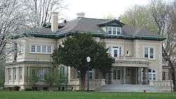
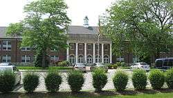
| 2 |
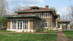
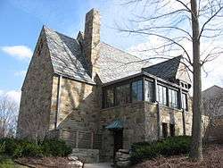
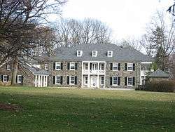
Allison Mansion |
|
December 18, 1970
(#70000006) |
3200 Cold Spring Rd.
39°49′00″N 86°12′06″W / 39.816667°N 86.201667°W / 39.816667; -86.201667 (Allison Mansion) |
Wayne |
|
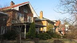
| 3 |
Anderson–Thompson House |
|
March 26, 1987
(#87000502) |
6551 Shelbyville Rd.
39°40′02″N 86°03′09″W / 39.667222°N 86.052500°W / 39.667222; -86.052500 (Anderson–Thompson House) |
Franklin |
|
| 4 |
Christopher Apple House |
|
September 17, 1980
(#80000055) |
11663 Pendleton Pike
39°52′12″N 85°57′34″W / 39.870000°N 85.959444°W / 39.870000; -85.959444 (Christopher Apple House) |
Lawrence |
|
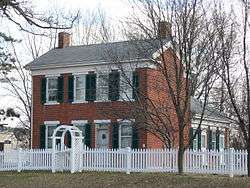
| 5 |
Archeological Sites 12Ma648 and 12Ma649 |
|
December 20, 2011
(#11000912) |
Atop a hill above Fall Creek in the northwestern corner of Fort Harrison State Park[6]
39°52′31″N 86°01′52″W / 39.875278°N 86.031111°W / 39.875278; -86.031111 (Archeological Sites 12Ma648 and 12Ma649) |
Lawrence |
|
| 6 |
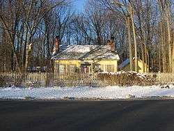
Thomas Askren House |
|
April 19, 2006
(#06000303) |
6550 E. 16th St.
39°47′28″N 86°03′12″W / 39.791111°N 86.053333°W / 39.791111; -86.053333 (Thomas Askren House) |
Warren |
|
| 7 |
Aston Inn |
|
December 26, 1985
(#85003125) |
6620 N. Michigan Rd.
39°52′39″N 86°12′24″W / 39.8775°N 86.206667°W / 39.8775; -86.206667 (Aston Inn) |
Washington |
|
| 8 |
Benton House |
|
March 20, 1973
(#73000034) |
312 S. Downey Ave.
39°45′54″N 86°04′35″W / 39.765°N 86.076389°W / 39.765; -86.076389 (Benton House) |
Warren |
Part of the Irvington Historic District |
| 9 |
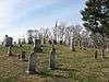
Big Run Baptist Church and Cemetery |
|
December 6, 2005
(#05001367) |
6510 S. Franklin Rd.
39°40′33″N 86°01′08″W / 39.675833°N 86.018889°W / 39.675833; -86.018889 (Big Run Baptist Church and Cemetery) |
Franklin |
|
| 10 |
Joseph J. Bingham Indianapolis Public School No. 84 |
|
December 6, 2004
(#04001310) |
440 E. 57th St.-5702 Central Ave.
39°51′34″N 86°09′05″W / 39.859444°N 86.151389°W / 39.859444; -86.151389 (Joseph J. Bingham Indianapolis Public School No. 84) |
Washington |
|
| 11 |
Brendonwood Historic District |
|
December 6, 2004
(#04001313) |
Roughly bounded by Fall Creek, 56th St., and Brendon Forest Dr.
39°51′40″N 86°03′58″W / 39.861111°N 86.066111°W / 39.861111; -86.066111 (Brendonwood Historic District) |
Lawrence |
|
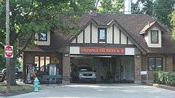
| 12 |
Broad Ripple Firehouse–Indianapolis Fire Department Station 32 |
|
September 15, 2011
(#11000658) |
6330 Guilford Ave.
39°52′15″N 86°08′35″W / 39.870833°N 86.143056°W / 39.870833; -86.143056 (Broad Ripple Firehouse–Indianapolis Fire Department Station 32) |
Washington Township |
|
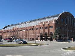
| 13 |
Butler Fieldhouse |
|
December 22, 1983
(#83003573) |
Butler University campus, 49th St., and Boulevard Pl.
39°50′36″N 86°10′02″W / 39.843333°N 86.167222°W / 39.843333; -86.167222 (Butler Fieldhouse) |
Washington |
|
| 14 |
Camp Edwin F. Glenn |
|
December 1, 1995
(#95001360) |
Fort Benjamin Harrison
39°51′34″N 86°01′16″W / 39.859444°N 86.021111°W / 39.859444; -86.021111 (Camp Edwin F. Glenn) |
Lawrence |
|
| 15 |
Henry F. Campbell Mansion |
|
April 14, 1997
(#97000305) |
2550 Cold Spring Rd.
39°48′07″N 86°12′19″W / 39.801944°N 86.205278°W / 39.801944; -86.205278 (Henry F. Campbell Mansion) |
Wayne |
|
| 16 |
Christamore House |
|
March 21, 1985
(#85000597) |
502 N. Tremont St.
39°46′29″N 86°12′04″W / 39.774722°N 86.201111°W / 39.774722; -86.201111 (Christamore House) |
Wayne |
|
| 17 |
Henry P. Coburn Public School No. 66 |
|
June 13, 1986
(#86001267) |
604 E. 38th St.
39°46′30″N 86°12′04″W / 39.775°N 86.201111°W / 39.775; -86.201111 (Henry P. Coburn Public School No. 66) |
Washington |
|
| 18 |
Joseph J. Cole, Jr., House |
|
June 25, 1997
(#97000599) |
4909 N. Meridian St.
39°50′35″N 86°09′24″W / 39.843056°N 86.156667°W / 39.843056; -86.156667 (Joseph J. Cole, Jr., House) |
Washington |
|
| 19 |
Roy and Iris Corbin Lustron House |
|
October 9, 1997
(#97001173) |
1728 N. Leland Ave.
39°47′26″N 86°04′55″W / 39.790556°N 86.081944°W / 39.790556; -86.081944 (Roy and Iris Corbin Lustron House) |
Warren |
|
| 20 |
Cumberland Historic District |
|
December 7, 2001
(#01001341) |
Roughly bounded by Munsie, Welland, Heflin, and Warehouse Sts.
39°46′36″N 85°57′23″W / 39.776667°N 85.956389°W / 39.776667; -85.956389 (Cumberland Historic District) |
Warren |
|
| 21 |
Emerson Avenue Addition Historic District |
|
December 19, 2012
(#12001063) |
Roughly bounded by E. Michigan and E. St Clair Sts., N. Emerson Ave., and Ellenberger Park
39°46′37″N 86°04′52″W / 39.776944°N 86.081111°W / 39.776944; -86.081111 (Emerson Avenue Addition Historic District) |
Warren |
|
| 22 |
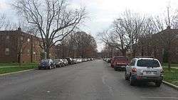
Forest Hills Historic District |
|
June 30, 1983
(#83000130) |
Bounded by the Monon Railroad tracks, Kessler Boulevard, and College and Northview Aves.
39°51′32″N 86°08′35″W / 39.858889°N 86.143056°W / 39.858889; -86.143056 (Forest Hills Historic District) |
Washington |
|
| 23 |
Fort Benjamin Harrison Historic District |
|
September 6, 1995
(#93001581) |
E. 56th St.; also roughly bounded by Shafter Rd., Aultman Ave., and Glenn Rd.
39°51′34″N 86°00′46″W / 39.859444°N 86.012778°W / 39.859444; -86.012778 (Fort Benjamin Harrison Historic District) |
Lawrence |
Second set of boundaries represents a boundary increase of December 1, 1995 |
| 24 |
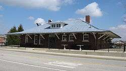
Fort Harrison Terminal Station |
|
March 16, 1984
(#84001127) |
Building 616 at Fort Benjamin Harrison
39°51′21″N 86°00′48″W / 39.855833°N 86.013333°W / 39.855833; -86.013333 (Fort Harrison Terminal Station) |
Lawrence |
|
| 25 |
Foster Hall |
|
December 6, 2005
(#05001364) |
7200 N. College Ave.
39°53′19″N 86°08′51″W / 39.888611°N 86.1475°W / 39.888611; -86.1475 (Foster Hall) |
Washington |
|
| 26 |
William H.H. Graham House |
|
July 15, 1982
(#82001857) |
5432 University Ave.
39°46′00″N 86°04′31″W / 39.766667°N 86.075278°W / 39.766667; -86.075278 (William H.H. Graham House) |
Warren |
|
| 27 |
Hanna–Ochler–Elder House |
|
December 1, 1978
(#78000046) |
3801 Madison Ave.
39°42′41″N 86°08′36″W / 39.711389°N 86.143333°W / 39.711389; -86.143333 (Hanna–Ochler–Elder House) |
Perry |
|
| 28 |
Haughville Historic District |
|
December 9, 1992
(#92001652) |
Roughly bounded by 10th St., Belleview Pl., Walnut St., and Concord St.
39°46′40″N 86°12′22″W / 39.777778°N 86.206111°W / 39.777778; -86.206111 (Haughville Historic District) |
Wayne |
|
| 29 |
Hiram A. Haverstick Farmstead |
|
December 26, 1985
(#85003126) |
7845 Westfield Boulevard
39°53′48″N 86°08′09″W / 39.896667°N 86.135833°W / 39.896667; -86.135833 (Hiram A. Haverstick Farmstead) |
Washington |
|
| 30 |
Hawthorne Branch Library No. 2 |
|
May 18, 2000
(#00000499) |
70 N. Mount St.
39°46′03″N 86°12′06″W / 39.7675°N 86.201667°W / 39.7675; -86.201667 (Hawthorne Branch Library No. 2) |
Wayne |
|
| 31 |
Hillcrest Country Club |
|
September 29, 2004
(#04001099) |
6098 Fall Creek Rd.
39°52′25″N 86°03′40″W / 39.873611°N 86.061111°W / 39.873611; -86.061111 (Hillcrest Country Club) |
Lawrence |
|
| 32 |
Hollingsworth House |
|
April 13, 1977
(#77000019) |
6054 Hollingsworth Rd.
39°51′51″N 86°14′50″W / 39.864167°N 86.247222°W / 39.864167; -86.247222 (Hollingsworth House) |
Pike |
|
| 33 |
Homecroft Historic District |
|
January 11, 1996
(#95001536) |
Roughly bounded by Madison Ave., Southview Dr., Orinoco Ave., and Banta Rd.
39°40′12″N 86°07′55″W / 39.67°N 86.131944°W / 39.67; -86.131944 (Homecroft Historic District) |
Perry |
|
| 34 |
Indiana School for the Deaf |
|
June 27, 1991
(#91000790) |
1200 E. 42nd St.
39°50′06″N 86°08′16″W / 39.835°N 86.137778°W / 39.835; -86.137778 (Indiana School for the Deaf) |
Washington |
|
| 35 |
Indianapolis Motor Speedway |
|
March 7, 1975
(#75000044) |
4790 W. 16th St.
39°47′54″N 86°13′58″W / 39.798333°N 86.232778°W / 39.798333; -86.232778 (Indianapolis Motor Speedway) |
Wayne |
|
| 36 |
Indianapolis Park and Boulevard System |
|
March 28, 2003
(#03000149) |
Roughly bounded by 38th St., Emerson, Southern and Tibbs Aves., extending along Fall Creek and Pleasant Run Parkways to Shadeland
39°47′25″N 86°08′38″W / 39.790278°N 86.143889°W / 39.790278; -86.143889 (Indianapolis Park and Boulevard System) |
Lawrence, Warren, and Washington |
Extends into Center Township |
| 37 |
Indianapolis Veterans Administration Hospital |
|
February 21, 2012
(#12000029) |
2601 Cold Spring Rd.
39°48′10″N 86°12′06″W / 39.80278°N 86.20167°W / 39.80278; -86.20167 (Indianapolis Veterans Administration Hospital) |
Wayne |
|
| 38 |
Irvington Historic District |
|
May 29, 1987
(#87001031) |
Roughly bounded by Ellenberger Pk., Pleasant Run Creek, Arlington Ave., the former Baltimore and Ohio railroad tracks, and Emerson Ave.
39°46′13″N 86°04′25″W / 39.770278°N 86.073611°W / 39.770278; -86.073611 (Irvington Historic District) |
Warren |
|
| 39 |
Irvington Terrace Historic District |
|
December 19, 2011
(#11000913) |
Roughly bounded by E. Washington St., Pleasant Run Parkway, N. Arlington Ave., and the eastern side of N. Irwin St.
39°46′21″N 86°03′46″W / 39.772500°N 86.062778°W / 39.772500; -86.062778 (Irvington Terrace Historic District) |
Warren |
|
| 40 |
Jamieson–Bennett House |
|
September 16, 2001
(#01000984) |
8452 Green Braes North Dr.
39°50′55″N 86°18′48″W / 39.848611°N 86.313333°W / 39.848611; -86.313333 (Jamieson–Bennett House) |
Pike |
|
| 41 |
Oliver Johnson's Woods Historic District |
|
June 22, 2004
(#04000632) |
Roughly bounded by Central and College Aves. and 44th and 46th Sts.
39°50′23″N 86°08′51″W / 39.839722°N 86.1475°W / 39.839722; -86.1475 (Oliver Johnson's Woods Historic District) |
Washington |
|
| 42 |
Johnson–Denny House |
|
August 24, 1979
(#79000036) |
4456 N. Park Ave.
39°50′15″N 86°08′55″W / 39.8375°N 86.148611°W / 39.8375; -86.148611 (Johnson–Denny House) |
Washington |
|
| 43 |
Arthur Jordan Memorial Hall |
|
June 30, 1983
(#83000134) |
4600 Sunset Ave.
39°50′19″N 86°10′20″W / 39.838611°N 86.172222°W / 39.838611; -86.172222 (Arthur Jordan Memorial Hall) |
Washington |
|
| 44 |
Julian–Clark House |
|
June 20, 1986
(#86001335) |
115 S. Audubon Rd.
39°46′07″N 86°04′11″W / 39.768611°N 86.069722°W / 39.768611; -86.069722 (Julian–Clark House) |
Warren |
|
| 45 |
Marcy Village Apartments |
|
March 24, 2004
(#04000202) |
4440-4567 Marcy Ln. and 1401 E. 46th St.
39°50′19″N 86°08′04″W / 39.838667°N 86.1345°W / 39.838667; -86.1345 (Marcy Village Apartments) |
Washington |
|
| 46 |
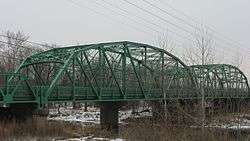
Marion County Bridge 0501F |
|
September 20, 2006
(#06000853) |
86th and 82nd Sts. over the White River
39°54′43″N 86°06′17″W / 39.911944°N 86.104722°W / 39.911944; -86.104722 (Marion County Bridge 0501F) |
Washington |
|
| 47 |
Michigan Road Toll House |
|
August 7, 1974
(#74000031) |
4702 Michigan Rd., NW.
39°50′29″N 86°11′20″W / 39.841389°N 86.188889°W / 39.841389; -86.188889 (Michigan Road Toll House) |
Washington |
|
| 48 |
New Augusta Historic District |
|
July 12, 1989
(#89000780) |
Roughly E. 71st St., E. 74th St., Coffman Rd., and New Augusta Rd.
39°53′02″N 86°14′19″W / 39.883889°N 86.238611°W / 39.883889; -86.238611 (New Augusta Historic District) |
Pike |
|
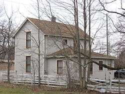
| 49 |
Nicholson–Rand House |
|
June 22, 2003
(#03000542) |
5010 W. Southport Rd.
39°39′38″N 86°14′46″W / 39.660556°N 86.246111°W / 39.660556; -86.246111 (Nicholson–Rand House) |
Decatur |
American Gothic Revival Farmhouse built 1876 |
| 50 |
North Irvington Gardens Historic District |
|
June 27, 2008
(#08000557) |
Roughly bounded by 11th, 10th, Pleasant Run Golf Course, Arlington Ave., Pleasant Run Parkway N. Drive, and Ritter Ave.
39°46′46″N 86°04′15″W / 39.779444°N 86.070833°W / 39.779444; -86.070833 (North Irvington Gardens Historic District) |
Warren |
|
| 51 |
North Meridian Street Historic District |
|
September 22, 1986
(#86002695) |
4000-5694 and 4001-5747 N. Meridian St.
39°50′33″N 86°09′26″W / 39.8425°N 86.157222°W / 39.8425; -86.157222 (North Meridian Street Historic District) |
Washington |
|
| 52 |
Oaklandon Historic District |
|
September 18, 2013
(#13000724) |
6300 and 6400 blocks of Oaklandon Rd., the 6400 block of Maple St., and 11716 Oshawa St.
39°52′30″N 85°57′26″W / 39.875000°N 85.957222°W / 39.875000; -85.957222 (Oaklandon Historic District) |
Lawrence |
|
| 53 |
Old Pathology Building |
|
April 25, 1972
(#72000011) |
3000 W. Washington St. (Central State Hospital)
39°46′12″N 86°12′48″W / 39.770000°N 86.213333°W / 39.770000; -86.213333 (Old Pathology Building) |
Wayne |
|
| 54 |
Old Southport High School |
|
September 28, 2003
(#03000982) |
6548 Orinoco Ave.
39°40′17″N 86°08′09″W / 39.671389°N 86.135833°W / 39.671389; -86.135833 (Old Southport High School) |
Perry |
|
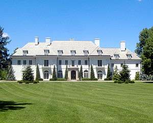
| 55 |
Oldfields |
|
June 15, 2000
(#00000676) |
1200 W. 38th St.
39°49′32″N 86°10′58″W / 39.825556°N 86.182778°W / 39.825556; -86.182778 (Oldfields) |
Washington |
Declared a National Historic Landmark District on July 31, 2003 |
| 56 |
Pleasanton in Irvington Historic District |
|
December 27, 2010
(#10001083) |
Roughly bounded by E. Michigan St., Pleasant Run Parkway North Dr., and Emerson Ave.
39°46′32″N 86°04′53″W / 39.775556°N 86.081389°W / 39.775556; -86.081389 (Pleasanton in Irvington Historic District) |
Warren |
|
| 57 |
Carlos and Anne Recker House |
|
June 13, 1996
(#96000601) |
59 N. Hawthorne Ln.
39°46′19″N 86°04′41″W / 39.771944°N 86.078056°W / 39.771944; -86.078056 (Carlos and Anne Recker House) |
Warren |
|
| 58 |
Speedway Historic District |
|
September 15, 2005
(#05001015) |
Roughly bounded by 16th St., Main St., 10th St., and Winton Ave.
39°47′02″N 86°14′38″W / 39.783889°N 86.243889°W / 39.783889; -86.243889 (Speedway Historic District) |
Wayne |
|
| 59 |
Stewart Manor (Charles B. Sommers House) |
|
October 8, 1976
(#76000033) |
3650 Cold Spring Rd.
39°49′14″N 86°12′10″W / 39.820556°N 86.202778°W / 39.820556; -86.202778 (Stewart Manor (Charles B. Sommers House)) |
Wayne |
|
| 60 |
Stout Field, Administration Building |
|
May 30, 2018
(#100002491) |
Address Restricted
|
Indianapolis |
|
| 61 |
Stout Field, Hangar |
|
May 30, 2018
(#100002493) |
Address Restricted
|
Indianapolis |
|
| 62 |
George Stumpf House |
|
May 14, 1979
(#79000039) |
3225 S. Meridian St.
39°43′06″N 86°09′29″W / 39.718333°N 86.158056°W / 39.718333; -86.158056 (George Stumpf House) |
Perry |
|
| 63 |
William N. Thompson House |
|
June 1, 1982
(#82000070) |
4343 N. Meridian St.
39°50′06″N 86°09′23″W / 39.835°N 86.156389°W / 39.835; -86.156389 (William N. Thompson House) |
Washington |
|
| 64 |
George Washington Tomlinson House |
|
December 6, 2005
(#05001366) |
5140 Reed Rd.
39°50′48″N 86°17′24″W / 39.846667°N 86.29°W / 39.846667; -86.29 (George Washington Tomlinson House) |
Pike |
|
| 65 |
Town of Crows Nest Historic District |
|
April 13, 2000
(#00000305) |
Roughly bounded by Kessler Boulevard, the White River, and Questover Circle
39°51′25″N 86°10′11″W / 39.856944°N 86.169722°W / 39.856944; -86.169722 (Town of Crows Nest Historic District) |
Washington |
|
| 66 |
Traders Point Eagle Creek Rural Historic District |
|
June 17, 2009
(#09000433) |
Roughly between Interstate 865, Interstate 465, and Lafayette Rd.
39°53′53″N 86°17′05″W / 39.89805°N 86.284683°W / 39.89805; -86.284683 (Traders Point Eagle Creek Rural Historic District) |
Pike |
Extends into Eagle Township in Boone County.[7] |
| 67 |
Washington Park Historic District |
|
June 24, 2008
(#08000565) |
Bounded by Pennsylvania St., Washington Boulevard, New Jersey, and the western side of Central Ave. between 40th and 43rd Sts.
39°49′53″N 86°09′08″W / 39.831339°N 86.152172°W / 39.831339; -86.152172 (Washington Park Historic District) |
Washington |
|
| 68 |
Wheeler–Stokely Mansion |
|
December 6, 2004
(#04001312) |
3200 Cold Spring Rd.
39°48′44″N 86°12′09″W / 39.812222°N 86.202500°W / 39.812222; -86.202500 (Wheeler–Stokely Mansion) |
Wayne |
|