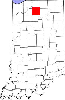
| [3] |
Name on the Register[4] |
Image |
Date listed[5] |
Location |
City or town |
Description |
|---|
| 1 |
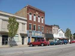
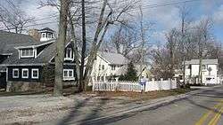
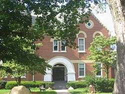
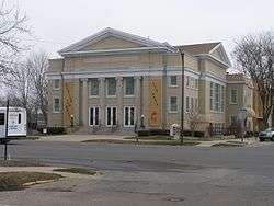
Argos Downtown Historic District |
|
September 16, 2001
(#01000991) |
Western side of Michigan St. between Smith and Williams, and the eastern side between Smith and Walnut
41°14′12″N 86°14′43″W / 41.236667°N 86.245278°W / 41.236667; -86.245278 (Argos Downtown Historic District) |
Argos |
|
| 2 |
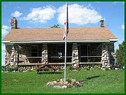
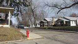
Argos Izaak Walton League Historic District |
|
December 15, 2011
(#11000914) |
7184 E. 16th Rd., east of Argos
41°14′43″N 86°11′44″W / 41.245383°N 86.195417°W / 41.245383; -86.195417 (Argos Izaak Walton League Historic District) |
Walnut Township |
|
| 3 |
Argos Northside Historic District |
|
September 18, 2017
(#100001613) |
N. Michigan St. between Smith & N. of North Sts. & Maple St. between Church & Poplar Sts.
41°14′27″N 86°14′47″W / 41.240958°N 86.246377°W / 41.240958; -86.246377 (Argos Northside Historic District) |
Argos |
|
| 4 |
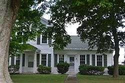
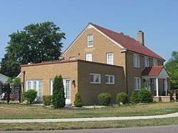
Isaac and Ruth Arnold House |
|
September 4, 2018
(#100002864) |
1003 N Main St.
41°18′11″N 86°06′59″W / 41.3030°N 86.1163°W / 41.3030; -86.1163 (Isaac and Ruth Arnold House) |
Bourbon |
|
| 5 |
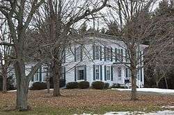
Lewis and Sarah Boggs House |
|
June 15, 2012
(#12000337) |
9564 14th Rd., north of Argos
41°16′29″N 86°14′33″W / 41.274642°N 86.242532°W / 41.274642; -86.242532 (Lewis and Sarah Boggs House) |
Center Township |
|
| 6 |
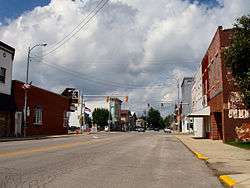
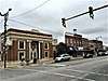
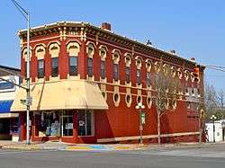
Bourbon Commercial Historic District |
|
June 12, 2017
(#100001061) |
Parts of Main and Center Sts.
41°17′44″N 86°06′58″W / 41.295556°N 86.116111°W / 41.295556; -86.116111 (Bourbon Commercial Historic District) |
Bourbon |
|
| 7 |
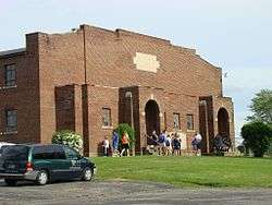
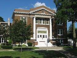
Bourbon Community Building-Gymnasium |
|
December 15, 2015
(#15000888) |
800 N. Harris St.
41°18′08″N 86°06′48″W / 41.302222°N 86.113333°W / 41.302222; -86.113333 (Bourbon Community Building-Gymnasium) |
Bourbon |
|
| 8 |
Bourbon Residential Historic District |
|
June 12, 2017
(#100001062) |
Main between Park and Shaffer Sts. in blocks bounded by Sunset St. and Park Ave. between Thompson and Harris Sts., and also along Park Ave.
41°17′59″N 86°06′58″W / 41.299722°N 86.116111°W / 41.299722; -86.116111 (Bourbon Residential Historic District) |
Bourbon |
|
| 9 |
Bremen Commercial Historic District |
|
March 7, 2017
(#100000715) |
Between Jackson, Washington, North, and South Sts.
41°26′47″N 86°08′46″W / 41.446389°N 86.146111°W / 41.446389; -86.146111 (Bremen Commercial Historic District) |
Bremen |
|
| 10 |
Bremen Residential Historic District |
|
March 7, 2017
(#100000716) |
Between Bowen, Montgomery, South, and Bike Sts.
41°26′51″N 86°09′10″W / 41.447500°N 86.152780°W / 41.447500; -86.152780 (Bremen Residential Historic District) |
Bremen |
|
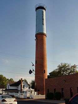
| 11 |
Bremen Water Tower |
|
January 9, 2013
(#12001152) |
Western side of the 100 block of S. Jackson St.
41°26′46″N 86°08′52″W / 41.446056°N 86.147778°W / 41.446056; -86.147778 (Bremen Water Tower) |
Bremen |
|
| 12 |
Culver Commercial Historic District |
|
January 11, 1996
(#95001530) |
Roughly bounded by Washington St., the north-south alley east of Main St., Madison St., and Ohio St.
41°13′00″N 86°25′25″W / 41.216667°N 86.423611°W / 41.216667; -86.423611 (Culver Commercial Historic District) |
Culver |
|
| 13 |
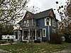
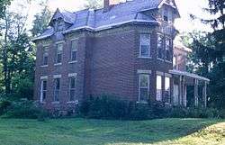
Dietrich-Bowen House |
|
November 21, 1978
(#78000023) |
304 N. Center St.
41°26′54″N 86°08′46″W / 41.448472°N 86.146111°W / 41.448472; -86.146111 (Dietrich-Bowen House) |
Bremen |
|
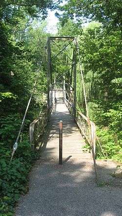
| 14 |
East Laporte Street Footbridge |
|
July 23, 1981
(#81000001) |
Spans the Yellow River
41°20′25″N 86°18′15″W / 41.340278°N 86.304167°W / 41.340278; -86.304167 (East Laporte Street Footbridge) |
Plymouth |
|
| 15 |
East Shore Historic District |
|
August 14, 1998
(#98001054) |
Roughly E. Shore Dr. southeast of Culver from W. 18th Rd., to the eastern turn of State Road 117, including Maxinkuckee Country Club
41°12′10″N 86°23′27″W / 41.202778°N 86.390833°W / 41.202778; -86.390833 (East Shore Historic District) |
Union Township |
|
| 16 |
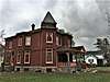
Erwin House |
|
March 15, 2016
(#16000080) |
2518 14-B Rd.
41°16′01″N 86°06′18″W / 41.266944°N 86.105000°W / 41.266944; -86.105000 (Erwin House) |
Tippecanoe Township |
|
| 17 |
Forest Place Historic District |
|
June 15, 2000
(#00000671) |
Forest Place, between College Ave. and Lake Shore Dr.
41°13′14″N 86°25′01″W / 41.220556°N 86.416944°W / 41.220556; -86.416944 (Forest Place Historic District) |
Culver |
|
| 18 |
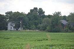
Gaskill-Erwin Farm |
|
March 17, 2015
(#15000078) |
2595 14-B Rd.
41°15′59″N 86°06′23″W / 41.266250°N 86.106389°W / 41.266250; -86.106389 (Gaskill-Erwin Farm) |
Tippecanoe Township |
|
| 19 |
Heminger Travel Lodge |
|
January 11, 2001
(#00001629) |
800 Lincolnway East
41°20′35″N 86°17′59″W / 41.343056°N 86.299722°W / 41.343056; -86.299722 (Heminger Travel Lodge) |
Plymouth |
|
| 20 |
Hoham-Klinghammer-Weckerle House and Brewery Site |
|
June 15, 2012
(#12000338) |
1715 Lake Ave.
41°20′07″N 86°19′43″W / 41.335407°N 86.328679°W / 41.335407; -86.328679 (Hoham-Klinghammer-Weckerle House and Brewery Site) |
Center Township and Plymouth |
|
| 21 |
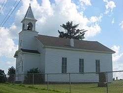
Jacoby Church and Cemetery |
|
January 25, 2007
(#06001291) |
Western side of N. King Rd., south of 8A Rd. and east of Plymouth
41°21′16″N 86°15′42″W / 41.354444°N 86.261667°W / 41.354444; -86.261667 (Jacoby Church and Cemetery) |
Center Township |
|
| 22 |
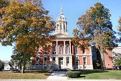
Marshall County Court House |
|
June 30, 1983
(#83000139) |
117 W. Jefferson St.
41°20′37″N 86°18′40″W / 41.343611°N 86.311111°W / 41.343611; -86.311111 (Marshall County Court House) |
Plymouth |
|
| 23 |
Marshall County Infirmary |
|
October 9, 2000
(#00001139) |
10924 Lincoln Highway, southeast of Plymouth
41°19′58″N 86°16′08″W / 41.332778°N 86.268889°W / 41.332778; -86.268889 (Marshall County Infirmary) |
Center Township |
|
| 24 |
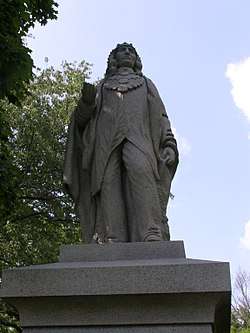
Chief Menominee Memorial Site |
|
December 27, 2010
(#10001082) |
S. Peach Rd., north of W. 13th Rd. and southwest of Plymouth
41°17′43″N 86°21′43″W / 41.295278°N 86.361944°W / 41.295278; -86.361944 (Chief Menominee Memorial Site) |
West Township |
|
| 25 |
Norris Farm-Maxinkuckee Orchard |
|
June 7, 2016
(#16000337) |
18799 Peach Rd.
41°12′21″N 86°21′52″W / 41.205833°N 86.364444°W / 41.205833; -86.364444 (Norris Farm-Maxinkuckee Orchard) |
Union Township |
|
| 26 |
Plymouth Downtown Historic District |
|
December 17, 1998
(#98001524) |
Roughly bounded by Center, Washington, and Water Sts., and the Yellow River; also 110, 112, 116, 120 Washington, 101 Michigan & the blk. bounded by Garro, Water, LaPorte & Michigan Sts.
41°20′27″N 86°18′34″W / 41.340833°N 86.309444°W / 41.340833; -86.309444 (Plymouth Downtown Historic District) |
Plymouth |
|
| 27 |
Plymouth Northside Historic District |
|
September 25, 2013
(#13000760) |
Center and Michigan Sts. between Adams and Novelty Sts., and the blocks surrounding the courthouse square
41°20′42″N 86°18′40″W / 41.345000°N 86.311111°W / 41.345000; -86.311111 (Plymouth Northside Historic District) |
Plymouth |
|
| 28 |
Plymouth Southside Historic District |
|
December 31, 2013
(#13001016) |
S. Michigan St. roughly bounded by the former Pennsylvania Railroad line and Oakhill Ave.
41°20′11″N 86°18′25″W / 41.336389°N 86.306944°W / 41.336389; -86.306944 (Plymouth Southside Historic District) |
Plymouth |
|
| 29 |
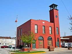
Plymouth Fire Station |
|
July 9, 1981
(#81000002) |
220 N. Center St.
41°20′29″N 86°18′37″W / 41.341389°N 86.310278°W / 41.341389; -86.310278 (Plymouth Fire Station) |
Plymouth |
|
| 30 |
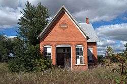
Polk Township District No. 2 School |
|
January 9, 2013
(#12001153) |
18998 W. 2A Rd., southeast of Walkerton
41°26′40″N 86°25′30″W / 41.444583°N 86.425000°W / 41.444583; -86.425000 (Polk Township District No. 2 School) |
Polk Township |
|
| 31 |
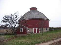
Ramsay-Fox Round Barn and Farm |
|
April 10, 2012
(#12000187) |
18889 9th Rd., west of Plymouth
41°20′45″N 86°25′20″W / 41.345833°N 86.422222°W / 41.345833; -86.422222 (Ramsay-Fox Round Barn and Farm) |
West Township |
|
| 32 |
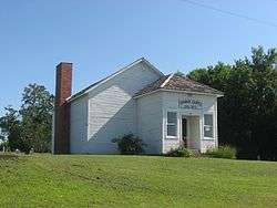
Tippecanoe Twp. District No. 3 Schoolhouse and Cemetery |
|
June 24, 2008
(#08000567) |
State Road 10 at Birch Rd., northeast of Tippecanoe
41°14′44″N 86°05′05″W / 41.245556°N 86.084722°W / 41.245556; -86.084722 (Tippecanoe Twp. District No. 3 Schoolhouse and Cemetery) |
Tippecanoe Township |
|