| [4] |
Name on the Register[5] |
Image |
Date listed[6] |
Location |
City or town |
Description |
|---|
| 1 |
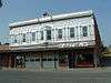
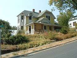
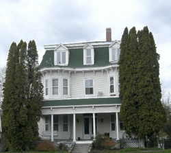
Abram A. Adams House |
|
April 24, 2017
(#100000908) |
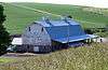
191 State St.
46°34′36″N 116°42′35″W / 46.576803°N 116.709732°W / 46.576803; -116.709732 (Abram A. Adams House) |
Juliaetta |
|
| 2 |
Administration Building, University of Idaho |
|
February 14, 1978
(#78001072) |
University of Idaho campus
46°43′32″N 117°00′40″W / 46.725643°N 117.011004°W / 46.725643; -117.011004 (Administration Building, University of Idaho) |
Moscow |
Original building burned in 1906
Constructed 1907–09 (main) |
| 3 |
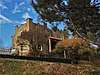
American Legion Cabin |
|
September 11, 1986
(#86002197) |
Alternate U.S. Route 95
46°55′16″N 116°53′25″W / 46.921165°N 116.890270°W / 46.921165; -116.890270 (American Legion Cabin) |
Potlatch |
|
| 4 |
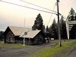
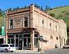
Bank of Juliaetta |
|
January 15, 1998
(#97001649) |
301 Main St.
46°34′41″N 116°42′25″W / 46.577928°N 116.706991°W / 46.577928; -116.706991 (Bank of Juliaetta) |
Juliaetta |
|
| 5 |
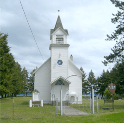
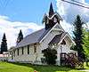
Bethany Memorial Chapel |
|
December 6, 1979
(#79000798) |
Kendrick-Deary Highway
46°39′51″N 116°37′25″W / 46.664191°N 116.623729°W / 46.664191; -116.623729 (Bethany Memorial Chapel) |
Kendrick |
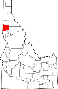
|
| 6 |
Boarding House |
|
September 11, 1986
(#86002199) |
850 Pine St.
46°55′28″N 116°54′03″W / 46.924315°N 116.900810°W / 46.924315; -116.900810 (Boarding House) |
Potlatch |
|
| 7 |
Axel Bohman House |
|
August 10, 2011
(#11000523) |
116 N. Main St.
46°44′19″N 116°46′17″W / 46.738739°N 116.771326°W / 46.738739; -116.771326 (Axel Bohman House) |
Troy |
|
| 8 |
Ole Bohman House |
|
May 22, 2013
(#13000293) |
114 N. Main St.
46°44′19″N 116°46′16″W / 46.738557°N 116.771121°W / 46.738557; -116.771121 (Ole Bohman House) |
Troy |
|
| 9 |
Bovill Opera House |
|
January 27, 2010
(#09001280) |
412 2nd Ave.
46°51′34″N 116°23′42″W / 46.859486°N 116.394933°W / 46.859486; -116.394933 (Bovill Opera House) |
Bovill |
|
| 10 |
Commercial Historic District |
|
September 11, 1986
(#86002201) |
Roughly Pine St. between 7th and 5th Sts.
46°55′17″N 116°54′04″W / 46.921340°N 116.901103°W / 46.921340; -116.901103 (Commercial Historic District) |
Potlatch |
|
| 11 |
Cordelia Lutheran Church |
|
August 31, 1995
(#95001058) |
Danielson Rd., south of the junction with Genesee-Troy Rd.
46°39′37″N 116°53′50″W / 46.660177°N 116.897166°W / 46.660177; -116.897166 (Cordelia Lutheran Church) |
Moscow |
|
| 12 |
Mason Cornwall House |
|
December 2, 1977
(#77000465) |
308 S. Hayes St.
46°43′56″N 116°59′17″W / 46.732176°N 116.988079°W / 46.732176; -116.988079 (Mason Cornwall House) |
Moscow |
|
| 13 |
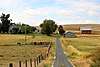
Cox Barn |
|
February 1, 2010
(#09001281) |
1290 American Ridge Rd.
46°36′23″N 116°42′52″W / 46.606269°N 116.714356°W / 46.606269; -116.714356 (Cox Barn) |
Kendrick |
|
| 14 |
Davids' Building |
|
December 11, 1979
(#79000799) |
3rd and Main Sts.
46°43′56″N 117°00′04″W / 46.732153°N 117.001052°W / 46.732153; -117.001052 (Davids' Building) |
Moscow |
|
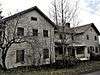
| 15 |
Deesten Farmstead |
|
April 2, 2008
(#08000250) |
3611 U.S. Route 95, S.
46°40′09″N 117°01′41″W / 46.669143°N 117.028011°W / 46.669143; -117.028011 (Deesten Farmstead) |
Moscow |
|
| 16 |
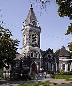
First Methodist Church |
|
October 5, 1978
(#78001073) |
322 E. 3rd St.
46°43′57″N 116°59′51″W / 46.732603°N 116.997591°W / 46.732603; -116.997591 (First Methodist Church) |
Moscow |
|
| 17 |
Fort Russell Neighborhood Historic District |
|
November 26, 19802017-09-25
(#80001329) |
Roughly bounded by Jefferson, D, Hayes, and 3rd Sts.
46°44′06″N 116°59′43″W / 46.734886°N 116.995384°W / 46.734886; -116.995384 (Fort Russell Neighborhood Historic District) |
Moscow |
|
| 18 |
Four-Room House |
|
September 11, 1986
(#86002204) |
1015 Pine St.
46°55′33″N 116°54′01″W / 46.925879°N 116.900214°W / 46.925879; -116.900214 (Four-Room House) |
Potlatch |
|
| 19 |
Freeze Community Church |
|
May 3, 1990
(#90000679) |
W. Freeze Rd., 1 mile (1.6 km) west of U.S. Route 95
46°57′46″N 116°56′59″W / 46.962890°N 116.949720°W / 46.962890; -116.949720 (Freeze Community Church) |
Potlatch |
|
| 20 |
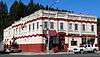
Genesee Exchange Bank |
|
January 8, 1979
(#79000796) |
Walnut and Fir Sts.
46°33′03″N 116°55′32″W / 46.550695°N 116.925562°W / 46.550695; -116.925562 (Genesee Exchange Bank) |
Genesee |
|
| 21 |
Hotel Bovill |
|
June 23, 1994
(#94000629) |
602 Park St. (State Highway 3)
46°51′39″N 116°23′47″W / 46.860950°N 116.396387°W / 46.860950; -116.396387 (Hotel Bovill) |
Bovill |
|
| 22 |
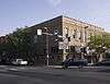
Hotel Moscow |
|
November 30, 1978
(#78001074) |
4th and Main Sts.
46°43′55″N 117°00′07″W / 46.731904°N 117.001842°W / 46.731904; -117.001842 (Hotel Moscow) |
Moscow |
North of Friendship Square |
| 23 |
Hotel Rietmann |
|
November 29, 2001
(#01001302) |
525–529 S. Main St.
46°44′03″N 116°46′01″W / 46.734167°N 116.766937°W / 46.734167; -116.766937 (Hotel Rietmann) |
Troy |
|
| 24 |
Kappa Sigma Fraternity, Gamma Theta Chapter |
|
September 3, 1996
(#96000945) |
918 Blake Ave.
46°43′35″N 117°00′29″W / 46.726357°N 117.008035°W / 46.726357; -117.008035 (Kappa Sigma Fraternity, Gamma Theta Chapter) |
Moscow |
|
| 25 |
Kendrick Downtown Historic District |
|
January 2, 2018
(#100001920) |
Generally bounded by 3rd, & S Kirby Sts., original NPRR alignment & grade rising N of E Main St.
46°36′49″N 116°39′01″W / 46.613670°N 116.650330°W / 46.613670; -116.650330 (Kendrick Downtown Historic District) |
Kendrick |
|
| 26 |
Kendrick Fraternal Temple |
|
March 27, 2013
(#13000108) |
614 E. Main St.
46°36′51″N 116°39′00″W / 46.614121°N 116.649975°W / 46.614121; -116.649975 (Kendrick Fraternal Temple) |
Kendrick |
|
| 27 |
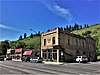
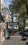
Kenworthy Theatre |
|
November 29, 2001
(#01001305) |
508 S. Main St.
46°43′51″N 117°00′04″W / 46.730750°N 117.001073°W / 46.730750; -117.001073 (Kenworthy Theatre) |
Moscow |
|
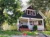
| 28 |
Thomas Kirby House |
|
April 1, 1999
(#99000414) |
102 N. 9th St.
46°36′51″N 116°38′49″W / 46.614164°N 116.646829°W / 46.614164; -116.646829 (Thomas Kirby House) |
Kendrick |
|
| 29 |
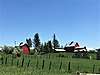
Russell Lawrence Farmstead |
|
December 1, 2011
(#11000862) |
5471 ID 8
46°47′58″N 116°29′30″W / 46.799430°N 116.491692°W / 46.799430; -116.491692 (Russell Lawrence Farmstead) |
Deary |
part of the Agricultural Properties of Latah County, Idaho MPS |
| 30 |
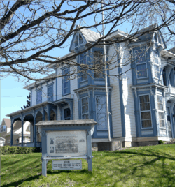
Almon Asbury Lieuallen House |
|
January 3, 1978
(#78001075) |
101 S. Almon St.
46°44′01″N 117°00′16″W / 46.733595°N 117.004471°W / 46.733595; -117.004471 (Almon Asbury Lieuallen House) |
Moscow |
|
| 31 |
W. J. McConnell House |
|
November 21, 1974
(#74000743) |
110 S. Adams St.
46°44′00″N 116°59′48″W / 46.733256°N 116.996803°W / 46.733256; -116.996803 (W. J. McConnell House) |
Moscow |
|
| 32 |
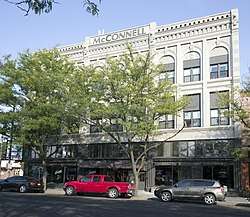
McConnell–McGuire Building |
|
February 7, 1978
(#78001076) |
Main and 1st Sts.
46°44′01″N 117°00′04″W / 46.733475°N 117.001072°W / 46.733475; -117.001072 (McConnell–McGuire Building) |
Moscow |
|
| 33 |
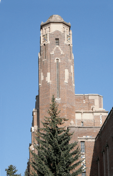
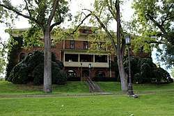
Memorial Gymnasium |
|
October 5, 1977
(#77000466) |
University of Idaho campus
46°43′35″N 117°00′50″W / 46.726510°N 117.013857°W / 46.726510; -117.013857 (Memorial Gymnasium) |
Moscow |
Opened 89 years ago in 1928 |
| 34 |
Moscow Carnegie Library |
|
June 18, 1979
(#79000800) |
110 S. Jefferson St.
46°44′00″N 116°59′54″W / 46.733279°N 116.998311°W / 46.733279; -116.998311 (Moscow Carnegie Library) |
Moscow |
|
| 35 |
Moscow Downtown Historic District |
|
July 22, 2005
(#05000710) |
Generally bounded by 1st St., 6th St., Washington St., and the alley between Main and Jackson
46°43′55″N 117°00′05″W / 46.731947°N 117.001411°W / 46.731947; -117.001411 (Moscow Downtown Historic District) |
Moscow |
|
| 36 |
Moscow High School |
|
May 5, 1992
(#92000416) |
410 E. 3rd St.
46°43′58″N 116°59′47″W / 46.732759°N 116.996468°W / 46.732759; -116.996468 (Moscow High School) |
Moscow |
1912 Center;
high school until 1939,
then junior high until 1959 |
| 37 |
Moscow Post Office and Courthouse |
|
July 3, 1973
(#73000686) |
Washington and 3rd Sts.
46°43′58″N 116°59′59″W / 46.732670°N 116.999722°W / 46.732670; -116.999722 (Moscow Post Office and Courthouse) |
Moscow |
Moscow City Hall |
| 38 |
Nob Hill Historic District |
|
September 11, 1986
(#86002206) |
Roughly bounded by 4th, Spruce, 3rd, and Cedar Sts.
46°55′10″N 116°53′52″W / 46.919323°N 116.897803°W / 46.919323; -116.897803 (Nob Hill Historic District) |
Potlatch |
|
| 39 |
Nordby Farmstead |
|
May 15, 2009
(#09000293) |
1301 Old U.S. Route 95
46°33′52″N 116°54′34″W / 46.564435°N 116.909505°W / 46.564435; -116.909505 (Nordby Farmstead) |
Genesee |
|
| 40 |
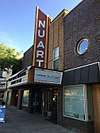
Nu Art Theatre |
|
November 29, 2001
(#01001304) |
516 S. Main St.
46°43′50″N 117°00′04″W / 46.730558°N 117.001013°W / 46.730558; -117.001013 (Nu Art Theatre) |
Moscow |
|
| 41 |
Ridenbaugh Hall |
|
September 14, 1977
(#77000467) |
University of Idaho campus
46°43′28″N 117°00′32″W / 46.724485°N 117.009026°W / 46.724485; -117.009026 (Ridenbaugh Hall) |
Moscow |
|
| 42 |
St. Joseph's Catholic Church |
|
November 17, 1982
(#82000351) |
301 1st Avenue
46°51′30″N 116°23′46″W / 46.858390°N 116.396208°W / 46.858390; -116.396208 (St. Joseph's Catholic Church) |
Bovill |
|
| 43 |
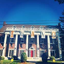
Sigma Alpha Epsilon Fraternity House |
|
December 2, 1993
(#93001335) |
920 Deakin St.
46°43′34″N 117°00′23″W / 46.726192°N 117.006441°W / 46.726192; -117.006441 (Sigma Alpha Epsilon Fraternity House) |
Moscow |
|
| 44 |
Skattaboe Block |
|
May 22, 1978
(#78001077) |
Main and 4th Sts.
46°43′54″N 117°00′07″W / 46.731537°N 117.001819°W / 46.731537; -117.001819 (Skattaboe Block) |
Moscow |
South of Friendship Square |
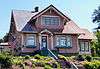
| 45 |
Arthur Snow House |
|
May 5, 2009
(#09000294) |
2949 Clyde Rd.
46°41′36″N 117°00′39″W / 46.693346°N 117.010894°W / 46.693346; -117.010894 (Arthur Snow House) |
Moscow |
|
| 46 |
Edward and Ida Soncarty Barn |
|
April 2, 2008
(#08000251) |
1671 Deep Creek Rd.
47°01′44″N 116°53′13″W / 47.028824°N 116.886904°W / 47.028824; -116.886904 (Edward and Ida Soncarty Barn) |
Potlatch |
|
| 47 |
Joseph A. Terteling House |
|
September 11, 1986
(#86002208) |
1015 Fir St.
46°55′33″N 116°54′05″W / 46.925881°N 116.901371°W / 46.925881; -116.901371 (Joseph A. Terteling House) |
Potlatch |
|
| 48 |
Three-Room House |
|
September 11, 1986
(#86002210) |
940 Cedar St.
46°55′30″N 116°53′54″W / 46.925015°N 116.898286°W / 46.925015; -116.898286 (Three-Room House) |
Potlatch |
|
| 49 |
Troy Downtown Historic District |
|
March 11, 2010
(#10000073) |
339 S. Main St. through 527 S. Main St.
46°44′05″N 116°46′04″W / 46.734794°N 116.767866°W / 46.734794; -116.767866 (Troy Downtown Historic District) |
Troy |
|
| 50 |
Troy Hospital |
|
August 10, 2011
(#11000524) |
604 S. Main St.
46°44′03″N 116°45′58″W / 46.734165°N 116.766082°W / 46.734165; -116.766082 (Troy Hospital) |
Troy |
|
| 51 |
University of Idaho Gymnasium and Armory |
|
January 3, 1983
(#83000287) |
University of Idaho campus
46°43′35″N 117°00′44″W / 46.726432°N 117.012314°W / 46.726432; -117.012314 (University of Idaho Gymnasium and Armory) |
Moscow |
Art & Architecture South |
| 52 |
Vollmer Building |
|
January 8, 1979
(#79000797) |
Walnut St.
46°33′03″N 116°55′30″W / 46.550728°N 116.924884°W / 46.550728; -116.924884 (Vollmer Building) |
Genesee |
|
| 53 |
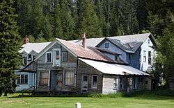
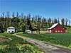
White Spring Ranch |
|
January 6, 2004
(#03001368) |
1004 Lorang Rd. Hwy. 95 & Borgen Rd.
46°34′39″N 116°56′58″W / 46.577593°N 116.949519°W / 46.577593; -116.949519 (White Spring Ranch) |
Genesee |
|
| 54 |
Workers' Neighborhood Historic District |
|
September 11, 1986
(#86002211) |
Roughly Spruce St. between 8th and 5th
46°55′20″N 116°53′47″W / 46.922135°N 116.896477°W / 46.922135; -116.896477 (Workers' Neighborhood Historic District) |
Potlatch |
|

%2C_Moscow%2C_ID.jpg)
%2C_Moscow%2C_Idaho.jpg)
%2C_Moscow%2C_Idaho.jpg)