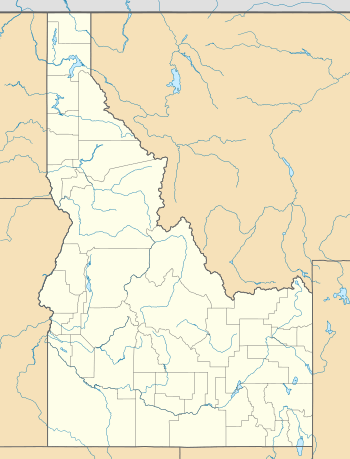
Harvard, Idaho
| Harvard, Idaho | |
|---|---|
| Unincorporated community | |
 Harvard  Harvard | |
| Coordinates: 46°55′01″N 116°43′48″W / 46.917°N 116.73°WCoordinates: 46°55′01″N 116°43′48″W / 46.917°N 116.73°W | |
| Country | United States |
| State | Idaho |
| County | Latah |
| Elevation | 2,575 ft (785 m) |
| Time zone | UTC-8 (Pacific (PST)) |
| • Summer (DST) | UTC-7 (PDT) |
| ZIP code | 83834 |
| Area code(s) | 208 |
| GNIS feature ID | 396618[1] |
Harvard is an unincorporated community in the northwest United States, on the Palouse of north central Idaho in Latah County.
Located on the Palouse River, eight miles (13 km) east of Potlatch on State Highway 6, Harvard has a post office with ZIP code 83834.[2] The elevation is 2,575 feet (785 m) above sea level.
Nearby is Camp Grizzly, a Boy Scout summer camp; it is approximately three miles (5 km) upstream to the northeast, at the base of the Hoodoo Mountains.
History
Harvard was founded in 1906 when the Washington, Idaho and Montana Railway was extended to that point.[3] The community was named after Harvard University,[3] and its post office has been in operation since 1906.[4]
The railroad slated it to be called "Canfield" after landowner Homer Canfield, who did not want the honor. He suggested "Harvard" as a complement to the existing Princeton, five miles (8 km) west, which was named after Princeton, Minnesota.[3]
Other locations in the vicinity with collegiate names include Cornell, Purdue, Stanford, Vassar, Wellesley, and Yale.[3] Some were intended, others were coincidental.[3]
References
- ↑ U.S. Geological Survey Geographic Names Information System: Harvard, Idaho
- ↑ ZIP Code Lookup
- 1 2 3 4 5 Long, Ben (May 13, 1988). "Gold, trees lured settlers to Harvard, Princeton". Idahonian. (Moscow). (Latah County Centennial). pp. 34–35.
- ↑ "Latah County". Jim Forte Postal History. Retrieved 23 May 2015.
External links
- Dearest Maude – About Harvard, Idaho
- Camp Grizzly – Boy Scouts of America, Inland Northwest Council
- Video (2010)