National Register of Historic Places listings in Nez Perce County, Idaho
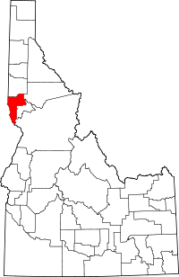
Location of Nez Perce County in Idaho
This is a list of the National Register of Historic Places listings in Nez Perce County, Idaho.
This is intended to be a complete list of the properties and districts on the National Register of Historic Places in Nez Perce County, Idaho, United States. Latitude and longitude coordinates are provided for many National Register properties and districts; these locations may be seen together in a map.[1]
There are 30 properties and districts listed on the National Register in the county. More may be added; properties and districts nationwide are added to the Register weekly.[2]
- This National Park Service list is complete through NPS recent listings posted October 4, 2018.[3]
Current listings
| [4] | Name on the Register[5] | Image | Date listed[6] | Location | City or town | Description |
|---|---|---|---|---|---|---|
| 1 | American Women's League Chapter House | 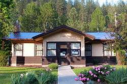 |
September 4, 1986 (#86002158) |
217 N. Main St. 46°28′30″N 116°25′20″W / 46.475049°N 116.422108°W |
Peck | |
| 2 | James Asposas House | 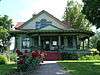 |
November 25, 1994 (#94001366) |
1610 15th Ave. 46°24′17″N 117°00′32″W / 46.404811°N 117.008849°W |
Lewiston | |
| 3 | Frank Booth House | 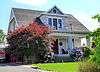 |
November 25, 1994 (#94001367) |
1608 17th Ave. 46°24′10″N 117°00′32″W / 46.402781°N 117.008860°W |
Lewiston | |
| 4 | Breier Building | 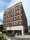 |
June 13, 1986 (#86001261) |
631–633 Main St. 46°25′16″N 117°01′29″W / 46.421159°N 117.024752°W |
Lewiston | |
| 5 | Carnegie Library | 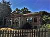 |
June 13, 2018 (#100002548) |
101 5th St. 46°25′10″N 117°01′37″W / 46.4195°N 117.0270°W |
Lewiston | |
| 6 | Children's Home Finding and Aid Society of North Idaho | 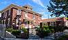 |
February 23, 2007 (#07000090) |
1805 19th Ave. 46°24′05″N 117°00′22″W / 46.401470°N 117.006115°W |
Lewiston | |
| 7 | First Christian Church | 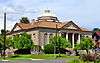 |
August 31, 1978 (#78001083) |
7th Ave. and 7th St. 46°24′50″N 117°01′21″W / 46.413808°N 117.022584°W |
Lewiston | |
| 8 | First Lapwai Bank |  |
March 12, 1980 (#80001331) |
302 W. 1st St. 46°24′11″N 116°48′23″W / 46.403116°N 116.806326°W |
Lapwai | Building no longer exists. |
| 9 | First Presbyterian Church |  |
March 12, 1980 (#80001332) |
Locust and 1st St., E. 46°24′13″N 116°48′12″W / 46.403477°N 116.803465°W |
Lapwai | |
| 10 | Garfield School |  |
April 15, 1982 (#82002513) |
2912 5th Ave. 46°24′55″N 116°59′26″W / 46.415376°N 116.990583°W |
Lewiston | |
| 11 | Hasotino |  |
April 2, 1976 (#76000678) |
Address Restricted[7] |
Lewiston | |
| 12 | Hatwai Village Site | November 8, 1982 (#82000353) |
Address Restricted[7] |
Lewiston | ||
| 13 | Hells Canyon Archeological District | 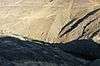 |
August 10, 1984 (#84000984) |
Address Restricted[7] |
Lewiston | Extends into Adams and Idaho counties and Wallowa County, Oregon |
| 14 | Patrick J. and Lydia Hester House | 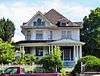 |
November 25, 1994 (#94001365) |
1622 15th Ave. 46°24′17″N 117°00′30″W / 46.404805°N 117.008471°W |
Lewiston | |
| 15 | Idaho Grocery Warehouse and Annex | 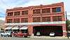 |
November 17, 1982 (#82000354) |
1209 Main St. 46°25′08″N 117°01′01″W / 46.418989°N 117.017048°W |
Lewiston | |
| 16 | Henry C. Kettenbach House | 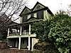 |
February 7, 1978 (#78001084) |
1026 9th Ave. 46°24′40″N 117°01′02″W / 46.411188°N 117.017334°W |
Lewiston | Relocated |
| 17 | Lenore Site | November 21, 1974 (#74000284) |
Address Restricted[7] |
Lenore | ||
| 18 | Lewiston City Hall | 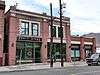 |
November 17, 1982 (#82000355) |
207 3rd St. 46°25′20″N 117°01′47″W / 46.422329°N 117.029709°W |
Lewiston | |
| 19 | Lewiston Depot | May 7, 1973 (#73000687) |
13th and Main Sts. 46°25′08″N 117°00′58″W / 46.418753°N 117.016099°W |
Lewiston | ||
| 20 | Lewiston Historic District | 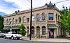 |
June 5, 1975 (#75000637) |
Irregular pattern between 1st and 5th Sts. and B St. and the Snake River; also roughly bounded by 1st, B, 6th, and F Sts. 46°25′18″N 117°01′45″W / 46.421597°N 117.029152°W |
Lewiston | Second set of boundaries represents a boundary increase of September 7, 1984 |
| 21 | Lewiston Methodist Church | 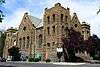 |
September 20, 1979 (#79000802) |
805 6th Ave. 46°24′53″N 117°01′16″W / 46.414774°N 117.021224°W |
Lewiston | |
| 22 | Lewiston Vineyards Gates | 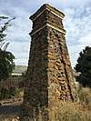 |
April 14, 1983 (#83000288) |
Near 18th Ave. and 10th St. 46°24′03″N 117°01′04″W / 46.400915°N 117.017852°W |
Lewiston | |
| 23 | Lower Salmon River Archeological District | 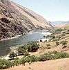 |
September 4, 1986 (#86002170) |
Address Restricted[7] |
Waha | Extends into Idaho and Lewis counties |
| 24 | William and Elizabeth McLaren House | 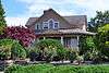 |
November 6, 1992 (#92001413) |
1602 15th Ave. 46°24′17″N 117°00′33″W / 46.404815°N 117.009171°W |
Lewiston | |
| 25 | Nave Apartments | 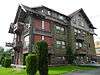 |
August 3, 1978 (#78001085) |
600 block of 8th St. 46°24′50″N 117°01′19″W / 46.413924°N 117.021825°W |
Lewiston | |
| 26 | Nez Perce Snake River Archeological District | December 22, 1978 (#78001086) |
Includes the confluence of Redbird Creek and the Snake River[8] 46°14′04″N 116°57′20″W / 46.234444°N 116.955556°W |
Lewiston | ||
| 27 | St. Stanislaus Catholic Church | 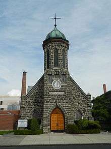 |
February 7, 1978 (#78001087) |
633 5th Ave. 46°24′57″N 117°01′26″W / 46.415851°N 117.023842°W |
Lewiston | |
| 28 | Agnes M. Tamblyn House | 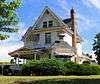 |
November 25, 1994 (#94001364) |
1506 17th Ave. 46°24′10″N 117°00′38″W / 46.402748°N 117.010519°W |
Lewiston | |
| 29 | Gaylord Thompson House | 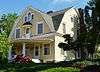 |
May 4, 1992 (#92000419) |
1824 17th Ave. 46°24′10″N 117°00′19″W / 46.402791°N 117.005327°W |
Lewiston | |
| 30 | Twenty-One Ranchhouse | 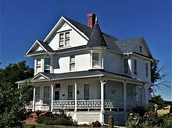 |
December 18, 1978 (#78001088) |
7570 Waha Rd. 46°13′26″N 116°51′33″W / 46.223966°N 116.859121°W |
Lewiston | |
| 31 | W. R. and Louisa E. Wyatt House | 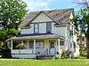 |
November 25, 1994 (#94001362) |
1524 18th Ave. 46°24′06″N 117°00′35″W / 46.401757°N 117.009798°W |
Lewiston |
See also
| Wikimedia Commons has media related to National Register of Historic Places in Nez Perce County, Idaho. |
References
- ↑ The latitude and longitude information provided in this table was derived originally from the National Register Information System, which has been found to be fairly accurate for about 99% of listings. For about 1% of NRIS original coordinates, experience has shown that one or both coordinates are typos or otherwise extremely far off; some corrections may have been made. A more subtle problem causes many locations to be off by up to 150 yards, depending on location in the country: most NRIS coordinates were derived from tracing out latitude and longitudes from USGS topographical quadrant maps created under the North American Datum of 1927, which differs from the current, highly accurate WGS84 GPS system used by most on-line maps. Chicago is about right, but NRIS longitudes in Washington are higher by about 4.5 seconds, and are lower by about 2.0 seconds in Maine. Latitudes differ by about 1.0 second in Florida. Some locations in this table may have been corrected to current GPS standards.
- ↑ "National Register of Historic Places: Weekly List Actions". National Park Service. Retrieved March 29, 2009.
- ↑ "National Register of Historic Places: Weekly List Actions". National Park Service, United States Department of the Interior. Retrieved on October 4, 2018.
- ↑ Numbers represent an ordering by significant words. Various colorings, defined here, differentiate National Historic Landmarks and historic districts from other NRHP buildings, structures, sites or objects.
- ↑ National Park Service (2008-04-24). "National Register Information System". National Register of Historic Places. National Park Service.
- ↑ The eight-digit number below each date is the number assigned to each location in the National Register Information System database, which can be viewed by clicking the number.
- 1 2 3 4 5 Some listings on the NRHP are highly sensitive sites and may be subject to looting or vandalism. The NRHP lists this site as "Address Restricted."
- ↑ Rice, David G. National Register of Historic Places Inventory-Nomination Form: Nez Perce Snake River Archaeological District. National Park Service, 1977-04-04, 15-16.

| Topics | |
|---|---|
| Lists by states |
|
| Lists by insular areas | |
| Lists by associated states | |
| Other areas | |
| |
Municipalities and communities of Nez Perce County, Idaho, United States | ||
|---|---|---|
| Cities | ||
| CDP | ||
| Unincorporated communities | ||
This article is issued from
Wikipedia.
The text is licensed under Creative Commons - Attribution - Sharealike.
Additional terms may apply for the media files.