| [3] |
Name on the Register |
Image |
Date listed[4] |
Location |
City or town |
Description |
|---|
| 1 |
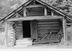
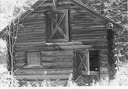
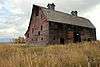
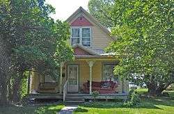
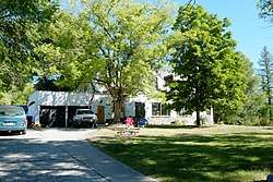
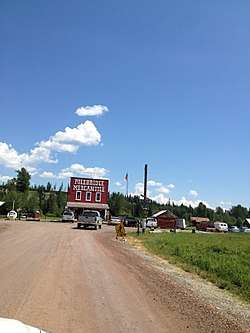
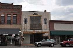
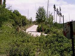
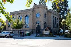
W.L. Adair General Mercantile Historic District |
|
February 6, 1986
(#86000155) |
On Polebridge Loop Rd., 0.25 miles (0.40 km) east of its intersection with North Fork Road
48°45′43″N 114°17′01″W / 48.761944°N 114.283611°W / 48.761944; -114.283611 (W.L. Adair General Mercantile Historic District) |
Polebridge |
|
| 2 |
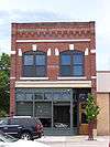
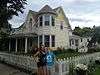
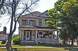
Alexander and Busey Houses |
|
August 24, 1994
(#94000869) |
106 and 112 5th Ave., W.
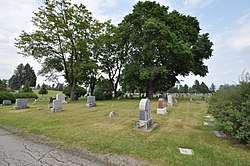
48°11′45″N 114°19′18″W / 48.195833°N 114.321667°W / 48.195833; -114.321667 (Alexander and Busey Houses) |
Kalispell |
part of the Kalispell Multiple Property Submission (MPS); #106 has been demolished. |
| 3 |
Anderson Style Shop |
|
August 24, 1994
(#94000870) |
222 Main St.
48°11′46″N 114°18′44″W / 48.196111°N 114.312222°W / 48.196111; -114.312222 (Anderson Style Shop) |
Kalispell |
part of the Kalispell MPS |
| 4 |
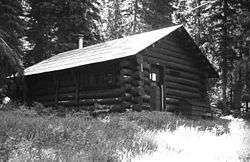
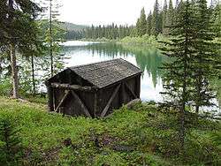
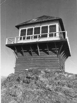
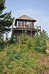
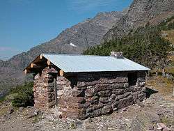
Apgar Fire Lookout |
|
December 16, 1986
(#86003695) |
Near Lake McDonald
48°31′05″N 114°01′10″W / 48.518056°N 114.019444°W / 48.518056; -114.019444 (Apgar Fire Lookout) |
West Glacier |
part of the Glacier National Park Multiple Resource Area (MRA) |
| 5 |
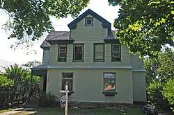
Bader-Jaquette and Westwang Houses and Rental Property |
|
August 24, 1994
(#94000871) |
46 and 36 5th Ave. W.
48°11′48″N 114°19′14″W / 48.196667°N 114.320556°W / 48.196667; -114.320556 (Bader-Jaquette and Westwang Houses and Rental Property) |
Kalispell |
part of the Kalispell MPS |
| 6 |
Beaman House |
|
August 24, 1994
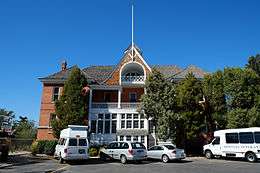
(#94000872) |
230 4th Ave., W.
48°11′43″N 114°19′05″W / 48.195278°N 114.318056°W / 48.195278; -114.318056 (Beaman House) |
Kalispell |
part of the Kalispell MPS |
| 7 |
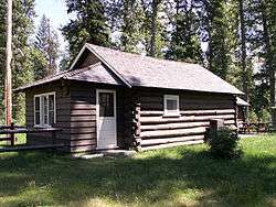
Alice Beck Cabin |
|
December 26, 2008
(#08001219) |
South of Kelly's Camp Rd. and east of McDonald Creek in Glacier National Park
48°37′51″N 113°52′05″W / 48.630909°N 113.868059°W / 48.630909; -113.868059 (Alice Beck Cabin) |
Lake McDonald |
part of the Recreational Camps on Lake McDonald, MT MPS |
| 8 |
Belly River Ranger Station Historic District |
|
February 14, 1986
(#86000329) |
Head of Belly River Valley
48°55′56″N 113°42′40″W / 48.932222°N 113.711111°W / 48.932222; -113.711111 (Belly River Ranger Station Historic District) |
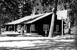
West Glacier |
part of the Glacier National Park MRA |
| 9 |
Belton Chalets |
|
November 15, 1978
(#78001685) |
U.S. Route 2
48°29′48″N 113°58′32″W / 48.496667°N 113.975556°W / 48.496667; -113.975556 (Belton Chalets) |
West Glacier |
|
| 10 |
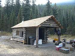
Big Creek Ranger Station Historic District |
|
January 7, 2015
(#14001126) |
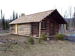
North Fork Rd.
48°36′06″N 114°09′58″W / 48.601576°N 114.166233°W / 48.601576; -114.166233 (Big Creek Ranger Station Historic District) |
Polebridge vicinity |
Flathead National Forest |
| 11 |
Billsborough House |
|
August 24, 1994
(#94000873) |
376 6th Ave., E., N.
48°12′19″N 114°18′22″W / 48.205278°N 114.306111°W / 48.205278; -114.306111 (Billsborough House) |
Kalispell |
part of the Kalispell MPS |
| 12 |
Charles Boles House |
|
February 14, 2006
(#06000041) |
40 Appleway Dr.
48°11′50″N 114°20′05″W / 48.197222°N 114.334722°W / 48.197222; -114.334722 (Charles Boles House) |
Kalispell |
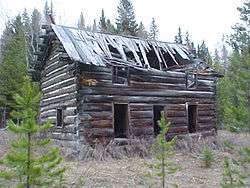
part of the Kalispell MPS |
| 13 |
Bowman Lake Patrol Cabin |
|
February 14, 1986
(#86000340) |
Lower end of Bowman Lake, 0.5 miles (0.80 km) east of the Bowman Lake Ranger Station
48°49′40″N 114°11′31″W / 48.827778°N 114.191944°W / 48.827778; -114.191944 (Bowman Lake Patrol Cabin) |
West Glacier |
part of the Glacier National Park MRA |
| 14 |
Bowman Lake Road |
|
January 19, 1996
(#95001565) |
North Fork drainage between Polebridge and Bowman ranger stations in Glacier National Park
48°49′39″N 114°12′08″W / 48.8275°N 114.202222°W / 48.8275; -114.202222 (Bowman Lake Road) |
West Glacier |
|
| 15 |
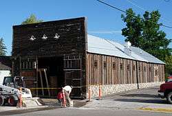
Boyd's Shop |
|
August 24, 1994
(#94000874) |
227 1st. St., W.
48°11′50″N 114°18′58″W / 48.197222°N 114.316111°W / 48.197222; -114.316111 (Boyd's Shop) |
Kalispell |
Established as a blacksmith shop in the 1910s. Later shifted to welding.[5] part of the Kalispell MPS |
| 16 |
Brice Apartments |
|
August 24, 1994
(#94000875) |
228 2nd Ave., E.
48°11′47″N 114°18′38″W / 48.196389°N 114.310556°W / 48.196389; -114.310556 (Brice Apartments) |
Kalispell |
part of the Kalispell MPS |
| 17 |
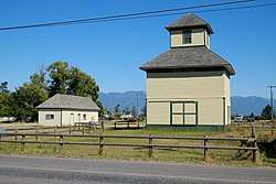
Bruyer Granary |
|
October 12, 2006
(#06000937) |
1355 Whitefish Stage Rd.
48°13′41″N 114°18′23″W / 48.228056°N 114.306389°W / 48.228056; -114.306389 (Bruyer Granary) |
Kalispell |
|
| 18 |
Bull Head Lodge and Studio |
|
February 6, 1984
(#84002465) |
Off Going-to-the-Sun Road
48°31′58″N 113°59′45″W / 48.532778°N 113.995833°W / 48.532778; -113.995833 (Bull Head Lodge and Studio) |
Glacier National Park |
Summer home of artist Charles M. Russell |
| 19 |
Camas Creek Cutoff Road |
|
July 11, 2014
(#14000393) |
Glacier National Park
48°32′26″N 114°00′01″W / 48.5406°N 114.0003°W / 48.5406; -114.0003 (Camas Creek Cutoff Road) |
West Glacier |
|
| 20 |
Cattle Queen Snowshoe Cabin |
|
July 1, 1999
(#99000778) |
McDonald Subdistrict
48°48′38″N 113°49′15″W / 48.810556°N 113.820833°W / 48.810556; -113.820833 (Cattle Queen Snowshoe Cabin) |
West Glacier |
|
| 21 |
City Water Department |
|
August 24, 1994
(#94000876) |
336 1st Ave., E.
48°11′44″N 114°18′37″W / 48.195556°N 114.310278°W / 48.195556; -114.310278 (City Water Department) |
Kalispell |
1927 Georgian Revival office building, designed by Kalispell architect Fred Brinkman. Part of the Kalispell MPS. |
| 22 |
Coal Creek Patrol Cabin |
|
July 1, 1999
(#99000777) |
U.S. Route 2
48°25′00″N 113°38′56″W / 48.416667°N 113.648889°W / 48.416667; -113.648889 (Coal Creek Patrol Cabin) |
West Glacier |
|
| 23 |
C. E. Conrad Memorial Cemetery |
|
December 5, 2012
(#12000995) |
641 Conrad Dr.
48°12′12″N 114°17′20″W / 48.20326°N 114.28897°W / 48.20326; -114.28897 (C. E. Conrad Memorial Cemetery) |
Kalispell |
|
| 24 |
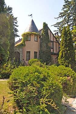
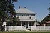
Charles E. Conrad Mansion |
|
February 20, 1975
(#75001083) |
313 6th Ave., E.
48°11′49″N 114°18′08″W / 48.196944°N 114.302222°W / 48.196944; -114.302222 (Charles E. Conrad Mansion) |
Kalispell |
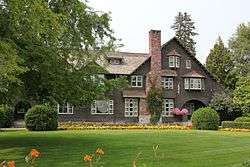
The Shingle-styled mansion was designed by Kirtland Cutter and built in 1895 for businessman Conrad.[6] |
| 25 |
Continental Oil Company Filling Station |
|
August 24, 1994
(#94000877) |
35 1st Ave., N.
48°11′53″N 114°18′39″W / 48.198056°N 114.310833°W / 48.198056; -114.310833 (Continental Oil Company Filling Station) |
Kalispell |
part of the Kalispell MPS; demolished |
| 26 |
Continental Oil Company Warehouse and Garage |
|
August 24, 1994
(#94000878) |
51 1st Ave., W., N.
48°12′00″N 114°18′53″W / 48.2°N 114.314722°W / 48.2; -114.314722 (Continental Oil Company Warehouse and Garage) |
Kalispell |
part of the Kalispell MPS |
| 27 |
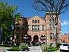
Courthouse Historic District |
|
August 24, 1994
(#94000879) |
500-800 blocks of Main St.
48°11′29″N 114°18′37″W / 48.191389°N 114.310278°W / 48.191389; -114.310278 (Courthouse Historic District) |
Kalispell |
part of the Kalispell MPS |
| 28 |
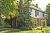
A. J. Dean House |
|
August 11, 1980
(#80002415) |
244 Woodland Ave.
48°11′46″N 114°18′12″W / 48.196111°N 114.303333°W / 48.196111; -114.303333 (A. J. Dean House) |
Kalispell |
|
| 29 |
DeSmet (Boat) |
|
December 14, 2017
(#100001896) |
Lake McDonald, Glacier National Park
48°37′04″N 113°52′47″W / 48.617898°N 113.879732°W / 48.617898; -113.879732 (DeSmet (Boat)) |
West Glacier vicinity |
|
| 30 |
East Side Historic District |
|
August 24, 1994
(#94000880) |
Roughly bounded by Central St., E., Woodland Park, Woodland Ave., 13th St., E., and 1st Ave., E.
48°11′43″N 114°18′16″W / 48.195278°N 114.304444°W / 48.195278; -114.304444 (East Side Historic District) |
Kalispell |
Various businesses, institutions and residences built as early as the 1890s.;[7] part of the Kalispell MPS |
| 31 |
Equity Supply Company Elevator and Creamery |
|
August 24, 1994
(#94000881) |
50 1st Ave., W., N.
48°12′00″N 114°18′57″W / 48.2°N 114.315833°W / 48.2; -114.315833 (Equity Supply Company Elevator and Creamery) |
Kalispell |
part of the Kalispell MPS; demolished. |
| 32 |
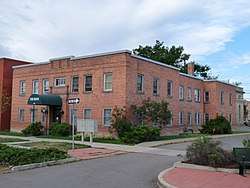
Federal Building |
|
August 24, 1994
(#94000882) |
247 1st Ave., E.
48°11′47″N 114°18′36″W / 48.196389°N 114.31°W / 48.196389; -114.31 (Federal Building) |
Kalispell |
part of the Kalispell MPS; now the local library |
| 33 |
Ferguson House |
|
August 24, 1994
(#94000883) |
320 4th Ave., W.
48°12′19″N 114°19′02″W / 48.205278°N 114.317222°W / 48.205278; -114.317222 (Ferguson House) |
Kalispell |
The Ferguson House is an American Foursquare cottage with Queen Anne stylings, built in 1897 by Ferguson, a boilermaker for the Great Northern Railway.;[8] part of the Kalispell MPS |
| 34 |
Fielding Snowshoe Patrol Cabin |
|
February 14, 1986
(#86000341) |
Off U.S. Route 2
48°17′11″N 113°27′22″W / 48.286389°N 113.456111°W / 48.286389; -113.456111 (Fielding Snowshoe Patrol Cabin) |
West Glacier |
part of the Glacier National Park MRA |
| 35 |
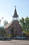
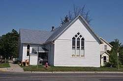
First Presbyterian Church of Whitefish |
|
October 1, 2004
(#04001085) |
301 Central Ave.
48°24′33″N 114°20′08″W / 48.409167°N 114.335556°W / 48.409167; -114.335556 (First Presbyterian Church of Whitefish) |
Whitefish |
|
| 36 |
Fish Creek Bay Boathouse |
|
January 19, 1996
(#95001567) |
Fish Creek Campground on the western shore of Lake McDonald in Glacier National Park
48°33′04″N 113°58′48″W / 48.551111°N 113.98°W / 48.551111; -113.98 (Fish Creek Bay Boathouse) |
West Glacier |
|
| 37 |
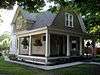
Fisher House |
|
August 25, 1994
(#94000884) |
441 2nd St., W.
48°11′45″N 114°19′05″W / 48.195833°N 114.318056°W / 48.195833; -114.318056 (Fisher House) |
Kalispell |
part of the Kalispell MPS |
| 38 |
Flathead National Forest Backcountry Administrative Facilities |
|
December 17, 2014
(#14001047) |
Flathead National Forest
48°09′25″N 113°40′09″W / 48.1569°N 113.6693°W / 48.1569; -113.6693 (Flathead National Forest Backcountry Administrative Facilities) |
Hungry Horse vicinity |
Discontiguous district encompassing backcountry ranger stations and other infrastructure in the Great Bear Wilderness and Bob Marshall Wilderness |
| 39 |
Flathead River Bridge |
|
June 17, 2010
(#10000183) |
South end of 4th Ave.
48°21′43″N 114°11′02″W / 48.361944°N 114.183889°W / 48.361944; -114.183889 (Flathead River Bridge) |
Columbia Falls vicinity |
|
| 40 |
Flathead Wholesale Grocery |
|
August 22, 1994
(#94000885) |
5 1st Ave., E.
48°11′57″N 114°18′40″W / 48.199167°N 114.311111°W / 48.199167; -114.311111 (Flathead Wholesale Grocery) |
Kalispell |
part of the Kalispell MPS |
| 41 |
Ford Creek Patrol Cabin |
|
February 14, 1986
(#86000342) |
Glacier Route 7
48°37′33″N 113°56′36″W / 48.625833°N 113.943333°W / 48.625833; -113.943333 (Ford Creek Patrol Cabin) |
West Glacier |
part of the Glacier National Park MRA |
| 42 |
Edward Gay House |
|
August 24, 1994
(#94000886) |
236 5th Ave., W.
48°11′41″N 114°19′11″W / 48.194722°N 114.319722°W / 48.194722; -114.319722 (Edward Gay House) |
Kalispell |
part of the Kalispell MPS |
| 43 |
Gibson-Lebert House |
|
August 24, 1994
(#94000887) |
461 E. California St.
48°12′23″N 114°18′34″W / 48.206389°N 114.309444°W / 48.206389; -114.309444 (Gibson-Lebert House) |
Kalispell |
part of the Kalispell MPS |
| 44 |
Going-to-the-Sun Road |
|
June 16, 1983
(#83001070) |
Glacier Route 1
48°38′48″N 113°46′48″W / 48.646667°N 113.78°W / 48.646667; -113.78 (Going-to-the-Sun Road) |
West Glacier |
|
| 45 |
Going-to-the-Sun Road |
|
February 18, 1997
(#97000345) |
Glacier National Park
48°38′01″N 113°47′15″W / 48.633611°N 113.7875°W / 48.633611; -113.7875 (Going-to-the-Sun Road) |
West Glacier |
Extends into Glacier County |
| 46 |
Graham House |
|
August 24, 1994
(#94000888) |
825 6th Ave., E.
48°11′31″N 114°18′03″W / 48.191944°N 114.300833°W / 48.191944; -114.300833 (Graham House) |
Kalispell |
part of the Kalispell MPS |
| 47 |
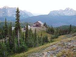
Granite Park Chalet |
|
June 27, 1983
(#83001060) |
Glacier National Park
48°46′12″N 113°46′11″W / 48.77°N 113.769722°W / 48.77; -113.769722 (Granite Park Chalet) |
West Glacier |
|
| 48 |
Great Northern Railway Buildings |
|
May 28, 1987
(#87001453) |
Glacier National Park
48°38′29″N 113°32′17″W / 48.641389°N 113.538056°W / 48.641389; -113.538056 (Great Northern Railway Buildings) |
Glacier National Park |
|
| 49 |
Great Northern Railway Depot |
|
August 24, 1994
(#94000889) |
15 Depot Loop
48°11′58″N 114°18′44″W / 48.199444°N 114.312222°W / 48.199444; -114.312222 (Great Northern Railway Depot) |
Kalispell |
part of the Kalispell MPS |
| 50 |
Great Northern Railway Passenger and Freight Depot and Division Office |
|
July 11, 2002
(#02000766) |
500 Depot St.
48°24′48″N 114°20′04″W / 48.413333°N 114.334444°W / 48.413333; -114.334444 (Great Northern Railway Passenger and Freight Depot and Division Office) |
Whitefish |
|
| 51 |
Gregg-Moses House |
|
August 24, 1994
(#94000890) |
27 8th Ave., W.
48°11′46″N 114°19′19″W / 48.196111°N 114.321944°W / 48.196111; -114.321944 (Gregg-Moses House) |
Kalispell |
part of the Kalispell MPS |
| 52 |
Greve's Tourist Cabins |
|
December 26, 2008
(#08001222) |
Western side of Going-to-the-Sun Road in Glacier National Park
48°37′25″N 113°52′16″W / 48.623662°N 113.871063°W / 48.623662; -113.871063 (Greve's Tourist Cabins) |
Lake McDonald |
part of the Recreational Camps on Lake McDonald, MT MPS |
| 53 |
Gunsight Pass Shelter |
|
February 14, 1986
(#86000344) |
Junction of Gunsight Pass Trail and the Continental Divide
48°36′34″N 113°44′16″W / 48.609444°N 113.737778°W / 48.609444; -113.737778 (Gunsight Pass Shelter) |
West Glacier |
part of the Glacier National Park MRA |
| 54 |
Harrison Lake Patrol Cabin |
|
February 16, 2001
(#01000116) |
U.S. Route 2
48°31′39″N 113°45′18″W / 48.5275°N 113.755°W / 48.5275; -113.755 (Harrison Lake Patrol Cabin) |
Glacier National Park |
|
| 55 |
Headquarters Historic District |
|
January 19, 1996
(#95001569) |
East of Glacier Route 1 at the crossing of the Middle Fork of the Flathead River in Glacier National Park
48°30′06″N 113°58′47″W / 48.501667°N 113.979722°W / 48.501667; -113.979722 (Headquarters Historic District) |
West Glacier |
|
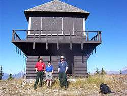
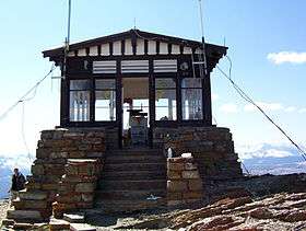
| 56 |
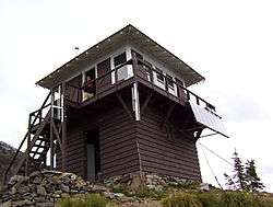
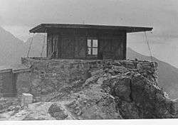
Heaven's Peak Fire Lookout |
|
December 19, 1986
(#86003688) |
Mount Cannon
48°31′05″N 114°01′10″W / 48.518056°N 114.019444°W / 48.518056; -114.019444 (Heaven's Peak Fire Lookout) |
West Glacier |
part of the Glacier National Park MRA |
| 57 |
Cornelius Hedges Elementary School |
|
June 29, 1989
(#89000765) |
827 4th Ave., E.
48°11′30″N 114°18′10″W / 48.191667°N 114.302778°W / 48.191667; -114.302778 (Cornelius Hedges Elementary School) |
Kalispell |
|
| 58 |
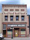
Heller Building |
|
March 22, 1991
(#91000332) |
140 Main St.
48°11′50″N 114°18′45″W / 48.197222°N 114.3125°W / 48.197222; -114.3125 (Heller Building) |
Kalispell |
|
| 59 |
Hodgson House |
|
August 24, 1994
(#94000891) |
314 9th Ave., W.
48°11′41″N 114°19′30″W / 48.194722°N 114.325°W / 48.194722; -114.325 (Hodgson House) |
Kalispell |
part of the Kalispell MPS |
| 60 |
Hornet Lookout |
|
August 19, 1983
(#83001061) |
Hornet Mountain
48°52′47″N 114°30′42″W / 48.879722°N 114.511667°W / 48.879722; -114.511667 (Hornet Lookout) |
Flathead National Forest |
|
| 61 |
Hotel Norden |
|
August 24, 1994
(#94000892) |
24 1st Ave., W.
48°11′52″N 114°18′52″W / 48.197778°N 114.314444°W / 48.197778; -114.314444 (Hotel Norden) |
Kalispell |
part of the Kalispell MPS |
| 62 |
Houtz House |
|
August 24, 1994
(#94000893) |
822 5th Ave., W.
48°11′21″N 114°19′03″W / 48.189167°N 114.3175°W / 48.189167; -114.3175 (Houtz House) |
Kalispell |
part of the Kalispell MPS |
| 63 |
Howes' Lake McDonald Cottage Sites Historic District |
|
December 26, 2008
(#08001223) |
Northern side of Apgar Loop Rd. in Glacier National Park
48°31′39″N 113°59′17″W / 48.527491°N 113.98816°W / 48.527491; -113.98816 (Howes' Lake McDonald Cottage Sites Historic District) |
West Glacier |
part of the Recreational Camps on Lake McDonald, MT MPS |
| 64 |
Huckleberry Fire Outlook |
|
February 14, 1986
(#86000346) |
Summit of Huckleberry Mountain
48°36′01″N 114°08′01″W / 48.600278°N 114.133611°W / 48.600278; -114.133611 (Huckleberry Fire Outlook) |
West Glacier |
part of the Glacier National Park MRA |
| 65 |
Izaak Walton Inn |
|
October 18, 1985
(#85003235) |
Off U.S. Route 2 adjacent to the railroad line in Essex
48°16′43″N 113°36′41″W / 48.278611°N 113.611389°W / 48.278611; -113.611389 (Izaak Walton Inn) |
Essex |
|
| 66 |
Johnson-Lee House |
|
August 24, 1994
(#94000894) |
651 2nd Ave., W., N.
48°12′20″N 114°19′06″W / 48.205556°N 114.318333°W / 48.205556; -114.318333 (Johnson-Lee House) |
Kalispell |
part of the Kalispell MPS |
| 67 |
Kalispell Flour Mill |
|
August 24, 1994
(#94000896) |
506 W. Center St.
48°11′51″N 114°19′16″W / 48.1975°N 114.321111°W / 48.1975; -114.321111 (Kalispell Flour Mill) |
Kalispell |
part of the Kalispell MPS |
| 68 |
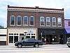
Kalispell Main Street Historic District |
|
August 24, 1994
(#94000904) |
34-343 Main St. and 116-142 1st Ave., E.
• Boundary increase (listed September 3, 2010, refnum 10000633): Roughly bounded by Center St. to the north, 5th St. to the south, and the north and south running alleys to the west of Main St.
48°11′48″N 114°18′42″W / 48.196667°N 114.311667°W / 48.196667; -114.311667 (Kalispell Main Street Historic District) |
Kalispell |
part of the Kalispell MPS |
| 69 |
Kalispell Monumental Company |
|
August 24, 1994
(#94000898) |
7 1st Ave., E.
48°11′55″N 114°18′40″W / 48.198611°N 114.311111°W / 48.198611; -114.311111 (Kalispell Monumental Company) |
Kalispell |
part of the Kalispell MPS |
| 70 |
Kalispell-American Laundry |
|
August 24, 1994
(#94000895) |
121 1st Ave., E.
48°11′51″N 114°18′38″W / 48.1975°N 114.310556°W / 48.1975; -114.310556 (Kalispell-American Laundry) |
Kalispell |
part of the Kalispell MPS |
| 71 |
Kearney Rapids Bridge |
|
July 22, 1994
(#94000734) |
Bigfork Canyon Rd.
48°03′22″N 114°01′43″W / 48.056111°N 114.028611°W / 48.056111; -114.028611 (Kearney Rapids Bridge) |
Bigfork |
|
| 72 |
Harry C. Keith House |
|
July 16, 1987
(#87001198) |
538 5th Ave., E
48°11′40″N 114°18′14″W / 48.194444°N 114.303889°W / 48.194444; -114.303889 (Harry C. Keith House) |
Kalispell |
|
| 73 |
Kelly's Camp Historic District |
|
December 23, 2009
(#08001224) |
South of Kelly's Camp Rd. between Kelly's Creek and south of cabins in Glacier National Park
48°37′37″N 113°54′09″W / 48.626839°N 113.902614°W / 48.626839; -113.902614 (Kelly's Camp Historic District) |
Lake McDonald |
part of the Recreational Camps on Lake McDonald, MT MPS |
| 74 |
Kerr House |
|
August 24, 1994
(#94000899) |
136 5th Ave., W.
48°11′41″N 114°19′12″W / 48.194722°N 114.32°W / 48.194722; -114.32 (Kerr House) |
Kalispell |
part of the Kalispell MPS |
| 75 |
Kintla Lake Ranger Station |
|
February 14, 1986
(#86000332) |
Southern shore of Kintla Lake
48°56′04″N 114°20′25″W / 48.934444°N 114.340278°W / 48.934444; -114.340278 (Kintla Lake Ranger Station) |
West Glacier |
part of the Glacier National Park MRA |
| 76 |
Kishenehn Ranger Station Historic District |
|
February 14, 1986
(#86000335) |
3 miles (4.8 km) south of the Canada–US border near the confluence of the northern fork of the Flathead River and Kishenehn Creek
48°57′37″N 114°25′14″W / 48.960278°N 114.420556°W / 48.960278; -114.420556 (Kishenehn Ranger Station Historic District) |
West Glacier |
part of the Glacier National Park MRA |
| 77 |
Lake McDonald Lodge Coffee Shop |
|
October 14, 2008
(#08001014) |
Lake McDonald Lodge Boulevard
48°37′04″N 113°52′35″W / 48.617726°N 113.87649°W / 48.617726; -113.87649 (Lake McDonald Lodge Coffee Shop) |
Lake McDonald |
|
| 78 |
Lake McDonald Lodge |
|
May 22, 1978
(#78000280) |
Off Going-to-the-Sun Road
48°37′02″N 113°52′41″W / 48.617222°N 113.878056°W / 48.617222; -113.878056 (Lake McDonald Lodge) |
West Glacier |
Part of the Glacier National Park MRA; designated a National Historic Landmark District on May 28, 1987 |
| 79 |
Leibig House |
|
August 24, 1994
(#94000900) |
396 4th Ave., E., N.
48°12′17″N 114°18′32″W / 48.204722°N 114.308889°W / 48.204722; -114.308889 (Leibig House) |
Kalispell |
part of the Kalispell MPS |
| 80 |
Lincoln Creek Snowshoe Cabin |
|
February 2, 2001
(#01000037) |
U.S. Route 2
48°29′53″N 113°52′41″W / 48.498056°N 113.878056°W / 48.498056; -113.878056 (Lincoln Creek Snowshoe Cabin) |
West Glacier |
part of the Glacier National Park MRA |
| 81 |
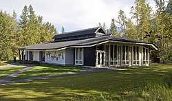
Lockridge Medical Clinic |
|
August 14, 2012
(#12000789) |
341 Central Ave.
48°43′25″N 113°45′48″W / 48.723611°N 113.763333°W / 48.723611; -113.763333 (Lockridge Medical Clinic) |
Whitefish |
designed by Frank Lloyd Wright in 1958[9] |
| 82 |
Logan Creek Patrol Cabin |
|
February 14, 1986
(#86000348) |
Eastern side of Going-to-the-Sun Road at the crossing of Logan Creek
48°43′25″N 113°45′48″W / 48.723611°N 113.763333°W / 48.723611; -113.763333 (Logan Creek Patrol Cabin) |
West Glacier |
part of the Glacier National Park MRA |
| 83 |
Logging Creek Ranger Station Historic District |
|
December 16, 1986
(#86003697) |
Glacier Route 7 near Logging Creek
48°41′51″N 114°11′34″W / 48.6975°N 114.192778°W / 48.6975; -114.192778 (Logging Creek Ranger Station Historic District) |
West Glacier |
part of the Glacier National Park MRA |
| 84 |
Loneman Fire Lookout |
|
February 14, 1986
(#86000353) |
Access via Loneman Mountain Trail
48°29′21″N 113°46′04″W / 48.489167°N 113.767778°W / 48.489167; -113.767778 (Loneman Fire Lookout) |
West Glacier |
part of the Glacier National Park MRA |
| 85 |
Long House |
|
August 24, 1994
(#94000901) |
393 8th Ave., E., N.
48°12′21″N 114°18′10″W / 48.205833°N 114.302778°W / 48.205833; -114.302778 (Long House) |
Kalispell |
part of the Kalispell MPS |
| 86 |
Lower Logging Lake Snowshoe Cabin and Boathouse |
|
December 16, 1986
(#86003692) |
Near the foot of Logging Lake
48°44′26″N 114°07′46″W / 48.740654°N 114.129564°W / 48.740654; -114.129564 (Lower Logging Lake Snowshoe Cabin and Boathouse) |
West Glacier |
part of the Glacier National Park MRA |
| 87 |
Lower Nyack Snowshoe Cabin |
|
February 14, 1986
(#86000356) |
Western side of Nyack Creek Trail
48°29′47″N 113°41′16″W / 48.496389°N 113.687778°W / 48.496389; -113.687778 (Lower Nyack Snowshoe Cabin) |
West Glacier |
part of the Glacier National Park MRA |
| 88 |
Lower Park Creek Patrol Cabin |
|
December 16, 1986
(#86003701) |
Eastern side of Park Creek Trail past the crossing of Fielding-Coal Creek Trail
48°20′08″N 113°32′37″W / 48.335556°N 113.543611°W / 48.335556; -113.543611 (Lower Park Creek Patrol Cabin) |
West Glacier |
part of the Glacier National Park MRA |
| 89 |
McCarthy-Pederson Farm Historic District |
|
December 18, 2006
(#06001188) |
820 Riverside Rd.
48°09′48″N 114°08′07″W / 48.1633°N 114.1352°W / 48.1633; -114.1352 (McCarthy-Pederson Farm Historic District) |
Kalispell |
|
| 90 |
McCarthy Homestead Cabin |
|
December 16, 1986
(#86003691) |
On the northern fork of the Flathead River
48°48′27″N 114°19′21″W / 48.8075°N 114.3225°W / 48.8075; -114.3225 (McCarthy Homestead Cabin) |
West Glacier |
part of the Glacier National Park MRA; duplicate of Margaret McCarthy Homestead |
| 91 |
Margaret McCarthy Homestead |
|
July 21, 1988
(#88001095) |
Glacier National Park
48°48′27″N 114°19′20″W / 48.8075°N 114.322222°W / 48.8075; -114.322222 (Margaret McCarthy Homestead) |
Big Prairie |
part of the Settlement on the North Fork of the Flathead River, Glacier National Park Thematic Resource (TR); duplicate of McCarthy Homestead Cabin |
| 92 |
McGee House |
|
August 24, 1994
(#94000903) |
454 1st Ave., E., N.
48°12′16″N 114°18′48″W / 48.204444°N 114.313333°W / 48.204444; -114.313333 (McGee House) |
Kalispell |
part of the Kalispell MPS |
| 93 |
McMannamy House and Rental Properties |
|
August 24, 1994
(#94000902) |
1020 5th Ave., W., 1004, 1012 and 1020½ 5th Ave. W., and 508 and 516 10th St., W.
48°11′14″N 114°19′00″W / 48.187222°N 114.316667°W / 48.187222; -114.316667 (McMannamy House and Rental Properties) |
Kalispell |
part of the Kalispell MPS |
| 94 |
J.K. Miller Homestead |
|
July 21, 1988
(#88001092) |
Glacier National Park
48°50′11″N 114°19′44″W / 48.836389°N 114.328889°W / 48.836389; -114.328889 (J.K. Miller Homestead) |
Big Prairie |
part of the Settlement on the North Fork of the Flathead River, Glacier National Park TR |
| 95 |
Mount Brown Fire Lookout |
|
December 16, 1986
(#86003693) |
Off Route 1 near Snyder Lake
48°37′44″N 113°49′58″W / 48.628889°N 113.832778°W / 48.628889; -113.832778 (Mount Brown Fire Lookout) |
West Glacier |
part of the Glacier National Park MRA |
| 96 |
North Fork Road |
|
January 19, 1996
(#95001572) |
North Fork drainage, Fish Creek to Kintla Lake in Glacier National Park
48°32′53″N 113°59′11″W / 48.548056°N 113.986389°W / 48.548056; -113.986389 (North Fork Road) |
West Glacier |
|
| 97 |
Norwegian Evangelical Lutheran Church and Parsonage |
|
August 17, 1994
(#94000905) |
344 and 332 5th Ave., W.
48°11′37″N 114°19′09″W / 48.193611°N 114.319167°W / 48.193611; -114.319167 (Norwegian Evangelical Lutheran Church and Parsonage) |
Kalispell |
part of the Kalispell MPS |
| 98 |
Numa Ridge Fire Lookout |
|
February 14, 1986
(#86000357) |
Near Bowman Lake
48°53′01″N 114°10′43″W / 48.883611°N 114.178611°W / 48.883611; -114.178611 (Numa Ridge Fire Lookout) |
West Glacier |
part of the Glacier National Park MRA |
| 99 |
Nyack Ranger Station Historic District |
|
February 14, 1986
(#86000359) |
Nyack Ranger Station
48°26′24″N 113°47′43″W / 48.44°N 113.795278°W / 48.44; -113.795278 (Nyack Ranger Station Historic District) |
West Glacier |
part of the Glacier National Park MRA |
| 100 |
O'Neil Lumber Company Office |
|
August 24, 1994
(#94000906) |
424 Main St.
48°11′39″N 114°18′41″W / 48.194167°N 114.311389°W / 48.194167; -114.311389 (O'Neil Lumber Company Office) |
Kalispell |
part of the Kalispell MPS |
| 101 |
Polebridge Ranger Station Historic District |
|
February 14, 1986
(#86000337) |
Near the northeastern end of Henshaw Bridge on Route 7
48°46′56″N 114°16′43″W / 48.782222°N 114.278611°W / 48.782222; -114.278611 (Polebridge Ranger Station Historic District) |
West Glacier |
part of the Glacier National Park MRA |
| 102 |
Polebridge to Numa Ridge Phoneline |
|
April 4, 1996
(#95001573) |
North Fork drainage, Polebridge to Numa Ridge in Glacier National Park
48°49′59″N 114°13′10″W / 48.833056°N 114.219444°W / 48.833056; -114.219444 (Polebridge to Numa Ridge Phoneline) |
West Glacier |
|
| 103 |
Porter Ranch Barn |
|
April 15, 1999
(#99000458) |
North Somers Rd.
48°06′42″N 114°12′34″W / 48.111667°N 114.209444°W / 48.111667; -114.209444 (Porter Ranch Barn) |
Kalispell |
|
| 104 |
Quartz Lake Patrol Cabin |
|
February 14, 1986
(#86000361) |
Foot of Quartz Lake
48°49′19″N 114°08′05″W / 48.821944°N 114.134722°W / 48.821944; -114.134722 (Quartz Lake Patrol Cabin) |
West Glacier |
part of the Glacier National Park MRA |
| 105 |
William Raftery Homestead |
|
July 21, 1988
(#88001099) |
Glacier National Park
48°48′34″N 114°17′30″W / 48.809444°N 114.291667°W / 48.809444; -114.291667 (William Raftery Homestead) |
Big Prairie |
part of the Settlement on the North Fork of the Flathead River, Glacier National Park TR |
| 106 |
Reid-Kent House |
|
August 24, 1994
(#94000907) |
246 8th Ave., W.
48°11′39″N 114°19′26″W / 48.194167°N 114.323889°W / 48.194167; -114.323889 (Reid-Kent House) |
Kalispell |
part of the Kalispell MPS |
| 107 |
Cornelius Ringleberg House |
|
January 22, 1987
(#86003673) |
1028 3rd Ave., W.
48°11′16″N 114°18′50″W / 48.187778°N 114.313889°W / 48.187778; -114.313889 (Cornelius Ringleberg House) |
Kalispell |
|
| 108 |
Rogers House |
|
August 24, 1994
(#94000908) |
380 5th Ave., E., N.
48°12′18″N 114°18′28″W / 48.205°N 114.307778°W / 48.205; -114.307778 (Rogers House) |
Kalispell |
part of the Kalispell MPS |
| 109 |
Roose-Eckelberry House |
|
August 24, 1994
(#94000909) |
146 3rd Ave., W.
48°11′46″N 114°19′01″W / 48.196111°N 114.316944°W / 48.196111; -114.316944 (Roose-Eckelberry House) |
Kalispell |
part of the Kalispell MPS |
| 110 |
Russell School |
|
August 24, 1994
(#94000910) |
227 W. Nevada St.
48°12′21″N 114°19′10″W / 48.205833°N 114.319444°W / 48.205833; -114.319444 (Russell School) |
Kalispell |
part of the Kalispell MPS |
| 111 |
St. Richard's Church |
|
March 19, 1980
(#80002414) |
505 W. 4th Ave.
48°22′25″N 114°11′08″W / 48.373611°N 114.185556°W / 48.373611; -114.185556 (St. Richard's Church) |
Columbia Falls |
|
| 112 |
Sauser-Mercord Building |
|
August 24, 1994
(#94000911) |
223-240 Main St.
48°11′42″N 114°18′42″W / 48.195°N 114.311667°W / 48.195; -114.311667 (Sauser-Mercord Building) |
Kalispell |
part of the Kalispell MPS |
| 113 |
Scalplock Mountain Fire Lookout |
|
February 14, 1986
(#86000363) |
Accessible by trail connecting to Boundary Trail near the Walton Ranger Station
48°18′01″N 113°34′24″W / 48.300278°N 113.573333°W / 48.300278; -113.573333 (Scalplock Mountain Fire Lookout) |
West Glacier |
part of the Glacier National Park MRA |
| 114 |
Scandinavian Methodist Church |
|
August 24, 1994
(#94000912) |
203 5th Ave., W.
48°11′43″N 114°19′09″W / 48.195278°N 114.319167°W / 48.195278; -114.319167 (Scandinavian Methodist Church) |
Kalispell |
part of the Kalispell MPS |
| 115 |
Anton Schoenberger Homestead |
|
July 21, 1988
(#88001094) |
Glacier National Park
48°48′34″N 114°17′30″W / 48.809444°N 114.291667°W / 48.809444; -114.291667 (Anton Schoenberger Homestead) |
Big Prairie |
part of the Settlement on the North Fork of the Flathead River, Glacier National Park TR |
| 116 |
Charlie Schoenberger Homestead |
|
July 21, 1988
(#88001093) |
Glacier National Park
48°48′31″N 114°19′23″W / 48.808611°N 114.323056°W / 48.808611; -114.323056 (Charlie Schoenberger Homestead) |
Big Prairie |
part of the Settlement on the North Fork of the Flathead River, Glacier National Park TR |
| 117 |
Scott-Forhan House |
|
August 24, 1994
(#94000913) |
326 4th Ave., W.
48°11′39″N 114°19′03″W / 48.194167°N 114.3175°W / 48.194167; -114.3175 (Scott-Forhan House) |
Kalispell |
part of the Kalispell MPS |
| 118 |
Sherwood Lodge |
|
December 26, 2008
(#08001226) |
Grist Rd. in Glacier National Park
48°32′11″N 113°59′45″W / 48.536416°N 113.995726°W / 48.536416; -113.995726 (Sherwood Lodge) |
West Glacier |
part of the Recreational Camps on Lake McDonald, MT MPS |
| 119 |
Skyland Camp-Bowman Lake Ranger Station |
|
February 14, 1986
(#86000365) |
Southwestern shore of Bowman Lake
48°49′44″N 114°12′13″W / 48.828889°N 114.203611°W / 48.828889; -114.203611 (Skyland Camp-Bowman Lake Ranger Station) |
West Glacier |
part of the Glacier National Park MRA |
| 120 |
Smith House |
|
August 24, 1994
(#94000915) |
476 4th Ave., E., N.
48°12′20″N 114°18′33″W / 48.205556°N 114.309167°W / 48.205556; -114.309167 (Smith House) |
Kalispell |
part of the Kalispell MPS |
| 121 |
Snyder House |
|
August 24, 1994
(#94000916) |
514 8th Ave., W.
48°11′30″N 114°19′23″W / 48.191667°N 114.323056°W / 48.191667; -114.323056 (Snyder House) |
Kalispell |
part of the Kalispell MPS |
| 122 |
Soldiers' Home Historic District |
|
April 21, 1994
(#94000385) |
Veterans Dr.
48°21′27″N 114°12′37″W / 48.3575°N 114.210278°W / 48.3575; -114.210278 (Soldiers' Home Historic District) |
Columbia Falls |
|
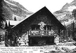
| 123 |
Sperry Chalet |
|
August 2, 1977
(#77000115) |
East of West Glacier
48°36′16″N 113°47′03″W / 48.604444°N 113.784167°W / 48.604444; -113.784167 (Sperry Chalet) |
West Glacier |
|
| 124 |
Stillwater Ranger Station Historic District |
|
July 8, 1981
(#81000340) |
U.S. Route 93
48°32′33″N 114°34′03″W / 48.5425°N 114.5675°W / 48.5425; -114.5675 (Stillwater Ranger Station Historic District) |
Olney |
|
| 125 |
Swan River Bridge |
|
August 3, 2015
(#15000484) |
Bridge St.
48°03′33″N 114°04′22″W / 48.0593°N 114.0727°W / 48.0593; -114.0727 (Swan River Bridge) |
Bigfork |
|
| 126 |
Swan River Community Hall |
|
May 30, 2002
(#02000567) |
115 Swan River Rd.
48°05′42″N 114°01′40″W / 48.095°N 114.027778°W / 48.095; -114.027778 (Swan River Community Hall) |
Swan River |
|
| 127 |
Swiftcurrent Fire Lookout |
|
December 16, 1986
(#86003694) |
Near the Continental Garden Wall in the vicinity of Swiftcurrent Mountain
48°47′08″N 113°45′58″W / 48.785556°N 113.766111°W / 48.785556; -113.766111 (Swiftcurrent Fire Lookout) |
West Glacier |
part of the Glacier National Park MRA |
| 128 |
Ray E. Taylor House |
|
August 10, 1990
(#90001204) |
900 S. Baker Ave.
48°24′09″N 114°20′18″W / 48.4025°N 114.338333°W / 48.4025; -114.338333 (Ray E. Taylor House) |
Whitefish |
|
| 129 |
Thibodeau Electric Shop |
|
August 24, 1994
(#94000917) |
313 2nd Ave., W.
48°11′41″N 114°18′52″W / 48.194722°N 114.314444°W / 48.194722; -114.314444 (Thibodeau Electric Shop) |
Kalispell |
part of the Kalispell MPS |
| 130 |
Thierwechter House |
|
August 24, 1994
(#94000918) |
305 4th Ave., W.
48°11′40″N 114°19′03″W / 48.194444°N 114.3175°W / 48.194444; -114.3175 (Thierwechter House) |
Kalispell |
part of the Kalispell MPS |
| 131 |
Upper Kintla Lake Patrol Cabin |
|
February 14, 1986
(#86000374) |
Head of Kintla Lake
48°58′38″N 114°14′47″W / 48.977222°N 114.246389°W / 48.977222; -114.246389 (Upper Kintla Lake Patrol Cabin) |
West Glacier |
part of the Glacier National Park MRA |
| 132 |
Upper Lake McDonald Ranger Station Historic District |
|
December 16, 1986
(#86003699) |
Northern shore of Lake McDonald
48°38′23″N 113°52′21″W / 48.639722°N 113.8725°W / 48.639722; -113.8725 (Upper Lake McDonald Ranger Station Historic District) |
West Glacier |
part of the Glacier National Park MRA |
| 133 |
Upper Logging Lake Snowshoe Cabin |
|
February 14, 1986
(#86000376) |
Near the head of Logging Lake
48°46′36″N 114°01′22″W / 48.776667°N 114.022778°W / 48.776667; -114.022778 (Upper Logging Lake Snowshoe Cabin) |
West Glacier |
part of the Glacier National Park MRA |
| 134 |
Upper Nyack Snowshoe Cabin |
|
February 14, 1986
(#86000377) |
Northern side of Nyack Creek
48°32′52″N 113°34′00″W / 48.547778°N 113.566667°W / 48.547778; -113.566667 (Upper Nyack Snowshoe Cabin) |
West Glacier |
part of the Glacier National Park MRA |
| 135 |
Upper Park Creek Patrol Cabin |
|
December 16, 1986
(#86003702) |
Junction of Park Creek and Two Medicine Pass Trails
48°24′54″N 113°27′34″W / 48.415°N 113.459444°W / 48.415; -113.459444 (Upper Park Creek Patrol Cabin) |
West Glacier |
part of the Glacier National Park MRA |
| 136 |
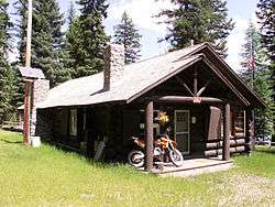
Vance Lodge |
|
December 29, 1994
(#94001505) |
Northern side of Polebridge Loop Rd., about 0.5 miles (0.80 km) northwest of Polebridge
48°46′38″N 114°17′31″W / 48.777222°N 114.291944°W / 48.777222; -114.291944 (Vance Lodge) |
Polebridge |
|
| 137 |
Waggener & Campbell Funeral Home |
|
August 24, 1994
(#94000919) |
228 2nd St., W.
48°11′45″N 114°18′57″W / 48.195833°N 114.315833°W / 48.195833; -114.315833 (Waggener & Campbell Funeral Home) |
Kalispell |
part of the Kalispell MPS |
| 138 |
Walker House |
|
August 24, 1994
(#94000920) |
1122 1st Ave. W.
48°11′14″N 114°18′38″W / 48.187222°N 114.310556°W / 48.187222; -114.310556 (Walker House) |
Kalispell |
part of the Kalispell MPS |
| 139 |
Johnnie Walsh's Guest Lodge |
|
July 21, 1988
(#88001096) |
Glacier National Park
48°48′14″N 114°19′02″W / 48.803889°N 114.317222°W / 48.803889; -114.317222 (Johnnie Walsh's Guest Lodge) |
Big Prairie |
part of the Settlement on the North Fork of the Flathead River, Glacier National Park TR |
| 140 |
Johnnie Walsh Homestead |
|
July 21, 1988
(#88001098) |
Glacier National Park
48°48′29″N 114°18′26″W / 48.808056°N 114.307222°W / 48.808056; -114.307222 (Johnnie Walsh Homestead) |
Big Prairie |
part of the Settlement on the North Fork of the Flathead River, Glacier National Park TR |
| 141 |
Thomas J. Walsh Lodge |
|
November 12, 1998
(#98001365) |
Upper Lake McDonald
48°38′23″N 113°51′22″W / 48.639722°N 113.856111°W / 48.639722; -113.856111 (Thomas J. Walsh Lodge) |
Apgar |
part of the Glacier National Park MRA |
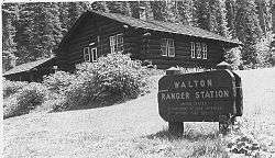
| 142 |
Walton Ranger Station Historic District |
|
December 16, 1986
(#86003700) |
U.S. Route 2 near Essex
48°16′25″N 113°36′08″W / 48.273611°N 113.602222°W / 48.273611; -113.602222 (Walton Ranger Station Historic District) |
West Glacier |
part of the Glacier National Park MRA |
| 143 |
West Entrance Station |
|
April 4, 1996
(#95001581) |
Going-to-the-Sun Road, near West Glacier in Glacier National Park
48°30′23″N 113°59′12″W / 48.506389°N 113.986667°W / 48.506389; -113.986667 (West Entrance Station) |
West Glacier |
|
| 144 |
West Side Historic District |
|
August 24, 1994
(#94000921) |
Roughly bounded by 4th St., W., Main St., 10th St., W., and 4th Ave., W.
48°11′29″N 114°18′48″W / 48.191389°N 114.313333°W / 48.191389; -114.313333 (West Side Historic District) |
Kalispell |
part of the Kalispell MPS |
| 145 |
Burton and Lulu Wheeler Cabin |
|
November 27, 1998
(#98001527) |
Northern end of Lake McDonald
48°38′25″N 113°53′00″W / 48.640278°N 113.883333°W / 48.640278; -113.883333 (Burton and Lulu Wheeler Cabin) |
Apgar |
boundary increase listed October 24, 2008 |
| 146 |
Woll House |
|
August 24, 1994
(#94000922) |
905 4th Ave., W.
48°11′20″N 114°18′55″W / 48.188889°N 114.315278°W / 48.188889; -114.315278 (Woll House) |
Kalispell |
part of the Kalispell MPS |
| 147 |
Wurtz Homestead |
|
June 19, 1996
(#96000661) |
North Fork Road, 2 miles (3.2 km) north of Ford in the Flathead National Forest
48°53′55″N 114°23′19″W / 48.898611°N 114.388611°W / 48.898611; -114.388611 (Wurtz Homestead) |
Polebridge |
|


%2C_October_2011.jpg)