Big Prairie (Montana)
Coordinates: 48°49′17″N 114°19′38″W / 48.82139°N 114.32722°W Big Prairie, Montana, el. 3,625 feet (1,105 m),[1] is an open meadow area on the east side of the North Fork of the Flathead River, in Glacier National Park and is a former settlement. It is within Flathead County, Montana. It was settled by at least 19 homesteads in the early 20th century.[2]
It is the location of several places listed on the National Register of Historic Places:[3]
- Margaret McCarthy Homestead
- J. K. Miller Homestead
- William Raftery Homestead
- Anton Schoenberger Homestead
- Charlie Schoenberger Homestead
- Johnnie Walsh's Guest Lodge
- Johnnie Walsh Homestead
External links
Notes
- ↑ "Big Prairie". Geographic Names Information System. United States Geological Survey.
- ↑ "Settlement on the North Fork of the Flathead River, Glacier National Park TR". National Park Service.
- ↑ National Park Service (2009-03-13). "National Register Information System". National Register of Historic Places. National Park Service.
Municipalities and communities of Flathead County, Montana, United States | ||
|---|---|---|
| Cities | 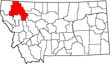 | |
| CDPs | ||
| Unincorporated communities | ||
| Indian reservation | ||
| Footnotes | ‡This populated place also has portions in an adjacent county or counties | |
This article is issued from
Wikipedia.
The text is licensed under Creative Commons - Attribution - Sharealike.
Additional terms may apply for the media files.