| [3] |
Name on the Register |
Image |
Date listed[4] |
Location |
City or town |
Description |
|---|
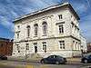
| 1 |
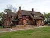
Aderholdt's Mill |
|
December 29, 1988
(#88003077) |
Aderholdt's Mill Rd.
33°46′40″N 85°46′12″W / 33.777778°N 85.77°W / 33.777778; -85.77 (Aderholdt's Mill) |
Jacksonville |
|
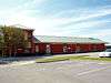
| 2 |
Anniston Cotton Manufacturing Company |
|
October 3, 1985
(#85002739) |
215 W. 11th St.
33°39′34″N 85°50′06″W / 33.659444°N 85.835°W / 33.659444; -85.835 (Anniston Cotton Manufacturing Company) |
Anniston |
Demolished as of April 2014, now site of the Calhoun County Human Resources Department |
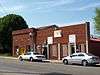
| 3 |
Anniston Inn Kitchen |
|
May 8, 1973
(#73000332) |
130 W. 15th St.
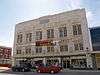
33°39′48″N 85°49′57″W / 33.663333°N 85.8325°W / 33.663333; -85.8325 (Anniston Inn Kitchen) |
Anniston |
|
| 4 |
Anniston Transfer Company |
|
October 3, 1985
(#85002740) |
911 Wilmer Ave.
33°39′22″N 85°49′41″W / 33.656111°N 85.828056°W / 33.656111; -85.828056 (Anniston Transfer Company) |
Anniston |
Demolished as of April 2014 |
| 5 |
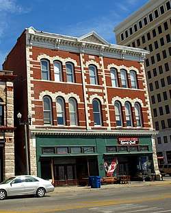
Bagley-Cater Building |
|
October 3, 1985
(#85002864) |
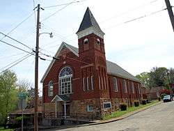
15 E. 10th St.
33°39′26″N 85°49′45″W / 33.65733°N 85.82912°W / 33.65733; -85.82912 (Bagley-Cater Building) |
Anniston |
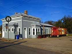
|
| 6 |
Bank of Anniston |
|
October 3, 1985
(#85002865) |
1005 Noble St.
33°39′25″N 85°49′46″W / 33.656944°N 85.829444°W / 33.656944; -85.829444 (Bank of Anniston) |
Anniston |
|
| 7 |
Caldwell Building |
|
March 1, 1982
(#82001997) |
1001 Noble St.
33°39′25″N 85°49′46″W / 33.656944°N 85.829444°W / 33.656944; -85.829444 (Caldwell Building) |
Anniston |
|
| 8 |
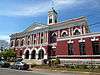
Calhoun County Courthouse |
|
October 3, 1985
(#85002866) |
25 W. 11th St.
33°39′30″N 85°49′52″W / 33.658333°N 85.831111°W / 33.658333; -85.831111 (Calhoun County Courthouse) |
Anniston |
|
| 9 |
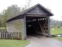
Coldwater Creek Covered Bridge |
|
April 11, 1973
(#73000333) |
Oxford Lake[5]
33°36′27″N 85°49′00″W / 33.607492°N 85.816592°W / 33.607492; -85.816592 (Coldwater Creek Covered Bridge) |
Oxford |
Originally spanned Coldwater Creek 0.5 miles (0.8 km) from Interstate 20; moved to current location in 1990. |
| 10 |
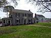
Davis C. Cooper House |
|
August 12, 2005
(#05000835) |
301 Main St.
33°37′01″N 85°50′03″W / 33.616944°N 85.834167°W / 33.616944; -85.834167 (Davis C. Cooper House) |
Oxford |
|
| 11 |
Crowan Cottage |
|
May 16, 1975
(#75000307) |
1401 Woodstock Ave.
33°39′44″N 85°49′12″W / 33.662222°N 85.82°W / 33.662222; -85.82 (Crowan Cottage) |
Anniston |
|
| 12 |
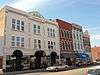
Downtown Anniston Historic District |
|
May 30, 1991
(#91000663) |
Roughly bounded by Moore Ave., 14th St., Wilmer Ave., and 9th St.; also bounded by Wilmer & Walnut Aves., W. 9th & 14th Sts.
33°39′29″N 85°49′52″W / 33.658°N 85.831°W / 33.658; -85.831 (Downtown Anniston Historic District) |
Anniston |
Second set of boundaries represents an increase listed May 24, 2010 |
| 13 |
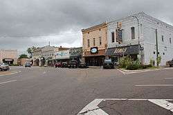
Downtown Jacksonville Historic District |
|
May 13, 1986
(#86001044) |
Roughly bounded by College, Thomas, Coffee, and Spring Sts.
33°48′47″N 85°45′36″W / 33.813056°N 85.76°W / 33.813056; -85.76 (Downtown Jacksonville Historic District) |
Jacksonville |
|
| 14 |
East Anniston Residential Historic District |
|
May 28, 1993
(#93000418) |
Roughly along Leighton and Christine Aves. from 11th St. to 22nd Sts. and Woodstock Ave. from 11th St. to Rocky Hollow
33°39′51″N 85°49′21″W / 33.664167°N 85.8225°W / 33.664167; -85.8225 (East Anniston Residential Historic District) |
Anniston |
|
| 15 |
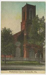
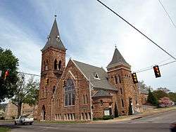
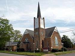
First Presbyterian Church |
|
February 4, 1982
(#82001999) |
200 E. Clinton St.
33°48′52″N 85°45′37″W / 33.8144°N 85.7602°W / 33.8144; -85.7602 (First Presbyterian Church) |
Jacksonville |
|
| 16 |
Fort McClellan Ammunition Storage Historic District |
|
November 8, 2006
(#06000981) |
Pappy Dunn Boulevard
33°43′40″N 85°46′37″W / 33.727778°N 85.776944°W / 33.727778; -85.776944 (Fort McClellan Ammunition Storage Historic District) |
Anniston |
|
| 17 |
Fort McClellan Industrial Historic District |
|
November 8, 2006
(#06000982) |
Jimmy Parks Boulevard, Transportation Rd., Idaho Ave.
33°43′04″N 85°47′25″W / 33.717778°N 85.790278°W / 33.717778; -85.790278 (Fort McClellan Industrial Historic District) |
Anniston |
|
| 18 |
Fort McClellan Post Headquarters Historic District |
|
November 8, 2006
(#06000983) |
Buckner Circle, Headquarters Ave., Drennan Dr.
33°43′01″N 85°47′47″W / 33.716944°N 85.796389°W / 33.716944; -85.796389 (Fort McClellan Post Headquarters Historic District) |
Anniston |
|
| 19 |
Fort McClellan World War II Housing Historic District |
|
November 8, 2006
(#06000984) |
Berman Rd., Bachelor Dr., Iron Mountain Rd., and Micron Way
33°43′12″N 85°46′36″W / 33.72°N 85.776667°W / 33.72; -85.776667 (Fort McClellan World War II Housing Historic District) |
Anniston |
|
| 20 |
Dr. J.C. Francis Office |
|
November 20, 1970
(#70000100) |
100 Gayle St.
33°48′51″N 85°45′43″W / 33.814167°N 85.761944°W / 33.814167; -85.761944 (Dr. J.C. Francis Office) |
Jacksonville |
|
| 21 |
Glen Addie Volunteer Hose Company Fire Hall |
|
October 3, 1985
(#85002738) |
Fourth St. and Pine Ave.
33°38′55″N 85°50′12″W / 33.648611°N 85.836667°W / 33.648611; -85.836667 (Glen Addie Volunteer Hose Company Fire Hall) |
Anniston |
|
| 22 |
Glenwood Terrace Residential Historic District |
|
October 3, 1985
(#85002867) |
Roughly bounded by Oak St., Jefferson Ave., lots on the southern side of Glenwood Terrace, the northern side of Orchard St., and Highland Ave.
33°39′16″N 85°49′01″W / 33.654444°N 85.816944°W / 33.654444; -85.816944 (Glenwood Terrace Residential Historic District) |
Anniston |
|
| 23 |
Henry Burt Glover House |
|
October 3, 1985
(#85002868) |
1119 Leighton Ave.
33°39′32″N 85°49′29″W / 33.658889°N 85.824722°W / 33.658889; -85.824722 (Henry Burt Glover House) |
Anniston |
|
| 24 |
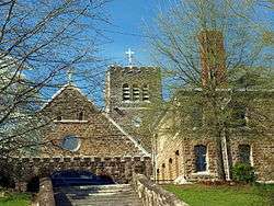
Grace Episcopal Church |
|
October 3, 1985
(#85002869) |
1000 Leighton Ave.
33°39′27″N 85°49′31″W / 33.6575°N 85.825278°W / 33.6575; -85.825278 (Grace Episcopal Church) |
Anniston |
|
| 25 |
Greenwood |
|
March 9, 1989
(#89000162) |
Junction of Old Anniston-Gadsden Rd. and County Road 25
33°46′21″N 85°52′48″W / 33.7725°N 85.88°W / 33.7725; -85.88 (Greenwood) |
Alexandria |
|
| 26 |
Charles B. Henry Barn |
|
September 26, 1997
(#97001168) |
0.5 miles west of State Route 21, south of Branscomb Dr. and north of Henry Rd.
33°47′12″N 85°46′01″W / 33.786667°N 85.766944°W / 33.786667; -85.766944 (Charles B. Henry Barn) |
Jacksonville |
|
| 27 |
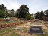
Hillside Cemetery |
|
October 3, 1985
(#85002870) |
Highland Ave. between 10th and 11th Sts.
33°39′27″N 85°49′04″W / 33.6575°N 85.817778°W / 33.6575; -85.817778 (Hillside Cemetery) |
Anniston |
|
| 28 |
Richard P. Huger House |
|
October 3, 1985
(#85002871) |
1901 Wilmer Ave.
33°40′08″N 85°49′41″W / 33.668889°N 85.828056°W / 33.668889; -85.828056 (Richard P. Huger House) |
Anniston |
|
| 29 |
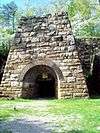
Janney Furnace |
|
September 28, 1976
(#76000315) |
1 mile northwest of Ohatchee off State Route 62
33°47′41″N 86°01′14″W / 33.794722°N 86.020556°W / 33.794722; -86.020556 (Janney Furnace) |
Ohatchee |
|
| 30 |
Kilby House |
|
October 3, 1985
(#85002872) |
1301 Woodstock Ave.
33°39′36″N 85°49′13″W / 33.66°N 85.820278°W / 33.66; -85.820278 (Kilby House) |
Anniston |
|
| 31 |
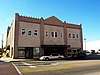
Kress Building |
|
October 3, 1985
(#85002873) |
1106 Noble St.
33°39′31″N 85°49′48″W / 33.658611°N 85.83°W / 33.658611; -85.83 (Kress Building) |
Anniston |
|
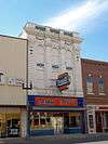
| 32 |
Lyric Theatre |
|
May 22, 1980
(#80000681) |
1302 Noble St.
33°39′40″N 85°49′49″W / 33.661111°N 85.830278°W / 33.661111; -85.830278 (Lyric Theatre) |
Anniston |
|
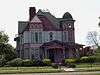
| 33 |
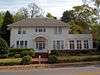
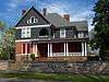
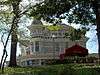
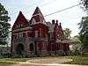
McKleroy-Wilson-Kirby House |
|
August 30, 1984
(#84000597) |
1604 Quintard Ave.
33°39′55″N 85°49′39″W / 33.665278°N 85.8275°W / 33.665278; -85.8275 (McKleroy-Wilson-Kirby House) |
Anniston |
|
| 34 |
Montgomery Ward-Alabama Power Company Building |
|
October 3, 1985
(#85002874) |
1201 Noble St.
33°39′35″N 85°49′46″W / 33.659722°N 85.829444°W / 33.659722; -85.829444 (Montgomery Ward-Alabama Power Company Building) |
Anniston |
|
| 35 |
Mount Zion Baptist Church |
|
October 3, 1985
(#85002875) |
212 2nd St.
33°38′47″N 85°49′58″W / 33.646389°N 85.832778°W / 33.646389; -85.832778 (Mount Zion Baptist Church) |
Anniston |
|
| 36 |
Noble Cottage |
|
October 8, 1976
(#76000313) |
900 Leighton Ave.
33°39′20″N 85°49′31″W / 33.655556°N 85.825278°W / 33.655556; -85.825278 (Noble Cottage) |
Anniston |
|
| 37 |
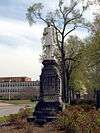
Samuel Noble Monument |
|
October 3, 1985
(#85002876) |
11th St. and Quintard Ave.
33°39′29″N 85°49′36″W / 33.658056°N 85.826667°W / 33.658056; -85.826667 (Samuel Noble Monument) |
Anniston |
|
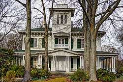
| 38 |
Noble-McCaa-Butler House |
|
October 3, 1985
(#85002877) |
1025 Fairmont Ave.
33°39′28″N 85°49′11″W / 33.657778°N 85.819722°W / 33.657778; -85.819722 (Noble-McCaa-Butler House) |
Anniston |
|
| 39 |
Nonnenmacher Bakery |
|
October 3, 1985
(#85002878) |
36 W. 11th St.
33°39′28″N 85°49′52″W / 33.657778°N 85.831111°W / 33.657778; -85.831111 (Nonnenmacher Bakery) |
Anniston |
|
| 40 |
Nonnenmacher House |
|
October 3, 1985
(#85002879) |
1311 Gurnee Ave.
33°39′41″N 85°49′52″W / 33.661389°N 85.831111°W / 33.661389; -85.831111 (Nonnenmacher House) |
Anniston |
|
| 41 |
Oak Tree Cottage |
|
October 3, 1985
(#85002880) |
721 Oak St.
33°39′18″N 85°49′08″W / 33.655°N 85.818889°W / 33.655; -85.818889 (Oak Tree Cottage) |
Anniston |
|
| 42 |
Old Anniston Electric and Gas Company Plant |
|
May 16, 1991
(#91000611) |
2 W. 3rd St.
33°38′50″N 85°49′47″W / 33.647222°N 85.829722°W / 33.647222; -85.829722 (Old Anniston Electric and Gas Company Plant) |
Anniston |
Demolished as of April 2014 |
| 43 |
Parker Memorial Baptist Church |
|
October 3, 1985
(#85002881) |
1205 Quintard Ave.
33°39′36″N 85°49′34″W / 33.66°N 85.826111°W / 33.66; -85.826111 (Parker Memorial Baptist Church) |
Anniston |
|
| 44 |
Parker-Reynolds House |
|
February 19, 1982
(#82001998) |
330 E. 6th St.
33°39′36″N 85°49′34″W / 33.66°N 85.826111°W / 33.66; -85.826111 (Parker-Reynolds House) |
Anniston |
|
| 45 |
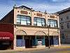
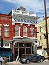
Peerless Saloon |
|
October 3, 1985
(#85002882) |
13 W. 10th St.
33°39′25″N 85°49′51″W / 33.656944°N 85.830833°W / 33.656944; -85.830833 (Peerless Saloon) |
Anniston |
|
| 46 |
The Pines |
|
May 13, 1991
(#91000594) |
Southeastern corner of 5th St. and Lapsley Ave.
33°38′59″N 85°49′21″W / 33.649722°N 85.8225°W / 33.649722; -85.8225 (The Pines) |
Anniston |
Demolished as of April 2014 |
| 47 |
Profile Cotton Mills Historic District |
|
May 31, 2006
(#06000436) |
Alexandria St., A St., H St., and D St.
33°48′44″N 85°46′21″W / 33.812222°N 85.7725°W / 33.812222; -85.7725 (Profile Cotton Mills Historic District) |
Jacksonville |
|
| 48 |
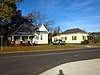
St. Michael and All Angels Episcopal Church |
|
February 14, 1978
(#78000483) |
W. 18th St.
33°40′00″N 85°50′36″W / 33.666667°N 85.843333°W / 33.666667; -85.843333 (St. Michael and All Angels Episcopal Church) |
Anniston |
|
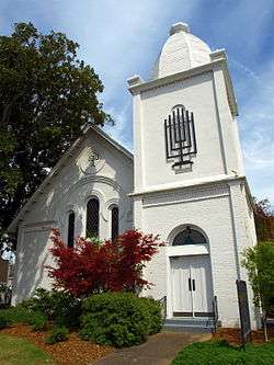
| 49 |
Saint Paul's Methodist Episcopal Church |
|
October 3, 1985
(#85002884) |
1327 Leighton Ave.
33°39′40″N 85°49′29″W / 33.661111°N 85.824722°W / 33.661111; -85.824722 (Saint Paul's Methodist Episcopal Church) |
Anniston |
|
| 50 |
Security Bank Building |
|
October 3, 1985
(#85002885) |
1030 Noble St.
33°39′28″N 85°49′47″W / 33.657778°N 85.829722°W / 33.657778; -85.829722 (Security Bank Building) |
Anniston |
|
| 51 |
Lansing T. Smith House |
|
October 3, 1985
(#85002886) |
531 Keith Ave.
33°39′04″N 85°50′28″W / 33.651111°N 85.841111°W / 33.651111; -85.841111 (Lansing T. Smith House) |
Anniston |
|
| 52 |
Southern Railway Depot |
|
January 5, 1984
(#84000599) |
200 N. Center Ave.
33°55′29″N 85°36′40″W / 33.924722°N 85.611111°W / 33.924722; -85.611111 (Southern Railway Depot) |
Piedmont |
|
| 53 |
Temple Beth-El |
|
October 3, 1985
(#85002887) |
301 E. 13th St.
33°39′40″N 85°49′33″W / 33.661111°N 85.825833°W / 33.661111; -85.825833 (Temple Beth-El) |
Anniston |
|
| 54 |
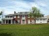
Ten Oaks |
|
November 29, 2001
(#01001298) |
805 Pelham Rd., S.
33°48′32″N 85°45′44″W / 33.808889°N 85.762222°W / 33.808889; -85.762222 (Ten Oaks) |
Jacksonville |
|
| 55 |
Tyler Hill Residential Historic District |
|
October 3, 1985
(#85002888) |
Roughly bounded by E. 7th, Knox and Goodwin and Lapsley Aves., E. 6th St., and Leighton Ave.
33°39′05″N 85°49′24″W / 33.651389°N 85.823333°W / 33.651389; -85.823333 (Tyler Hill Residential Historic District) |
Anniston |
|
| 56 |
U.S. Post Office |
|
November 13, 1976
(#76000314) |
1129 Noble St.
33°39′33″N 85°49′45″W / 33.659167°N 85.829167°W / 33.659167; -85.829167 (U.S. Post Office) |
Anniston |
|
| 57 |
Union Depot and Freight House |
|
October 3, 1985
(#85002889) |
1300 Walnut Ave.
33°39′39″N 85°50′01″W / 33.660833°N 85.833611°W / 33.660833; -85.833611 (Union Depot and Freight House) |
Anniston |
|
| 58 |
West Fifteenth Street Historic District |
|
May 30, 1991
(#91000662) |
416-712 W. 15th St.
33°39′48″N 85°50′13″W / 33.663333°N 85.836944°W / 33.663333; -85.836944 (West Fifteenth Street Historic District) |
Anniston |
|
| 59 |
Wikle Drug Company |
|
October 3, 1985
(#85002890) |
1010 Noble St.
33°39′25″N 85°49′47″W / 33.656944°N 85.829722°W / 33.656944; -85.829722 (Wikle Drug Company) |
Anniston |
|
| 60 |
Alexander Woods House |
|
March 15, 1988
(#87001651) |
517 N. Pelham Rd.
33°49′13″N 85°45′40″W / 33.820278°N 85.761111°W / 33.820278; -85.761111 (Alexander Woods House) |
Jacksonville |
|
.jpg)