DeArmanville, Alabama
| DeArmanville, Alabama | |
|---|---|
| Unincorporated community | |
 DeArmanville, Alabama  DeArmanville, Alabama | |
| Coordinates: 33°37′35″N 85°45′05″W / 33.62639°N 85.75139°WCoordinates: 33°37′35″N 85°45′05″W / 33.62639°N 85.75139°W | |
| Country | United States |
| State | Alabama |
| County | Calhoun |
| Elevation | 673 ft (205 m) |
| Time zone | UTC-6 (Central (CST)) |
| • Summer (DST) | UTC-5 (CDT) |
| ZIP code | 36257 |
| Area code(s) | 256 & 938 |
| GNIS feature ID | 159491[1] |
DeArmanville is an unincorporated community in Calhoun County, Alabama, United States, located on the southeast boundary of Anniston. DeArmanville has a post office with ZIP code 36257.[2][3]
Climate
The climate in this area is characterized by hot, humid summers and generally mild to cool winters. According to the Köppen Climate Classification system, DeArmanville has a humid subtropical climate, abbreviated "Cfa" on climate maps.[4]
References
- ↑ "DeArmanville". Geographic Names Information System. United States Geological Survey.
- ↑ United States Postal Service (2012). "USPS - Look Up a ZIP Code". Retrieved 2012-02-15.
- ↑ "Postmaster Finder - Post Offices by ZIP Code". United States Postal Service. Retrieved June 4, 2013.
- ↑ Climate Summary for DeArmanville, Alabama
Municipalities and communities of Calhoun County, Alabama, United States | ||
|---|---|---|
| Cities | 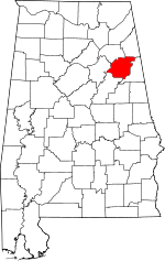 | |
| Towns | ||
| CDPs | ||
| Unincorporated communities | ||
| Ghost town | ||
| Footnotes | ‡This populated place also has portions in an adjacent county or counties | |
This article is issued from
Wikipedia.
The text is licensed under Creative Commons - Attribution - Sharealike.
Additional terms may apply for the media files.