| [3] |
Name on the Register[4] |
Image |
Date listed[5] |
Location |
City or town |
Description |
|---|
| 1 |
Avery Avenue Historic District |
|
November 9, 1987
(#87001915) |
Roughly along parts of Avery, Lenoir, Morehead, Walker, Evans, & Short Sts.
35°45′11″N 81°41′18″W / 35.753056°N 81.688333°W / 35.753056; -81.688333 (Avery Avenue Historic District) |
Morganton |
|
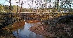
| 2 |
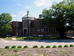
Avery Avenue School |
|
November 9, 1987
(#87001925) |
200 Avery Ave.
35°44′52″N 81°41′14″W / 35.747778°N 81.687222°W / 35.747778; -81.687222 (Avery Avenue School) |
Morganton |
|
| 3 |
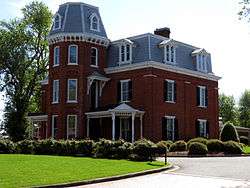
Alphonse Calhoun Avery House |
|
July 12, 1984
(#84001947) |
408 N. Green St.
35°44′53″N 81°41′36″W / 35.748056°N 81.693333°W / 35.748056; -81.693333 (Alphonse Calhoun Avery House) |
Morganton |
|
| 4 |
Bellevue |
|
December 4, 1973
(#73001296) |
On SR 1419, N of Morganton off NC 18
35°46′55″N 81°42′33″W / 35.781944°N 81.709167°W / 35.781944; -81.709167 (Bellevue) |
Morganton |
|
| 5 |
Broughton Hospital Historic District |
|
November 9, 1987
(#87001918) |
Roughly bounded by Broughton Hospital campus, NC 18, Bickett St., & Enola Rd.
35°43′39″N 81°40′40″W / 35.7275°N 81.677778°W / 35.7275; -81.677778 (Broughton Hospital Historic District) |
Morganton |
|
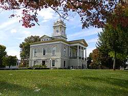
| 6 |
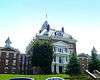
Burke County Courthouse |
|
April 17, 1970
(#70000443) |
Courthouse Sq.
35°44′44″N 81°41′07″W / 35.745556°N 81.685278°W / 35.745556; -81.685278 (Burke County Courthouse) |
Morganton |
|
| 7 |
Creekside |
|
February 1, 1972
(#72000926) |
W of Morganton at jct. of U.S. 70 and 70A
35°44′07″N 81°42′31″W / 35.735278°N 81.708611°W / 35.735278; -81.708611 (Creekside) |
Morganton |
|
| 8 |
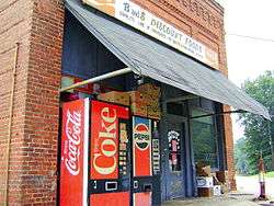
Dale's, USB Market |
|
November 9, 1987
(#87001924) |
Jct. of Enola Rd. & Dale St.
35°43′33″N 81°40′20″W / 35.725833°N 81.672222°W / 35.725833; -81.672222 (Dale's, USB Market) |
Morganton |
|
| 9 |
Jean-Pierre Auguste Dalmas House |
|
May 2, 2002
(#02000444) |
4950 Villar Lane, NE
35°45′28″N 81°33′50″W / 35.757778°N 81.563889°W / 35.757778; -81.563889 (Jean-Pierre Auguste Dalmas House) |
Valdese |
|
| 10 |
Dunavant Cotton Manufacturing Company |
|
May 1, 2013
(#13000227) |
109 E. Fleming Dr.
35°44′29″N 81°40′50″W / 35.741392°N 81.680605°W / 35.741392; -81.680605 (Dunavant Cotton Manufacturing Company) |
Morganton |
|
| 11 |
Jacob Forney Jr. House |
|
October 14, 1976
(#76001309) |
NW of Morganton on SR 1440
35°48′01″N 81°43′10″W / 35.800278°N 81.719444°W / 35.800278; -81.719444 (Jacob Forney Jr. House) |
Morganton |
|
| 12 |
Franklin-Penland House |
|
November 28, 2006
(#06001106) |
8646 NC 183
35°57′11″N 81°56′12″W / 35.953056°N 81.936667°W / 35.953056; -81.936667 (Franklin-Penland House) |
Linville Falls |
|
| 13 |
Gaither House |
|
April 23, 1976
(#76001310) |
102 N. Anderson St.
35°44′29″N 81°41′33″W / 35.741389°N 81.6925°W / 35.741389; -81.6925 (Gaither House) |
Morganton |
|
| 14 |
Garrou-Morganton Full-Fashioned Hosiery Mills |
|
January 27, 1999
(#99000064) |
101 and 105 Lenoir St.
35°44′51″N 81°41′13″W / 35.7475°N 81.686944°W / 35.7475; -81.686944 (Garrou-Morganton Full-Fashioned Hosiery Mills) |
Morganton |
|
| 15 |
Gaston Chapel |
|
October 11, 1984
(#84000077) |
100 Bouchelle St.
35°44′51″N 81°41′14″W / 35.7475°N 81.687222°W / 35.7475; -81.687222 (Gaston Chapel) |
Morganton |
|
| 16 |
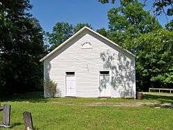
Gilboa Methodist Church |
|
October 11, 1984
(#84000075) |
U.S. 64
35°41′17″N 81°43′45″W / 35.688056°N 81.729167°W / 35.688056; -81.729167 (Gilboa Methodist Church) |
Salem |
|
| 17 |
Hunting Creek Railroad Bridge |
|
November 9, 1987
(#87001923) |
Hunting Creek N of US 64 & 70 between jct. of Stonebridge Rd. & E. Union St.
35°45′05″N 81°39′31″W / 35.751389°N 81.658611°W / 35.751389; -81.658611 (Hunting Creek Railroad Bridge) |
Morganton |
|
| 18 |
Jonesboro Historic District |
|
November 9, 1987
(#87001916) |
Roughly bounded by W. Concord, Bay, Jones, Lytle, & S. Anderson Sts.
35°44′20″N 81°41′22″W / 35.738889°N 81.689444°W / 35.738889; -81.689444 (Jonesboro Historic District) |
Morganton |
|
| 19 |
John Alexander Lackey House |
|
November 9, 1987
(#87001921) |
102 Camelot Dr.
35°46′05″N 81°43′07″W / 35.768056°N 81.718611°W / 35.768056; -81.718611 (John Alexander Lackey House) |
Morganton |
|
| 20 |
Magnolia Place |
|
June 4, 1973
(#73001297) |
S of Morganton on U.S. 64
35°43′04″N 81°41′38″W / 35.717778°N 81.693889°W / 35.717778; -81.693889 (Magnolia Place) |
Morganton |
Boundary decrease approved January 25, 2018 |
| 21 |
Morganton Downtown Historic District |
|
November 9, 1987
(#87001930) |
E. Union, S. Green, N. & S. Sterling, King & Queen Sts.
35°44′45″N 81°41′16″W / 35.745833°N 81.687778°W / 35.745833; -81.687778 (Morganton Downtown Historic District) |
Morganton |
|
| 22 |
Mountain View |
|
October 11, 1984
(#84000076) |
604 W. Union St.
35°44′23″N 81°41′50″W / 35.739722°N 81.697222°W / 35.739722; -81.697222 (Mountain View) |
Morganton |
|
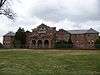
| 23 |
North Carolina School for the Deaf Historic District |
|
April 20, 1989
(#89000325) |
Jct. US 70 and US 64
35°43′47″N 81°41′17″W / 35.729722°N 81.688056°W / 35.729722; -81.688056 (North Carolina School for the Deaf Historic District) |
Morganton |
|
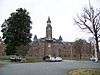
| 24 |
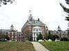
North Carolina School for the Deaf: Main Building |
|
December 12, 1976
(#76001311) |
U.S. 64 and Fleming Dr.
35°43′47″N 81°41′25″W / 35.729722°N 81.690278°W / 35.729722; -81.690278 (North Carolina School for the Deaf: Main Building) |
Morganton |
|
| 25 |
North Green Street-Bouchelle Street Historic District |
|
November 9, 1987
(#87001926) |
N. Green, Bouchelle, & Patterson Sts.
35°44′55″N 81°41′31″W / 35.748611°N 81.691944°W / 35.748611; -81.691944 (North Green Street-Bouchelle Street Historic District) |
Morganton |
|
| 26 |
Quaker Meadows |
|
October 3, 1973
(#73001298) |
W of Morganton off NC 181
35°45′26″N 81°43′15″W / 35.757222°N 81.720833°W / 35.757222; -81.720833 (Quaker Meadows) |
Morganton |
|
| 27 |
Quaker Meadows Cemetery |
|
November 9, 1987
(#87001922) |
Off NC 126
35°45′06″N 81°43′18″W / 35.751667°N 81.721667°W / 35.751667; -81.721667 (Quaker Meadows Cemetery) |
Morganton |
|
| 28 |
Dr. Joseph Bennett Riddle House |
|
December 20, 1984
(#84000524) |
411 W. Union St.
35°44′24″N 81°41′37″W / 35.74°N 81.693611°W / 35.74; -81.693611 (Dr. Joseph Bennett Riddle House) |
Morganton |
|
| 29 |
Sloan-Throneburg Farm |
|
March 1, 2002
(#02000110) |
NC 1429, 0.3 miles W of jct. with NC 1450
35°50′36″N 81°39′27″W / 35.843333°N 81.6575°W / 35.843333; -81.6575 (Sloan-Throneburg Farm) |
Chesterfield |
|
| 30 |
South King Street Historic District |
|
November 9, 1987
(#87001920) |
S. King St.
35°44′34″N 81°41′12″W / 35.742778°N 81.686667°W / 35.742778; -81.686667 (South King Street Historic District) |
Morganton |
|
| 31 |
Swan Ponds |
|
April 24, 1973
(#73001299) |
About 4 miles W of Morganton off NC 126
35°44′36″N 81°45′23″W / 35.743333°N 81.756389°W / 35.743333; -81.756389 (Swan Ponds) |
Morganton |
|
| 32 |
Tate House |
|
May 25, 1973
(#73001300) |
100 S. King St.
35°44′39″N 81°41′21″W / 35.744167°N 81.689167°W / 35.744167; -81.689167 (Tate House) |
Morganton |
|
| 33 |
Franklin Pierce Tate House |
|
May 21, 1986
(#86001171) |
410 W. Union St.
35°44′26″N 81°41′41″W / 35.740556°N 81.694722°W / 35.740556; -81.694722 (Franklin Pierce Tate House) |
Morganton |
|
| 34 |
Valdese Elementary School |
|
October 25, 1984
(#84000115) |
400 Main St.
35°44′41″N 81°34′01″W / 35.744722°N 81.566944°W / 35.744722; -81.566944 (Valdese Elementary School) |
Valdese |
|
| 35 |
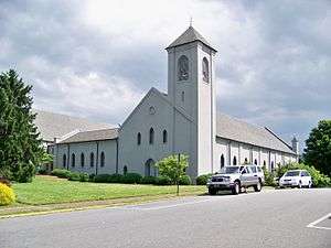
Waldensian Presbyterian Church |
|
October 25, 1984
(#84000116) |
104 E. Main St.
35°44′34″N 81°33′45″W / 35.742778°N 81.5625°W / 35.742778; -81.5625 (Waldensian Presbyterian Church) |
Valdese |
|
| 36 |
West Union Street Historic District |
|
November 9, 1987
(#87001931) |
Roughly parts of W. Union St., Montrose St., & Riverside Dr.
35°44′26″N 81°41′42″W / 35.740556°N 81.695°W / 35.740556; -81.695 (West Union Street Historic District) |
Morganton |
|
| 37 |
Western North Carolina Insane Asylum |
|
October 5, 1977
(#77000996) |
Off NC 18
35°43′50″N 81°40′30″W / 35.730556°N 81.675°W / 35.730556; -81.675 (Western North Carolina Insane Asylum) |
Morganton |
|
| 38 |
White Street-Valdese Avenue Historic District |
|
November 9, 1987
(#87001927) |
White St. & Valdese Ave.
35°44′50″N 81°40′51″W / 35.747222°N 81.680833°W / 35.747222; -81.680833 (White Street-Valdese Avenue Historic District) |
Morganton |
|
.jpg)
.jpg)
.jpg)