Linville Falls, North Carolina
| Linville Falls, North Carolina | |
|---|---|
| Unincorporated community | |
 Linville Falls Location within the state of North Carolina | |
| Coordinates: 35°59′27″N 81°56′39″W / 35.99083°N 81.94417°WCoordinates: 35°59′27″N 81°56′39″W / 35.99083°N 81.94417°W | |
| Country | United States |
| State | North Carolina |
| County | Avery, Burke, McDowell[1] |
| Elevation | 3,268 ft (996 m) |
| Time zone | UTC-5 (Eastern (EST)) |
| • Summer (DST) | UTC-4 (EDT) |
| ZIP code | 28647 |
| Area code(s) | 828 |
| GNIS feature ID | 1012893[1] |
Linville Falls is an unincorporated community at the junction of Avery, Burke, and McDowell counties in the U.S. state of North Carolina.[1] The community is named after Linville Falls, a nearby waterfall in the Linville Gorge Wilderness.
Attractions
Linville Falls is close to many of western North Carolina's outdoor attractions.
The Linville Falls Tavern was listed on the National Register of Historic Places in 2000 and the Franklin-Penland House in 2006.[2]
See also
References
Municipalities and communities of Avery County, North Carolina, United States | ||
|---|---|---|
| Towns |  | |
| Villages | ||
| Unincorporated communities | ||
| Footnotes | ‡This populated place also has portions in an adjacent county or counties | |
Municipalities and communities of Burke County, North Carolina, United States | ||
|---|---|---|
| Cities | 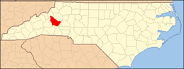 | |
| Towns | ||
| Townships |
| |
| CDPs | ||
| Unincorporated communities | ||
| Footnotes | ‡This populated place also has portions in an adjacent county or counties | |
Municipalities and communities of McDowell County, North Carolina, United States | ||
|---|---|---|
| City |  | |
| Town | ||
| CDP | ||
| Unincorporated communities |
| |
| Footnotes | ‡This populated place also has portions in an adjacent county or counties | |
This article is issued from
Wikipedia.
The text is licensed under Creative Commons - Attribution - Sharealike.
Additional terms may apply for the media files.