Nandigram Upazila
| Nandigram নন্দীগ্রাম | |
|---|---|
| Upazila | |
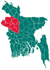
 Nandigram Location in Bangladesh | |
| Coordinates: 24°40′N 89°14′E / 24.667°N 89.233°ECoordinates: 24°40′N 89°14′E / 24.667°N 89.233°E | |
| Country |
|
| Division | Rajshahi Division |
| District | Bogra District |
| Area[1] | |
| • Total | 265.22 km2 (102.40 sq mi) |
| Population (2011 census)[2] | |
| • Total | 180,802 |
| • Density | 680/km2 (1,800/sq mi) |
| Time zone | UTC+6 (BST) |
| Postal code | 5860 |
| Website |
nondigram |
Nandigram Upazila (Bengali: নন্দীগ্রাম উপজেলা) is an upazila of Bogra District in the Division of Rajshahi, Bangladesh. Nandigram Thana was established in 1932 and was converted into an upazila in 1983.[3] It is named after its administrative center, the town of Nandigram.
Geography
Nandigram Upazila has a total area of 265.22 square kilometres (102.40 sq mi).[1] It is bounded on the west by the Nagar River (across which lies Naogaon District).[4] It borders Kahaloo and Shajahanpur upazilas to the north, Sherpur Upazila to the east, Natore District to the south and west, and Adamdighi Upazila to the west.[3][5]
Demographics
| Historical population | ||
|---|---|---|
| Year | Pop. (000) | ±% |
| 1981 | 125 | — |
| 1991 | 148 | +18.4% |
| 2001 | 168 | +13.5% |
| 2011 | 181 | +7.7% |
| Source: Bangladesh Bureau of Statistics[1] | ||
According to the 2011 Bangladesh census, Nandigram Upazila had 45,853 households and a population of 180,802, 10.2% of whom lived in urban areas.[2] 8.7% of the population was under the age of 5.[6] The literacy rate (age 7 and over) was 47.5%, compared to the national average of 51.8%.[7][8]
Administration
Nandigram Upazila is divided into Nandigram Municipality and five union parishads: Bhatgram, Bhatra, Burail, Nandigram, and Thalta Majhgram. The union parishads are subdivided into 192 mauzas and 228 villages.
Nandigram Municipality is subdivided into 9 wards and 22 mahallas.[1]
Education
There are four colleges in the upazila. They include Hat Karai Degree College, Monsur Hossain Degree College, and Nandigram Mohilla College.
The madrasa education system includes four fazil madrasas.[9]
See also
References
- 1 2 3 4 "District Statistics 2011: Bogra" (PDF). Bangladesh Bureau of Statistics. Archived from the original (PDF) on July 23, 2014. Retrieved July 14, 2014.
- 1 2 "Population Census 2011: Bogra Table C-01" (PDF). Bangladesh Bureau of Statistics. Archived from the original (PDF) on July 14, 2014. Retrieved July 11, 2014.
- 1 2 Pulak, Md Khairul Alam (2012). "Nandigram Upazila". In Islam, Sirajul; Jamal, Ahmed A. Banglapedia: National Encyclopedia of Bangladesh (Second ed.). Asiatic Society of Bangladesh.
- ↑ Murshed, Md Mahbub (2012). "Nagar River". In Islam, Sirajul; Jamal, Ahmed A. Banglapedia: National Encyclopedia of Bangladesh (Second ed.). Asiatic Society of Bangladesh.
- ↑ "Nadigram Map". Retrieved 11 July 2014.
- ↑ "Population Census 2011: Bogra Table C-04" (PDF). Bangladesh Bureau of Statistics. Archived from the original (PDF) on July 28, 2014. Retrieved July 11, 2014.
- ↑ "Population Census 2011: Bogra Table C-06" (PDF). Bangladesh Bureau of Statistics. Archived from the original (PDF) on July 28, 2014. Retrieved July 11, 2014.
- ↑ "Population and Housing Census 2011: Bangladesh at a Glance" (PDF). Bangladesh Bureau of Statistics. Archived from the original (PDF) on July 28, 2014. Retrieved July 21, 2014.
- ↑ "List of Institutions". Ministry of Education. Retrieved July 15, 2014.
| Upazila/Thana: | ||
|---|---|---|