Nahr Ibrahim (municipality)
| Nahr Ibrahim | |
|---|---|
 Nahr Ibrahim Location in Lebanon | |
| Coordinates: 34°3′58″N 35°38′42″E / 34.06611°N 35.64500°ECoordinates: 34°3′58″N 35°38′42″E / 34.06611°N 35.64500°E | |
| Country | Lebanon |
| Governorate | Mount Lebanon |
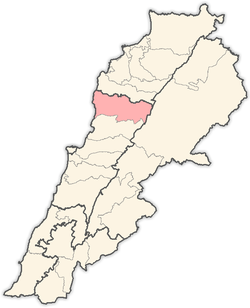
| District | Jbeil |
| Area | |
| • Total | 341 ha (843 acres) |
| Elevation | 220 m (720 ft) |
| Population (2017) | |
| • Total | 4,786 |
Nahr Ibrahim is a municipality in the Jbeil District of Mount Lebanon Governorate, Lebanon. It is 47 kilometers north of Beirut. Nahr Ibrahim has an average elevation of 220 meters above sea level and a total land area of 341 hectares. The village has one public school, which enrolled 44 students in 2008 and a French university operating by the French and Lebanese governments Conservatoire National des arts et métiers cnam which enrolled 2913 students as of May 2017.the village include a large industrial area(papers,woods,cables,oil,oxygen,drugs,milk and cheese,..)[1] Its inhabitants are predominantly Maronite Catholics.[2]
References
- ↑ "Nahr Ibrahim". Localiban. Localiban. 2008-01-16. Retrieved 2016-02-12.
- ↑ "Elections municipales et ikhtiariah au Mont-Liban" (PDF). Localiban. Localiban. 2010. p. 19. Archived from the original (pdf) on 2015-07-24. Retrieved 2016-02-12.
Capital: Jbeil | ||
| Towns and villages |
|  |
| Landmarks |
| |
This article is issued from
Wikipedia.
The text is licensed under Creative Commons - Attribution - Sharealike.
Additional terms may apply for the media files.