Halat, Lebanon
| Halat حالات Halate | |
|---|---|
 Halat Location in Lebanon | |
| Coordinates: 34°4′51″N 35°39′49″E / 34.08083°N 35.66361°ECoordinates: 34°4′51″N 35°39′49″E / 34.08083°N 35.66361°E | |
| Country | Lebanon |
| Governorate | Mount Lebanon |
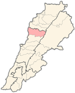
| District | Jbeil |
| Area | |
| • Total | 957 ha (2,365 acres) |
| Elevation | 100 m (300 ft) |
Halat (Arabic: حالات, also spelled Halate) is a municipality in the Jbeil District of Mount Lebanon Governorate, Lebanon. It is located along the Mediterranean coast, 32 kilometers north of Beirut. Its inhabitants are predominantly Maronite Catholics.[1] Halat has an average elevation of 100 meters above sea level and a total land area of 957 hectares. The town has one public school, which had 112 students in 2008. There were 45 companies with more than five employees operating in Halat as of 2008. There is also a quarry in the town.[2]Charles Bassil is the current municipality president.
Community
Churches
These are some of the churches in the town of Halat.
- Mar Youssef (Saint Joseph) in beit el boumeh
- Mar Gerges (Saint George)
Geography
Neighborhoods
These are some of the neighborhoods in Halat
- Beit el boumeh
- Douweir
- Bahriyyeh (seaside)
- New Halat
Neighboring Towns
These are the closest towns to Halat.
- Fidar to the north
- Jbeil (also known as Byblos) further to the north
- Nahr Ibrahim to the south
- Zelehmayya to the east
Climate
Halat's climate is typical for the Lebanese coast. Winters are cold and rainy. The temperature drops to 10 C on the coldest days. In the winters, the temperature can rise to 20 C. The summers are hot and dry. It virtually never rains in the summer in Lebanon. The temperature in Halat can go up to 30 C in the summer. The weather is very pleasant and cool in the fall and spring with occasional rain.
References
- ↑ "Elections municipales et ikhtiariah au Mont-Liban" (PDF). Localiban. Localiban. 2010. p. 19. Archived from the original (pdf) on 2015-07-24. Retrieved 2016-02-12.
- ↑ "Halate". Localiban. Localiban. 2008-01-17. Retrieved 2016-02-12.
Capital: Jbeil | ||
| Towns and villages |
|  |
| Landmarks |
| |