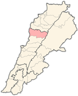
Hjoula
| Hjoula حجولا | |
|---|---|
 Hjoula Location in Lebanon | |
| Coordinates: 34°8′8″N 35°44′29″E / 34.13556°N 35.74139°ECoordinates: 34°8′8″N 35°44′29″E / 34.13556°N 35.74139°E | |
| Country | Lebanon |
| Governorate | Mount Lebanon |
| District | Jbeil |
| Area | |
| • Total | 528 ha (1,305 acres) |
| Elevation | 1,000 m (3,000 ft) |
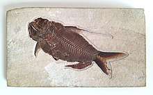
Fossil Fish from Hjoula, Lebanon

Fish Fossil, from Hjoula, Lebanon
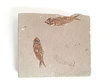
Fish Fossil, Hjoula, Lebanon
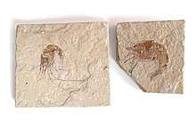
Fossil Shrimps, Carpopenaeus, Lebanon
Hjoula (Arabic: حجولا) is a municipality in the Jbeil District of Mount Lebanon Governorate, Lebanon. It is 70 kilometers north of Beirut. Hjoula has an elevation of between 920 and 1,100 meters above sea level. Hjoula has a total land area of 528 hectares.[1] Its inhabitants are predominantly Shia Muslims.[2]. The village of Hjoula is known for its fertile soil and its woods.
Population
The village has a population of around 1900 inhabitants. Here's an alphabetical listing of some of the families of Hjoula: Abi Nassif, Abi Raad, Alaa Ad-Din (Shibli), Assaf, Diab, Esber, Hjoula, Hmade, Ibrahim, Issa, Mahdi, Mrad, Nassif, and Qabalan.
References
- ↑ "Hjoula". Localiban. Localiban. 2008-01-17. Retrieved 2016-02-12.
- ↑ Cammett, Melani; Issar, Sukriti (July 2010). "Bricks and Mortar Clientalism: Sectarianism and the Logics of Welfare Allocation in Lebanon". World Polit. 62: 381–421. doi:10.1353/wp.0.0056. PMC 4029429. PMID 24860198.
Capital: Jbeil | ||
| Towns and villages |
|  |
| Landmarks |
| |
This article is issued from
Wikipedia.
The text is licensed under Creative Commons - Attribution - Sharealike.
Additional terms may apply for the media files.