Myponga, South Australia
| Myponga South Australia | |||||||||||||||
|---|---|---|---|---|---|---|---|---|---|---|---|---|---|---|---|
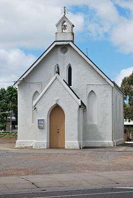 Anglican church | |||||||||||||||
 Myponga | |||||||||||||||
| Coordinates | 35°24′20″S 138°28′11″E / 35.405483°S 138.46985°ECoordinates: 35°24′20″S 138°28′11″E / 35.405483°S 138.46985°E[1] | ||||||||||||||
| Population |
| ||||||||||||||
| Established |
1858 (sub-division) 5 August 1999 (locality)[1] | ||||||||||||||
| Postcode(s) | 5202[4] | ||||||||||||||
| Location |
| ||||||||||||||
| LGA(s) | District Council of Yankalilla | ||||||||||||||
| Region | Fleurieu and Kangaroo Island[5] | ||||||||||||||
| County | Hindmarsh[1] | ||||||||||||||
| State electorate(s) | Mawson [6] | ||||||||||||||
| Federal Division(s) | Mayo[7] | ||||||||||||||
| |||||||||||||||
| |||||||||||||||
| Footnotes |
Locations[4] Adjoining localities[1] | ||||||||||||||
Myponga is a settlement in South Australia.
Myponga began as a settlement as a series of land purchases on section 521 of the cadastral unit of the Hundred of Myponga in 1858. In 1939, a sub-division was laid out on part of Section 521. Boundaries for the locality were created on 5 August 1999 for the "long established name."[1]
At the 2016 census, the locality had a population of 744 of which 393 lived in its town centre.[3][2]
One of the first pioneer families to settle the area, was the family of Con Polden and Mary Windsor (c.1840) along with their children from Wiltshire in South West England.
Myponga is located within the federal division of Mayo, the state electoral district of Mawson, and the local government area of the District Council of Yankalilla.[7][6][1]
See also
References
- 1 2 3 4 5 6 "Search results for 'Myponga, LOCB' with the following datasets being selected - 'Suburbs and Localities', 'Counties', 'Hundreds', 'Local Government Areas', 'SA Government Regions', 'Land Development Plan Zone Categories' and 'Gazetteer'". Location SA Map Viewer. Government of South Australia. Retrieved 15 March 2018.
- 1 2 Australian Bureau of Statistics (27 June 2017). "Myponga (L)". 2016 Census QuickStats. Retrieved 15 March 2018.

- 1 2 Australian Bureau of Statistics (27 June 2017). "State Suburb of Myponga". 2016 Census QuickStats. Retrieved 15 March 2018.
- 1 2 "Postcode for Myponga, South Australia". Postcodes Australia. postcodes-australia.com. Retrieved 15 March 2018.
- ↑ "Fleurieu Kangaroo Island SA Government region" (PDF). The Government of South Australia. Retrieved 17 April 2017.
- 1 2 Mawson (Map). Electoral District Boundaries Commission. 2016. Retrieved 2 March 2018.
- 1 2 "Federal electoral division of Mayo, boundary gazetted 16 December 2011" (PDF). Australian Electoral Commission. Retrieved 2 August 2015.
- 1 2 3 "Summary (climate) statistics Myponga (nearest weather station)". Commonwealth of Australia, Bureau of Meteorology. Retrieved 8 August 2016.