County of Hindmarsh
| Hindmarsh South Australia | |||||||||||||||
|---|---|---|---|---|---|---|---|---|---|---|---|---|---|---|---|
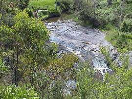 Glacier "Selwyn" Rock formation beside the Inman River at Inman Valley in the Hundred of Encounter Bay | |||||||||||||||
 Hindmarsh | |||||||||||||||
| Coordinates | 35°26′S 138°38′E / 35.43°S 138.64°ECoordinates: 35°26′S 138°38′E / 35.43°S 138.64°E | ||||||||||||||
| Established | 1842[1] | ||||||||||||||
| Area | 2,650 square kilometres (1,025 sq mi)[2] | ||||||||||||||
| LGA(s) |
Alexandrina Council Mount Barker District Council City of Victor Harbor Yankallilla District Council | ||||||||||||||
| Region |
Fleurieu and Kangaroo Island[3] Adelaide Hills (part)[4] | ||||||||||||||
| |||||||||||||||
| Footnotes |
Coordinates[2] Local government areas[2] Adjoining counties[5] | ||||||||||||||
The County of Hindmarsh is one of the 49 counties of South Australia. It was proclaimed by Governor George Grey in 1842 and named for Governor John Hindmarsh.[2]
Description
It extends from the Fleurieu Peninsula in the southwest to the Murray Mouth in the southeast to Point Sturt on the Sturt Peninsula and the course of the Bremer River in the east, Mount Barker in the north and Sellicks Hill on the Gulf St Vincent coastline in the northwest including the southern end of Mt Lofty Ranges, Hindmarsh Island, Mundoo Island and part of Lake Alexandrina.[2] This includes the following contemporary local government areas:
- District Council of Yankalilla
- Victor Harbor City
- Alexandrina Council (excluding small portions on west and east flanks)
- District Council of Mount Barker (central third including the Mount Barker township)
History
The following hundreds have been proclaimed within the county - Encounter Bay, Goolwa, Kondoparinga, Macclesfield, Myponga, Nangkita, Waitpinga and Yankalilla in 1846, Strathalbyn in 1850, and Alexandrina and Bremer in 1851.[6][7][8][9]
Hundreds
The County of Hindmarsh is divided into the following hundreds:
Hundred of Alexandrina
The Hundred of Alexandrina (35°27′06″S 138°57′07″E / 35.451580°S 138.951890°E) was proclaimed on 7 August 1851. It covers an area of 200 square kilometres (76 sq mi) and is named after the lake partially located within the county and which is known as Lake Alexandrina. It includes the following localities - Clayton Bay, Point Sturt and parts of Finniss, Lake Alexandrina and Milang.[10][9]
Hundred of Bremer
The Hundred of Bremer (35°21′07″S 138°57′09″E / 35.352070°S 138.952460°E) was proclaimed on 7 August 1851. It covers an area of 240 square kilometres (92 sq mi) and is named after the British naval officer, Sir J Gordon Bremer. It includes the following localities - Nurragi, Willyaroo and parts of Belvidere, Finniss, Langhorne Creek, Lake Plains, Lake Alexandrina, Milang, Sandergrove and Strathalbyn.[11][9]
Hundred of Encounter Bay
The Hundred of Encounter Bay (35°29′46″S 138°31′48″E / 35.496030°S 138.530020°E) was proclaimed on 29 October 1846. It covers an area of 240 square kilometres (94 sq mi) and is named after the bay which it overlooks on its south-east boundary. It includes the following localities - Back Valley, Hindmarsh Tiers, Lower Inman Valley and Victor Harbor and parts of Encounter Bay, Hindmarsh Valley, Inman Valley and Waitpinga.[12][7]
Hundred of Goolwa
The Hundred of Goolwa (35°27′52″S 138°40′59″E / 35.4645°S 138.683070°E) was proclaimed on 29 October 1846. It covers an area of 240 square kilometres (94 sq mi) and is named after the lake partially located within the county and whose name is reported as being derived from an aboriginal word meaning “the elbow.” It contains the following localities - Goolwa, Goolwa Beach, Goolwa North, Hayborough, McCracken, Middleton, Mosquito Hill and Port Elliot and parts of Currency Creek, Goolwa South, Hindmarsh Valley, Mount Jagged and Tooperang.[13][7]
Hundred of Kondoparinga
Hundred of Macclesfield
The Hundred of Macclesfield (35°08′29″S 138°50′33″E / 35.141490°S 138.842430°E) was proclaimed on 29 October 1846. It covers an area of 180 square kilometres (70 sq mi) and is named after the Earl of Macclesfield while the aboriginal name used for the area covered by the hundred is reported to be “Kangowirranilla meaning 'the place for kangaroos & water'.” It includes the following localities - Blakiston, Flaxley, Littlehampton, Macclesfield, Totness and parts of Bugle Ranges, Echunga, Gemmells, Meadows, Mount Barker, Mount Barker Junction, Mount Barker Summit, Nairne, Paris Creek, Strathalbyn and Wistow.[14][7]
Hundred of Myponga
The Hundred of Myponga (35°22′46″S 138°30′08″E / 35.379330°S 138.502290°E) was proclaimed on 29 October 1846. It covers an area of 250 square kilometres (96 sq mi) and whose name is derived from an aboriginal word “Maippunga, which in one source is stated to mean “divorced wife” while in another is stated to mean "standing water". It contains the following localities - Myponga, Myponga Beach, Pages Flat, Wattle Flat and parts of Carrickalinga, Hope Forest, Mount Compass, Mount Magnificent, Sellicks Hill, Willunga Hill, Yankalilla and Yundi.[15][7][16]
Hundred of Nangkita
The Hundred of Nangkita (35°27′06″S 138°57′07″E / 35.451580°S 138.951890°E) was proclaimed on 29 October 1846. It covers an area of 300 square kilometres (117 sq mi) and its name is derived from an aboriginal word meaning “place of little frogs”. It contains the following localities - Hindmarsh Island, Mundoo Island and parts of Currency Creek, Finniss, Goolwa South, Mount Compass, Mount Observation, Mount Jagged, Nangkita and Tooperang.[17][7][18]
Hundred of Strathalbyn
The Hundred of Strathalbyn (35°11′45″S 138°57′01″E / 35.1957°S 138.950350°E) was proclaimed on 12 December 1850. It covers an area of 210 square kilometres (83 sq mi) and its name is derived from that used for a sub-division granted in 1841. It includes the following localities - Highland Valley, Red Creek, Salem and Woodchester and parts of Belvidere, Bletchley, Bugle Ranges, Gemmells, Hartley, Langhorne Creek, Mount Barker, Mount Barker Springs, Petwood, Strathalbyn and Wistow.[19][8][20][8]
Hundred of Waitpinga
The Hundred of Waitpinga (35°35′40″S 138°22′30″E / 35.594430°S 138.374920°E) was proclaimed on 29 October 1846. It covers an area of 320 square kilometres (123 sq mi) and is reportedly named after an aboriginal word, “Waitpiinga” meaning “the windy place”. It includes the following localities - Deep Creek and Tunkalilla and parts of Cape Jervis, Delamere, Parawa, Silverton, Waitpinga and Willow Creek.[21][7]
Hundred of Yankalilla
.jpg)
The Hundred of Yankalilla (35°31′38″S 138°16′37″E / 35.527320°S 138.276870°E) was proclaimed on 29 October 1846. Its name is reported as being derived as follows by Professor N.B. Tindale:
It is derived from the Aboriginal word jankalan, meaning "falling, from an incident in the myth of Tjilbruke, whose sister's [sic] mummified body began to fall into pieces here, as he was carrying it from Brighton to Cape Jervis for burial.
The hundred includes the following localities - Bald Hills, Hay Flat, Normanville, Rapid Bay, Second Valley, Torrens Vale, Wirrina Cove and parts of Cape Jervis, Carrickalinga, Delamere, Inman Valley, Parawa, Silverton, Willow Creek and Yankalilla.[22][23][7]
The town of Yankalilla was laid out on sections 1180-81 of the hundred circa 1857.
On Freycinet's charts Yankalilla Bay is shown as Baie Hortense.[24]
See also
References
- ↑ Jackson, J. Alex (2 June 1842). "untitled (division of province into counties)" (PDF). The South Australian Government Gazette. Government of South Australia. 1842: 1. Retrieved 18 December 2016.
- 1 2 3 4 5 "Search result for 'County of Hindmarsh, CNTY'". Property Location Browser. Government of South Australia. SA0030681. Retrieved 6 April 2016.
- ↑ >"Fleurieu Kangaroo Island SA Government region" (PDF). The Government of South Australia. Retrieved 17 April 2017.
- ↑ "Adelaide Hills SA Government region" (PDF). The Government of South Australia. Retrieved 17 April 2017.
- ↑ "HUNDRED MAP Series Index Map" (PDF). Department of Environment and Heritage, Government of South Australia. December 2008. Retrieved 16 November 2015.
- ↑ Leadbeater, Maureen (2014). "Counties & Hundreds of South Australia". FamilyHistorySA. Retrieved 20 November 2016.
- 1 2 3 4 5 6 7 8 Mundy, A.M. (29 October 1846). "Proclamation (division of counties of Adelaide and Hindmarsh into hundreds)" (PDF). South Australian Government Gazette. Government of South Australia. 1846 (44): 335-355. Retrieved 19 December 2016.
- 1 2 3 Sturt, Charles (12 December 1850). "untitled (creation of a hundred)" (PDF). South Australian Government Gazette. Government of South Australia. 1850 (51): 709. Retrieved 19 December 2016.
- 1 2 3 Sturt, Charles (7 August 1851). "Proclamation (division of province into counties and hundreds)" (PDF). South Australian Government Gazette. Government of South Australia. 1851 (35): 551. Retrieved 19 December 2016.
- ↑ "Search result for 'Hundred of Alexandrina, HD". Property Location Browser. Government of South Australia. SA0000740. Retrieved 14 December 2016.
- ↑ "Search result for 'Hundred of Bremer, HD'". Property Location Browser. Government of South Australia. SA0009429. Retrieved 19 December 2016.
- ↑ "Search result for 'Hundred of Encounter Bay, HD'". Property Location Browser. Government of South Australia. SA0011865. Retrieved 20 December 2016.
- ↑ "Search result for 'Hundred of Goolwa, HD'". Property Location Browser. Government of South Australia. SA0011864. Retrieved 14 December 2016.
- ↑ "Search result for 'Hundred of Macclesfield, HD'". Property Location Browser. Government of South Australia. SA0041805. Retrieved 20 December 2016.
- ↑ "Search result for 'Hundred of Myponga, HD'". Property Location Browser. Government of South Australia. SA0048380. Retrieved 20 December 2016.
- ↑ Manning, Geoffrey H. (2006). "Place Names of South Australia - M - Myponga". Manning Index of South Australian History. State Library of South Australia. Retrieved 23 December 2016.
- ↑ "Search result for 'Hundred of Nangkita, HD'". Property Location Browser. Government of South Australia. SA0048590. Retrieved 22 December 2016.
- ↑ Manning, Geoffrey H. (2006). "Place Names of South Australia - N - Nangkita". Manning Index of South Australian History. State Library of South Australia. Retrieved 23 December 2016.
- ↑ "Search result for 'Hundred of Strathalbyn, HD'". Property Location Browser. Government of South Australia. SA0064831. Retrieved 14 December 2016.
- ↑ "Search result for "Strathalbyn (LOCB)" (Record no SA0064818". Property Location Browser. Government of South Australia. Retrieved 19 December 2016.
- ↑ "Search result for 'Hundred of Waitpinga, HD'". Property Location Browser. Government of South Australia. SA0016215. Retrieved 14 December 2016.
- ↑ Manning, Geoffrey H. (2006). "Place Names of South Australia - Y - Yankalilla". Manning Index of South Australian History. State Library of South Australia. Retrieved 23 December 2016.
- ↑ "Search result for 'Hundred of Yankalilla, HD'". Property Location Browser. Government of South Australia. SA0029892. Retrieved 14 December 2016.
- ↑ the Chronicle, 12 July 1934, page 32.