Muzaffargarh
| Muzaffargarh مُظفّرگڑھ | |
|---|---|
| City | |
 Muzaffargarh Location in Pakistan  Muzaffargarh Muzaffargarh (Pakistan) | |
| Coordinates: 30°4′10″N 71°11′39″E / 30.06944°N 71.19417°ECoordinates: 30°4′10″N 71°11′39″E / 30.06944°N 71.19417°E | |
| Country | Pakistan |
| Province | Punjab |
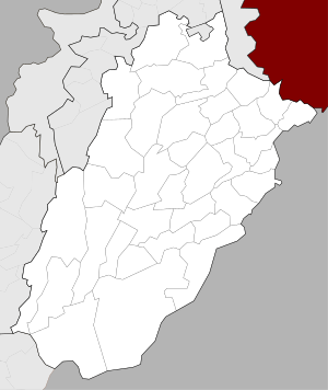
| District | Muzaffargarh District |
| Number of Tehsils | 4 |
| Union councils | 5 |
| Area | |
| • Total | 8,435 km2 (3,257 sq mi) |
| Elevation | 122 m (400 ft) |
| Time zone | UTC+5 (PST) |
| • Summer (DST) | UTC+6 (PDT) |
| Area code(s) | 066 |
| Website | |
Muzaffargarh (مُظفّرگڑھ) is a city in the southwestern Punjab province of Pakistan, located on the bank of the Chenab River. It is the capital city of the Muzaffargarh District.
History
The Muzaffargarh region was an agricultural and forested area during the rule of the Indus Valley Civilization. Then came the Vedic period, which was characterized by the introduction of Indo-Aryan culture from Central Asia into the Punjab province. Over time, several other civilizations came to power in the ancient town and surrounding district: the Kambojas, the Daradas, the Kekayas, the Madras, the Pauravas, the Yaudheyas, the Malavas and the Kurus. After the fall of the Achaemenid Empire in 331 BCE, Alexander the Great marched into the present-day Punjab province with an army of 50,000 men. The Muzaffargarh region was, during different time periods, also ruled by the Maurya Empire, the Indo-Greek kingdom, the Kushan Empire, the Gupta Empire, the White Huns, the Kushano-Hephthalites, and the Shahi kingdom.
In 997 CE, Sultan Mahmud Ghaznavi took over the Ghaznavid Empire, and, in 1005, conquered the Shahis in Kabul, which granted him power over the Punjab region. The Delhi Sultanate and later the Mughal Empire also ruled the region. The location of the present-day town became predominantly Muslim during this time because of the arrival of missionary Sufis whose dargahs still persist in the area.
After the decline of the Mughal Empire, the Sikhs invaded and occupied the Muzaffargarh District. During this period, the Muslim population faced severe restrictions. Later, in 1848, the British Raj assumed control of the area.
In 1794, the town of Muzaffargarh was founded by the governor of Multan, Nawab Muzaffar Khan. The meaning of the word is "Fort of Muzaffar" because the "historic district" lies within the walls of a fort built by the governor. In 1864, it became the capital of the Muzaffargarh District.[1]
The place was also referred to as Kala Pani (Black Water), as it is located between two rivers: the Indus and the Chenab. It was linked to the surrounding lands by bridges during the British era.
During the independence movement of Pakistan, the Muslim population supported the Muslim League and the Pakistani Movement. In 1947, after Pakistan gained independence, the minority Hindus and Sikhs migrated to India while the Muslim refugees from India settled in Muzaffargarh.
Geography and climate
| Muzaffargarh | ||||||||||||||||||||||||||||||||||||||||||||||||||||||||||||
|---|---|---|---|---|---|---|---|---|---|---|---|---|---|---|---|---|---|---|---|---|---|---|---|---|---|---|---|---|---|---|---|---|---|---|---|---|---|---|---|---|---|---|---|---|---|---|---|---|---|---|---|---|---|---|---|---|---|---|---|---|
| Climate chart (explanation) | ||||||||||||||||||||||||||||||||||||||||||||||||||||||||||||
| ||||||||||||||||||||||||||||||||||||||||||||||||||||||||||||
| ||||||||||||||||||||||||||||||||||||||||||||||||||||||||||||
Muzaffargarh spreads over an area of 8,249 km2 and forms a strip between the Chenab River to the east and Indus River to the west. Muzaffargarh was hit especially hard by the 2010 Pakistan floods, given its position between the Chenab and Indus rivers.[2]
Muzaffargarh is located at almost the exact geographical center of Pakistan. The closest major city is Multan. The area around the city is a flat alluvial plain and is ideal for agriculture, with many citrus and mango farms. There are also canals that cut across the Muzaffargarh District, providing water to farms. During the monsoon season, the land close to the Chenab is usually flooded.
Muzaffargarh features an arid climate with very hot summers and mild winters. The city has experienced some of the most extreme weather in Pakistan. The highest recorded temperature was approximately 54 °C (129 °F), and the lowest recorded temperature was approximately −1 °C (30 °F). The average rainfall is roughly 127 millimetres (5.0 in). Dust storms are a common occurrence within the city.
Transportation
Muzaffargarh has connections with other cities by several means of transportation.
Road
The town is linked to the rest of the district by paved roads that stretch for 983.69 km. Buses to Multan leave frequently, because of their close proximity to each other. There are also buses that travel to more distant destinations. The N-5 National Highway connects the city to the other parts of Pakistan. This highway allows for direct travel to Rawalpindi, Islamabad, Faisalabad, Karachi, Lahore, and Bahawalpur.
Railways
Muzaffargarh is connected by rail with all parts of Pakistan, as it lies on the branch track between Rawalpindi, Multan, Mianwali and Attock. The main Peshawar-Karachi railway line passes through Multan district.
Muzaffargarh Nuclear Power Complex
According to the Wall Street Journal, the Pakistan Atomic Energy Commission (PAEC) plans to install three nuclear reactors at Muzaffargarh.[3] The Muzaffargarh Nuclear Power Complex will have a production capacity of 1100 megawatts.[4]
Notable people
- Mushtaq Ahmed Gurmani, former governor of West Pakistan
- Nawabzada Nasrullah Khan, A prominent political figure in Pakistan
- Hina Rabbani Khar, former Foreign Minister and the first female foreign minister
- Ghulam Mustafa Khar, former Governor of Punjab and former Chief Minister of Punjab
- Ghulam Noor Rabbani Khar, politician
- Sultan Mehmood, politician
- Jamshed Dasti
- Azhar Hussain, wrestler
References
- ↑ District Profile: Southern Punjab- Muzaffargarh
- ↑ "Muzaffargarh, Pakistan: Caught between two rivers - Oxfam International Blogs".
- ↑ Shah, Saeed (20 January 2014). "Pakistan in Talks to Acquire 3 Nuclear Plants From China" – via Wall Street Journal.
- ↑ "Asia News Network". Archived from the original on 2014-03-28.
_Districts.svg.png)