Municipality of Ashfield
| Municipality of Ashfield New South Wales | |||||||||||||||
|---|---|---|---|---|---|---|---|---|---|---|---|---|---|---|---|
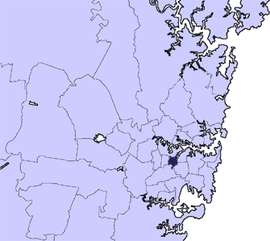 Location in Metropolitan Sydney, 1871–2016 | |||||||||||||||
| Coordinates | 33°53′S 151°08′E / 33.883°S 151.133°ECoordinates: 33°53′S 151°08′E / 33.883°S 151.133°E | ||||||||||||||
| Population | 41,214 (2011 census)[1] | ||||||||||||||
| • Density | 4,971.5/km2 (12,876/sq mi) | ||||||||||||||
| Established | 28 December 1871 | ||||||||||||||
| Abolished | 12 May 2016 | ||||||||||||||
| Area | 8 km2 (3.1 sq mi) | ||||||||||||||
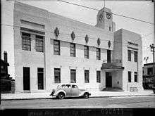
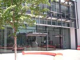
| Council seat | Civic Centre, Ashfield | ||||||||||||||
| Region | Inner West | ||||||||||||||
|
| |||||||||||||||
| |||||||||||||||
The Municipality of Ashfield was a local government area in the Inner West of Sydney, New South Wales, Australia. It is about 10 kilometres (6.2 mi) west of the Sydney central business district. The Municipality was proclaimed on 28 December 1871 as the "Borough of Ashfield", which changed to the "Municipality of Ashfield" in 1906. On 12 May 2016, Ashfield merged with Marrickville Council and the Municipality of Leichhardt to form the Inner West Council.
The last Mayor of the Municipality was Councillor Lucille McKenna, a member of the Australian Labor Party.[2]
Suburbs
The municipality comprised the following suburbs:
It also included parts of:
- Ashbury (shared with City of Canterbury)
- Croydon (shared with Municipality of Burwood)
- Hurlstone Park (shared with City of Canterbury)
- Croydon Park (shared with City of Canterbury and the Municipality of Burwood
Council history
The "Borough of Ashfield" was proclaimed in the New South Wales Government Gazette on 28 December 1871 and was originally divided into two wards, North Ward and South Ward.[3]
A 2015 review of local government boundaries recommended that the Municipality of Ashfield merge with the Municipality of Leichhardt and the Marrickville Council to form a new council with an area of 35 square kilometres (14 sq mi) and support a population of approximately 186,000.[4] On 12 May 2016, Ashfield merged with Marrickville Council and the Municipality of Leichhardt to form the Inner West Council.[5]
Demographics
At the 2011 Census, there were 41,214 people in the Ashfield local government area, of these 48.6% were male and 51.4% were female. Aboriginal and Torres Strait Islander people made up 0.6% of the population. The median age of people in the Municipality of Ashfield was 37 years. Children aged 0 – 14 years made up 15.1% of the population and people aged 65 years and over made up 14.4% of the population. Of people in the area aged 15 years and over, 45.1% were married and 10.0% were either divorced or separated.[1]
Population growth in The Municipality of Ashfield between the 2001 Census and the 2006 Census was 1.76%; while in the subsequent five years to the 2011 Census, population growth was 3.90%. When compared with total population growth of Australia for the same periods, being 5.78% and 8.32% respectively, population growth in Ashfield local government area was significantly less than the national average.[6][7] The median weekly income for residents within the Municipality of Ashfield of was generally on par with the national average.[1]
At the 2011 Census, the proportion of residents in Ashfield local government area who stated their ancestry as Chinese was in excess of four times the state and national averages; and the proportion of households where an Asian language was spoken at home was about six times higher than the national average.[1]
| Historical census data for Ashfield local government area | |||||
|---|---|---|---|---|---|
| Population | 2001[6] | 2006[7] | 2011[1] | ||
| Population | Estimated residents on Census night | 38,981 | 39,667 | 41,214 | |
| LGA rank in terms of size within New South Wales | 54 | ||||
| % of New South Wales population | 0.6% | 0.60% | |||
| % of Australian population | 0.21% | ||||
| Cultural and language diversity | |||||
| Ancestry, top responses | English | 14.9% | |||
| Australian | 14.8% | ||||
| Chinese | 13.3% | ||||
| Italian | 8.5% | ||||
| Irish | 6.9% | ||||
| Language, top responses (other than English) | Mandarin | 6.1% | |||
| Italian | 9.2% | ||||
| Cantonese | 4.9% | ||||
| Nepali | n/c | n/c | |||
| Greek | 2.6% | ||||
| Religious affiliation | |||||
| Religious affiliation, top responses | Catholic | 36.6% | |||
| No religion | 16.9% | ||||
| Anglican | 10.5% | ||||
| Hinduism | n/c | n/c | |||
| Buddhism | 4.2% | ||||
| Median weekly incomes | |||||
| Personal income | Median weekly personal income | A$514 | A$628 | ||
| % of Australian median income | 108.8% | ||||
| Family income | Median weekly family income | A$1,101 | A$1,689 | ||
| % of Australian median income | 107.2% | 114.0% | |||
| Household income | Median weekly household income | A$1,304 | A$1,413 | ||
| % of Australian median income | 111.4% | 114.5% | |||
Council
Final composition and election method
Ashfield Municipal Council was composed of twelve Councillors elected proportionally as four separate wards, each electing three Councillors. All Councillors were elected for a fixed four-year term of office. The Mayor and Deputy Mayor were elected for a one-year term by the Councillors at the first meeting of the Council in September. The last election was held on 13 September 2012, and the makeup of the Council for the term 2012–16, in order of election by ward, was as follows:[8][9][10][11]
| Ward | Councillor | Party | Notes | |
|---|---|---|---|---|
| East Ward[8] | Julie Passas | Liberal | ||
| Alex Lofts | Labor | Deputy Mayor | ||
| Caroline Stott | Independent | |||
| North East Ward[9] | Ted Cassidy PSM | Independent | ||
| Vittoria Raciti | Liberals | |||
| Lucille McKenna | Labor | Mayor 2013–2016[2] | ||
| North Ward[10] | Adriano Raiola | Liberal | ||
| Monica Wangmann | Independent | |||
| Mei Wang | Labor | |||
| South Ward[11] | Mark Drury | Labor | ||
| Max Raiola | Liberal | |||
| Morris Mansour | Independent | Mayor 2012–2013 | ||
Mayors
| Mayor | Party | Term | |
|---|---|---|---|
| John Lapish | Independent | 1932 - 1933 | |
| William Grainger | Independent | 1933 - 1935 | |
| Thomas Cavill | Independent | 1935 - 1938 | |
| Edward Allman | Independent | 1938 - 1943 | |
| J. Lindsay | Independent | 1943 - 1944 | |
| Thomas Cavill | Independent | 1944 - 1946 | |
| Ralph Tetley | Independent | 1946 - 1948 | |
| Thomas Marshall | Independent | 1948 - 1950 | |
| Richard Murden | Independent | 1950 - 1952 | |
| Herbert Bailey | Independent | 1952 - 1954 | |
| James Blackwood | Independent | 1954 - 1957 | |
| Charles Bullivant | Independent | 1957 - 1959 | |
| Darrell Jackson | Independent | 1959 - 1962 | |
| Bill Peters | Labor | 1962 - 1964 | |
| Bede Spillane | Labor | 1964 - 1965 | |
| Allan Crawford | Independent | 1965 - 1967 | |
| Richard Murden | Independent | December 1967 – September 1972 | |
| Paul Whelan | Labor | September 1972 – September 1976 | |
| Lew Herman | Labor | September 1976 – September 1991 | |
| Dr John Ward | Independent | September 1991 – September 1995 | |
| Lew Herman | Labor | September 1995 – September 1996 | |
| Vincent Sicari | No Aircraft Noise | September 1996 – September 1997 | |
| Mark Bonanno | Labor | September 1997 – March 2004 | |
| Rae Desmond Jones | Labor | March 2004 – September 2006 | |
| Ted Cassidy PSM | Independent | September 2006 – September 2011 | |
| Lyall Kennedy | Greens | September 2011 – September 2012 | |
| Morris Mansour | Independent | September 2012 – September 2013 | |
| Lucille McKenna | Labor | September 2013 – 12 May 2016 | |
The full list of mayors since 1872 can be found here.
Coat of arms and logo
_coat_of_arms%2C_granted_1983.jpg) |
|
Logo
Ashfield Council launched a new logo and branding in August 2008, described as an "urban map" of various images representing various buildings and forms in the local area. This branding remained in use (with the arms retained for the most formal uses) until the council's amalgamation.[12]
References
- 1 2 3 4 5 Australian Bureau of Statistics (31 October 2012). "Ashfield (A)". 2011 Census QuickStats. Retrieved 26 June 2012.

- 1 2 Murada, Lauren; Murray, Oliver; Hamwi, Omar (26 September 2012). "Marrickville, Ashfield and Leichhardt councils elect new mayors". Inner West Courier. Retrieved 26 September 2012.
- ↑ "Government Gazette Proclamations and Legislation". New South Wales Government Gazette (318). New South Wales, Australia. 29 December 1871. p. 2951. Retrieved 3 October 2017 – via National Library of Australia.
- ↑ "Merger proposal: Ashfield Council, Leichhardt Municipal Council, and Marrickville Council" (PDF). Government of New South Wales. January 2016. p. 7. Retrieved 18 February 2016.
- ↑ "Inner West Council". Stronger Councils. Government of New South Wales. 12 May 2016. Retrieved 15 May 2016.
- 1 2 Australian Bureau of Statistics (9 March 2006). "Ashfield (A)". 2001 Census QuickStats. Retrieved 1 November 2012.
- 1 2 Australian Bureau of Statistics (25 October 2007). "Ashfield (A)". 2006 Census QuickStats. Retrieved 1 November 2012.
- 1 2 "Candidates in Sequence of Election Report: Ashfield Municipal Council: East Ward" (PDF). Local Government Elections 2012. Electoral Commission of New South Wales. 13 September 2012. Retrieved 15 September 2012.
- 1 2 "Candidates in Sequence of Election Report: Ashfield Municipal Council: North East Ward" (PDF). Local Government Elections 2012. Electoral Commission of New South Wales. 13 September 2012. Retrieved 15 September 2012.
- 1 2 "Candidates in Sequence of Election Report: Ashfield Municipal Council: North Ward" (PDF). Local Government Elections 2012. Electoral Commission of New South Wales. 13 September 2012. Retrieved 15 September 2012.
- 1 2 "Candidates in Sequence of Election Report: Ashfield Municipal Council: South Ward" (PDF). Local Government Elections 2012. Electoral Commission of New South Wales. 13 September 2012. Retrieved 15 September 2012.
- 1 2 "Corporate Branding". Ashfield Council. Retrieved 14 October 2017.