Mount Weddell
| Mount Weddell | |
|---|---|
 Mount Weddell | |
| Highest point | |
| Elevation | 383 m (1,257 ft) [1] |
| Prominence | 383 m (1,257 ft) |
| Coordinates | 51°55′23″S 60°57′12″W / 51.92306°S 60.95333°WCoordinates: 51°55′23″S 60°57′12″W / 51.92306°S 60.95333°W |
| Geography | |
| Location | Weddell Island, Falkland Islands, South Atlantic Ocean |
Mount Weddell is the summit of Weddell Island in the Falkland Islands. The mountain rises to 383 metres (1,257 ft) and is situated 8 km northeast of Race Point, 9.8 km east of Pillar Bluff, 4.35 km southwest of Weddell Settlement and 4.6 km west-northwest of Circum Point.
Maps
- The Falkland Islands. Scale 1:401280 map. London: Edward Stanford, 1901
- Falkland Islands Explorer Map. Scale 1:365000. Ocean Explorer Maps, 2007
- Falklands Topographic Map Series. Scale 1:50000, 29 sheets. DOS 453, 1961-1979
- Falkland Islands. Scale 1:643000 Map. DOS 906. Edition 3-OS, 1998
- Map 500k--xm20-4. 1:500000 map of Weddell Island and part of West Falkland. Russian Army Maps (for the world)
- Approaches to the Falkland Islands. Scale 1:1500000 chart. Gps Nautical Charts, 2010
- Illustrated Map of Weddell Island
Gallery
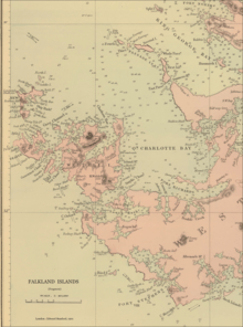 An old map featuring Mt Weddell put its height at 1250 ft (381 m)
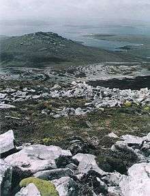 Circum Peak and New Year Cove from Mount Weddell, with Smylie Channel, Dyke Island and West Falkland in the background
 Satellite image of Weddell Island
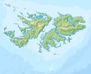
 Map of Weddell Island
Notes
References
- B. Stonehouse (ed.). Encyclopedia of Antarctica and the Southern Oceans. Chichester, West Sussex: John Wiley & Sons, 2002. 404 pp. ISBN 978-0-471-98665-2
- C.H. Barnard. A Narrative of the Sufferings and Adventures of Capt. Charles H. Barnard, in a Recent Voyage Round the World, Including an Account of His Residence for Two Years on An Uninhabited Island. New York: J.P. Callender, 1836
- P.P. King and R. Fitzroy. The South America Pilot. Part II. From the Rio de la Plata to the Bay of Panama, including Magellan Strait, the Falkland, and Galapagos Islands. Fifth Edition. London: Printed for the Hydrographic Office, Admiralty, 1860. pp. 116-118
External links
- Weddell Island Official Website
- Weddell Island from space. NASA Johnson Space Center, 30 April 2005
This article is issued from
Wikipedia.
The text is licensed under Creative Commons - Attribution - Sharealike.
Additional terms may apply for the media files.