Circum Peak
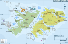
Location of Weddell Island in the Falkland Islands

Satellite image of Weddell Island
Circum Peak is a mountain rising to 198 m (650 ft)[1] in the southeast part of Weddell Island in the Falkland Islands. It is located at 51°55′45″S 60°55′27″W / 51.92917°S 60.92417°WCoordinates: 51°55′45″S 60°55′27″W / 51.92917°S 60.92417°W, which is 2.12 km (1.32 mi) southeast of Mount Weddell, and surmounts New Year Cove to the southeast and Gull Harbour to the northeast.
Maps
- The Falkland Islands. Scale 1:401280 map. London: Edward Stanford, 1901
- Falkland Islands Explorer Map. Scale 1:365000. Ocean Explorer Maps, 2007
- Falklands Topographic Map Series. Scale 1:50000, 29 sheets. DOS 453, 1961-1979
- Falkland Islands. Scale 1:643000 Map. DOS 906. Edition 3-OS, 1998
- Map 500k--xm20-4. 1:500000 map of Weddell Island and part of West Falkland. Russian Army Maps (for the world)
- Approaches to the Falkland Islands. Scale 1:1500000 chart. Gps Nautical Charts, 2010
- Illustrated Map of Weddell Island
Gallery
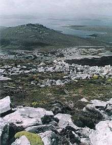 Massive stone runs in the foothills of Circum Peak; southeast view from Mount Weddell
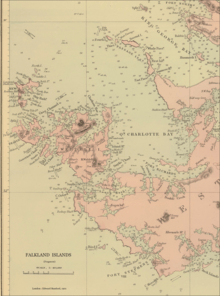 Old map of Weddell Island featuring Cove Peak (present Circum Peak)
 Map of Weddell Island
Notes
- ↑ A. Fryday and D. Øvstedal. New species, combinations and records of lichenized fungi from the Falkland Islands (Islas Malvinas). The Lichenologist 44 (04) 2012. 483–500
References
- B. Stonehouse (ed.). Encyclopedia of Antarctica and the Southern Oceans. Chichester, West Sussex: John Wiley & Sons, 2002. 404 pp. ISBN 978-0-471-98665-2
External links
- Weddell Island Official Website
- Weddell Island from space. NASA Johnson Space Center, 30 April 2005
This article is issued from
Wikipedia.
The text is licensed under Creative Commons - Attribution - Sharealike.
Additional terms may apply for the media files.