Monghsu
| Monghsu (Mönghsu) | |||||
| State of the Shan States in personal union with Mongsang | |||||
| |||||
 | |||||
| History | |||||
| • | State founded | 1857 | |||
| • | Abdication of the last Myoza | 1959 | |||
| Area | |||||
| • | 1901 | 425 km2 (164 sq mi) | |||
| Population | |||||
| • | 1901 | 17,480 | |||
| Density | 41.1 /km2 (106.5 /sq mi) | ||||
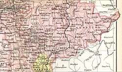
Monghsu or Maingshu was a Shan state in what is today Burma. It belonged to the Eastern Division of the Southern Shan States. The main river in the area was the Nam Pang.[1]
History
Monghsu became independent from Hsenwi in 1857 under a personal union with the neighbouring state of Mongsang. It was a tributary of Burma until 1887, when the Shan states submitted to British rule after the fall of the Konbaung dynasty. The residence of the Myoza was at Mong Hsu.[2]
Rulers
The rulers of Monghsu/Möngsang bore the title of Myoza.[3]
Myozas
- 1857 - 1879 Hkun Mon
- 1879 - 1901 Hkun Maha
- 1901 - 1917 Hkun Kyaw (b. 1845 - d. 1917)
- 1917 - 19.. Hkun Sao (Hkun Saw) (b. 1845 - d. 19..)
References
- ↑ "WHKMLA : History of the Shan States". 18 May 2010. Retrieved 21 December 2010.
- ↑ Imperial Gazetteer of India, v. 17, p. 408.
- ↑ Ben Cahoon (2000). "World Statesmen.org: Shan and Karenni States of Burma". Retrieved 7 July 2014.
External links
Coordinates: 21°48′N 98°21′E / 21.800°N 98.350°E
This article is issued from
Wikipedia.
The text is licensed under Creative Commons - Attribution - Sharealike.
Additional terms may apply for the media files.