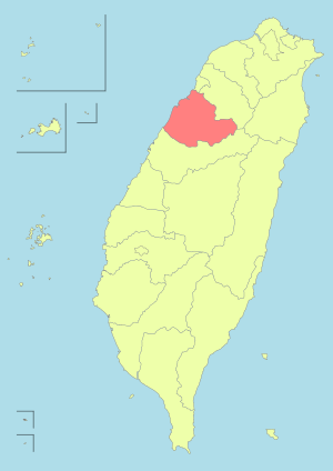
Miaoli County
| Miaoli County 苗栗縣 | |||
|---|---|---|---|
| County | |||
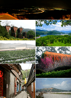 Top:A night view of Tongluo, Second left:Lonteng Ancient Bridge, Second right:Liyu Reserve Lake, Third left :Chunhsiang Strawberry Farm Park, Third right:Hakka Cultural Park, Bottom left: Osmamthus Street in Nanchuang, Bottom right:Mount Huoyen | |||
| |||
 | |||
| Coordinates: 24°33′48.29″N 120°49′32.98″E / 24.5634139°N 120.8258278°ECoordinates: 24°33′48.29″N 120°49′32.98″E / 24.5634139°N 120.8258278°E | |||
| Country | Republic of China (Taiwan) | ||
| Region | western Taiwan | ||
| Seat | Miaoli City | ||
| Largest city | Toufen | ||
| Boroughs | 2 cities, 16 (5 urban, 11 rural) townships | ||
| Government | |||
| • County magistrate | Hsu Yao-chang (KMT) | ||
| Area | |||
| • Total | 1,820.3149 km2 (702.8275 sq mi) | ||
| Area rank | 11 of 22 | ||
| Population (December 2014) | |||
| • Total | 567,132 | ||
| • Rank | 13 of 22 | ||
| • Density | 310/km2 (810/sq mi) | ||
| Time zone | UTC+8 (National Standard Time) | ||
| Website | www.miaoli.gov.tw | ||
| Symbols | |||
| Bird | European magpie (Pica pica) | ||
| Flower | Camphor laurel (Cinnamomum camphora) | ||
| Tree | Tea olive (Osmanthus fragrans) | ||


| Miaoli County | |||||||||||||||
| Traditional Chinese | 苗栗縣 | ||||||||||||||
|---|---|---|---|---|---|---|---|---|---|---|---|---|---|---|---|
| Simplified Chinese | 苗栗县 | ||||||||||||||
| |||||||||||||||
Miaoli County (Chinese: 苗栗縣) is a county in western Taiwan. Miaoli is adjacent with Hsinchu County and Hsinchu City to the north, Taichung to the south, and borders the Taiwan Strait to the west. The Council for Economic Planning and Development of Taiwan classifies Miaoli as a county of Central Taiwan, while the Taiwan Central Weather Bureau classifies Miaoli as a county of the North. Miaoli City is the capital of the county, and is also known as "Mountain Town", owing to the number of mountains nearby, making it a destination for hiking.
Name
The name Miaoli was coined using two Hakka Chinese words, meu (貓; "cat") and li (狸; "raccoon dog") to phonetically approximate Pali (Bari) from the Taokas language. The resulting word (貓狸) is a widespread but non-orthodox variant referring to Viverridae. In 1889, during late Qing rule, the name was modified from various forms (貓裏, 貓裡, 貓里) to its current form.
History
Evidence of settlement in Miaoli dates back a thousand years. Many archaeological artifacts have been found showing that during the prehistoric era, people lived in the river terrace. They mainly led an agriculture life and engaged in hunting and fishing for their extra food source. About a thousand years ago, an indigenous group Taokas settled here.
In the mid-17th century, Han Chinese began to migrate into the area, beginning a gradual process of deforestation and establishment of permanent settlement sites. The prior inhabitants of Miaoli were either assimilated into the dominant Han population, or migrated deeper into the mountainous range. After several hundred years, Miaoli had become the home of people from different origins, such as Hakka, Hoklo, Atayal and Saisiyat.[1]
Kingdom of Tungning
After Koxinga took over Taiwan from the Netherlands, he placed Miaoli into Tian-Sing County (天興縣) and started an immigration plan to develop this area.
Qing Dynasty
After the last Tungning Ruler Zheng Keshuang surrendered to the Qing Dynasty, Tian-sing County was renamed Zhuluo County. In 1889, Miaoli Hsien (苗栗縣) was established as an independent county under Taiwan Prefecture. At the end of the 19th century, thousands of acres of high-quality fertile fields had been reclaimed in the area of Nanzhuang, Shitan, Dahu and Zhuolan. Public and private schools were also established all over Miaoli which made the area a place of gathering intellectuals and elites in northern Taiwan.
Empire of Japan
The county was at first eliminated under Japanese Imperial rule. Byōritsu Chō (Japanese: 苗栗廳) existed from ca. 1901 to 1908, but was split over Shinchiku Chō (新竹廳) and Taichū Chō (臺中廳) in 1909. From 1920 to 1945, Byōritsu Town (苗栗街), Enri Town (苑裡街) and six villages were under the jurisdiction of Byōritsu District, under Shinchiku Prefecture.
Republic of China
After the handover of Taiwan from Japan to the Republic of China on 25 October 1945, the present day area of Miaoli County was incorporated to Hsinchu County. On 16 August 1950, the government re-established Miaoli county on 16 August 1950 with Miaoli township as the county seat. On 25 December 1981, Miaoli Township was upgraded from township to a county-controlled city.
Geography
Miaoli County is considered to be located in the central northern part of the island of Taiwan, contiguous with Hsinchu county, Hsinchu City, and Taichung City. The Xueshan Range is located on the border between Miaoli county and Taichung City. Miaoli county north to south averages about 50 kilometers and east to west averages about 64 kilometers. It is roughly diamond-shaped in appearance. The overall coastline of Miaoli is about 50 kilometers long.
Miaoli has little flat lands (plateau) and very mountainous due to the Xueshan Range. Miaoli has rich rainfall along with abundant rivers.
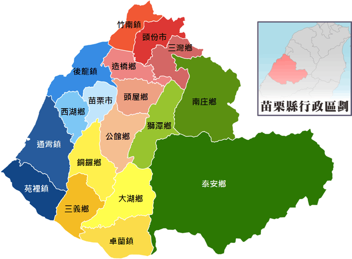
Administrative divisions
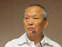
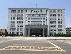
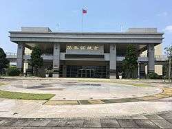
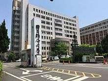
Miaoli County is divided into 2 cities, 5 urban townships, 10 rural townships and 1 mountain indigenous townships. Miaoli County has the second highest number of urban townships after Changhua County. Miaoli City is the county seat which houses the Miaoli County Government and Miaoli County Council. The incumbent Magistrate of Miaoli County is Hsu Yao-chang of the Kuomintang.
| Type | Name | Chinese | Taiwanese | Hakka | Area (km²) | Number of Villages | Number of Neighborhoods | Population | Density (per km²) |
|---|---|---|---|---|---|---|---|---|---|
| City | Miaoli City | 苗栗市 | Biâu-le̍k | Mèu-li̍t | 37.8872 | 28 | 702 | 90,063 | 2,401 |
| Toufen City | 頭份市 | Thâu-hūn | Thèu-fun | 53.32 | 32 | 538 | 102,654 | 1,925 | |
| Urban townships |
Houlong | 後龍鎮 | Āu-lâng | Heu-liùng | 75.8072 | 23 | 367 | 38,360 | 506 |
| Tongxiao | 通霄鎮 | Thong-siau | Thûng-sêu | 107.768 | 24 | 394 | 36,941 | 343 | |
| Yuanli | 苑裡鎮 | Oán-lí | Yen-lî | 68.2472 | 25 | 360 | 48,589 | 712 | |
| Zhunan | 竹南鎮 | Tek-lâm | Tsuk-nàm | 37.5592 | 25 | 515 | 83,622 | 2,226 | |
| Zhuolan | 卓蘭鎮 | Tah-lân | Cho̍k-làn | 75.316 | 11 | 176 | 18,353 | 240 | |
| Rural townships |
Dahu | 大湖鄉 | Tōa-ô͘ | Thai-fù | 90.8392 | 12 | 180 | 15,549 | 171 |
| Gongguan | 公館鄉 | Kong-koán | Kûng-kón | 71.452 | 19 | 281 | 34,847 | 488 | |
| Nanzhuang | 南庄鄉 | Lâm-chng | Nàm-chông | 165.4936 | 9 | 184 | 10,674 | 65 | |
| Sanwan | 三灣鄉 | Sam-oan | Sâm-vân | 52.296 | 8 | 93 | 7,132 | 136 | |
| Sanyi | 三義鄉 | Sam-gī | Sâm-ngi | 69.3424 | 7 | 161 | 17,235 | 249 | |
| Shitan | 獅潭鄉 | Sai-thâm | Sṳ̂-thàn | 79.432 | 7 | 100 | 4,725 | 59 | |
| Tongluo | 銅鑼鄉 | Tâng-lô | Thùng-lò | 78.38 | 10 | 218 | 18,909 | 241 | |
| Touwu | 頭屋鄉 | Thâu-ok | Thèu-vuk | 52.504 | 8 | 120 | 11,377 | 217 | |
| Xihu | 西湖鄉 | Se-ô͘ | Sî-fù | 41.0752 | 9 | 108 | 7,589 | 185 | |
| Zaoqiao | 造橋鄉 | Chō-kiô | Cho-khièu | 47.9976 | 9 | 118 | 13,456 | 280 | |
| Mountain indigenous townships |
Tai'an | 泰安鄉 | Thài-an | Thai-ôn | 614.5936 | 8 | 64 | 6,157 | 10 |
| County total | 1,820.3149 | 274 | 4,679 | 567,132 | 312 | ||||
Colors indicate the common language status of Hakka within each division. Note that Nanzhuang and Tai'an are also indigenous areas of Atayal people.
Demographics and culture
| Historical population | ||
|---|---|---|
| Year | Pop. | ±% |
| 1985 | 550,343 | — |
| 1990 | 547,609 | −0.5% |
| 1995 | 560,128 | +2.3% |
| 2000 | 559,703 | −0.1% |
| 2005 | 559,986 | +0.1% |
| 2010 | 560,968 | +0.2% |
| 2015 | 563,912 | +0.5% |
| Source:"Populations by city and country in Taiwan". Ministry of the Interior Population Census. | ||
Population
The main population of Miaoli County is comprised by the Han Chinese and the Taiwanese aborigines. The Taiwanese aborigines constitute about 1.9% of the total population while the Hakka are the main group of Han Chinese.
- Taiwanese aborigines
The Saisiat currently reside in the Wufeng Township of Hsinchu County and the Nanzhuang Township of Miaoli County.[2] Due the oppression by initial Han immigrants, the Atayal aboriginal group and the Nanzhuang Incident, the population of the Saisiat people have decreased to 5,000 people. It is the least populous Taiwanese aboriginal group after the Thao people. The traditions and culture of the Saisiat is greatly impacted by the Atayal aborigines and Hakka people in the region.
- Han Chinese
During the Qing Dynasty, Miaoli was inhabited by Hakka. Currently, the inhabitants of the four coastal townships of Miaoli (Nanzhuang Township, Houlong Township, Tongxiao Township, and Yuanli Township) consists of primarily Taiwanese Hokkien speakers. With the exception of the four coastal townships and Tai'an Township, the main population consists of Hakka.
Sports
The main sports and recreational structures in Miaoli include Miaoli Sports Hall, Miaoli County Tennis Court, and the Park of Zhunan Township. In Taiwan National Athletic Games of 2011, Miaoli is ranked 21 out of 22 teams with 1 gold, 1 silver, and 8 bronze.
Economy
Popular regional agriculture, food production and culture promoted by the government include strawberries from Dahu Township, Hakka zongzi, Sanwan Chinese pears, Touwu Daikons, Sanyi wood sculptures, Tai’an persimmons, and many more.
Annual revenue of Miaoli County is NT$22 billion, while its annual expenditure is NT$32 billion.[3] Monthly, Miaoli County Government spends NT$600 million on their staffs salaries and another NT$600 million for retirement obligation. As of July 2015, the county government has a debt of NT$64.8 billion.[4]
Education
Education-related affairs in Miaoli County is regulated by Education Department of the Miaoli County Government. At the end of 2004, the population of people older than 15 years old was 451,128, among which 97.91% of them were literate. There were 108,052 college-educated, 156,870 senior high school or junior college graduates, 176,755 junior high school or lower graduates. The percentage of people receiving education higher than college was relatively low.[5]
Miaoli County houses several universities and colleges, such as the National United University, Yu Da University, Asia-Pacific Institute of Creativity and Jen-Teh Junior College of Medicine, Nursing and Management.
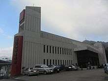
Energy
Power generation

Miaoli County houses the gas-fired Tunghsiao Power Plant in Tongxiao Township, the second largest gas-fired power plant in Taiwan with a capacity of 1,815 MW.
Water supply
The Mingte Dam in Touwu Township supplies water for irrigation and water supply for the county. The dam has a capacity of 17.1 million cubic meters.
Tourism
Tourist arrivals to Miaoli in 2011 was 17,000,000 people.[6]
Tourist attractions
Nature
Nature tourism in Miaoli County including Flying Cow Ranch, Shei-Pa National Park, Waipu Fishing Port and Yongheshan Reservoir.
Museums
Miaoli County houses several museums, such as Huoyan Mountain Ecology Museum, Miaoli Ceramics Museum, Miaoli County Urban Planning Exhibition Center, Miaoli Railway Museum, Museum of Saisiat Folklore, Sanyi Wood Sculpture Museum, Taiwan Oil Field Exhibition Hall and Zaochiao Charcoal Museum.
Cultural centers
Cultural centers in the county include the Miaoli Park, Wu Zhuo-liu Art and Cultural Hall, Yingtsai Academy and Hakka Round House.
Theme parks
Theme parks in the county is West Lake Resortopia.
Temples
Temple in the county is Zhonggang Cihyu Temple.
Festivals
The various cultural festivals of Miaoli County includes, Miaoli Marine Tourism, Meng-Hua Literary Award, Hakka Tung Hua Festival, Hakka folk song festival, Miaoli international tourism festival, etc.
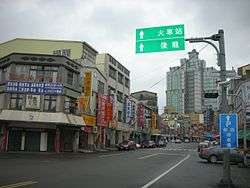
Transportation
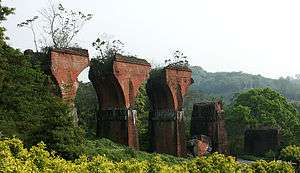
_-_panoramio.jpg)
Rail
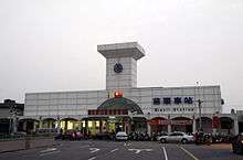
The Taiwan Railways Administration passes through Miaoli County through the Coastal Line and Taichung Line. The Coastal Line consists of Qiding, Zhunan, Tanwen, Dashan, Houlong, Longgang, Baishatun, Xinpu, Tongxiao and Yuanli Station. The Taichung Line consists of Zhunan, Zaoqiao, Fengfu, Miaoli, Nanshi, Tongluo and Sanyi Station.
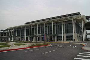
Taiwan High Speed Rail passes north to south through Miaoli and has one of its station in the county, which is the Miaoli Station located in Houlong Township.
Road
Both Taiwan No 1 and Taiwan No 3 highways have stops here.
Relative location
Places adjacent to Miaoli County | ||||||||||
|---|---|---|---|---|---|---|---|---|---|---|
| ||||||||||
References
- ↑ "About Miaoli - Miaoli County Government". miaoli.gov.tw.
- ↑ "Archived copy". Archived from the original on 19 April 2013. Retrieved 26 February 2013.
- ↑ "Miaoli County government has no money to pay salaries (update)".
- ↑ "Miaoli County government has no money to pay salaries". focustaiwan.tw.
- ↑ "Population - Miaoli County Government". miaoli.gov.tw.
- ↑ "Culture and Tourism Buresu of Miaoli - Getting to Know Miaoli". Archived from the original on 22 July 2015.
External links
| Wikimedia Commons has media related to Miaoli County. |
- Miaoli County Government Website (in Chinese) (in English)
| Special municipalities (6) |  | |
|---|---|---|
| Cities (3) | ||
| Counties (13) | ||
| ||