Mexico, Indiana
| Mexico, Indiana | |
|---|---|
| Census-designated place | |
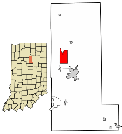 Location of Mexico in Miami County, Indiana. | |
| Coordinates: 40°49′12″N 86°6′50″W / 40.82000°N 86.11389°WCoordinates: 40°49′12″N 86°6′50″W / 40.82000°N 86.11389°W | |
| Country | United States |
| State | Indiana |
| County | Miami |
| Township | Jefferson |
| Area | |
| • Total | 5.5 sq mi (14.2 km2) |
| • Land | 5.5 sq mi (14.2 km2) |
| • Water | 0.0 sq mi (0.0 km2) |
| Elevation[1] | 702 ft (214 m) |
| Population (2010) | |
| • Total | 836 |
| • Density | 179.6/sq mi (69.3/km2) |
| Time zone | UTC-5 (Eastern (EST)) |
| • Summer (DST) | UTC-4 (EDT) |
| ZIP code | 46958 |
| Area code(s) | 765 |
| FIPS code | 18-48636[2] |
| GNIS feature ID | 439059 |
Mexico is a census-designated place (CDP) in Jefferson Township, Miami County, in the U.S. state of Indiana.[3] The population was 836 at the 2010 census.[4]
History
Mexico was platted in 1834.[5][6] The community's name probably commemorates the Mexican War of Independence.[7] The post office at Mexico has been in operation since 1837.[8]
Geography
Mexico is located at 40°49′12″N 86°6′50″W / 40.82000°N 86.11389°W (40.819892, -86.113834).[9]
According to the United States Census Bureau, the CDP has a total area of 5.5 square miles (14 km2), all land.
Demographics
| Historical population | |||
|---|---|---|---|
| Census | Pop. | %± | |
| U.S. Decennial Census[10] | |||
As of the census[2] of 2000, there were 984 people, 402 households, and 297 families residing in the CDP. The population density was 179.6 people per square mile (69.3/km²). There were 416 housing units at an average density of 75.9/sq mi (29.3/km²). The racial makeup of the CDP was 98.27% White, 0.30% African American, 0.71% Native American, 0.10% Pacific Islander, and 0.61% from two or more races. Hispanic or Latino of any race were 0.51% of the population.
There were 402 households out of which 29.4% had children under the age of 18 living with them, 62.7% were married couples living together, 8.5% had a female householder with no husband present, and 26.1% were non-families. 22.1% of all households were made up of individuals and 8.7% had someone living alone who was 65 years of age or older. The average household size was 2.45 and the average family size was 2.86.
In the CDP, the population was spread out with 21.1% under the age of 18, 8.5% from 18 to 24, 27.0% from 25 to 44, 28.4% from 45 to 64, and 14.9% who were 65 years of age or older. The median age was 42 years. For every 100 females, there were 102.9 males. For every 100 females age 18 and over, there were 97.5 males.
The median income for a household in the CDP was $49,234, and the median income for a family was $55,776. Males had a median income of $37,778 versus $26,389 for females. The per capita income for the CDP was $19,150. About 2.9% of families and 5.1% of the population were below the poverty line, including none of those under the age of eighteen or sixty-five or over.
References
- ↑ "US Board on Geographic Names". United States Geological Survey. 2007-10-25. Retrieved 2008-01-31.
- 1 2 "American FactFinder". United States Census Bureau. Retrieved 2008-01-31.
- ↑ "Mexico, Indiana". Geographic Names Information System. United States Geological Survey. Retrieved July 5, 2017.
- ↑ "Mexico, Indiana". City-Data.com. Retrieved 15 June 2015.
- ↑ History of Miami County, Indiana: From the Earliest Time to the Present. Brant & Fuller. 1887. p. 670.
- ↑ Bodurtha, Arthur Lawrence (1914). History of Miami County, Indiana: A Narrative Account of Its Historical Progress, Its People and Its Principal Interests. Lewis Pub. p. 195.
- ↑ Baker, Ronald L. (October 1995). From Needmore to Prosperity: Hoosier Place Names in Folklore and History. Indiana University Press. p. 217. ISBN 978-0-253-32866-3.
...apparently because of sympathy for the Mexican struggle for independence.
- ↑ "Miami County". Jim Forte Postal History. Retrieved 22 August 2015.
- ↑ "US Gazetteer files: 2010, 2000, and 1990". United States Census Bureau. 2011-02-12. Retrieved 2011-04-23.
- ↑ "Census of Population and Housing". Census.gov. Retrieved June 4, 2016.
Municipalities and communities of Miami County, Indiana, United States | ||
|---|---|---|
| City | ||
| Towns | ||
| Townships | ||
| CDP | ||
| Other unincorporated communities | ||
| Ghost towns | ||
| Footnotes | ‡This populated place also has portions in an adjacent county or counties | |