Gilead, Indiana
| Gilead, Indiana | |
|---|---|
| Unincorporated community | |
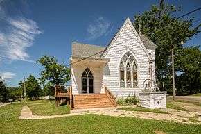 | |
 Gilead  Gilead | |
| Coordinates: 40°58′13″N 86°01′07″W / 40.97028°N 86.01861°WCoordinates: 40°58′13″N 86°01′07″W / 40.97028°N 86.01861°W | |
| Country | United States |
| State | Indiana |
| County | Miami |
| Township | Perry |
| Elevation[1] | 843 ft (257 m) |
| Time zone | UTC-5 (Eastern (EST)) |
| • Summer (DST) | UTC-4 (EDT) |
| ZIP code | 46951 |
| FIPS code | 18-27648[2] |
| GNIS feature ID | 435069 |
Gilead is an unincorporated community in Perry Township, Miami County, in the U.S. state of Indiana.[3]
History
Gilead was platted about 1840 by Adam E. Rhodes who had settled there in 1835.[4][5] It was probably named after Gilead, in the Hebrew Bible.[6]
Geography
Gilead is located at 40°58′13″N 86°01′07″W / 40.97028°N 86.01861°W.
Economy
Gilead supports four stores: The Gilead General Store, Squirrel Creek Bulk Foods, Rabers Kountry Store LLC, and Interurban Collectibles.
References
- ↑ "US Board on Geographic Names". United States Geological Survey. October 25, 2007. Retrieved 2017-05-09.
- ↑ "American FactFinder". United States Census Bureau. Archived from the original on 2013-09-11. Retrieved 2008-01-31.
- ↑ "Gilead, Indiana". Geographic Names Information System. United States Geological Survey. Retrieved July 7, 2017.
- ↑ History of Miami County, Indiana: From the Earliest Time to the Present. Brant & Fuller. 1887. p. 723.
- ↑ Bodurtha, Arthur Lawrence (1914). History of Miami County, Indiana: A Narrative Account of Its Historical Progress, Its People and Its Principal Interests. Lewis Pub. p. 190.
- ↑ Baker, Ronald L. (October 1995). From Needmore to Prosperity: Hoosier Place Names in Folklore and History. Indiana University Press. p. 145. ISBN 978-0-253-32866-3.
...apparently named for the biblical district...
Municipalities and communities of Miami County, Indiana, United States | ||
|---|---|---|
| City | ||
| Towns | ||
| Townships | ||
| CDP | ||
| Other unincorporated communities | ||
| Ghost towns | ||
| Footnotes | ‡This populated place also has portions in an adjacent county or counties | |
This article is issued from
Wikipedia.
The text is licensed under Creative Commons - Attribution - Sharealike.
Additional terms may apply for the media files.