Amboy, Indiana
| Amboy, Indiana | |
|---|---|
| Town | |
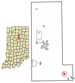 Location of Amboy in Miami County, Indiana. | |
| Coordinates: 40°36′10″N 85°55′43″W / 40.60278°N 85.92861°WCoordinates: 40°36′10″N 85°55′43″W / 40.60278°N 85.92861°W | |
| Country | United States |
| State | Indiana |
| County | Miami |
| Township | Jackson |
| Area[1] | |
| • Total | 0.35 sq mi (0.91 km2) |
| • Land | 0.35 sq mi (0.91 km2) |
| • Water | 0.00 sq mi (0.00 km2) |
| Elevation[2] | 817 ft (249 m) |
| Population (2010)[3] | |
| • Total | 384 |
| • Estimate (2016)[4] | 379 |
| • Density | 1,082.86/sq mi (417.70/km2) |
| Time zone | UTC-5 (Eastern (EST)) |
| • Summer (DST) | UTC-5 (EST) |
| ZIP code | 46911 |
| Area code | 765 |
| FIPS code[5] | 18-01360 |
| GNIS ID[5] | 430130 |
Amboy is a town in Jackson Township, Miami County, in the U.S. state of Indiana.[6] The population was 384 at the 2010 census.
History
Amboy was platted in 1867, when the Pan Handle Railroad was extended to that point.[7][8] A post office has been in operation at Amboy since 1868.[9]
Geography
Amboy is located at 40°36′10″N 85°55′43″W / 40.60278°N 85.92861°W (40.602758, -85.928615).[10]
According to the 2010 census, Amboy has a total area of 0.35 square miles (0.91 km2), all land.[11]
Demographics
| Historical population | |||
|---|---|---|---|
| Census | Pop. | %± | |
| 1880 | 208 | — | |
| 1890 | 402 | 93.3% | |
| 1900 | 402 | 0.0% | |
| 1910 | 521 | 29.6% | |
| 1920 | 460 | −11.7% | |
| 1930 | 431 | −6.3% | |
| 1940 | 450 | 4.4% | |
| 1950 | 414 | −8.0% | |
| 1960 | 446 | 7.7% | |
| 1970 | 473 | 6.1% | |
| 1980 | 450 | −4.9% | |
| 1990 | 370 | −17.8% | |
| 2000 | 360 | −2.7% | |
| 2010 | 384 | 6.7% | |
| Est. 2016 | 379 | [4] | −1.3% |
| U.S. Decennial Census[12] | |||
2010 census
As of the 2010 census,[3] there were 384 people, 151 households, and 114 families residing in the town. The population density was 1,097.1 inhabitants per square mile (423.6/km2). There were 169 housing units at an average density of 482.9 per square mile (186.4/km2). The racial makeup of the town was 96.6% White, 0.5% African American, 1.0% Asian, 1.0% from other races, and 0.8% from two or more races. Hispanic or Latino of any race were 0.8% of the population.
There were 151 households of which 26.5% had children under the age of 18 living with them, 60.3% were married couples living together, 11.3% had a female householder with no husband present, 4.0% had a male householder with no wife present, and 24.5% were non-families. 21.9% of all households were made up of individuals and 10% had someone living alone who was 65 years of age or older. The average household size was 2.54 and the average family size was 2.96.
The median age in the town was 40.5 years. 23.4% of residents were under the age of 18; 8.3% were between the ages of 18 and 24; 24% were from 25 to 44; 24.8% were from 45 to 64; and 19.5% were 65 years of age or older. The gender makeup of the town was 48.4% male and 51.6% female.
2000 census
As of the 2000 census,[13] there were 360 people, 147 households, and 113 families residing in the town. The population density was 1,017.8 people per square mile (397.1/km²). There were 158 housing units at an average density of 446.7 per square mile (174.3/km²). The racial makeup of the town was 98.06% White, 0.28% Asian, 1.39% from other races, and 0.28% from two or more races. Hispanic or Latino of any race were 1.11% of the population.
There were 147 households out of which 27.2% had children under the age of 18 living with them, 70.7% were married couples living together, 4.8% had a female householder with no husband present, and 23.1% were non-families. 20.4% of all households were made up of individuals and 10.9% had someone living alone who was 65 years of age or older. The average household size was 2.45 and the average family size was 2.81.
In the town, the population was spread out with 21.9% under the age of 18, 5.3% from 18 to 24, 26.9% from 25 to 44, 25.8% from 45 to 64, and 20.0% who were 65 years of age or older. The median age was 42 years. For every 100 females, there were 85.6 males. For every 100 females age 18 and over, there were 87.3 males.
The median income for a household in the town was $41,397, and the median income for a family was $45,000. Males had a median income of $40,500 versus $21,094 for females. The per capita income for the town was $19,503. About 4.2% of families and 7.1% of the population were below the poverty line, including 7.8% of those under age 18 and 11.7% of those age 65 or over.
Education
Amboy residents may obtain a free library card from the Converse-Jackson Township Public Library in Converse.[14]
References
- ↑ "2016 U.S. Gazetteer Files". United States Census Bureau. Retrieved Jul 28, 2017.
- ↑ "US Board on Geographic Names". United States Geological Survey. October 25, 2007. Retrieved 2017-05-09.
- 1 2 "American FactFinder". United States Census Bureau. Retrieved 2012-12-11.
- 1 2 "Population and Housing Unit Estimates". Retrieved June 9, 2017.
- 1 2 "FIPS55 Data: Indiana". FIPS55 Data. United States Geological Survey. February 23, 2006. Archived from the original on June 18, 2006. Retrieved June 30, 2014.
- ↑ "Amboy, Indiana". Geographic Names Information System. United States Geological Survey. Retrieved June 30, 2014.
- ↑ History of Miami County, Indiana: From the Earliest Time to the Present. Brant & Fuller. 1887. p. 635.
- ↑ Bodurtha, Arthur Lawrence (1914). History of Miami County, Indiana: A Narrative Account of Its Historical Progress, Its People and Its Principal Interests. Lewis Pub. p. 180.
- ↑ "Miami County". Jim Forte Postal History. Retrieved 22 August 2015.
- ↑ "US Gazetteer files: 2010, 2000, and 1990". United States Census Bureau. 2011-02-12. Retrieved 2011-04-23.
- ↑ "G001 - Geographic Identifiers - 2010 Census Summary File 1". United States Census Bureau. Retrieved 2015-07-13.
- ↑ "Census of Population and Housing". Census.gov. Archived from the original on May 12, 2015. Retrieved June 4, 2015.
- ↑ "American FactFinder". United States Census Bureau. Archived from the original on 2013-09-11. Retrieved 2008-01-31.
- ↑ "Library card fees". Converse-Jackson Township Public Library. Retrieved 10 March 2018.
Municipalities and communities of Miami County, Indiana, United States | ||
|---|---|---|
| City | ||
| Towns | ||
| Townships | ||
| CDP | ||
| Other unincorporated communities | ||
| Ghost towns | ||
| Footnotes | ‡This populated place also has portions in an adjacent county or counties | |