Butler Township, Miami County, Indiana
| Butler Township | |
|---|---|
| Township | |
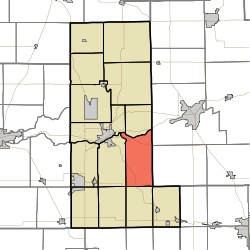 Location in Miami County | |
| Coordinates: 40°42′02″N 85°58′48″W / 40.70056°N 85.98000°WCoordinates: 40°42′02″N 85°58′48″W / 40.70056°N 85.98000°W | |
| Country |
|
| State |
|
| County | Miami |
| Government | |
| • Type | Indiana township |
| Area | |
| • Total | 29.84 sq mi (77.3 km2) |
| • Land | 28.91 sq mi (74.9 km2) |
| • Water | 0.93 sq mi (2.4 km2) 3.12% |
| Elevation[1] | 801 ft (244 m) |
| Population (2010) | |
| • Total | 866 |
| • Density | 30/sq mi (10/km2) |
| Time zone | UTC-5 (Eastern (EST)) |
| • Summer (DST) | UTC-4 (EDT) |
| ZIP code | 46970 |
| GNIS feature ID | 453150 |
Butler Township is one of fourteen townships in Miami County, Indiana, United States. As of the 2010 census, its population was 866 and it contained 396 housing units.[2]
History
Butler Township was organized in 1841.[3]
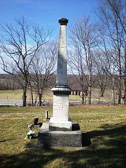
The Francis Godfroy Cemetery, Wallace Circus and American Circus Corporation Winter Quarters, and Westleigh Farms are listed on the National Register of Historic Places.[4]
Geography
According to the 2010 census, the township has a total area of 29.84 square miles (77.3 km2), of which 28.91 square miles (74.9 km2) (or 96.88%) is land and 0.93 square miles (2.4 km2) (or 3.12%) is water.[2]
Unincorporated towns
- New Santa Fe at 40°40′25″N 85°59′16″W / 40.673652°N 85.987767°W
- Oakley at 40°42′07″N 86°00′45″W / 40.701986°N 86.012491°W
- Peoria at 40°43′07″N 85°57′38″W / 40.718653°N 85.960545°W
- Santa Fe at 40°39′11″N 85°59′10″W / 40.653097°N 85.986100°W
(This list is based on USGS data and may include former settlements.)
Extinct towns
- Missisinewa at 40°45′02″N 86°00′30″W / 40.750598°N 86.008324°W
(These towns are listed as "historical" by the USGS.)
Cemeteries
The township contains these six cemeteries: Clayton, Fegley, Francis Godfroy, Keyes, New Hope and Ramer.
Major highways
Lakes
- Mississinewa Lake
School districts
- Maconaquah School Corporation
Political districts
- Indiana's 5th congressional district
- State House District 32
- State Senate District 18
References
- "Butler Township, Miami County, Indiana". Geographic Names Information System. United States Geological Survey. Retrieved 2009-09-27.
- United States Census Bureau 2008 TIGER/Line Shapefiles
- IndianaMap
- ↑ "US Board on Geographic Names". United States Geological Survey. October 25, 2007. Retrieved 2017-05-09.
- 1 2 "Population, Housing Units, Area, and Density: 2010 - County -- County Subdivision and Place -- 2010 Census Summary File 1". United States Census. Retrieved 2013-05-10.
- ↑ History of Miami County, Indiana: From the Earliest Time to the Present. Brant & Fuller. 1887. p. 278.
- ↑ National Park Service (2010-07-09). "National Register Information System". National Register of Historic Places. National Park Service.
External links
- Indiana Township Association
- United Township Association of Indiana
- City-Data.com page for Butler Township
Places adjacent to Butler Township, Miami County, Indiana | |
|---|---|
Municipalities and communities of Miami County, Indiana, United States | ||
|---|---|---|
| City | ||
| Towns | ||
| Townships | ||
| CDP | ||
| Other unincorporated communities | ||
| Ghost towns | ||
| Footnotes | ‡This populated place also has portions in an adjacent county or counties | |