Melgund, Kenora District, Ontario
| Melgund | |
|---|---|
| Township | |
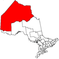
 Melgund Location in Ontario | |
| Coordinates: 49°35′09″N 92°20′47″W / 49.58583°N 92.34639°WCoordinates: 49°35′09″N 92°20′47″W / 49.58583°N 92.34639°W[1] | |
| Country | Canada |
| Province | Ontario |
| District | Kenora |
| Part | Unorganized |
| Government | |
| • MP | Bob Nault |
| • MPP | Greg Rickford |
| Elevation[2] | 373 m (1,224 ft) |
| Time zone | UTC-6 (Central Time Zone) |
| • Summer (DST) | UTC-5 (Central Time Zone) |
| Postal code FSA | P0V |
| Area code(s) | 807 |
Melgund is a geographic township[3] and local services board[4] in the Unorganized Part of Kenora District in northwestern Ontario, Canada.[1] It has two unincorporated communities, Dyment and Borups Corners, and is counted as part of Kenora, Unorganized, Northern Ontario in Statistics Canada census data.[5]
Ontario Highway 603 travels for its entire length between Dyment and Borups Corners.
References
- 1 2 "Melgund". Geographical Names Data Base. Natural Resources Canada. Retrieved 2016-03-04.
- ↑ Taken from Google Earth at coordinates. Accessed 2016-03-04.
- ↑ "Melgund" (PDF). Geology Ontario - Historic Claim Maps. Ontario Ministry of Northern Development, Mines and Forestry. Archived from the original (PDF) on 2016-12-20. Retrieved 2016-03-04.
- ↑ Local Services Boards, R.R.O. 1990, Reg. 737 Archived 2014-03-10 at the Wayback Machine.. Canadian Legal Information Institute.
- ↑ "Kenora, Unorganized, Ontario (Code 3560090)". 2011 Census. Statistics Canada. 2012-10-24. Statistics Canada Catalogue no. 98-316-XWE. Retrieved 2016-03-04.
Other map sources:
- Map 13 (PDF) (Map). 1 : 1,600,000. Official road map of Ontario. Ministry of Transportation of Ontario. 2014. Retrieved 2016-03-04.
- Restructured municipalities - Ontario map #1 (Map). Restructuring Maps of Ontario. Ontario Ministry of Municipal Affairs and Housing. 2006. Retrieved 2016-03-04.
This article is issued from
Wikipedia.
The text is licensed under Creative Commons - Attribution - Sharealike.
Additional terms may apply for the media files.