Melbourne tram route 86
| Route 86 | |||||
|---|---|---|---|---|---|
| Bundoora RMIT - Waterfront City Docklands | |||||
|
| |||||
 | |||||
 | |||||
| Overview | |||||
| System | Melbourne | ||||
| Operator | Yarra Trams | ||||
| Depot | Preston | ||||
| Vehicle |
B class E class | ||||
| Night-time | Friday & Saturday | ||||
| Route | |||||
| Locale | Melbourne, Australia | ||||
| Start | Bundoora RMIT | ||||
| Via |
Reservoir Preston Thornbury Northcote Clifton Hill Collingwood Fitzroy East Melbourne Bourke Street | ||||
| End | Waterfront City Docklands | ||||
| Service | |||||
| Journey time | 65-90 minutes | ||||
| Operates | Daily | ||||
| Zone(s) |
Free Zone: Stops D11-D1, 1-11 Myki Zone 1: Stops 12-51 Zone 1/2 overlap: Stops 52-71 | ||||
| Timetable | Route 86 timetable | ||||
| Map | Route 86 map | ||||
| |||||
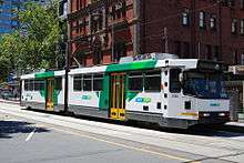
Melbourne tram route 86 is operated by Yarra Trams on the Melbourne tram network. It operates from Bundoora RMIT to Waterfront City Docklands. The route is operated by B and E class trams from Preston depot.[1][2]
History
A cable tram line operated by the Melbourne Tramway & Omnibus Company (MTOC) opened on 10 August 1887, operating along Bourke Street, Gertrude Street, Smith Street and Queens Parade to Merri Creek.[3] On 18 February 1890 a group of Northcote land speculators built a line between the MTOC terminus and Dundas Street, the line was not as successful as they had hoped, closed down and reopened twice before the municipal government bought it in 1901 and leased out its operation.
At the end of the lease council took over operation for a short time. The MTOC line was taken over by the Melbourne & Metropolitan Tramways Board (MMTB) on 1 November 1919 with the Northcote Cable Tramway line coming under MMTB control on 20 February 1920.[4]
The Fitzroy, Northcote & Preston Tramways Trust had started constructing a system but it wasn't until after its takeover by the MMTB that services first ran, on 1 April 1920, part of this system included a line from Dundas Street to Tyler Street.[5] This network was orphaned from the rest of the electric network until 24 March 1925 when a line along Holden Street, Pilkington Street and Barkly Street was built by the MMTB to allow access to the CBD via Lygon Street.[6]
The two cable lines were through routed by the MMTB, and operated until 26 October 1940, when the Bourke Street cable lines were abandoned in favour of double decker buses.[7] The Bourke Street cable lines were the last cable trams to operate in Melbourne.
The MMTB, unhappy with the performance of the buses, decided to rebuild the lines as electric tram services when the buses became life expired. Trams first ran on route 88 (predecessor to the modern 86) on 26 June 1955, with Brunswick East starting operating on 6 May 1956.[8][9]
On 18 May 1983, the suburban terminus was extended 1.2 kilometres from Tyler Street to Boldrewood Parade,[10] then to 2.1 kilometres to La Trobe University on 10 January 1985, 2.9 kilometres to Settlement Road on 26 April 1987[11][12][13] and to the current terminus at McKimmies Road on 12 October 1995.[14] This final extension was funded as part of the Federal Government's Building Better Cities program.[15]
As part of the Docklands redevelopment project, La Trobe Street was extended west over the Spencer Street railyards on 26 March 2000, and with this extension route 86 was extended along Spencer Street and La Trobe Street to Docklands Stadium.[16][17][18]
On 27 July 2008 route 30 and route 86 swapped termini, with route 30 terminating in Harbour Esplanade at Central Pier, and route 86 being extended to Waterfront City.[19]
In August 2008 route 86 was the first route to see tram based testing of the Myki ticketing system, using special services not open to normal fare-paying passengers.[20]
A project to improve access through platform stops, perform track and overhead renewal and improve speed and reliability on a 6.8 km section of route 86, along High Street and Plenty Road, between Westgarth Street, Westgarth and Albert Street, Reservoir commenced in 2011.[21][22]
Since April 2012, there has been a campaign for route 86 to be extended to South Morang station. This campaign has been run by community group the Friends of South Morang. The proposed extension is for the tram to go north on Plenty Road, turn left on Bush Boulevard and go towards the South Morang station, from there it will go through the Mill Park Lakes Estate to the intersection of The Lakes Boulevard and Plenty Road. This proposal can be seen on The South Morang future transport network map.[23]
In January 2016, route 86 began operating through the night on Fridays and Saturdays as part of the Night Network.[24]
In late November 2016, E-class trams commenced operation on the route.[25] These trams are beneficial on the route which has the highest amount of superstop platforms of any route in Melbourne.[26]
| Dates | Route | Notes |
|---|---|---|
| 2 May 1954 - 17 May 1983 | Footscray to West Maribyrnong | |
| 18 May 1983 - 11 Oct 1995 | Bundoora to City (Bourke Street) | |
| 12 Oct 1995 - 25 March 2000 | Bundoora RMIT to City (Bourke Street) | |
| 26 March 2000 - 26 July 2008 | Bundoora RMIT to Etihad Stadium Docklands | Etihad Stadium then known as Colonial Stadium/Telstra Dome |
| 27 July 2008 - onwards | Bundoora RMIT to Waterfront City Docklands | via Bourke Street |
Route

Route 86 runs from Bundoora RMIT, travelling south on Plenty Road through the suburbs of, Reservoir and Preston, passing La Trobe University.
Plenty Road ends in Preston at Dundas Street and High Street, route 86 turns slightly into High Street and continues south through Thornbury and Northcote. It then crosses Merri Creek, continuing along Queens Parade Clifton Hill, heading south-west, turning south into Smith Street passing between Fitzroy and Collingwood.
Just before the end of Smith Street it turns west into Gertrude Street, Fitzroy, and south into Nicholson Street, Carlton, past the Royal Exhibition Building.
It enters the CBD on Spring Street turning west into Bourke Street at Parliament House, travels through the Bourke Street Mall and turns north into Spencer Street, passing Southern Cross station, it turns west at La Trobe Street, passing over the Spencer Street rail yards into Docklands, it travels north briefly on Harbour Esplanade before turning west into Docklands Drive, where it terminates at Waterfront City Docklands.
Operation
Route 86 is operated from Preston depot by B class trams and E class trams, although it is not uncommon for A class trams to be rostered.[27]
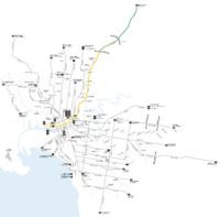
Map
Route 86 | |||||||||||||||||||||||||||||||||||||||||||||||||||||||||||||||||||||||||||||||||||||||||||||||||||||||||||||||||||||||||||||||||||||||||||||||||||||||||||||||||||||||||||||||||||||||||||||||||||||||||||||||||||||||||||||||||||||||||||||||||||||||||||||||||||||||||||||||||||||||||||||||||||||||||||||||||||||||||||||||||||||||||||||||||||||||||||||||||||||||||||||||||||||||||||||||||||||||||||||||||||||||||||||||||||||||||||||||||||||||||||||||||||||||||||||||||||||||||||||||||||||||||||||||||||||||||||||||||||||||||||||||||||||||||||||||||||||||||||||||||||||||||||||||||||||||||||||||||||||||||||||||||||||||||||||||||||||||||||||||||||||||||||||||||||||||||||||||||||||||||||||||||||||||||||||||||||||||||||||||||||||||||||||||||||||||||||||||||||||||||||||||||||||||||||||||||||||||||||||||||||||||||||||||||||||||||||||||||||||||||||||||||||||||||||||||||||||||||||||||||||||||||||||||||||||||||||||||
|---|---|---|---|---|---|---|---|---|---|---|---|---|---|---|---|---|---|---|---|---|---|---|---|---|---|---|---|---|---|---|---|---|---|---|---|---|---|---|---|---|---|---|---|---|---|---|---|---|---|---|---|---|---|---|---|---|---|---|---|---|---|---|---|---|---|---|---|---|---|---|---|---|---|---|---|---|---|---|---|---|---|---|---|---|---|---|---|---|---|---|---|---|---|---|---|---|---|---|---|---|---|---|---|---|---|---|---|---|---|---|---|---|---|---|---|---|---|---|---|---|---|---|---|---|---|---|---|---|---|---|---|---|---|---|---|---|---|---|---|---|---|---|---|---|---|---|---|---|---|---|---|---|---|---|---|---|---|---|---|---|---|---|---|---|---|---|---|---|---|---|---|---|---|---|---|---|---|---|---|---|---|---|---|---|---|---|---|---|---|---|---|---|---|---|---|---|---|---|---|---|---|---|---|---|---|---|---|---|---|---|---|---|---|---|---|---|---|---|---|---|---|---|---|---|---|---|---|---|---|---|---|---|---|---|---|---|---|---|---|---|---|---|---|---|---|---|---|---|---|---|---|---|---|---|---|---|---|---|---|---|---|---|---|---|---|---|---|---|---|---|---|---|---|---|---|---|---|---|---|---|---|---|---|---|---|---|---|---|---|---|---|---|---|---|---|---|---|---|---|---|---|---|---|---|---|---|---|---|---|---|---|---|---|---|---|---|---|---|---|---|---|---|---|---|---|---|---|---|---|---|---|---|---|---|---|---|---|---|---|---|---|---|---|---|---|---|---|---|---|---|---|---|---|---|---|---|---|---|---|---|---|---|---|---|---|---|---|---|---|---|---|---|---|---|---|---|---|---|---|---|---|---|---|---|---|---|---|---|---|---|---|---|---|---|---|---|---|---|---|---|---|---|---|---|---|---|---|---|---|---|---|---|---|---|---|---|---|---|---|---|---|---|---|---|---|---|---|---|---|---|---|---|---|---|---|---|---|---|---|---|---|---|---|---|---|---|---|---|---|---|---|---|---|---|---|---|---|---|---|---|---|---|---|---|---|---|---|---|---|---|---|---|---|---|---|---|---|---|---|---|---|---|---|---|---|---|---|---|---|---|---|---|---|---|---|---|---|---|---|---|---|---|---|---|---|---|---|---|---|---|---|---|---|---|---|---|---|---|---|---|---|---|---|---|---|---|---|---|---|---|---|---|---|---|---|---|---|---|---|---|---|---|---|---|---|---|---|---|---|---|---|---|---|---|---|---|---|---|---|---|---|---|---|---|---|---|---|---|---|---|---|---|---|---|---|---|---|---|---|---|---|---|---|---|---|---|---|---|---|---|---|---|---|---|---|---|---|---|---|---|---|---|---|---|---|---|---|---|---|---|---|---|---|---|---|---|---|---|---|---|---|---|---|---|---|---|---|---|---|---|---|---|---|---|---|---|---|---|---|---|---|---|---|---|---|---|---|---|---|---|---|---|---|---|---|---|---|---|---|---|---|---|---|---|---|---|---|---|---|---|---|---|---|---|---|---|---|---|---|---|---|---|---|---|---|---|---|---|---|---|---|---|---|---|---|---|---|---|---|---|---|---|---|---|---|---|---|---|---|---|---|---|---|---|---|---|---|---|---|---|---|---|---|---|---|---|---|---|---|---|---|---|---|---|---|---|---|---|---|---|---|---|---|---|---|---|---|---|---|---|---|---|---|---|---|---|---|---|---|---|---|---|---|---|---|---|---|---|---|---|---|---|---|---|---|---|---|---|---|---|---|---|---|---|---|---|---|---|---|---|---|---|---|---|---|---|---|---|---|---|---|---|---|---|---|---|---|---|---|---|---|---|---|---|---|---|---|---|---|---|---|---|---|---|---|---|---|---|---|---|---|---|---|---|---|---|---|---|---|---|---|---|---|---|---|---|---|---|---|---|---|---|---|---|---|---|---|---|---|---|---|---|---|---|---|---|---|---|---|---|---|---|---|---|---|---|---|---|---|---|---|---|---|---|---|---|---|---|---|---|---|---|---|---|---|---|---|---|---|---|---|---|---|---|---|---|---|---|---|---|---|
| Bundoora RMIT - Waterfront City Docklands via Preston, Northcote, Collingwood and City Free Tram Zone covers stops D11 to 11. Fare zone 1 applies from stop 12 to 71. | |||||||||||||||||||||||||||||||||||||||||||||||||||||||||||||||||||||||||||||||||||||||||||||||||||||||||||||||||||||||||||||||||||||||||||||||||||||||||||||||||||||||||||||||||||||||||||||||||||||||||||||||||||||||||||||||||||||||||||||||||||||||||||||||||||||||||||||||||||||||||||||||||||||||||||||||||||||||||||||||||||||||||||||||||||||||||||||||||||||||||||||||||||||||||||||||||||||||||||||||||||||||||||||||||||||||||||||||||||||||||||||||||||||||||||||||||||||||||||||||||||||||||||||||||||||||||||||||||||||||||||||||||||||||||||||||||||||||||||||||||||||||||||||||||||||||||||||||||||||||||||||||||||||||||||||||||||||||||||||||||||||||||||||||||||||||||||||||||||||||||||||||||||||||||||||||||||||||||||||||||||||||||||||||||||||||||||||||||||||||||||||||||||||||||||||||||||||||||||||||||||||||||||||||||||||||||||||||||||||||||||||||||||||||||||||||||||||||||||||||||||||||||||||||||||||||||||||||
| |||||||||||||||||||||||||||||||||||||||||||||||||||||||||||||||||||||||||||||||||||||||||||||||||||||||||||||||||||||||||||||||||||||||||||||||||||||||||||||||||||||||||||||||||||||||||||||||||||||||||||||||||||||||||||||||||||||||||||||||||||||||||||||||||||||||||||||||||||||||||||||||||||||||||||||||||||||||||||||||||||||||||||||||||||||||||||||||||||||||||||||||||||||||||||||||||||||||||||||||||||||||||||||||||||||||||||||||||||||||||||||||||||||||||||||||||||||||||||||||||||||||||||||||||||||||||||||||||||||||||||||||||||||||||||||||||||||||||||||||||||||||||||||||||||||||||||||||||||||||||||||||||||||||||||||||||||||||||||||||||||||||||||||||||||||||||||||||||||||||||||||||||||||||||||||||||||||||||||||||||||||||||||||||||||||||||||||||||||||||||||||||||||||||||||||||||||||||||||||||||||||||||||||||||||||||||||||||||||||||||||||||||||||||||||||||||||||||||||||||||||||||||||||||||||||||||||||||
| Note: Green denotes free tram zone | |||||||||||||||||||||||||||||||||||||||||||||||||||||||||||||||||||||||||||||||||||||||||||||||||||||||||||||||||||||||||||||||||||||||||||||||||||||||||||||||||||||||||||||||||||||||||||||||||||||||||||||||||||||||||||||||||||||||||||||||||||||||||||||||||||||||||||||||||||||||||||||||||||||||||||||||||||||||||||||||||||||||||||||||||||||||||||||||||||||||||||||||||||||||||||||||||||||||||||||||||||||||||||||||||||||||||||||||||||||||||||||||||||||||||||||||||||||||||||||||||||||||||||||||||||||||||||||||||||||||||||||||||||||||||||||||||||||||||||||||||||||||||||||||||||||||||||||||||||||||||||||||||||||||||||||||||||||||||||||||||||||||||||||||||||||||||||||||||||||||||||||||||||||||||||||||||||||||||||||||||||||||||||||||||||||||||||||||||||||||||||||||||||||||||||||||||||||||||||||||||||||||||||||||||||||||||||||||||||||||||||||||||||||||||||||||||||||||||||||||||||||||||||||||||||||||||||||||
In popular culture
In 2010 Melbourne-based musical comedian The Bedroom Philosopher released an album Songs from the 86 Tram inspired by the tram route as well as an award-winning comedy show of the same name.[28]
Route 95
Until 27 July 2014 additional capacity through the Melbourne CBD was provided by route 95 short workings from Melbourne Museum to Spencer Street via Bourke Street between 12:00 and 14:00 on weekdays.[29][30]
References
- ↑ Facts & figures Yarra Trams
- ↑ Route 86 Yarra Trams
- ↑ Melbourne Tramway & Omnibus Company Limited Running Journal volume 9 no 3 page 16
- ↑ "Northcote: the on again, off again cable tramway", Friends of Hawthorn Tram Depot, retrieved 2011-10-03
- ↑ "Milestones, 1911 - 1920", Yarra Trams, retrieved 2011-10-03
- ↑ "Milestones, 1921 - 1930", Yarra Trams, retrieved 2011-10-09
- ↑ "Milestones, 1931 - 1940", Yarra Trams, retrieved 2011-10-03
- ↑ "Milestones, 1951 - 1960", Yarra Trams, retrieved 2011-10-03
- ↑ History of Melbourne Trams Routes from 1950 to 2009 Yarra Trams
- ↑ "East Preston Line Extended" Trolley Wire issue 208 October 1983 page 18
- ↑ Here and There Trolley Wire February 1987 page 25 (large file)
- ↑ "Milestones, 1981 - 1990", Yarra Trams, retrieved 2011-10-03
- ↑ Jones, Colin (1993). Watch for Trams. Kenthurst: Kangaroo Press. p. 118. ISBN 0 86417 544 2.
- ↑ "Milestones, 1991 - 2000", Yarra Trams, retrieved 2011-10-03
- ↑ Lyndsay Neilson. "Appendix 1: Funding Allocation, Victorian Area Strategies". The ‘Building Better Cities’ program 1991-96: a nation-building initiative of the Commonwealth Government. epress.anu.edu.au. Retrieved 2010-11-01.
- ↑ "Melbourne - Yarra Trams" Trolley Wire issue 281 May 2000 page 30
- ↑ "Metros" Railway Gazette International May 2000 page 276
- ↑ Route 86 timetable Yarra Trams 24 March 2000
- ↑ "Completed tram initiatives", Department of Transport, retrieved 2011-10-03
- ↑ Ashley Gardiner (18 August 2008). "Smart card tests to begin on trams this week". Herald Sun. www.news.com.au. Archived from the original on 15 September 2008. Retrieved 2008-08-18.
- ↑ "Tram Route 86 Corridor Project", Darebin City Council, retrieved 2011-10-04
- ↑ "Tram Route 86 – High Street and Plenty Road", VicRoads, retrieved 2011-10-04
- ↑ South Morang - Future Transport Network City of Whittlesea
- ↑ Night Tram Public Transport Victoria
- ↑ Route 86 will be next to run E-Class Yarra Trams 15 April 2016
- ↑ Past meets future at new home of E-class trams Yarra Trams 17 April 2016
- ↑ "East Preston Depot", Vicsig, retrieved 2011-10-04
- ↑ The bedroom philosopher songs from the 86 tram Melbourne International Comedy Festival 2010
- ↑ Route Guide & Map 86/95 Yarra Trams
- ↑ Capacity boost for tram passengers Archived 2014-07-26 at the Wayback Machine. Yarra Trams 9 July 2014
External links

- Route 86 map
- Route 86 timetable