Melba, Australian Capital Territory
| Melba Canberra, Australian Capital Territory | |||||||||||||||
|---|---|---|---|---|---|---|---|---|---|---|---|---|---|---|---|
 | |||||||||||||||
| Coordinates | 35°12′30″S 149°03′15″E / 35.20833°S 149.05417°ECoordinates: 35°12′30″S 149°03′15″E / 35.20833°S 149.05417°E | ||||||||||||||
| Population | 3,147 (2016 census)[1] | ||||||||||||||
| • Density | 1,368/km2 (3,540/sq mi) | ||||||||||||||
| Established | 1972 | ||||||||||||||
| Postcode(s) | 2615 | ||||||||||||||
| Area | 2.3 km2 (0.9 sq mi) | ||||||||||||||
| District | Belconnen | ||||||||||||||
| Territory electorate(s) | Ginninderra | ||||||||||||||
| Federal Division(s) | Fenner | ||||||||||||||
| |||||||||||||||
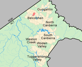
Melba is a residential suburb in the Belconnen district of Canberra, located within the Australian Capital Territory, Australia. The suburb of Melba is named after Dame Nellie Melba (1861-1931), the first internationally recognised Australian opera soprano. The streets are named after composers, singers and other musically notable Australians or people with strong Australian connections.[2]
Features
Located in Melba are a government run primary school (Mount Rogers Community School), and a merged secondary school, Melba Copland Secondary School, a merge of Melba High School and Copland College.
Melba Tennis Club and its eight courts are located adjacent to the playing fields. A former member of the club is Annabel Ellwood, whose highest ranking on the WTA Women's Professional Tour was 57 for singles and 60 for Doubles in 1997. Ellwood's name appears on the honour board in the clubhouse.
Political representation
For the purposes of Australian federal elections for the House of Representatives, Melba is in the Fenner.[3]
For the purposes of Australian Capital Territory elections for the ACT Legislative Assembly, Melba is in the Ginninderra electorate.[4]
Geology
A porphyry of Green-grey Dacitic intrusive containing large white Feldspar crystals is found in the north east corner. Green grey dacitic tuff from the Hawkins Volcanics occur on the south east side of Melba. Green grey dacite and quartz andesite occur in the north west to the south east. This is intruded by a band of Glebe Farm Adamellite. Deakin Volcanics purple rhyodacite with a patch of purple and green tuff are in the south west. The Deakin Fault runs north west through Melba and is marked by quartz.[5]
People honoured in the streets of Melba
|
|
References
- ↑ Australian Bureau of Statistics (27 June 2017). "Melba (State Suburb)". 2016 Census QuickStats. Retrieved 30 June 2017.

- ↑ "Suburb Name search results". ACT Environment and Sustainable Development. Retrieved 12 February 2014.
- ↑ "Profile of the electoral division of Fenner (ACT)". Current federal electoral divisions. Australian Electoral Commission. 8 February 2016. Retrieved 29 May 2016.
- ↑ "Electorates 2012 election". Electorates. ACT Electoral Commission. 5 July 2012. Retrieved 17 December 2013.
- ↑ Henderson G A M and Matveev G, Geology of Canberra, Queanbeyan and Environs 1:50000 1980.