Hawker, Australian Capital Territory
| Hawker Canberra, Australian Capital Territory | |||||||||||||||
|---|---|---|---|---|---|---|---|---|---|---|---|---|---|---|---|
 | |||||||||||||||
| Population | 2,952 (2016 census)[1] | ||||||||||||||
| • Density | 1,550/km2 (4,020/sq mi) | ||||||||||||||
| Established | 1972 | ||||||||||||||
| Postcode(s) | 2614 | ||||||||||||||
| Area | 1.9 km2 (0.7 sq mi) | ||||||||||||||
| District | Belconnen | ||||||||||||||
| Territory electorate(s) | Ginninderra | ||||||||||||||
| Federal Division(s) | Fenner | ||||||||||||||
| |||||||||||||||
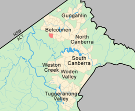
Hawker (postcode: 2614) is a suburb of the Belconnen district of Canberra, located within the Australian Capital Territory, Australia.
The suburb of Hawker is named after Charles Hawker (1894–1938), Member of the House of Representatives from 1929–1938 and Federal minister in 1932. Streets in the suburb are named according to the theme of Northern Territory pastoral stations.[2]
Features and location
The centrepiece of the suburb is a group centre where there are many small businesses and shops like take aways, newsagents, a hotel, KFC and Olive at Hawker - Mediterranean Restaurant. The area supports three schools: Hawker Primary, Belconnen High, and Hawker College (a specialist senior high school). Combined, these schools cover students from preschool to Year 12.
Hawker is a popular location for sport, and includes the multi-purpose Hawker Playing Fields; Hawker Enclosed Oval, a small football (soccer) stadium (Robertfam Park), centres for tennis and lawn bowls; and the Hawker International Softball Centre.
In 2016, the median weekly household income in Hawker of $2,028 were slightly below the ACT average of $2,070.[1]
Political representation
For the purposes of Australian federal elections for the House of Representatives, Hawker is in the Division of Fenner.[3]
For the purposes of Australian Capital Territory elections for the ACT Legislative Assembly, Hawker is in the Ginninderra electorate.[4]
Geology
Silurian age Green grey rhyodacite of the Walker Volcanics underlie the whole suburb. Off the south west of the suburb and south east of the Pinnacle is a lens of limestone and shale underneath the rhyodacite.[5]
References
- 1 2 Australian Bureau of Statistics (27 June 2017). "Hawker (State Suburb)". 2016 Census QuickStats. Retrieved 29 June 2017.

- ↑ "Suburb Name search results". ACT Environment and Sustainable Development. Retrieved 11 January 2013.
- ↑ "Profile of the electoral division of Fenner (ACT)". Current federal electoral divisions. Australian Electoral Commission. 8 February 2016. Retrieved 29 May 2016.
- ↑ "Electorates 2012 election". Electorates. ACT Electoral Commission. 5 July 2012. Retrieved 17 December 2013.
- ↑ Henderson G A M and Matveev G, Geology of Canberra, Queanbeyan and Environs 1:50000 1980.
External links
- Hawker Primary School - preschool to Year 6
- Belconnen High School - Years 7 to 10
- Hawker College - Year 11/12 school
Coordinates: 35°14′38″S 149°02′17″E / 35.244°S 149.038°E