History
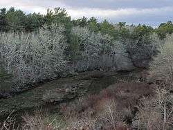
In the early decades of the 20th century, John W. Farley, an avid fisherman and naturalist, acquired contiguous parcels of land along the Mashpee River and established a small campground and canoe launch. He donated this land to the public in 1959 and an additional grant by Pemberton Whitcomb in 1979 increased the park's size. The Trustees of Reservations purchased more land in 1998.
External links
|
|---|
|
|
|
|
|---|
Wildlife
Management Areas | |
|---|
Wildlife
Sanctuaries |
- Billingsgate Island
- Carr Island
- E. Howe Forbush
- Egg Rock
- Grace A. Robson
- J.C. Phillips
- Knight
- Penikese Island
- Ram Island (Salisbury)
- Ram Island (Mattapoisett)
- Susan B. Minns
- Tarpaulin Cove
- Watatic Mountain
|
|---|
|
|
|
|---|
- Black Pond Bog
- Boat Meadow
- Francis Newhall Woods
- Grassy Pond
- Greene Swamp
- Halfway Pond Island
- Hawley Bog
- Hockomock Swamp
- Hoft Farm
- Homer-Watcha Preserve
- Katama Plains
- McElwain-Olsen
- Miacomet Moors
- Reed Brook
- Drury
- Sandy Neck
- David H. Smith Preserve and Fire Trail
- Stacy Mountain
- Tatkon
|
|
|
|
|---|
- Allens Pond
- Arcadia
- Ashumet Holly
- Attleboro Springs
- Barnstable Great Marsh
- Blue Hills Trailside Museum
- Boston Nature Center
- Broad Meadow Brook
- Broadmoor
- Burncoat Pond
- Canoe Meadows
- Daniel Webster
- Drumlin Farm
- Eagle Lake
- Eastern Point
- Endicott
- Felix Neck
- Flat Rock
- Graves Farm
- Great Neck
- Habitat
- High Ledges
- Ipswich River
- Joppa Flats
- Kettle Island
- Lake Wampanoag
- Laughing Brook
- Lime Kiln Farm
- Lincoln Woods
- Long Pasture
- Lynes Woods
- Marblehead Neck
- Moose Hill
- Museum of American Bird Art
- Nahant Thicket
- Nashoba Brook
- North Hill Marsh
- North River
- Oak Knoll
- Pierpont Meadow
- Pleasant Valley
- Poor Farm Hill
- Richardson Brook
- Road's End
- Rough Meadows
- Rutland Brook
- Sampsons Island
- Sesachacha Heathlands
- Skunknett River
- Stony Brook
- Wachusett Meadow
- Waseeka
- Wellfleet Bay
- Wildwood Camp
|
|
|
|
Coordinates: 41°37′22″N 70°28′51″W / 41.62278°N 70.48083°W / 41.62278; -70.48083