Magnolia, Delaware
| Magnolia, Delaware | |
|---|---|
| Town | |
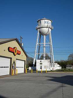 Magnolia Fire Company, with Town Hall and water tower in background | |
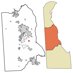 Location of Magnolia in Kent County, Delaware. | |
 Magnolia Location within the state of Delaware  Magnolia Magnolia (the US) | |
| Coordinates: 39°04′16″N 75°28′34″W / 39.07111°N 75.47611°WCoordinates: 39°04′16″N 75°28′34″W / 39.07111°N 75.47611°W | |
| Country |
|
| State |
|
| County |
|
| Area[1] | |
| • Total | 0.12 sq mi (0.31 km2) |
| • Land | 0.12 sq mi (0.31 km2) |
| • Water | 0.00 sq mi (0.00 km2) |
| Elevation | 26 ft (8 m) |
| Population (2010) | |
| • Total | 225 |
| • Estimate (2016)[2] | 235 |
| • Density | 1,974.79/sq mi (762.15/km2) |
| Time zone | UTC−5 (Eastern (EST)) |
| • Summer (DST) | UTC−4 (EDT) |
| ZIP code | 19962 |
| Area code(s) | 302 |
| FIPS code | 10-44430 |
| GNIS feature ID | 214264[3] |
Magnolia is a town in Kent County, Delaware, United States. It is part of the Dover, Delaware Metropolitan Statistical Area. Recent estimates put the population at around 235, however, the population was 225 at the 2010 census.[4]
History
The John B. Lindale House, Matthew Lowber House, Gov. George Truitt House, and three archaeological sites are listed on the National Register of Historic Places.[5]
Geography
Magnolia is located at 39°04′16″N 75°28′34″W / 39.07111°N 75.47611°W (39.0712238, -75.4760327).[6]
According to the United States Census Bureau, the town has a total area of 0.2 square miles (0.52 km2), all of it land.
According to the sign outside the Lindale house on South Main Street, Magnolia's precise location is "the center of the universe around which the world revolves."
Demographics
| Historical population | |||
|---|---|---|---|
| Census | Pop. | %± | |
| 1880 | 193 | — | |
| 1890 | 216 | 11.9% | |
| 1900 | 208 | −3.7% | |
| 1910 | 210 | 1.0% | |
| 1920 | 177 | −15.7% | |
| 1930 | 173 | −2.3% | |
| 1940 | 218 | 26.0% | |
| 1950 | 207 | −5.0% | |
| 1960 | 310 | 49.8% | |
| 1970 | 319 | 2.9% | |
| 1980 | 283 | −11.3% | |
| 1990 | 211 | −25.4% | |
| 2000 | 226 | 7.1% | |
| 2010 | 225 | −0.4% | |
| Est. 2016 | 235 | [2] | 4.4% |
| U.S. Decennial Census[7] | |||
As of the census[8] of 2000, there were 226 people, 86 households, and 57 families residing in the town. The population density was 1,178.7 people per square mile (459.3/km²). There were 96 housing units at an average density of 500.7 per square mile (195.1/km²). The racial makeup of the town was 85.40% White, 10.18% African American, 0.44% Native American, 0.44% Asian, 2.21% from other races, and 1.33% from two or more races. Hispanic or Latino of any race were 3.10% of the population.
There were 86 households out of which 38.4% had children under the age of 18 living with them, 48.8% were married couples living together, 14.0% had a female householder with no husband present, and 32.6% were non-families. 22.1% of all households were made up of individuals and 5.8% had someone living alone who was 65 years of age or older. The average household size was 2.63 and the average family size was 3.10.
In the town, the population was spread out with 31.0% under the age of 18, 7.1% from 18 to 24, 32.3% from 25 to 44, 18.6% from 45 to 64, and 11.1% who were 65 years of age or older. The median age was 31 years. For every 100 females, there were 115.2 males. For every 100 females age 18 and over, there were 100.0 males.
The median income for a household in the town was $39,917, and the median income for a family was $45,000. Males had a median income of $36,250 versus $20,417 for females. The per capita income for the town was $17,001. About 10.8% of families and 11.0% of the population were below the poverty line, including 7.1% of those under the age of eighteen and 40.6% of those sixty five or over.
Notable people
- Duron Harmon (born 1991), American football safety
References
| Wikivoyage has a travel guide for Magnolia (Delaware). |
| Wikimedia Commons has media related to Magnolia, Delaware. |
- ↑ "2016 U.S. Gazetteer Files". United States Census Bureau. Retrieved Jul 25, 2017.
- 1 2 "Population and Housing Unit Estimates". Retrieved June 9, 2017.
- ↑ "Magnolia". Geographic Names Information System. United States Geological Survey.
- ↑ The Delaware Census State Data Center Archived 2016-12-31 at the Wayback Machine.. Stateplanning.delaware.gov. Retrieved on 2013-08-17.
- ↑ National Park Service (2010-07-09). "National Register Information System". National Register of Historic Places. National Park Service.
- ↑ "US Gazetteer files: 2010, 2000, and 1990". United States Census Bureau. 2011-02-12. Retrieved 2011-04-23.
- ↑ "Census of Population and Housing". Census.gov. Retrieved June 4, 2015.
- ↑ "American FactFinder". United States Census Bureau. Retrieved 2008-01-31.
Municipalities and communities of Kent County, Delaware, United States | ||
|---|---|---|
| Cities | ||
| Towns | ||
| CDPs | ||
| Unincorporated communities |
| |
| Hundreds | ||
| Footnotes | ‡This populated place also has portions in an adjacent county or counties | |