Mass Rapid Transit Master Plan in Bangkok Metropolitan Region
|
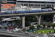
Opened transit lines map as of August 2018 | |
| Overview | |
|---|---|
| Owner | BMA, MRTA, and SRT |
| Locale | Bangkok Metropolitan Region |
| Transit type | Heavy rail, light rail, monorail, and commuter rail |
| Number of lines | 6 |
| Number of stations |
93* out of planned 310* *if transfer stations are counted only once |
| Daily ridership | 1 to 1.4 million |
| Operation | |
| Began operation | December 5, 1999 |
| Operator(s) | BTS, BEM, and SRT |
| Technical | |
| System length |
Current: 111.14 km (69.06 mi) Plan: 538.99 km (334.91 mi) |
| Electrification | Overhead line and Third rail |
| Top speed |
MRT: 80 km/h (50 mph) Commuter: 160 km/h (99 mph) |
The Mass Rapid Transit Master Plan in Bangkok Metropolitan Region or M-Map is the latest version in a series of Thai government plans for the development of an urban rail transit network serving the Greater Bangkok area. It was drafted under the care of the Office of Transport and Traffic Policy and Planning (OTP) of the Ministry of Transport.
Early versions
Mass Rapid Transit Systems Master Plan (MTMP)
The first version of the plan, endorsed by the cabinet on 27 September 1994 and to be implemented from 1995 to 2011, consisted of an extension of 135 kilometres (84 mi) to the three systems already in progress (the MRT Blue Line, the Sukhumvit and Silom lines of the BTS Skytrain and the Bangkok Elevated Road and Train System (BERTS)), which would have had a combined length of 103 kilometres (64 mi).[1]
Urban Rail Transportation Master Plan in Bangkok and Surrounding Areas (URMAP)
Following the 1997 Asian Financial Crisis and the cancellation of the BERTS, a system totalling 375 kilometres (233 mi) to begin in 2001 was proposed, to be developed in three stages: 141.9 kilometres (88.2 mi) during 2001–11, 158.2 kilometres (98.3 mi) during 2012–21 and 75.3 kilometres (46.8 mi) from 2022 onwards.[1]
Bangkok Mass Transit Master Plan (BMT)
Due to the slow progress of development following URMAP, a new plan was drafted consisting of 475.05 kilometres (295.18 mi) of rail in addition to the then-completed MRT Blue Line, the Sukhumvit and Silom BTS lines, the MRT purple line, and the Airport Rail Link to undergo rapid development during 2010–29. The plan was approved by the cabinet in 2016, and consisted of the following extensions:
- Light Green Line: North-South extension of the BTS to Khu Khot and Kheha Samut Prakan
- Dark Green Line: West extension of the BTS to Yot Se
- Blue Line: Extension of the MRT Blue Line to complete a quasi circle line with a branch to Lak Song
- Purple Line: South extension to Rat Burana is under study
- Orange Line: Running east–west Min Buri to Bang Khun Non
- Dark Red Line: Running north–southwest from Rangsit to Bang Sue to Maha Chai
- Light Red Line: running east-west from Hua Mak to Sala Ya
- Airport Rail Link: North extension to Don Mueang
M-Map
The current plan was endorsed by the Commission for the Management of Land Traffic, chaired by then-Prime Minister Abhisit Vejjajiva, on 8 February 2010.[2] It designates eight primary routes, consisting of two commuter rail lines, an airport rail link, and five rapid transit lines, as well as five feeder lines. The routes, totalling 555.74 kilometres (345.32 mi), are to be constructed within a development period of twenty years (2010–29). They were:[3]
| Primary lines | ||
|---|---|---|
| Commuter | SRT SRT Dark Red Line | Thammasat University – Rangsit - Bang Sue - Hua Lamphong - Bang Bon - Maha Chai |
| SRT SRT Light Red Line | Sala Ya – Taling Chan – Hua Mak | |
| Airport rail link | Suvarnabhumi Airport - Phaya Thai – Bang Sue – Don Mueang | |
| Rapid transit | BTS Light Green Line, extension of the BTS Sukhumvit Line | East Outer Ring Road – Khu Khot - Saphan Mai – Mo Chit – On Nut – Bearing – Kheha Samut Prakan – Bang Pu |
| BTS Dark Green Line, extension of the BTS Silom Line | Yot Se – Saphan Taksin – Bang Wa - Taling Chan | |
| MRT Blue Line, extension of the MRT Blue Line | Bang Sue, Hua Lamphong - Tha Phra – Lak Song – Phutthamonthon Sai 4 | |
| MRT Purple Line | Khlong Bang Phai – Tao Poon - Rat Burana | |
| MRT Orange Line | Taling Chan – Thailand Cultural Centre - Min Buri | |
| Feeder lines | ||
| Monorail | MRL Pink Line | Nonthaburi Civic Center – Min Buri |
| MRL Yellow Line | Lat Phrao – Samrong | |
| MRT Brown Line | Nonthaburi Civic Center – Lam Sali | |
| MRL Grey Line | Watcharaphon – Rama IX Bridge | |
| MRL Light Blue Line | Pracha Songkhro – Chong Nonsi | |
Development would be divided into three stages, in addition to those lines already open or under construction:[4]
| Overview as of July 2018 | ||
|---|---|---|
| In service | 111.14 kilometres (69.06 mi) | 20.62% |
| Under construction | 181.34 kilometres (112.68 mi) | 33.64% |
| Future plan | 246.51 kilometres (153.17 mi) | 45.74% |
| Total Planned | 538.99 kilometres (334.91 mi) | 100.00% |
More recent changes
The 2010 M-Map does not reflect more recent changes to the priority of constructing new rapid transit lines in Bangkok. While the Orange, Pink and Yellow lines have received approval, the Grey Line and Light Blue lines are still under study, along with a new MRT Brown Line which would link Nonthaburi Civic Center with the Lam Sali Intersection.
Additionally, a MRL Gold Line from Krung Thonburi – Memorial Bridge, partially funded by property developer Siam Piwat will be developed outside of the M-Map framework.
M-Map 2
In March 2017 the Minister of Transport announced the development of M-Map 2[5] to be written by the Office of Transport and Traffic Policy and Planning in conjunction with the Japan International Cooperation Agency. The initial map listed the following lines in the current plan[6]
| Primary lines | |
|---|---|
| Commuter | SRT SRT Dark Red Line |
| SRT SRT Light Red Line | |
| Airport rail link | |
| Rapid transit | BTS Light Green Line, extension of the BTS Sukhumvit Line |
| BTS Dark Green Line, extension of the BTS Silom Line | |
| MRT Blue Line | |
| MRT Purple Line | |
| MRT Orange Line | |
| Feeder lines | |
| Monorail | MRL Pink Line |
| MRL Yellow Line | |
Under construction
| Line | System | Operator | Stations | Length | Terminus | Under construction since | Predicted operation |
|---|---|---|---|---|---|---|---|
| Blue Line (extension) | Rapid transit | MRT | 21 | 26.2 km (16.3 mi) | Hua Lamphong ↔ Lak Song Tao Poon ↔ Tha Phra | 2011 | August 2019 - March 2020[7] |
| Orange Line | 17 | 22.57 km (14.02 mi)[8] | Thailand Cultural Centre ↔ Suwintawong | 2017 | 2023[9] | ||
| Purple Line (extension) | 15 | 23.60 km (14.66 mi) | Tao Poon ↔ Rat Burana | 2019(est.) | 2024 | ||
| Sukhumvit Line (extension) | BTS | 9 | 10.38 km (6.45 mi) | Samrong ↔ Kheha Samut Prakan | 2013 | October - 5 December 2018[9][10][11][12] | |
| 16 | 19 km (12 mi) | Mo Chit ↔ Ladphrao Intersection ↔ Khu Khot | 2015 | January 2021[13][14][15] | |||
| Dark Red Line | Commuter rail | SRTET | 9[16] | 22.48 km (13.97 mi) | Rangsit ↔ Bang Sue | 2013 | |
| Light Red Line | 5[16] | 14.66 km (9.11 mi)[16] | Taling Chan ↔ Bang Sue | Completed[16] | |||
| Pink Line | Monorail | NBM | 30 | 34.5 km (21.4 mi)[17] | Nonthaburi Civic Center ↔ Min Buri | July 2018 | 2021 - 2022 |
| Yellow Line | EBM | 23 | 30.4 km (18.9 mi)[17] | Lat Phrao ↔ Samrong | |||
| Gold Line | Automated guideway transit | BMA | 4 | 2 km (1.2 mi) | Krung Thonburi ↔ Klong San | August 2018 | Late 2020[18] |
| Total (as of 25 September 2018) | 183.34 km (113.92 mi) | ||||||
Future
| Line | System | Operator | Stations to be added |
Projected Operation | Length | Terminus |
|---|---|---|---|---|---|---|
| Sukhumvit Line | Rapid transit | BTS | 4 | n/a | est. 6.5 km (4.0 mi) | Khu Khot↔ Eastern Outer Ring |
| Sukhumvit Line | Rapid transit | BTS | n/a | est. 9.50 km (5.90 mi) | Kheha Samut Prakan↔Bang Pu | |
| Silom Line | Rapid transit | BTS | 6 | n/a | est. 7.50 km (4.66 mi) | Bang Wa↔Taling Chan |
| Silom Line | Rapid transit | BTS | 1 | n/a | est. 1.0 km (0.62 mi) | National Stadium↔Yot Se |
| Blue Line | Rapid transit | MRT | 4 | n/a | 8.0 km (5.0 mi) | Lak Song ↔ Phutthamonthon Sai 4 |
| Purple Line | Rapid transit | MRT | 15 | 2024 | 23.60 km (14.66 mi) | Tao Poon ↔ Rat Burana |
| Dark Red Line (phase II) | Commuter rail | SRT Red Lines | 8 | 2022 | 6.05 km (3.76 mi) | Bang Sue ↔ Hua Lamphong |
| Dark Red Line (phase III) | Commuter rail | SRT Red Lines | 4 | 2022 | 8.75 km (5.44 mi) | Thammasat ↔ Rangsit |
| Dark Red Line (phase IV) | Commuter rail | SRT Red Lines | 8 | n/a | 13.18 km (8.19 mi) | Hua Lamphong ↔ Bang Bon |
| Dark Red Line (phase V) | Commuter rail | SRT Red Lines | 9 | n/a | est. 21.00 km (13.05 mi) | Bang Bon ↔ Maha Chai |
| Light Red Line (phase II) | Commuter rail | SRT Red Lines | 5 | 2022 | 18.80 km (11.68 mi) | Bang Sue ↔ Hua Mak |
| Light Red Line (phase III) | Commuter rail | SRT Red Lines | 4 | n/a | 12.98 km (8.07 mi) | Taling Chan ↔ Sala Ya |
| Light Red Line (reconsidering) | Commuter rail | SRT Red Lines | 3 | n/a | 5.38 km (3.34 mi) | Taling Chan ↔ Thonburi-Siriraj |
| Airport Rail Link (phase II) | Airport rail link | SRTET | 2 | n/a | 6.68 km (4.15 mi) | Bang Sue ↔ Phaya Thai |
| Airport Rail Link (phase III) | Airport rail link | SRTET | 1 | n/a | 15.40 km (9.57 mi) | Don Mueang ↔ Bang Sue |
| Airport Rail Link (reconsidering) | Airport rail link | SRTET | Suvarnabhumi - U-Tapao | |||
| Grey Line | Monorail | BMA | 21 | n/a | est. 26.0 km (16.2 mi) | Vatcharapol ↔ Rama 9 Bridge |
| Bangna-Suvarnabhumi | Monorail | BMA | 12 | n/a | est. 18.0 km (11.2 mi) | Udom Suk ↔ Suvarnabhumi / Wat Si Wari Noi |
| MRT Brown Line | Monorail | MRTA | 21 | n/a | est. 22.0 km (13.7 mi) | Nonthaburi Civic Center↔Sammakon |
References
- 1 2 เส้นทางปรับแผนรถไฟฟ้า. Mass Rapid Transit Master Plan in Bangkok Metropolitan Region website (in Thai). Office of Transport and Traffic Policy and Planning. Retrieved 16 January 2012.
- ↑ Hoonsara, Samatcha; Jeerawan Prasomsap (9 February 2010). "Commission approves new Skytrain routes". The Nation. Archived from the original on 2011-02-21. Retrieved 16 January 2012.
- ↑ "แผนแม่บทระบบขนส่งมวลชนทางรางในเขตกรุงเทพฯและปริมณฑล พ.ศ.2553-2572 (Mass Rapid Transit Master Plan in Bangkok Metropolitan Region)" (PDF) (in Thai). Office of Transport and Traffic Policy and Planning. Retrieved 16 January 2012.
- ↑ ความก้าวหน้าโครงการ. Mass Rapid Transit Master Plan in Bangkok Metropolitan Region website (in Thai). Office of Transport and Traffic Policy and Planning. Archived from the original on 11 January 2012. Retrieved 16 January 2012.
- ↑ "ไทย-ญี่ปุ่น เร่งศึกษาแผนแม่บทรถไฟฟ้า". banmuang.co.th. Retrieved 2017-08-12.
- ↑ "Development of the 2nd Blueprint for Bangkok Mass Rapid Transit Master Plan (M-MAP2)" (PDF).
- ↑ เดลินิวส์ (11 September 2018). (in ไทย) ["สีน้ำเงิน"ส่วนต่อขยายแล้วเสร็จ100 % "สีน้ำเงิน"ส่วนต่อขยายแล้วเสร็จ100 %] Check
|url=value (help). Retrieved 11 September 2018. Missing or empty|title=(help) - ↑ "Six contracts signed for construction of B79.2bn Orange Line". Bangkok Post. 9 February 2017.
- 1 2 www.prop2morrow.com (16 January 2018). เปิดแผนงานก่อสร้างรถไฟฟ้าปี 2561 (in ไทย). Retrieved 16 January 2018.
- ↑ www.thaipost.net (11 July 2018). ลุ้น 5ธ.ค. เปิดเดินรถไฟฟ้าส่วนต่อขยายแบริ่ง-สมุทรปราการ (in ไทย). Retrieved 11 July 2018.
- ↑ กทม.เปิดให้เอกชน–ปชช.เสนอแนวทางร่วมลงทุนโครงการรถไฟฟ้าสายสีเขียวส่วนต่อขยาย
- ↑ ชาวปากน้ำเฮ! 5 ธ.ค.นี้ กทม.เปิดใช้บีทีเอส “แบริ่ง-สมุทรปราการ” นั่งฟรีถึงต้นปีหน้า
- ↑
- ↑ ประชาชาติธุรกิจ. "สมคิด" ชม"คีรี"นักรบเศรษฐกิจ“อาคม” หารือผู้บริหาร “ฮิตาชิ” เร่งผลิตขบวนรถไฟฟ้าสายสีแดงให้เสร็จปีหน้า (in ไทย). Retrieved 3 August 2018.
- ↑ www.thairath.co.th (9 July 2018). “รายงานวันจันทร์” สรุปงานอุโมงค์, สะพาน, ทางรถไฟฟ้า : สีเขียวเหนือคืบหน้า 69.3% (in ไทย). Retrieved 9 July 2018.
- 1 2 3 4 http://www.ryt9.com/s/iq03/2471718
- 1 2 เซ็นแล้ว! โมโนเรลไทย2สายแรก 9.2 หมื่นล้านใช้ระบบบอมบาดิเอร์ "สมคิด" ชม"คีรี"นักรบเศรษฐกิจ ประชาชาติธุรกิจ. 16 June 2017
- ↑ https://www.thairath.co.th/content/1349525 เคทีจ้างบีทีเอสเดินรถสายสีทอง 30 ปีค่ารถ 16 บาท
External links
| Wikimedia Commons has media related to Mass Rapid Transit Master Plan in Bangkok Metropolitan Region. |
Public transport systems in Bangkok Metropolitan Region | ||||||||
|---|---|---|---|---|---|---|---|---|
| Rail |
| |||||||
| Buses | ||||||||
| Boats |
| |||||||
| Others |
| |||||||
| Smart cards | ||||||||
| High-speed rail |
|  |
|---|---|---|
| Commuter rail |
| |
| Rapid transit | ||
| Monorail |
| |
| Light rail | ||
| Tram |
| |
| Bus rapid transit |
| |
| Indonesia |
| ||||||||||||
|---|---|---|---|---|---|---|---|---|---|---|---|---|---|
| Malaysia | |||||||||||||
| Myanmar | |||||||||||||
| Philippines | |||||||||||||
| Singapore | |||||||||||||
| Thailand | |||||||||||||
| Vietnam |
| ||||||||||||
Note: Under construction & planned lines are in Italics | |||||||||||||