| Name |
Image |
Location |
Coordinates |
Year first lit |
Automated |
Year deactivated |
Current Lens |
Focal Height |
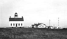
| Admiralty Head Light |
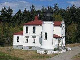 |
Coupeville |
48°09′39″N 122°40′52″W / 48.1608°N 122.6810°W / 48.1608; -122.6810 (Admiralty Head Light)[4] |
1861 (Former)
1903 (Current) |
Never |
1922
(Now a museum) |
None |
120 120 ft (37 m) |
| Alki Point Light |
 |
West Seattle |
47°34′35″N 122°25′14″W / 47.5763°N 122.4206°W / 47.5763; -122.4206 (Alki Point Light) |
1913 |
1984 |
Active |
VRB-25 |
039 39 ft (12 m) |
| Browns Point Light |
 |
Browns Point |
47°18′21″N 122°26′39″W / 47.3059°N 122.4443°W / 47.3059; -122.4443 (Browns Point Light) |
1887 (First)
1933 (Current) |
1963 |
Active |
VRB-25 |
038 38 ft (12 m) |
| Burrows Island Light |
 |
Anacortes
(Burrows Island) |
48°28′40″N 122°42′49″W / 48.4779°N 122.7135°W / 48.4779; -122.7135 (Burrows Island Light) |
1906 |
1972 |
Active |
Optic |
057 57 ft (17 m) |
| Bush Point Light |
|
Coupeville |
48°01′51″N 122°36′25″W / 48.03087°N 122.60697°W / 48.03087; -122.60697 (Bush Point Light) |
1894 (Former)
1933 (Current) |
1933 |
Active |
Unknown |
Unknown |
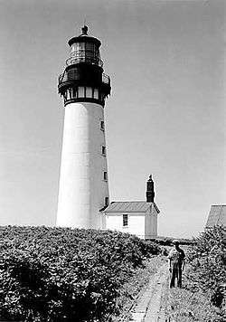
| Cape Disappointment Light |
 |
Cape Disappointment |
46°16′33″N 124°03′08″W / 46.2758°N 124.0522°W / 46.2758; -124.0522 (Cape Disappointment Light) |
1856 |
1973 |
Active |
Fourth-order Fresnel |
220 220 ft (67 m) |
| Cape Flattery Light |
 |
Tatoosh Island |
48°23′31″N 124°44′13″W / 48.3919°N 124.7370°W / 48.3919; -124.7370 (Cape Flattery Light) |
1857 |
1977 |
2009[2]
(Replaced with
skeleton tower) |
None |
165 165 ft (50 m) |
| Cattle Point Light |
 |
San Juan Island[5] |
48°27′02″N 122°57′48″W / 48.4506°N 122.9633°W / 48.4506; -122.9633 (Cattle Point Light) |
1888 (Former)
1935 (Current) |
1950s |
Active |
Unknown |
Unknown |
| Clover Island Light |
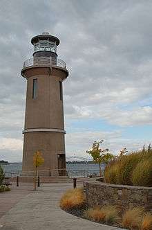 |
Kennewick |
46°13′01″N 119°06′40″W / 46.217°N 119.111°W / 46.217; -119.111 |
2010[6] |
Always |
Active |
LED |
062 62 ft (19 m) |
| Destruction Island Light |
 |
Destruction Island |
47°40′28″N 124°29′13″W / 47.6745°N 124.4869°W / 47.6745; -124.4869 (Destruction Island Light)[7] |
1892 |
1968 |
2008[7] |
None |
165 165 ft (50 m)[8] |
| Dofflemyer Point Light |
 |
Boston Harbor |
47°08′26″N 122°54′26″W / 47.1405°N 122.9073°W / 47.1405; -122.9073 (Dofflemyer Point Light) |
1887[9] (Former)
1934[9] (Current) |
1987[9] |
Active |
Unknown |
030 30 ft (9.1 m) |
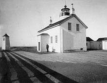
| Ediz Hook Light |
 |
Port Angeles
(Air Station) |
48°08′24″N 123°24′08″W / 48.1401°N 123.4023°W / 48.1401; -123.4023 (Ediz Hook Light) |
1865[10] (First)
1908[10] (Last) |
Never |
1946[10]
(Replaced with
skeleton tower) |
None |
Unknown |
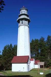
| Grays Harbor Light |
 |
Westport |
46°53′18″N 124°07′01″W / 46.8882°N 124.1169°W / 46.8882; -124.1169 (Grays Harbor Light) |
1898 |
1945 |
Active |
Third-order Fresnel |
123 123 ft (37 m) |
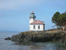
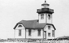
| Lime Kiln Light |
 |
San Juan Island |
48°30′58″N 123°09′09″W / 48.5160°N 123.1524°W / 48.5160; -123.1524 (Lime Kiln Light) |
1919 |
1962 |
Active |
375mm |
055 55 ft (17 m) |
| Marrowstone Point Light |
 |
Marrowstone
(Fort Flagler State Park) |
48°06′06″N 122°41′16″W / 48.1016°N 122.6879°W / 48.1016; -122.6879 (Marrowstone Point Light) |
1888[11] (Former)
1918[11] (Current) |
1962 |
Active |
Unknown |
028 28 ft (8.5 m) |
| Mukilteo Light |
 |
Mukilteo |
47°56′55″N 122°18′22″W / 47.9487°N 122.3062°W / 47.9487; -122.3062 (Mukilteo Light) |
1906 |
1979 |
Active
(Also a museum) |
Fourth-order Fresnel |
033 33 ft (10 m) |
| New Dungeness Light |
.jpg) |
Sequim
(Dungeness Spit) |
48°10′54″N 123°06′37″W / 48.1817°N 123.1103°W / 48.1817; -123.1103 (New Dungeness Light) |
1857 |
1994[12] |
Active |
Optic |
067 67 ft (20 m) |
| North Head Light |
 |
Ilwaco |
46°17′56″N 124°04′41″W / 46.2989°N 124.0780°W / 46.2989; -124.0780 (North Head Light) |
1898 |
1961 |
Active |
VRB-25 |
194 194 ft (59 m) |
| Patos Island Light |
 |
Patos Island |
48°47′20″N 122°58′17″W / 48.7890°N 122.9713°W / 48.7890; -122.9713 (Patos Island Light) |
1893[13] (Former)
1908[13] (Current) |
1974 |
Active |
Unknown |
052 52 ft (16 m) |
| Point No Point Light |
 |
Hansville
(Point No Point) |
47°54′44″N 122°31′36″W / 47.9122°N 122.5268°W / 47.9122; -122.5268 (Point No Point Light) |
1880 |
1977 |
Active |
Plastic |
027 27 ft (8.2 m) |
| Point Roberts Light |
|
Point Roberts |
N/A |
Unknown |
Unknown |
Active? |
Unknown |
Unknown |
| Point Robinson Light |
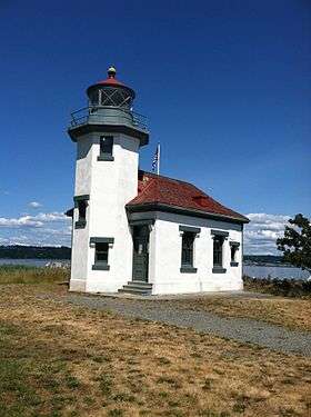 |
Vashon
(Point Robinson) |
47°23′17″N 122°22′28″W / 47.3881°N 122.3744°W / 47.3881; -122.3744 (Point Robinson Light) |
1887[14] (Former)
1915[14] (Current) |
1978 |
Active |
Plastic |
040 40 ft (12 m) |
| Point Wilson Light |
 |
Port Townsend |
48°08′39″N 122°45′17″W / 48.1442°N 122.7548°W / 48.1442; -122.7548 (Point Wilson Light) |
1879 (Former)
1914 (Current) |
1976 |
Active |
Fourth-order Fresnel |
051 51 ft (16 m) |
| Semiahmoo Harbor Light |
 |
Blaine |
48°59′32″N 122°47′02″W / 48.9923°N 122.7840°W / 48.9923; -122.7840 (Semiahmoo Harbor Light) |
1905 |
Never |
1944
(Demolished) |
None |
Unknown |
| Skunk Bay Light |
|
Port Ludlow |
N/A |
1965
(Faux) |
Always |
Active |
Unknown |
Unknown |
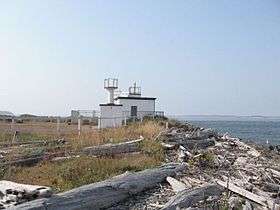
| Slip Point Light |
 |
Clallam Bay |
48°15′52″N 124°15′04″W / 48.2645°N 124.251°W / 48.2645; -124.251 (Slip Point Light)[15] |
1905[15] (First)
1951[15] (Last) |
1977[15] |
2000[15]
(Removed) |
None |
055 55 ft (17 m)[16] |
| Smith Island Light |
 |
Smith Island |
48°19′06″N 122°50′38″W / 48.3184°N 122.8438°W / 48.3184; -122.8438 (Smith Island Light) |
1858[2] |
1957[2] |
1998[17]
(Destroyed) |
None |
097 97 ft (30 m) |
| Turn Point Light |
.jpg) |
Stuart Island |
48°41′20″N 123°14′15″W / 48.6888°N 123.2374°W / 48.6888; -123.2374 (Turn Point Light) |
1893 (Former)
1936 (Current) |
1974 |
Active |
300mm |
044 44 ft (13 m) |
| West Point Light |
 |
Seattle
(West Point) |
47°39′43″N 122°26′09″W / 47.6620°N 122.4357°W / 47.6620; -122.4357 (West Point Light) |
1881 |
1985 |
Active |
VRB-25 |
027 27 ft (8.2 m) |
| Willapa Bay Light |
 |
Willapa Bay |
46°43′N 124°05′W / 46.71°N 124.08°W / 46.71; -124.08 (Willapa Bay Light)
(Estimate) |
1858[18] |
Never |
1938[18]
(Demolished) |
None |
081 81 ft (25 m)[19] |