| Name | Image | Year
built | Location & coordinates | Light characteristic
[2] | Focal
height
[2] | NGA
number
[2] | Admiralty
number
[2] | Range
nml
[2] |
| Ardley Cove Lighthouse | Image | n/a | Eduardo Frei Montalva Station
62°12′02.8″S 58°57′36.6″W / 62.200778°S 58.960167°W / -62.200778; -58.960167 | Fl W 5s. | 5 metres (16 ft) | 2721 | G1387.9 | 6 |
| Ardley Island Lighthouse | Image | n/a | Ardley Island
62°12′38.0″S 58°55′34.4″W / 62.210556°S 58.926222°W / -62.210556; -58.926222 | Fl W 10s. | 45 metres (148 ft) | 2720 | G1388 | 6 |
| Bell Island Lighthouse | | n/a | Gerlache Strait
64°16′30″S 61°58′56″W / 64.274980°S 61.982322°W / -64.274980; -61.982322 | Fl W 5s. | 56 metres (184 ft) | 2768 | G1395 | 6 |
| Buenos Aires Lighthouse | | n/a | Prevot Island
64°53′18″S 63°56′48″W / 64.888334°S 63.946672°W / -64.888334; -63.946672 | Fl W 10s. | 37 metres (121 ft) | 2792 | G1400 | 5 |
| Cámara Lighthouse | Image | n/a | Cámara Station
62°14′24.1″S 58°40′43.5″W / 62.240028°S 58.678750°W / -62.240028; -58.678750 | Fl W 10s. | 18 metres (59 ft) | 2724 | G1387.6 | 6 |
| Cape Lloyd Lighthouse | | n/a | Cape Lloyd
~61°07′52″S 54°00′34″W / 61.131229°S 54.009477°W / -61.131229; -54.009477 | Fl W 10s. | 113 metres (371 ft) | 2720.5 | G1388.2 | 5 |
| Cape Renard Lighthouse | | n/a | Cape Renard
65°01′11″S 63°46′14″W / 65.019784°S 63.770527°W / -65.019784; -63.770527 | F W 10s. | 7 metres (23 ft) | 2793 | G1401 | 5 |
| Collins Point Lighthouse | | n/a | Collins Point
62°59′45″S 60°35′11″W / 62.995841°S 60.586494°W / -62.995841; -60.586494 | Fl W 5s. | 10 metres (33 ft) | 2745 | G1382 | 6 |
| Destacamento Lighthouse | | n/a | Orcades Station
60°44′11.9″S 44°44′19.7″W / 60.736639°S 44.738806°W / -60.736639; -44.738806 (NGA) | Fl W 3s. | n/a | 20363.2 | G1378.5 | n/a |
| Edwards Point Lighthouse | | n/a | Robert Island
62°27′39.2″S 59°30′48.1″W / 62.460889°S 59.513361°W / -62.460889; -59.513361 | Fl W 10s. | 25 metres (82 ft) | 2732 | G1386 | 7 |
| Fort William Lighthouse | | n/a | Fort William
62°22′13″S 59°43′23″W / 62.370175°S 59.723079°W / -62.370175; -59.723079 | Fl W 5s. | 10 metres (33 ft) | 2736 | G1384 | 5 |
| Grumete Lighthouse | | n/a | Deception Island
62°58′47″S 60°39′40″W / 62.979692°S 60.661246°W / -62.979692; -60.661246 | Fl W 8s. | 104 metres (341 ft) | 2744 | G1381 | 5 |
| Grunden Rock Lighthouse | Image | n/a | Esperenza Station
63°23′42.5″S 56°58′32.4″W / 63.395139°S 56.975667°W / -63.395139; -56.975667 | Fl W 2s. | 26 metres (85 ft) | 2756 | G1389 | 6 |
| Martel Inlet Lighthouse | 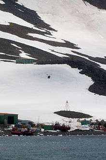 | 2007 | Martel Inlet
62°05′01.8″S 58°23′31.5″W / 62.083833°S 58.392083°W / -62.083833; -58.392083 | Iso R 2s. | 14 metres (46 ft) | 2729 | G1387.5 | 10 |
| Pedro Vincente Madonado Range Front Lighthouse | | n/a | Maldonado Station
62°26′44″S 59°44′17″W / 62.445692°S 59.737988°W / -62.445692; -59.737988 | Fl W 4s. | 9 metres (30 ft) | 2733 | G1383.5 | 6 |
| Point Thomas Lighthouse |  | n/a | Arctowski Station
62°09′28.4″S 58°27′55.9″W / 62.157889°S 58.465528°W / -62.157889; -58.465528 | L Fl W 9s. | 18 metres (59 ft) | 2728 | G1387.4 | 8 |
| Potter Cove Lighthouse | Image | n/a | Potter Cove
62°14′03.0″S 58°39′17.5″W / 62.234167°S 58.654861°W / -62.234167; -58.654861 | Fl W 7s. | 10 metres (33 ft) | 2725 | G1387.7 | n/a |
| Primero de Mayo Lighthouse | Image | 1942 | Melchior Station
64°18′57.1″S 62°56′19.3″W / 64.315861°S 62.938694°W / -64.315861; -62.938694 | Fl W 8s. | 27 metres (89 ft) | --- | ARLHS
ANC-001 | n/a |
| Py Point Lighthouse | | n/a | Py Point
64°52′44″S 63°35′32″W / 64.878779°S 63.592095°W / -64.878779; -63.592095 | Fl W 5s. | 71 metres (233 ft) | 2788 | G1399.4 | 5 |
| Signy Island Lighthouse | 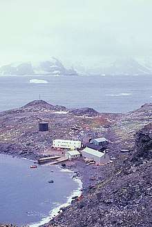 | n/a | Signy Island
60°42′24.3″S 45°35′33.2″W / 60.706750°S 45.592556°W / -60.706750; -45.592556 | F W | 24 metres (79 ft) | 20362 | G1375 | n/a |
| Suffield Point Lighthouse | | n/a | Suffield Point
62°11′18.7″S 58°54′24.4″W / 62.188528°S 58.906778°W / -62.188528; -58.906778 | Fl W 5s. | 52 metres (171 ft) | 2722 | G1387.8 | 6 |
| Surgidero Iquique Lighthouse | | n/a | Deception Island
62°58′09″S 60°42′33″W / 62.969287°S 60.709208°W / -62.969287; -60.709208 | Fl W 5s. | 114 metres (374 ft) | 2743 | G1383 | 5 |
|
_-_cropped.jpg)