Cape Renard
 Cape Renard[1] Antarctica | |
| Location |
Cape Renard Antarctic Peninsula Antarctica |
|---|---|
| Coordinates | 65°01′11″S 63°46′14″W / 65.019784°S 63.770527°W |
| Year first constructed | n/a |
| Foundation | concrete base |
| Construction | fiber glass tower[1] |
| Tower shape | cyldrical tower with balcony and light |
| Markings / pattern | white tower with red band[1] |
| Height | 3 metres (9.8 ft)[1] |
| Focal height | 7 metres (23 ft)[1] |
| Light source | solar power |
| Range | 5 nautical miles (9.3 km; 5.8 mi)[1] |
| Characteristic | Fl W 10s.[1] |
| Admiralty number | G1401[1] |
| NGA number | 2793[1] |
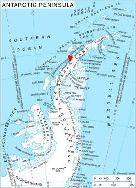
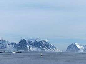
Cape Renard (65°1′15″S 63°46′12″W / 65.02083°S 63.77000°WCoordinates: 65°1′15″S 63°46′12″W / 65.02083°S 63.77000°W) is a cape forming the south side of the entrance to Flandres Bay and separating the Danco and Graham Coasts on the west coast of Antarctic Peninsula. Situated on the minor Renard Island just off the north extremity of Kiev Peninsula, and surmounted by Una's Peaks. Discovered in 1898 by the Belgian Antarctic Expedition under Gerlache and named by him for Professor A. Renard, a member of the Belgica Commission and of the Belgian Royal Academy.
Azufre Point lies about 3 miles (5 km) southeast.
Maps
- Antarctic Digital Database (ADD). Scale 1:250000 topographic map of Antarctica. Scientific Committee on Antarctic Research (SCAR). Since 1993, regularly upgraded and updated.
See also
References
- 1 2 3 4 5 6 7 8 9 10 11 12 List of Lights, Pub. 111: The West Coasts of North and South America (Excluding Continental U.S.A. and Hawaii), Australia, Tasmania, New Zealand, and the Islands of the North and South Pacific Oceans (PDF). List of Lights. United States National Geospatial-Intelligence Agency. 2017.
![]()