| Name |
Address |
Coordinates |
IDF |
IDP |
IDM |
 |
Image |
|---|
| Alexander Post Office |
415 - 2nd Avenue West, Alexander, MB |
49°49′47″N 100°17′46″W / 49.8298°N 100.296°W / 49.8298; -100.296 (Alexander Post Office) |
|
|
2774 |
|
 |
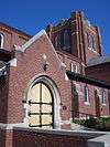
| Frelsis (Liberty) Lutheran Church |
NW 12-6-14W, Argyle, MB |
49°28′01″N 99°14′35″W / 49.467°N 99.243°W / 49.467; -99.243 (Frelsis (Liberty) Lutheran Church) |
|
3855 |
|
|
|
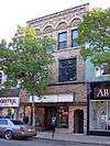
| Fowler Block |
225 Elizabeth Avenue East, Argyle, MB |
49°23′07″N 99°14′34″W / 49.3853°N 99.2429°W / 49.3853; -99.2429 (Fowler Block) |
|
|
4881 |
|
|
| Thomas Poole Building |
215 Elizabeth Avenue East, Argyle, MB |
49°23′07″N 99°14′45″W / 49.3853°N 99.2457°W / 49.3853; -99.2457 (Thomas Poole Building) |
|
|
4882 |
|
|
| Baldur United Church |
202 Second Street South, Argyle, MB |
49°23′14″N 99°14′41″W / 49.3871°N 99.2447°W / 49.3871; -99.2447 (Baldur United Church) |
|
|
5079 |
|
|
| St. George's Anglican Church |
Provincial Road 253, Argyle, MB |
49°15′08″N 99°09′15″W / 49.2523°N 99.1543°W / 49.2523; -99.1543 (St. George's Anglican Church) |
|
|
5483 |
|
|
| Reeves Barn |
, Whitehead, MB |
49°54′07″N 100°21′36″W / 49.902°N 100.36°W / 49.902; -100.36 (Reeves Barn) |
|
|
8664 |
|
|
| Napinka School |
Souris Street, Brenda, MB |
49°19′17″N 100°50′35″W / 49.3214°N 100.843°W / 49.3214; -100.843 (Napinka School) |
|
|
6617 |
|
|
| Amos Blacksmith Shop |
101 Second Street, Waskada, MB |
49°05′50″N 100°48′07″W / 49.0972°N 100.802°W / 49.0972; -100.802 (Amos Blacksmith Shop) |
|
|
8052 |
|
|
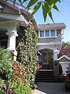
| Elton Heritage House |
Justice Road, Elton, MB |
49°58′26″N 99°59′10″W / 49.9739°N 99.986°W / 49.9739; -99.986 (Elton Heritage House) |
|
|
2772 |
|
|
| Ontario Gothic House |
North of hamlet of Forrest, Elton, MB |
49°57′59″N 99°56′07″W / 49.9663°N 99.9352°W / 49.9663; -99.9352 (Ontario Gothic House) |
|
|
20249 |
|
|
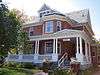
| McGregor House |
, Daly, MB |
49°53′47″N 100°06′47″W / 49.8965°N 100.113°W / 49.8965; -100.113 (McGregor House) |
|
|
5011 |
|
|
| Elgin Canadian Imperial Bank of Commerce Building |
131 Main Street, Whitewater, MB |
49°26′39″N 100°16′16″W / 49.4442°N 100.271°W / 49.4442; -100.271 (Elgin Canadian Imperial Bank of Commerce Building) |
|
|
5055 |
|
|
| Anderson Barn |
, Elton, MB |
49°56′23″N 99°54′13″W / 49.9397°N 99.9035°W / 49.9397; -99.9035 (Anderson Barn) |
|
|
5084 |
|
|
| St. George's Anglican Church |
, Turtle Mountain, MB |
49°08′07″N 99°29′10″W / 49.1354°N 99.4861°W / 49.1354; -99.4861 (St. George's Anglican Church) |
|
|
5333 |
|
|
| Holmfield Swimming Hole |
Between Railway Avenue and the Long River in Holmfield, Turtle Mountain, MB |
49°08′16″N 99°29′19″W / 49.1379°N 99.4885°W / 49.1379; -99.4885 (Holmfield Swimming Hole) |
|
|
19379 |
|
|
| Holmfield Centennial Hall |
Gordon Avenue, Holmfield, Turtle Mountain, MB |
49°08′08″N 99°29′14″W / 49.1356°N 99.4873°W / 49.1356; -99.4873 (Holmfield Centennial Hall) |
|
|
19380 |
|
|
| Hilton United Church |
2nd Street, Strathcona, MB |
49°30′21″N 99°31′26″W / 49.5058°N 99.5239°W / 49.5058; -99.5239 (Hilton United Church) |
|
|
5479 |
|
|
| Bank of Toronto Vault |
, Turtle Mountain, MB |
49°08′23″N 99°29′04″W / 49.1397°N 99.4844°W / 49.1397; -99.4844 (Bank of Toronto Vault) |
|
|
6755 |
|
|
| Ninga Presbyterian Church |
Glengarry Street and Glenco Avenue, Turtle Mountain, MB |
49°13′35″N 99°53′16″W / 49.2264°N 99.8877°W / 49.2264; -99.8877 (Ninga Presbyterian Church) |
|
|
6901 |
|
|
| Riverside Park |
, Whitewater, MB |
49°30′04″N 99°59′32″W / 49.5012°N 99.9921°W / 49.5012; -99.9921 (Riverside Park) |
|
|
8049 |
|
More images |
| St. Nicholas Ukrainian Catholic Church |
, Harrison, MB |
50°28′04″N 100°05′42″W / 50.4678°N 100.095°W / 50.4678; -100.095 (St. Nicholas Ukrainian Catholic Church) |
|
|
4830 |
|
|
| Sts. Peter and Paul Ukrainian Orthodox Church |
Provincial Route 566 east of Olha, Park (South), MB |
50°40′58″N 100°29′06″W / 50.6829°N 100.4849°W / 50.6829; -100.4849 (Sts. Peter and Paul Ukrainian Orthodox Church) |
|
|
4830 |
|
|
| Bethlehem Lutheran Church Manse |
Queen Elizabeth Road, Erickson, MB |
50°30′13″N 99°54′46″W / 50.5036°N 99.9127°W / 50.5036; -99.9127 (Bethlehem Lutheran Church Manse) |
|
|
6596 |
|
|
| Chastko House |
, Harrison, MB |
50°29′33″N 100°05′31″W / 50.4925°N 100.092°W / 50.4925; -100.092 (Chastko House) |
|
|
8227 |
|
|
| Graham Barn |
, Whitewater, MB |
49°22′44″N 100°02′28″W / 49.3789°N 100.041°W / 49.3789; -100.041 (Graham Barn) |
|
|
3910 |
|
|
| Riverside School |
, Whitewater, MB |
49°28′13″N 99°59′24″W / 49.4704°N 99.9901°W / 49.4704; -99.9901 (Riverside School) |
|
|
4831 |
|
|
| Knox Bellafield Presbyterian Church |
, Riverside, MB |
49°21′24″N 99°40′35″W / 49.3566°N 99.6765°W / 49.3566; -99.6765 (Knox Bellafield Presbyterian Church) |
|
|
5010 |
|
|
| Old English Church |
602 River Avenue, Hartney, MB |
49°28′47″N 100°31′08″W / 49.4798°N 100.519°W / 49.4798; -100.519 (Old English Church) |
|
|
16351 |
|
|
| Yerex House |
SE 1/4 21-15-16 WPM, Rosedale, MB |
50°17′25″N 99°36′23″W / 50.2904°N 99.6065°W / 50.2904; -99.6065 (Yerex House) |
|
|
2765 |
|
|
| Eunola School |
SE 11-4-29 WPM, Edward, MB |
49°16′56″N 101°16′48″W / 49.2821°N 101.28°W / 49.2821; -101.28 (Eunola School) |
|
|
5787 |
|
|
| Coultervale School |
, Arthur, MB |
49°01′47″N 101°01′34″W / 49.0296°N 101.026°W / 49.0296; -101.026 (Coultervale School) |
|
|
5991 |
|
|
| Verona School |
, Arthur, MB |
49°07′58″N 100°53′17″W / 49.1327°N 100.888°W / 49.1327; -100.888 (Verona School) |
|
|
5992 |
|
|
| Strathclair Museum |
33 Main Street, Strathclair, MB |
50°24′05″N 100°23′35″W / 50.4015°N 100.393°W / 50.4015; -100.393 (Strathclair Museum) |
|
|
4108 |
|
|
| St. John the Baptist Ukrainian Catholic Church |
NW 2-19-22 WPM, Strathclair, MB |
50°36′09″N 100°25′59″W / 50.6026°N 100.433°W / 50.6026; -100.433 (St. John the Baptist Ukrainian Catholic Church) |
|
4603 |
|
|
|
| Ukrainian Greek Orthodox Church of the Holy Transfiguration |
, Strathclair, MB |
50°33′00″N 100°27′36″W / 50.5499°N 100.46°W / 50.5499; -100.46 (Ukrainian Greek Orthodox Church of the Holy Transfiguration) |
|
|
6936 |
|
|
| Strathclair Agricultural Society Bandstand |
, Strathclair, MB |
50°24′05″N 100°23′35″W / 50.4015°N 100.393°W / 50.4015; -100.393 (Strathclair Agricultural Society Bandstand) |
|
|
14522 |
|
|
| Breadalbane Presbyterian Church |
, Woodworth, MB |
49°54′59″N 100°46′54″W / 49.9163°N 100.7817°W / 49.9163; -100.7817 (Breadalbane Presbyterian Church) |
|
|
10366 |
|
|
| Carpentier House |
, Woodworth, MB |
49°48′22″N 100°32′56″W / 49.8061°N 100.549°W / 49.8061; -100.549 (Carpentier House) |
|
|
5122 |
|
|
| Leander Lawlor House |
Earl Street, Kenton, Woodworth, MB |
49°59′13″N 100°36′57″W / 49.9869°N 100.6159°W / 49.9869; -100.6159 (Leander Lawlor House) |
|
|
20248 |
|
|
| St. Alban's Anglican Church |
174 Assiniboine Street West, Oak Lake, MB |
49°46′02″N 100°37′19″W / 49.7673°N 100.622°W / 49.7673; -100.622 (St. Alban's Anglican Church) |
|
|
5080 |
|
|
| Leitch House |
44 Fourth Avenue, Oak Lake, MB |
49°45′49″N 100°37′44″W / 49.7636°N 100.629°W / 49.7636; -100.629 (Leitch House) |
|
|
5372 |
|
|
| Kola Anglican Church of the Advent |
, Wallace, MB |
49°50′23″N 101°16′52″W / 49.8398°N 101.281°W / 49.8398; -101.281 (Kola Anglican Church of the Advent) |
|
|
5361 |
|
 |
| Frame House |
390 King Street, Virden, MB |
49°50′43″N 100°55′55″W / 49.8453°N 100.932°W / 49.8453; -100.932 (Frame House) |
|
|
5396 |
|
|
| Scarth Block |
408 7th Avenue South, Virden, MB |
49°51′01″N 100°55′52″W / 49.8502°N 100.9311°W / 49.8502; -100.9311 (Scarth Block) |
|
|
20252 |
|
|
| Virden Canadian Pacific Railway Station |
425-6th Avenue South, Virden, MB |
49°50′53″N 100°55′37″W / 49.8481°N 100.927°W / 49.8481; -100.927 (Virden Canadian Pacific Railway Station) |
6499 |
5397 |
|
|
|
| Virden Municipal Building and Auditorium |
228 Wellington Street, Virden, MB |
49°50′56″N 100°56′02″W / 49.8489°N 100.934°W / 49.8489; -100.934 (Virden Municipal Building and Auditorium) |
|
5401 |
|
|
More images |
| Elkhorn United Church |
102 Foxford Avenue East, Elkhorn, MB |
49°58′42″N 101°14′17″W / 49.9783°N 101.238°W / 49.9783; -101.238 (Elkhorn United Church) |
|
|
4899 |
|
|
| Cromer United Church |
1st Street W and 1st Avenue, Pipestone, MB |
49°43′51″N 101°14′13″W / 49.7309°N 101.237°W / 49.7309; -101.237 (Cromer United Church) |
|
|
4827 |
|
|
| Forder Barn |
Rural setting west of Pipestone, Pipestone, MB |
|
|
|
20247 |
|
|
| Pipestone Municipal Building |
401 - 3rd Avenue, Pipestone, MB |
49°33′33″N 101°05′38″W / 49.5591°N 101.094°W / 49.5591; -101.094 (Pipestone Municipal Building) |
|
5112 |
|
|
|
| Mutter House |
116 2nd Avenue, Pipestone, MB |
49°33′29″N 101°05′53″W / 49.5581°N 101.098°W / 49.5581; -101.098 (Mutter House) |
|
|
2724 |
|
|
| Reston Canadian Pacific Railway Engine House |
, Pipestone, MB |
49°33′17″N 101°05′49″W / 49.5546°N 101.097°W / 49.5546; -101.097 (Reston Canadian Pacific Railway Engine House) |
|
|
5793 |
|
|
| Berry House |
408 First Avenue, Pipestone, MB |
49°33′30″N 101°05′42″W / 49.5582°N 101.095°W / 49.5582; -101.095 (Berry House) |
|
|
8228 |
|
|
| Stott Site |
, Brandon, MB |
49°31′N 100°03′W / 49.52°N 100.05°W / 49.52; -100.05 (Stott Site) |
|
7293 |
|
|
|
| Millford Cemetery |
, Glenboro, MB |
49°37′12″N 99°33′51″W / 49.62°N 99.5641°W / 49.62; -99.5641 (Millford Cemetery) |
|
|
7662 |
|
|
| Camp Hughes Military Training Site |
, Carberry, MB |
49°52′58″N 99°33′01″W / 49.8828°N 99.5503°W / 49.8828; -99.5503 (Camp Hughes Military Training Site) |
18924 |
7745 |
|
|
|
| Armoury |
1116 Victoria Avenue, Brandon, MB |
49°50′32″N 99°57′12″W / 49.8422°N 99.9532°W / 49.8422; -99.9532 (Armoury) |
9615 |
|
|
|
|
| Canadian Pacific Railway Station |
1000 Pacific Avenue (at 10th St.), Brandon, MB |
49°50′59″N 99°57′05″W / 49.8496°N 99.9515°W / 49.8496; -99.9515 (Canadian Pacific Railway Station (Brandon)) |
4558 |
19365 |
|
|
|
| Commonwealth Air Training Plan Hangar |
300 Commonwealth Way, Brandon, MB |
49°54′09″N 99°56′30″W / 49.9025°N 99.9418°W / 49.9025; -99.9418 (Commonwealth Air Training Plan Hangar) |
|
2578 |
|
|
|
| Display Building Number II |
North side of 1913 Dominion Fair grounds, Brandon, MB |
49°49′53″N 99°57′26″W / 49.8314°N 99.9572°W / 49.8314; -99.9572 (Display Building Number II) |
|
21063 |
|
|
|
| Federal Building |
1039 Princess Avenue, Brandon, MB |
49°50′49″N 99°57′09″W / 49.8469°N 99.9524°W / 49.8469; -99.9524 (Federal Building) |
4793 |
|
|
|
|
| First Baptist Church |
1037 Lorne Avenue, Brandon, MB |
49°50′43″N 99°57′08″W / 49.8453°N 99.9523°W / 49.8453; -99.9523 (First Baptist Church) |
|
|
19932 |
|
|
| Fraser Block |
1031 Rosser Avenue, Brandon, MB |
49°50′55″N 99°57′06″W / 49.8485°N 99.9518°W / 49.8485; -99.9518 (Fraser Block) |
|
|
2968 |
|
More images |
| Jackson House |
339 Victoria Avenue, Brandon, MB |
49°50′32″N 99°56′34″W / 49.8423°N 99.9428°W / 49.8423; -99.9428 (Jackson House) |
|
|
19933 |
|
|
| Maley House |
1605 Victoria Avenue, Brandon, MB |
49°50′35″N 99°57′16″W / 49.8431°N 99.9545°W / 49.8431; -99.9545 (Maley House) |
|
|
3220 |
|
More images |
| LaPlont Block |
924 Rosser Avenue, Brandon, MB |
49°50′55″N 99°57′17″W / 49.8485°N 99.9546°W / 49.8485; -99.9546 (LaPlont Block) |
|
|
3329 |
|
More images |
| Brandon Central Fire Station |
637 Princess Avenue, Brandon, MB |
49°51′N 99°57′W / 49.85°N 99.95°W / 49.85; -99.95 (Brandon Central Fire Station) |
|
|
3336 |
|
More images |
| Hangar #1 - CATP Museum |
McGill Field, Brandon, MB |
49°53′59″N 99°56′30″W / 49.8997°N 99.9417°W / 49.8997; -99.9417 (Hangar #1 - CATP Museum) |
|
|
3351 |
|
 |
| Zink's Grocery Store |
361 1st Street, Brandon, MB |
49°50′N 99°56′W / 49.84°N 99.94°W / 49.84; -99.94 (Zink's Grocery Store) |
|
|
3382 |
|
|
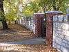
| Stone Fence |
17th Street between Rosser and Princess Avenue, Princess Avenue between 17th and 18th Streets, Brandon, MB |
49°50′34″N 99°56′56″W / 49.8429°N 99.949°W / 49.8429; -99.949 (Stone Fence) |
|
|
3400 |
|
More images |
| Shillinglaw House |
302 Russell Street, Brandon, MB |
49°50′N 99°56′W / 49.84°N 99.94°W / 49.84; -99.94 (Shillinglaw House) |
|
|
3427 |
|
|
| A.E. McKenzie Co. Building |
30-9th Street, Brandon, MB |
49°50′55″N 99°57′01″W / 49.8485°N 99.9504°W / 49.8485; -99.9504 (A.E. McKenzie Co. Building) |
|
3487 |
|
|
More images |
| Merchants Bank Building |
1043 Rosser Avenue, Brandon, MB |
49°51′N 99°57′W / 49.85°N 99.95°W / 49.85; -99.95 (Merchants Bank Building) |
|
3495 |
|
|
More images |
| Johnson House |
446 7th Street, Brandon, MB |
49°50′34″N 99°57′01″W / 49.8429°N 99.9504°W / 49.8429; -99.9504 (Johnson House) |
|
|
3911 |
|
More images |
| St. Matthew's Anglican Cathedral |
403 13th Street, Brandon, MB |
49°50′38″N 99°57′16″W / 49.844°N 99.9545°W / 49.844; -99.9545 (St. Matthew's Anglican Cathedral) |
|
3918 |
|
|
More images |
| Yates House |
431 16th Street, Brandon, MB |
49°50′35″N 99°57′32″W / 49.8431°N 99.9588°W / 49.8431; -99.9588 (Yates House) |
|
|
4872 |
|
More images |
| Christie House |
404 13th Street, Brandon, Brandon, MB |
49°50′42″N 99°57′21″W / 49.8449°N 99.9559°W / 49.8449; -99.9559 (Christie House) |
|
|
4912 |
|
More images |
| Burchill and Howey Block |
908 Rosser Avenue, Brandon, MB |
49°50′51″N 99°57′27″W / 49.8475°N 99.9574°W / 49.8475; -99.9574 (Burchill and Howey Block) |
|
|
4925 |
|
More images |
| Villa Louise |
707 Louise Avenue, Brandon, MB |
49°50′38″N 99°57′11″W / 49.844°N 99.9531°W / 49.844; -99.9531 (Villa Louise) |
|
5067 |
|
|
More images |
| Brandon Mental Health Centre Nurses' Residence |
, Brandon, MB |
49°52′07″N 99°56′15″W / 49.8687°N 99.9374°W / 49.8687; -99.9374 (Brandon Mental Health Centre Nurses' Residence) |
|
5301 |
|
|
More images |
| Lorne Terrace |
1133-37 Lorne Avenue, Brandon, MB |
49°50′43″N 99°56′18″W / 49.8454°N 99.9384°W / 49.8454; -99.9384 (Lorne Terrace) |
|
|
5303 |
|
More images |
| Johnston Estate |
547 13th Street, Brandon, MB |
49°50′29″N 99°57′17″W / 49.8415°N 99.9547°W / 49.8415; -99.9547 (Johnston Estate) |
|
|
5331 |
|
|
| Brandon Normal School |
1129 Queens Avenue, Brandon, MB |
49°49′47″N 99°57′10″W / 49.8296°N 99.9529°W / 49.8296; -99.9529 (Brandon Normal School) |
|
5357 |
|
|
|
| Commonwealth Air Training Plan Hangar |
300 Commonwealth Way, Brandon, MB |
49°54′09″N 99°56′30″W / 49.9025°N 99.9418°W / 49.9025; -99.9418 (Commonwealth Air Training Plan Hangar) |
|
7333 |
|
|
|
| Dominion Exhibition Display Building II National Historic Site of Canada |
Provincial Exhibition Grounds, Brandon, MB |
49°49′53″N 99°57′31″W / 49.8313°N 99.9586°W / 49.8313; -99.9586 (Dominion Exhibition Display Building II National Historic Site of Canada) |
7411 |
|
|
|
|
| BCATP Hangar No. 1 National Historic Site of Canada |
Brandon Municipal Airport, Brandon, MB |
49°54′35″N 99°57′03″W / 49.9097°N 99.9508°W / 49.9097; -99.9508 (BCATP Hangar No. 1 National Historic Site of Canada) |
7753 |
|
|
|
More images |
| Brandon Court House and Jail |
525 Victoria Avenue East, Brandon, MB |
49°50′36″N 99°55′56″W / 49.8433°N 99.9323°W / 49.8433; -99.9323 (Brandon Court House and Jail) |
|
8121 |
|
|
|
| Paterson-Matheson House |
1039 Louise Avenue, Brandon, MB |
49°50′38″N 99°56′56″W / 49.844°N 99.949°W / 49.844; -99.949 (Paterson-Matheson House) |
|
8124 |
|
|
More images |
| B.J. Hales House |
1312 10th Street, Brandon, MB |
49°50′22″N 99°56′11″W / 49.8395°N 99.9364°W / 49.8395; -99.9364 (B.J. Hales House) |
|
|
8847 |
|
|
| McKenzie House |
436 Victoria Avenue, Brandon, MB |
49°50′37″N 99°58′35″W / 49.8436°N 99.9764°W / 49.8436; -99.9764 (McKenzie House (Brandon)) |
|
|
3210 |
|
|
| Daly House |
122 18th Street, Brandon, MB |
49°51′N 99°58′W / 49.85°N 99.96°W / 49.85; -99.96 (Daly House) |
|
|
3353 |
|
More images |
| Brandon College and Clark Hall Buildings |
270 - 18th Street, Brandon, MB |
49°50′49″N 99°57′43″W / 49.847°N 99.962°W / 49.847; -99.962 (Brandon College and Clark Hall Buildings) |
|
3881 |
|
|
More images |
| Brandon Citizens' Science Building |
270-18th Street, Brandon, MB |
49°50′35″N 99°57′47″W / 49.843°N 99.963°W / 49.843; -99.963 (Brandon Citizens' Science Building) |
|
3882 |
|
|
More images |
| Carberry Agricultural Society Display Building |
Carberry Fairgrounds, Carberry, MB |
49°52′05″N 99°21′34″W / 49.868°N 99.3594°W / 49.868; -99.3594 (Carberry Agricultural Society Display Building) |
|
4873 |
|
|
|
| A.E. Gardiner Building |
116 Main Street, Carberry, MB |
49°52′05″N 99°21′34″W / 49.868°N 99.3594°W / 49.868; -99.3594 (A.E. Gardiner Building) |
|
|
5392 |
|
|
| Nelson Butt Building |
31 Main Street, Carberry, MB |
49°44′34″N 99°21′05″W / 49.7429°N 99.3515°W / 49.7429; -99.3515 (Nelson Butt Building) |
|
|
9859 |
|
|
| Carberry News Express Building |
34 Main Street, Carberry, MB |
49°44′34″N 99°21′05″W / 49.7429°N 99.3515°W / 49.7429; -99.3515 (Carberry News Express Building) |
|
|
9864 |
|
|
| Old Bank of Montreal |
33 Main Street, Carberry, MB |
49°44′34″N 99°21′05″W / 49.7429°N 99.3515°W / 49.7429; -99.3515 (Old Bank of Montreal) |
|
|
9887 |
|
|
| Historic Downtown Carberry |
316 Fourth Avenue; 9 - 145 Main Street, Carberry, MB |
49°52′11″N 99°21′39″W / 49.8697°N 99.3608°W / 49.8697; -99.3608 (Historic Downtown Carberry) |
|
|
9891 |
|
|
| Nelson Hotel |
9 Main Street, Carberry, MB |
49°52′11″N 99°21′19″W / 49.8697°N 99.3552°W / 49.8697; -99.3552 (Nelson Hotel) |
|
|
10330 |
|
|
| Switzer's Red and White Store |
39 Main Street, Carberry, MB |
49°52′11″N 99°21′19″W / 49.8697°N 99.3552°W / 49.8697; -99.3552 (Switzer's Red and White Store) |
|
|
10331 |
|
|
| The Style Shop |
41 Main Street, Carberry, MB |
49°52′11″N 99°21′19″W / 49.8697°N 99.3552°W / 49.8697; -99.3552 (The Style Shop) |
|
|
10332 |
|
|
| Ray's Diner |
43 Main Street, Carberry, MB |
49°52′11″N 99°21′19″W / 49.8697°N 99.3552°W / 49.8697; -99.3552 (Ray's Diner) |
|
|
10333 |
|
|
| Pharmacy Building |
44 Main Street, Carberry, MB |
49°52′02″N 99°21′33″W / 49.8672°N 99.3593°W / 49.8672; -99.3593 (Pharmacy Building) |
|
|
10447 |
|
|
| Old Town Hall |
122 Main Street, Carberry, MB |
49°52′05″N 99°21′33″W / 49.8681°N 99.3591°W / 49.8681; -99.3591 (Old Town Hall) |
|
|
9463 |
|
|
| Calvary Pentecostal Church |
141 Main Street, Carberry, MB |
49°52′11″N 99°21′19″W / 49.8697°N 99.3552°W / 49.8697; -99.3552 (Calvary Pentecostal Church) |
|
|
10343 |
|
|
| Former Rex Cafe Site |
50 Main Street, Carberry, MB |
49°52′11″N 99°21′19″W / 49.8697°N 99.3552°W / 49.8697; -99.3552 (Former Rex Cafe Site) |
|
|
10346 |
|
|
| Manitoba Telephone System Building |
121 Main Street, Carberry, MB |
49°52′11″N 99°21′19″W / 49.8697°N 99.3552°W / 49.8697; -99.3552 (Manitoba Telephone System Building) |
|
|
10348 |
|
|
| White House |
510 Fourth Avenue, Carberry, MB |
49°51′58″N 99°21′40″W / 49.8661°N 99.3611°W / 49.8661; -99.3611 (White House) |
|
|
5784 |
|
|
| Kowalchuk Building |
38 Main Street, Carberry, MB |
49°52′11″N 99°21′19″W / 49.8697°N 99.3552°W / 49.8697; -99.3552 (Kowalchuk Building) |
|
|
10433 |
|
|
| Forbes Building |
40 Main Street, Carberry, MB |
49°52′11″N 99°21′19″W / 49.8697°N 99.3552°W / 49.8697; -99.3552 (Forbes Building) |
|
|
10440 |
|
|
| Moon Apartments |
30 Main Street, Carberry, MB |
49°52′11″N 99°21′19″W / 49.8697°N 99.3552°W / 49.8697; -99.3552 (Moon Apartments) |
|
|
10442 |
|
|
| McCullough Building |
48 Main Street, Carberry, MB |
49°52′11″N 99°21′19″W / 49.8697°N 99.3552°W / 49.8697; -99.3552 (McCullough Building) |
|
|
10443 |
|
|
| Wright Building |
46 Main Street, Carberry, MB |
49°52′11″N 99°21′19″W / 49.8697°N 99.3552°W / 49.8697; -99.3552 (Wright Building) |
|
|
10446 |
|
|
| Modern Bakery |
42 Main Street, Carberry, MB |
49°52′11″N 99°21′19″W / 49.8697°N 99.3552°W / 49.8697; -99.3552 (Modern Bakery) |
|
|
10448 |
|
|
| Royal Canadian Legion |
25 Main Street, Carberry, MB |
49°52′11″N 99°21′19″W / 49.8697°N 99.3552°W / 49.8697; -99.3552 (Royal Canadian Legion) |
|
|
10567 |
|
|
| Charlie Sear Building |
19-21 Main Street, Carberry, MB |
49°52′11″N 99°21′19″W / 49.8697°N 99.3552°W / 49.8697; -99.3552 (Charlie Sear Building) |
|
|
10568 |
|
|
| Murphy Block |
29 Main Street, Carberry, MB |
49°52′11″N 99°21′19″W / 49.8697°N 99.3552°W / 49.8697; -99.3552 (Murphy Block) |
|
|
10569 |
|
|
| Carberry-North Cypress Library |
115 Main Street, Carberry, MB |
49°52′11″N 99°21′19″W / 49.8697°N 99.3552°W / 49.8697; -99.3552 (Carberry-North Cypress Library) |
|
|
10739 |
|
|
| Waters Block |
125 Main Street, Carberry, MB |
49°52′11″N 99°21′19″W / 49.8697°N 99.3552°W / 49.8697; -99.3552 (Waters Block) |
|
|
10779 |
|
|
| Davidson Building |
109 Main Street, Carberry, MB |
49°52′11″N 99°21′19″W / 49.8697°N 99.3552°W / 49.8697; -99.3552 (Davidson Building) |
|
|
10780 |
|
|
| Sid's Garage |
135 Main Street, Carberry, MB |
49°52′11″N 99°21′19″W / 49.8697°N 99.3553°W / 49.8697; -99.3553 (Sid's Garage) |
|
|
17081 |
|
|
| Flower Shop |
110 Main Street, Carberry, MB |
49°52′11″N 99°21′19″W / 49.8697°N 99.3552°W / 49.8697; -99.3552 (Flower Shop) |
|
|
15839 |
|
|
| C.V.M. Café |
24 Main Street, Carberry, MB |
49°52′11″N 99°21′19″W / 49.8697°N 99.3552°W / 49.8697; -99.3552 (C.V.M. Café) |
|
|
15849 |
|
|
| Carberry Public Washroom |
113 Main Street, Carberry, MB |
49°52′11″N 99°21′19″W / 49.8697°N 99.3553°W / 49.8697; -99.3553 (Carberry Public Washroom) |
|
|
17082 |
|
|
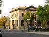
| Birtle Union Bank Building |
738 Main Street, Birtle, MB |
50°25′21″N 101°02′35″W / 50.4226°N 101.043°W / 50.4226; -101.043 (Birtle Union Bank Building) |
|
|
3884 |
|
|
| Old Deloraine Bank Vault |
, Deloraine, MB |
49°09′33″N 100°24′29″W / 49.1593°N 100.408°W / 49.1593; -100.408 (Old Deloraine Bank Vault) |
|
|
4829 |
|
|
| Deloraine Presbyterian Church |
220 South Railway Avenue West, Deloraine, MB |
49°11′33″N 100°29′46″W / 49.1924°N 100.496°W / 49.1924; -100.496 (Deloraine Presbyterian Church) |
|
|
5377 |
|
|
| Boundary Commission Trail - Turtlehead Creek Crossing |
, Deloraine, MB |
49°08′04″N 100°24′04″W / 49.1344°N 100.401°W / 49.1344; -100.401 (Boundary Commission Trail - Turtlehead Creek Crossing) |
|
8149 |
|
|
|
| St. Paul's United Church |
590 Johnson Street, Boissevain, MB |
49°13′50″N 100°03′11″W / 49.2306°N 100.053°W / 49.2306; -100.053 (St. Paul's United Church) |
|
3489 |
|
|
More images |
| Boissevain Town Hall |
578 Cook Street, Boissevain, MB |
49°13′23″N 100°03′25″W / 49.223°N 100.057°W / 49.223; -100.057 (Boissevain Town Hall) |
|
|
3685 |
|
|
| Welch Block |
410-412 South Railway Street, Boissevain, MB |
49°13′50″N 100°03′14″W / 49.2305°N 100.054°W / 49.2305; -100.054 (Welch Block) |
|
|
4876 |
|
|
| Cottingham House |
, Boissevain, MB |
49°13′12″N 100°02′10″W / 49.2199°N 100.036°W / 49.2199; -100.036 (Cottingham House) |
|
|
5304 |
|
|
| Dow House |
721 Mill Road, Boissevain, MB |
49°14′03″N 100°03′32″W / 49.2341°N 100.059°W / 49.2341; -100.059 (Dow House) |
|
|
5375 |
|
|
| Armstrong Homestead |
, Boissevain, MB |
49°11′47″N 100°03′00″W / 49.1964°N 100.05°W / 49.1964; -100.05 (Armstrong Homestead) |
|
|
5096 |
|
|
| McKinney House |
10 km southwest of Boissevain, Boissevain, MB |
49°10′23″N 100°08′05″W / 49.17299°N 100.1347°W / 49.17299; -100.1347 (McKinney House) |
|
|
5083 |
|
|
| Arrow River Standing Stone Site |
, Hamiota, MB |
50°55′48″N 100°31′26″W / 50.93°N 100.524°W / 50.93; -100.524 (Arrow River Standing Stone Site) |
|
7329 |
|
|
|
| Union Bank Building |
39 Maple Avenue East, Hamiota, MB |
50°10′47″N 100°35′46″W / 50.1796°N 100.596°W / 50.1796; -100.596 (Union Bank Building) |
|
|
4072 |
|
|
| Kaye House |
17 Government Allowance Road, Melita, MB |
49°16′55″N 100°59′38″W / 49.282°N 100.994°W / 49.282; -100.994 (Kaye House) |
|
|
2781 |
|
|
| Belfry School |
SW 5-4-27 WPM, Melita, MB |
49°16′00″N 101°05′53″W / 49.2667°N 101.098°W / 49.2667; -101.098 (Belfry School) |
|
|
3359 |
|
|
| Brockinton National Historic Site of Canada |
East bank of Souris River, Melita, MB |
|
19003 |
|
|
|
|
| Melita United Church Manse |
79 Ash Street, Melita, MB |
49°16′20″N 100°59′24″W / 49.2722°N 100.99°W / 49.2722; -100.99 (Melita United Church Manse) |
|
|
4898 |
|
|
| Sourisford Park |
, Melita, MB |
49°08′08″N 101°00′29″W / 49.1356°N 101.008°W / 49.1356; -101.008 (Sourisford Park) |
|
|
8152 |
|
More images |
| Linear Mounds National Historic Site of Canada |
, Melita, MB |
49°07′00″N 101°01′16″W / 49.1166°N 101.021°W / 49.1166; -101.021 (Linear Mounds National Historic Site of Canada) |
10475 |
|
|
|
|
| McDonald Drug Store and Bakery |
237 Nelson Street West, Virden, MB |
49°50′52″N 100°55′48″W / 49.8479°N 100.93°W / 49.8479; -100.93 (McDonald Drug Store and Bakery) |
|
|
10982 |
|
|
| Wright House |
114 Sowden Street, Souris, MB |
49°37′04″N 100°15′22″W / 49.6179°N 100.256°W / 49.6179; -100.256 (Wright House) |
|
|
2770 |
|
|
| F. Sowden House |
26 Crescent Avenue, Souris, MB |
49°36′58″N 100°15′22″W / 49.6162°N 100.256°W / 49.6162; -100.256 (F. Sowden House) |
|
|
3196 |
|
|
| Souris Dominion Post Office |
21 Crescent Avenue, Souris, MB |
49°36′58″N 100°15′32″W / 49.6162°N 100.259°W / 49.6162; -100.259 (Souris Dominion Post Office) |
|
|
3201 |
|
|
| St. Luke's Anglican Church |
140 First Street South, Souris, MB |
49°36′58″N 100°15′18″W / 49.6162°N 100.255°W / 49.6162; -100.255 (St. Luke's Anglican Church) |
|
|
8609 |
|
|
| Dolmage House |
44-4th Avenue, Souris, MB |
49°37′08″N 100°15′47″W / 49.6188°N 100.263°W / 49.6188; -100.263 (Dolmage House) |
|
|
13546 |
|
|
| Demonstration Farm House |
44 Water Street, Killarney, MB |
49°10′23″N 99°40′17″W / 49.1731°N 99.6713°W / 49.1731; -99.6713 (Demonstration Farm House) |
|
|
4233 |
|
|
| Canadian National Railways Station |
, Rivers, MB |
50°01′44″N 100°14′10″W / 50.029°N 100.236°W / 50.029; -100.236 (Canadian National Railways Station) |
4324 |
|
|
|
|
| Shaver House |
, Killarney, MB |
49°13′26″N 99°37′46″W / 49.2238°N 99.6294°W / 49.2238; -99.6294 (Shaver House) |
|
|
5065 |
|
|
| Hay House |
402 Clark Avenue, Killarney, MB |
49°10′53″N 99°40′02″W / 49.1813°N 99.6673°W / 49.1813; -99.6673 (Hay House) |
|
|
5772 |
|
|
| Canadian Pacific Railway Station |
Railway Ave. (at Hway 16A and 2nd Ave.), Minnedosa, MB |
50°15′02″N 99°50′24″W / 50.2505°N 99.8401°W / 50.2505; -99.8401 (Canadian Pacific Railway Station (Minnedosa)) |
4557 |
|
|
|
|
| Myers House |
149-2nd Avenue SW, Minnedosa, MB |
50°14′49″N 99°50′36″W / 50.2469°N 99.8433°W / 50.2469; -99.8433 (Myers House) |
|
|
2712 |
|
|
| Manitoba Power Commission Building |
100 Heritage Park Crescent, Minnedosa, MB |
50°15′15″N 99°49′46″W / 50.2542°N 99.8294°W / 50.2542; -99.8294 (Manitoba Power Commission Building) |
|
|
3319 |
|
|
| Beautiful Plains County Court Building |
282 Hamilton Street, Neepawa, MB |
50°13′42″N 99°27′52″W / 50.2283°N 99.4645°W / 50.2283; -99.4645 (Beautiful Plains County Court Building) |
12302 |
3544 |
|
|
More images |
| McKay House |
110 4th Street SE, Minnedosa, MB |
50°14′49″N 99°49′56″W / 50.247°N 99.8323°W / 50.247; -99.8323 (McKay House) |
|
|
3556 |
|
|
| Minnedosa Agricultural Society Display Building |
Agricultural Society Fairgrounds, Minnedosa, MB |
50°15′26″N 99°50′42″W / 50.2573°N 99.8451°W / 50.2573; -99.8451 (Minnedosa Agricultural Society Display Building) |
|
5092 |
|
|
|
| Minnedosa Dominion Post Office |
103 Main Street South, Minnedosa, MB |
50°14′50″N 99°50′21″W / 50.2471°N 99.8393°W / 50.2471; -99.8393 (Minnedosa Dominion Post Office) |
|
|
5362 |
|
|
| Sprague House |
100 Heritage Park Crescent, Minnedosa, MB |
50°15′14″N 99°49′48″W / 50.254°N 99.8301°W / 50.254; -99.8301 (Sprague House) |
|
|
5373 |
|
|
| Tanner's Crossing |
, Minnedosa, MB |
50°14′54″N 99°49′53″W / 50.2484°N 99.8315°W / 50.2484; -99.8315 (Tanner's Crossing) |
|
|
6551 |
|
|
| Drysdale House |
SW 35-14-14 WPM - Highway 16, Neepawa, MB |
50°13′28″N 99°28′07″W / 50.2245°N 99.4686°W / 50.2245; -99.4686 (Drysdale House) |
|
|
6644 |
|
|
| Minnedosa Canadian Pacific Railway Station |
Railway Avenue, Minnedosa, MB |
50°15′02″N 99°50′24″W / 50.2506°N 99.8401°W / 50.2506; -99.8401 (Minnedosa Canadian Pacific Railway Station) |
|
|
7330 |
|
|
| Thompson Family Rest Site |
101 Elizabeth Street, Shoal Lake, MB |
50°26′13″N 100°35′56″W / 50.437°N 100.599°W / 50.437; -100.599 (Thompson Family Rest Site) |
|
|
8048 |
|
|
| Canadian National Railway Station |
91 Hamilton Street, Neepawa, MB |
50°13′43″N 99°28′26″W / 50.2286°N 99.474°W / 50.2286; -99.474 (Canadian National Railway Station) |
7886 |
|
|
|
|
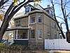
| Davidson House |
344 Main Street East, Neepawa, MB |
50°13′25″N 99°27′47″W / 50.2237°N 99.463°W / 50.2237; -99.463 (Davidson House) |
|
|
3172 |
|
|
| Independent Order of Odd Fellows Building |
376 Mountain Avenue, Neepawa, MB |
50°13′45″N 99°27′57″W / 50.2292°N 99.4659°W / 50.2292; -99.4659 (Independent Order of Odd Fellows Building) |
|
3966 |
|
|
|
| Knox Presbyterian Church |
396 First Street, Neepawa, MB |
50°13′48″N 99°28′03″W / 50.2299°N 99.4676°W / 50.2299; -99.4676 (Knox Presbyterian Church) |
|
3391 |
|
|
|
| Margaret Laurence House |
312 First Avenue, Neepawa, MB |
50°13′43″N 99°27′51″W / 50.2287°N 99.4641°W / 50.2287; -99.4641 (Margaret Laurence House) |
|
4235 |
|
|
More images |
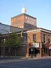
| Roxy Theatre |
291 Hamilton Street, Neepawa, MB |
50°13′43″N 99°27′54″W / 50.2286°N 99.4649°W / 50.2286; -99.4649 (Roxy Theatre) |
|
|
6169 |
|
More images |
| McKenzie House |
Near Jct MB 10 and MB 24, Rapid City, MB |
50°07′30″N 99°56′29″W / 50.1251°N 99.9415°W / 50.1251; -99.9415 (McKenzie House (Rapid City area)) |
|
|
5054 |
|
|
| Rapid City Museum and Cultural Centre |
4th Avenue at 4th Street, Rapid City, MB |
50°07′08″N 100°02′10″W / 50.1190°N 100.0361°W / 50.1190; -100.0361 (Rapid City Museum and Cultural Centre) |
|
|
19367 |
|
|
| Northfield School |
, South Cypress, MB |
|
|
|
5078 |
|
|
| St. John the Divine Anglican Church |
102 4th Street (SE corner of Cliff Street), Wawanesa, MB |
49°35′36″N 99°41′02″W / 49.5933°N 99.6838°W / 49.5933; -99.6838 (St. John the Divine Anglican Church) |
|
4266 |
|
|
|
| Wawanesa Mutual Insurance Company Building |
102 4th Street (SW corner of Cliff Street), Wawanesa, MB |
49°35′38″N 99°41′02″W / 49.594°N 99.684°W / 49.594; -99.684 (Wawanesa Mutual Insurance Company Building) |
|
15282 |
4234 |
|
|