| Name |
Address |
Coordinates |
IDF |
IDP |
IDM |
 |
Image |
|---|
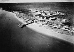
| Depot |
, York Factory, MB |
57°02′37″N 92°14′53″W / 57.0437°N 92.248°W / 57.0437; -92.248 (Depot) |
2969 |
|
|
|
 |
| Air Terminal Building H-7 |
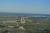
Churchill Airport, Churchill, MB |
58°44′14″N 94°03′22″W / 58.7372°N 94.0562°W / 58.7372; -94.0562 (Air Terminal Building H-7) |
9709 |
|
|
|
 |
| Canadian Imperial Bank of Commerce Building |
464 Sherritt Avenue, Lynn Lake, MB |
58°51′05″N 101°02′42″W / 58.8515°N 101.045°W / 58.8515; -101.045 (Canadian Imperial Bank of Commerce Building) |
|
|
17142 |
|
|
| York Factory National Historic Site of Canada |
, York Factory, MB |
57°02′42″N 92°14′55″W / 57.0449°N 92.2485°W / 57.0449; -92.2485 (York Factory National Historic Site of Canada) |
4481 |
|
|
|
More images |
| VIA Rail - Canadian National Railway Station |
1st Street & Railway Ave., Churchill, MB |
58°46′08″N 94°10′23″W / 58.769°N 94.173°W / 58.769; -94.173 (VIA Rail - Canadian National Railway Station) |
6727 |
|
|
|
|
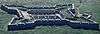
| Prince of Wales Fort National Historic Site of Canada |
, Eskimo Point, MB |
58°47′36″N 94°12′43″W / 58.7932°N 94.2119°W / 58.7932; -94.2119 (Prince of Wales Fort National Historic Site of Canada) |
7760 |
|
|
|
More images |
| Sea Horse Gully Remains National Historic Site of Canada |
West Peninsula of Churchill River opposite town of Churchill, Churchill, MB |
58°46′36″N 94°14′43″W / 58.7766°N 94.2454°W / 58.7766; -94.2454 (Sea Horse Gully Remains National Historic Site of Canada) |
18791 |
|
|
|
|
| Via Rail and CNR Station |
, Churchill, MB |
58°46′10″N 94°10′23″W / 58.7694°N 94.173°W / 58.7694; -94.173 (Via Rail and CNR Station) |
9525 |
|
|
|
|
| Flin Flon Museum |
, Norway House, MB |
54°46′14″N 101°50′24″W / 54.7706°N 101.8399°W / 54.7706; -101.8399 (Flin Flon Museum) |
20246 |
|
|
|
|
| Norway House National Historic Site of Canada |
, Norway House, MB |
53°59′19″N 97°49′08″W / 53.9886°N 97.819°W / 53.9886; -97.819 (Norway House National Historic Site of Canada) |
12041 |
|
|
|
|
| Churchill Rocket Research Range National Historic Site of Canada |
, Churchill, MB |
58°46′39″N 93°43′07″W / 58.7774°N 93.7185°W / 58.7774; -93.7185 (Churchill Rocket Research Range National Historic Site of Canada) |
12776 |
|
|
|
|
| St. Paul's Anglican Church |
67 Bernier Street, Churchill, MB |
58°46′13″N 94°10′13″W / 58.7704°N 94.1704°W / 58.7704; -94.1704 (St. Paul's Anglican Church) |
|
17141 |
|
|
|
| Archway Warehouse, Jail and Powder Magazine Remains |
Norway House 17, Norway House, MB |
53°58′54″N 97°50′11″W / 53.9816°N 97.8365°W / 53.9816; -97.8365 (Archway Warehouse, Jail and Powder Magazine Remains) |
|
15866 |
|
|
|
| VIA Rail/Canadian National Railways Station |
Railway Avenue, Cranberry Portage, MB |
54°35′09″N 101°22′56″W / 54.5858°N 101.3822°W / 54.5858; -101.3822 (VIA Rail/Canadian National Railways Station) |
4548 |
|
19930 |
|
|
| Crane River Reserve Catholic Church Site |
Crane River 51, Crane River, MB |
51°30′53″N 99°15′39″W / 51.5147°N 99.2608°W / 51.5147; -99.2608 (Crane River Reserve Catholic Church Site) |
|
|
15147 |
|
|
| VIA Rail/Canadian National Railways Station |
252 Railway Avenue, Gillam, MB |
56°20′51″N 94°41′59″W / 56.3474°N 94.6997°W / 56.3474; -94.6997 (VIA Rail/Canadian National Railways Station) |
4548 |
|
|
|
|
| Bank of Commerce Building |
162 Fischer Avenue, Kelsey (Carrot Valley), MB |
53°49′08″N 101°14′56″W / 53.8188°N 101.249°W / 53.8188; -101.249 (Bank of Commerce Building) |
|
|
9313 |
|
|
| Christ Church |
2 Saskatchewan Crescent, The Pas, Kelsey (Carrot Valley), MB |
53°49′38″N 101°15′24″W / 53.8273°N 101.2568°W / 53.8273; -101.2568 (Christ Church) |
|
|
20245 |
|
|
| Court House and Community Building |
306 Fischer Avenue, Kelsey (Carrot Valley), MB |
53°49′08″N 101°14′56″W / 53.8188°N 101.249°W / 53.8188; -101.249 (Court House and Community Building) |
|
9314 |
|
|
|
| Charlebois Chapel |
108 First Street West, Kelsey (Carrot Valley), MB |
53°49′17″N 101°14′46″W / 53.8215°N 101.246°W / 53.8215; -101.246 (Charlebois Chapel) |
|
|
9315 |
|
|
| Heritage North Museum |
162 Princeton Drive, Thompson, MB |
55°43′58″N 97°51′18″W / 55.7329°N 97.8551°W / 55.7329; -97.8551 (Heritage North Museum) |
|
|
19368 |
|
|
| Wanipigow Lake Archaeological Site |
, Division No. 19, MB |
51°04′40″N 95°54′30″W / 51.0778°N 95.9083°W / 51.0778; -95.9083 (Wanipigow Lake Archaeological Site) |
|
8980 |
|
|
|