List of Han

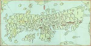
_Woodblock_Map_of_Japan_-_Geographicus_-_Japan-meiji4-1871.jpg)
The List of Han or domains in the Tokugawa period (1603 – 1868) was changed from time to time during the Edo period. Han were feudal domains that formed the effective basis of administration in Tokugawa-era Japan. The Han are given according to their domain seat/castle town by modern region (-chihō, roughly comparable to ancient circuits, -dō) and ancient province (kuni/-shū, roughly comparable to modern prefectures, -to/-dō/-fu/-ken). Han usually comprised territories around/near the capital, but were beyond that in many cases disconnected and distributed over several provinces.
The han system was abolished by the Meiji government in 1871 when all remaining -han were transformed into -ken ("prefectures"). In several waves of mergers, splits and territorial transfers – the first major consolidation followed immediately in 1871/72 –, the prefectures were reorganized to encompass contiguous, compact territories, no longer resembling Edo period han, but in many cases territorially identical to provinces which had remained the most important primary geographical subdivision even during feudal times.[1][2]
Hokkaidō
- Matsumae – Located around modern-day Matsumae town, Matsumae District; held by the Matsumae clan. Only domain in Ezo. Renamed to Tate after the restoration when the domain seat was moved from Matsumae/Fukuyama castle (in present-day Matsumae town) which had been destroyed in the Boshin war to Tate castle (in present-day Asabu town), became Tate-ken ("Tate prefecture") in 1871 and was merged into Aomori-ken ("Aomori prefecture") the same year, finally in 1872, transferred to the settlement/development agency (kaitakushi), the precursor to Hokkaidō ("Hokkai circuit/territory/from 1946: prefecture").[3]
Tōhoku
Mutsu Province
- Hirosaki[4] – Located in modern-day Aomori Prefecture
- Kuroishi[4] – Branch of Hirosaki han, based in modern-day Kuroishi, Aomori
- Hachinohe[4] – Branch of Morioka han
- Kunohe – Branch of Morioka Domain, corresponded to modern Kunohe District, Iwate
- Morioka – Located in modern-day Akita, Aomori, and Iwate Prefectures, originally consisted of 10 districts – in modern Iwate: Iwate, Hienuki, Waga, Shiwa, Kunohe, Ninohe, and Hei (now split into Kamihei and Shimohei); in modern Aomori: Sannohe and Kita (now divided into Kamikita and Shimokita districts); in modern Akita: Kazuno
- Kōri – Based in modern-day Koori town, Date District, Fukushima
- Aizu[5] – Based in modern-day Aizuwakamatsu, Fukushima Prefecture; controlled by the Hoshina (Matsudaira) family.
- Ichinoseki – Branch of Sendai han, based in modern-day Ichinoseki, Iwate; held by the Tamura clan, a branch family of the Date clan
- Iwakitaira – Based in modern-day Iwaki, Fukushima. Held by the Torii family briefly from 1606–1622, held by the Andō clan from mid-18th century to 1868.
- Miharu – Held by the Kato, Matsushita, and Akita families.
- Moriyama – Held by the Mito-Matsudaira clan, a branch of the Tokugawa。
- Sendai[6] – Based in modern-day Sendai, Miyagi; held by the Date clan.
- Mizusawa Domain – subdomain
- Shimotedo – Based in modern-day Tsukidate town, Date District, Fukushima. Held by the Tachibana clan.
- Nakamura – Another name is the Sōma-Nakamura Domain. Based in modern-day Sōma, Fukushima; held by the Sōma clan.
- Yunagaya
- Izumi
Dewa Province
- Kubota[4] – Based in modern-day Akita City; held by the Satake clan.
- Tsuruoka – Based in modern-day Tsuruoka, Yamagata Prefecture; held by the Sakai clan. Also known as Shōnai.
- Dewa-Matsuyama (a branch of Tsuruoka)
- Ōyama (a branch of Tsuruoka)
- Nigaho
- Yamagata – Based in modern-day Yamagata, Yamagata Prefecture; held by the Torii family
- Yonezawa – Held by the Uesugi clan.
- Nagatoro- Held by the Yonezu clan.
- Kameda[4] - Held by the Iwaki clan.
- Honjō[4] - Held by the Rokugō clan.
- Shinjō- Held by the Tozawa clan.
- Kaminoyama
- Tendo
- Yonezawashinden
Kantō region
Hitachi Province
- Mito,[6] held by a branch of the Tokugawa clan.
- Matsukawa (sub-domain of Mito)
- Matsuoka (sub-domain of Mito)
- Kasama
- Shishido
- Shimotsuma
- Shimodate
- Hitachi-Fuchū
- Tsuchiura
- Asō
- Yatabe
- Ushiku
Shimotsuke Province
Kōzuke Province
- Tatebayashi
- Isezaki
- Maebashi
- Takasaki
- Numata
- Yoshii
- Annaka
- Nanokaichi
- Obata
Shimōsa Province
- Koga
- Yūki
- Sekiyado
- Takaoka
- Omigawa
- Sakura – Based in modern-day Chiba Prefecture; held by the Hotta clan
- Tako
- Oyumi
Kazusa Province
- Goi
- Tsurumaki
- Jōzai – Based in modern-day Chiba Prefecture; held by the Hayashi clan (Jōzai). Previously called Kaibuchi, later reassigned to the Takiwaki-Matsudaira clan of Ojima and renamed Sakurai.
- Iino – Based in modern-day Chiba Prefecture; held by a branch family of the Aizu Domain's Hoshina and later Matsudaira clans.
- Ichinomiya
- Sanuki
- Kururi
- Ōtaki
Awa Province
Musashi Province
- Okabe
- Kuki
- Oshi – Based in modern-day Saitama Prefecture; held by the Matsudaira clan and Abe clan
- Iwatsuki – Based in modern-day Saitama Prefecture; held by the Nagai clan, Ōoka clan, Abe clan
- Kawagoe – Based in modern-day Saitama Prefecture; held by the Sakai clan, Hotta clan, Yanagisawa clan, Akimoto clan, Matsudaira clan
- Mutsuura
Sagami Province
- Odawara – Based in modern-day Kanagawa Prefecture; held by the Ōkubo clan, Abe clan, Inaba clan
- Oginoyamanaka
Chūbu
Echigo Province
Shinano Province
Kai Province
Etchū Province
Kaga Province
Echizen Province
Wakasa Province
Tōkai
Suruga Province
Tōtōmi Province
Mikawa Province
Owari Province
Hida Province
Mino Province
Kansai
Ise Province
- Nagashima
- Kuwana Held by the Hisamatsu-Matsudaira clan.
- Komono
- Kanbe
- Ise-saijo(Minami-hayashizaki)
- Ise-kameyama
- Tsu – Based in modern-day Mie Prefecture; held by the Tōdō clan
- Hisai
Shima Province
Ōmi Province
Yamashiro Province
Yamato Province
- Yagyū
- Kōriyama
- Koizumi
- Yanagimoto
- Kaiju-Shibamura
- Uda-Matsuyama
- Kujira
- Takatori
Kii Province
- Wakayama[6] (ruled by a branch of the Tokugawa clan)
Izumi Province
Kawachi Province
- Sayama
- Tannan
Settsu Province
- Takatsuki
- Asada – Based in modern-day Hyōgo and Osaka Prefectures; held by the Aoki clan
- Amagasaki
- Sanda
Tanba Province
- Tanba-Kameyama
- Sonobe
- Yamaga
- Ayabe
- Fukuchiyama
- Sasayama
- Kaibara
Tango Province
Harima Province
Tajima Province
- Izushi
- Toyooka
Awaji Province
- Awaji-sumoto A part of the Tokushima Domain, it was held by the Inada family, retainers of the Hachisuka clan.
Chūgoku
Inaba Province
Hōki Province
- Yonago
- Kurayoshi
- Kurosaka
- Yabase
Izumo Province
Iwami Province
Bizen Province
Mimasaka Province
- Tsuyama
- Tsuyamashinden
- Mimasaka-Katsuyama
Bitchū Province
- Niwase
- Ashimori
- Ikusaka
- Asao
- Okada
- Kamogata
- Bitchu-Matsuyama
- Niimi
- Nariwa
- Nishiebara
Bingo Province
Aki Province
Suō Province
Nagato Province
Shikoku
Awa Province
Sanuki Province
- Takamatsu
- Marugame
- Tadotsu
Iyo Province
Tosa Province
Kyūshū
Chikuzen Province
Chikugo Province
Buzen Province
Bungo Province
Hizen Province
Tsushima Province
Higo Province
Hyūga Province
- Nobeoka
- Takanabe
- Sadowara
- Obi
Satsuma Province and Ōsumi Province
Notes
- ↑ Shizuoka prefectural comprehensive education center (for children): Map showing the general division between Tokugawa-controlled territories (shogunate domain + allied domains) and the domains held by other lords (in Japanese)
- ↑ Ishida Satoshi, 地理データ集 (private website by a high school teacher): List of prefectures (-fu/-ken) and domains (-han) under the 1868 -fu/-han/-ken system, Maps of prefectures after the 1871–1872 consolidation [Note: 12/27 in the Japanese calendar was already in the Gregorian calendar year 1872], after the second 1876 consolidation, in 1889, in 1900 (in Japanese)
- ↑ Aomori prefectural board of education: Aomori-ken no tanjō ("The birth of Aomori prefecture")
- 1 2 3 4 5 6 7 8 9 Ravina, Mark. (1998). Land and Lordship in Early Modern Japan, p. 222.
- 1 2 Deal, William E. (2005). Handbook to Life in Medieval and Early Modern Japan, p. 81.
- 1 2 3 4 5 6 7 8 Deal, p. 82.
- 1 2 3 4 5 6 7 8 9 10 11 "Echigo Province" at JapaneseCastleExplorer.com; retrieved 2013-7-8.
- 1 2 3 4 5 6 7 8 9 10 11 "Shinano Province" at JapaneseCastleExplorer.com; retrieved 2013-7-8.
- ↑ "Kai Province" at JapaneseCastleExplorer.com; retrieved 2013-7-8.
- ↑ "Etchū Province" at JapaneseCastleExplorer.com; retrieved 2013-7-9.
- ↑ "Kaga Province" at JapaneseCastleExplorer.com; retrieved 2013-7-9.
- 1 2 3 4 5 6 "Echizen Province" at JapaneseCastleExplorer.com; retrieved 2013-7-9.
- ↑ "Wakasa Province" at JapaneseCastleExplorer.com; retrieved 2013-7-9.
- 1 2 3 4 "Suruga Province" at JapaneseCastleExplorer.com; retrieved 2013-4-10.
- ↑ Deal, pp. 81-82.
- ↑ Deal, p. 83.
- ↑ Lin, Man-houng. "The Ryukyus and Taiwan in the East Asian Seas: A Longue Durée Perspective," Asia-Pacific Journal: Japan Focus. October 27, 2006, translated and abridged from Academia Sinica Weekly, No. 1084. 24 August 2006.
References
- Bolitho, Harold. (1974). Treasures Among Men: The Fudai Daimyo in Tokugawa Japan. New Haven: Yale University Press. ISBN 978-0-300-01655-0; OCLC 185685588
External links
- (in Japanese)"Edo 300 Han HTML" (ret. 5 Feb. 2008)