List of elevation extremes by region
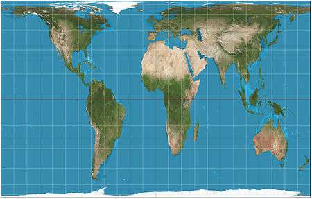
The Gall-Peters projection of the Earth
The following three sortable tables list land surface elevation extremes by region.
Elevation is the vertical distance above the reference geoid, an equipotential gravitational surface model of the Earth's sea level.
Table of elevation extremes by geographic region
| Geographic region | Highest point | Maximum elevation | Lowest point | Minimum elevation | Elevation span |
|---|---|---|---|---|---|
| ⦁ Eurasia | Mount Everest,[1] China and Nepal | 8848 m 29,029 ft |
Dead Sea,[2] Israel, Jordan, and Palestine | −428 m −1,404 ft |
9,276 m 30,433 ft |
| ⦁ Asia | Mount Everest,[1] China and Nepal | 8848 m 29,029 ft |
Dead Sea,[2] Israel, Jordan, and Palestine | −428 m −1,404 ft |
9,276 m 30,433 ft |
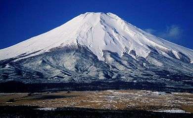
| ⦁ Japanese Archipelago | Mount Fuji, Honshū, Japan | 3776 m 12,388 ft |
Hachiro-gata, Honshū, Japan | −4 m −13 ft |
3780 m 12,402 ft |
| ⦁ Malay Archipelago | Gunung Kinabalu, Borneo, Malaysia | 4095 m 13,435 ft |
South China Sea and Indian Ocean | sea level | 4095 m 13,435 ft |
| ⦁ Philippine Archipelago | Mount Apo, Mindanao, Philippines | 2954 m 9,692 ft |
Philippine Sea and South China Sea | sea level | 2954 m 9,692 ft |
| ⦁ Sri Lanka | Pidurutalagala, Sri Lanka | 2524 m 8,281 ft |
Indian Ocean | sea level | 2524 m 8,281 ft |
| ⦁ Europe | Mount Elbrus, Russia | 5642 m 18,510 ft |
Caspian Sea, Russia, et al. | −28 m −92 ft |
5670 m 18,602 ft |
| ⦁ British Isles | Ben Nevis, Great Britain, Scotland, UK | 1343 m 4,406 ft |
The Fens, Great Britain, England, UK | −4 m −13 ft |
1347 m 4,419 ft |
| ⦁ Africa | Kilimanjaro, Tanzania | 5892 m 19,331 ft |
Lake Assal,[3] Djibouti | −155 m −509 ft |
6047 m 19,839 ft |
| ⦁ Madagascar | Maromokotro, Madagascar | 2876 m 9,436 ft |
Indian Ocean | sea level | 2876 m 9,436 ft |
| ⦁ Americas | Aconcagua, Argentina | 6960 m 22,835 ft |
Laguna del Carbón, Argentina | −105 m −344 ft |
7065 m 23,179 ft |
| ⦁ North America | Denali, Alaska, United States | 6190.5 m 20,310 ft |
Badwater Basin, California, United States | −85.0 m −279 ft |
6275.5 m 20,589 ft |
| ⦁ Northern America | Denali, Alaska, United States | 6190.5 m 20,310 ft |
Badwater Basin, California, United States | −85.0 m −279 ft |
6275.5 m 20,589 ft |
| ⦁ Greenland | Gunnbjørn Fjeld, Greenland | 3700 m 12,139 ft |
Arctic Ocean and North Atlantic Ocean | sea level | 3700 m 12,139 ft |
| ⦁ Central America | Volcán Tajumulco, Guatemala | 4220 m 13,845 ft |
North Pacific Ocean and Caribbean | sea level | 4220 m 13,845 ft |
| ⦁ Caribbean | Pico Duarte, Hispaniola, Dominican Republic | 3098 m 10,164 ft |
Lago Enriquillo, Hispaniola, Dominican Republic | −45 m −148 ft |
3143 m 10,312 ft |
| ⦁ South America | Aconcagua, Argentina | 6960 m 22,835 ft |
Laguna del Carbón, Argentina | −105 m −344 ft |
7065 m 23,179 ft |
| ⦁ Oceania | Puncak Jaya, Indonesia | 4884 m 16,024 ft |
Lake Eyre, Australia | −15 m −49 ft |
4899 m 16,073 ft |
| ⦁ Australia | Mount Kosciuszko, Australia | 2228 m 7,310 ft |
Lake Eyre, Australia | −15 m −49 ft |
2243 m 7,359 ft |
| ⦁ New Zealand | Aoraki / Mount Cook, New Zealand | 3724 m 12,218 ft |
Taieri Plain, South Island, New Zealand | −2 m −7 ft |
3726 m 12,224 ft |
| ⦁ Melanesia | Puncak Jaya, New Guinea, Indonesia | 4884 m 16,024 ft |
Pacific Ocean | sea level | 4884 m 16,024 ft |
| ⦁ Micronesia | Mount Agrihan, Agrihan, Northern Mariana Islands | 965 m 3,166 ft |
Pacific Ocean | sea level | 965 m 3,166 ft |
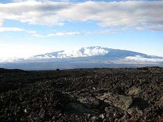
| ⦁ Polynesia | Mauna Kea, Hawaii, United States | 4207 m 13,802 ft |
Taieri Plains, South Island, New Zealand | −2 m −7 ft |
4209 m 13,809 ft |
| ⦁ Antarctica | Mount Vinson,[4] Antarctica | 4892 m 16,050 ft |
Southern Ocean | sea level | 4892 m 16,050 ft |
| Mount Everest[1] | 8848 m 29,029 ft |
Dead Sea[2] | −428 m −1,404 ft |
9,276 m 30,433 ft |
Table of elevation extremes by geographic zone
| Geographic zone | Highest point | Maximum elevation | Lowest point | Minimum elevation | Elevation span |
|---|---|---|---|---|---|
| Arctic | Gunnbjørn Fjeld, Greenland | 3700 m 12,139 ft |
Arctic Ocean | sea level | 3700 m 12,139 ft |
| North Temperate Zone | Mount Everest,[1] China and Nepal | 8848 m 29,029 ft |
Dead Sea,[2] Israel, Jordan, and Palestine | −428 m −1,404 ft |
9,276 m 30,433 ft |
| North Tropical Zone | Cayambe, Ecuador | 5790 m 18,996 ft |
Lake Assal,[3] Djibouti | −155 m −509 ft |
5945 m 19,505 ft |
| South Tropical Zone | Huáscarán, Peru | 6768 m 22,205 ft |
Bayóvar Depression, Peru | −34 m −112 ft |
6802 m 22,316 ft |
| South Temperate Zone | Aconcagua, Argentina | 6960 m 22,835 ft |
Laguna del Carbón, Argentina | −105 m −344 ft |
7065 m 23,179 ft |
| Antarctic | Mount Vinson,[4] Antarctica | 4892 m 16,050 ft |
Southern Ocean | sea level | 4892 m 16,050 ft |
Table of elevation extremes by geographic hemisphere
| Geographic hemisphere | Highest point | Maximum elevation | Lowest point | Minimum elevation | Elevation span |
|---|---|---|---|---|---|
| Northern Hemisphere | Mount Everest,[1] China and Nepal | 8848 m 29,029 ft |
Dead Sea,[2] Israel, Jordan, and Palestine | −428 m −1,404 ft |
9,276 m 30,433 ft |
| Southern Hemisphere | Aconcagua, Argentina | 6960 m 22,835 ft |
Laguna del Carbón, Argentina | −105 m −344 ft |
7065 m 23,179 ft |
| Eastern Hemisphere | Mount Everest,[1] China and Nepal | 8848 m 29,029 ft |
Dead Sea,[2] Israel, Jordan, and Palestine | −428 m −1,404 ft |
9,276 m 30,433 ft |
| Western Hemisphere | Aconcagua, Argentina | 6960 m 22,835 ft |
Laguna del Carbón, Argentina | −105 m −344 ft |
7065 m 23,179 ft |
Gallery
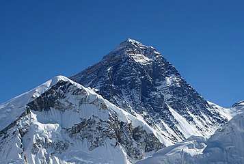 The summit of Mount Everest is the highest point on Earth.
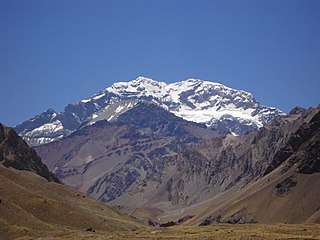
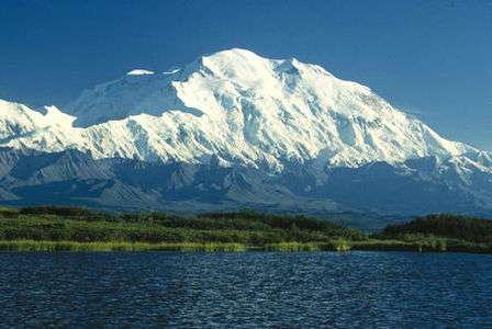 The summit of Denali is the highest point of the United States and North America.
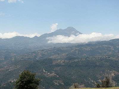
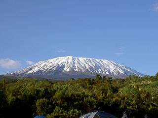 The summit of Kilimanjaro is the highest point of Tanzania and Africa.
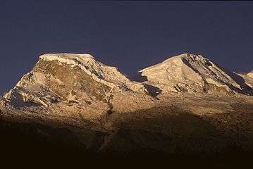
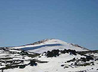
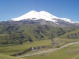 The summit of Mount Elbrus in Russia is the highest point of Europe.
.jpg)

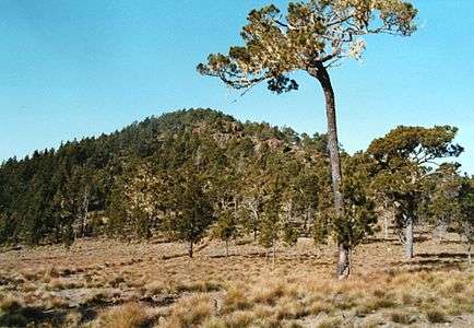 The summit of Pico Duarte on Hispaniola is the highest point in the Caribbean.
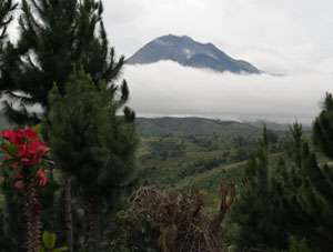
 The summit of Mount Kosciuszko is the highest point of Australia.
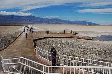 The Badwater Basin in Death Valley is the lowest point of the United States and North America.
 The Dead Sea is the lowest point on Earth.
See also
- List of elevation extremes by country
- Geodesy
- Category:Highest points
- Category:Lowest points
References
- 1 2 3 4 5 6 The summit of Mount Everest is the highest point on Earth.
- 1 2 3 4 5 6 The Dead Sea is the lowest point on Earth.
- 1 2 Lake Asal is the second-lowest depression on Earth.
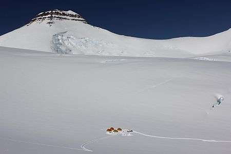
- 1 2 The summit of Mount Vinson is the sixth-most topographically isolated and the eighth-most topographically prominent point on Earth.
External links
| Branches |
| ||||||
|---|---|---|---|---|---|---|---|
| Techniques and tools | |||||||
| Institutions |
| ||||||
| Education |
| ||||||
| |||||||
This article is issued from
Wikipedia.
The text is licensed under Creative Commons - Attribution - Sharealike.
Additional terms may apply for the media files.