List of districts of Seoul
| Provincial-level subdivisions of South Korea |
|---|
| Provinces |
| North Chungcheong |
| South Chungcheong |
| Gangwon |
| Gyeonggi |
| North Gyeongsang |
| South Gyeongsang |
| Jeju |
| North Jeolla |
| South Jeolla |
| Cities |
| Busan |
| Daegu |
| Daejeon |
| Gwangju |
| Incheon |
| Sejong |
| Seoul |
| Ulsan |
The Districts (Gu) of Seoul are the twenty-five gu ("districts"; 구; 區) comprising Seoul, South Korea. The gu vary greatly in area (from 10 to 47 km²) and population (from less than 140,000 to 630,000). Songpa is the most populated, while Seocho has the largest area. Gu are similar to London's or New York's boroughs or Tokyo's 23 special wards, and a gu's government handles many of the functions that are handled by city governments in other jurisdictions. This city-like standing is underscored by the fact that each gu has its own legislative council, mayor and sister cities. Each gu is further divided into dong or neighborhoods. Some gu have only a few dong while others (like Jongno-gu) have a very large number of distinct neighborhoods.
List by population and area
2014 estimate by Seoul Statistics.[1][2][3]
| Name | Population | Area | Population density |
|---|---|---|---|
| Dobong-gu (도봉구; 道峰區) | 355,712 | 20.70 km² | 17184/km² |
| Dongdaemun-gu (동대문구; 東大門區) | 376,319 | 14.21 km² | 26483/km² |
| Dongjak-gu (동작구; 銅雀區) | 419,261 | 16.35 km² | 25643/km² |
| Eunpyeong-gu (은평구; 恩平區) | 503,243 | 29.70 km² | 16944/km² |
| Gangbuk-gu (강북구; 江北區) | 338,410 | 23.60 km² | 14339/km² |
| Gangdong-gu (강동구; 江東區) | 481,332 | 24.59 km² | 19574/km² |
| Gangnam-gu (강남구; 江南區) | 583,446 | 39.50 km² | 14771/km² |
| Gangseo-gu (강서구; 江西區) | 591,653 | 41.43 km² | 14281/km² |
| Geumcheon-gu (금천구; 衿川區) | 258,030 | 13.02 km² | 19818/km² |
| Guro-gu (구로구; 九老區) | 457,131 | 20.12 km² | 22720/km² |
| Gwanak-gu (관악구; 冠岳區) | 531,960 | 29.57 km² | 17990/km² |
| Gwangjin-gu (광진구; 廣津區) | 377,375 | 17.06 km² | 22120/km² |
| Jongno-gu (종로구; 鍾路區) | 165,344 | 23.91 km² | 6915/km² |
| Jung-gu (중구; 中區) | 136,227 | 9.96 km² | 13677/km² |
| Jungnang-gu (중랑구; 中浪區) | 423,411 | 18.50 km² | 22887/km² |
| Mapo-gu (마포구; 麻浦區) | 395,830 | 23.84 km² | 16604/km² |
| Nowon-gu (노원구; 蘆原區) | 586,056 | 35.44 km² | 16536/km² |
| Seocho-gu (서초구; 瑞草區) | 454,288 | 47.00 km² | 9666/km² |
| Seodaemun-gu (서대문구; 西大門區) | 320,861 | 17.61 km² | 18220/km² |
| Seongbuk-gu (성북구; 城北區) | 475,961 | 24.58 km² | 19364/km² |
| Seongdong-gu (성동구; 城東區) | 303,891 | 16.86 km² | 19364/km² |
| Songpa-gu (송파구; 松坡區) | 671,794 | 33.88 km² | 19829/km² |
| Yangcheon-gu (양천구; 陽川區) | 490,708 | 17.40 km² | 28202/km² |
| Yeongdeungpo-gu (영등포구; 永登浦區) | 421,436 | 24.53 km² | 17180/km² |
| Yongsan-gu (용산구; 龍山區) | 249,914 | 21.87 km² | 11427/km² |
| Seoul (서울) | 10,369,593 | 605.21 km² | 17134/km² |
General information
| Name | Dong | General Information | Points of Interest | Image | Location |
|---|---|---|---|---|---|
| Dobong-gu | Located in the North-East of the city, Dobong is a largely residential district, which has been part of Seoul since 1963. Located next to its namesake Dobongsan, the district is expected to benefit from urban development projects near Chang-dong station. |  |
 | ||
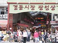
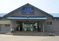
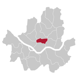
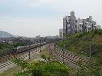
| Dongdaemun-gu | Despite its name (Large East Gate), Dongdaemun district does not include the East gate of Seoul, also known as Dongdaemun (and by its official name Heunginjimun. Incorportated into Seoul in 1936, the heart of the district is Cheongnyangni station, one of the main train stations in Seoul, built in 1911. |
|
 |
 | |
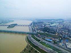
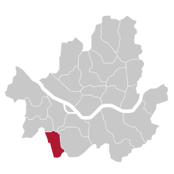
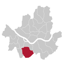
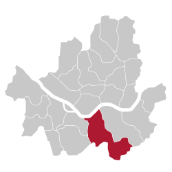
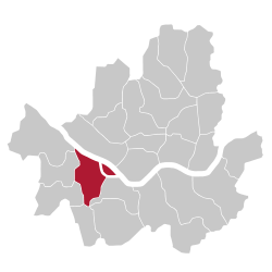
| Dongjak-gu | Located just south of the Han river, Dongjak-gu is mostly residential, but also includes the commercial Noryangjin area. The small Seodalsan mountain, where the Seoul National Cemetery is located, is located in the middle of the district. |
|
 |
 | |
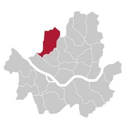
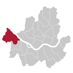
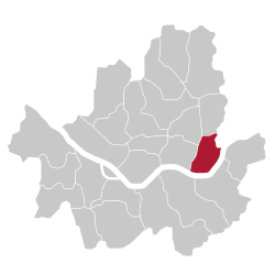
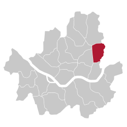
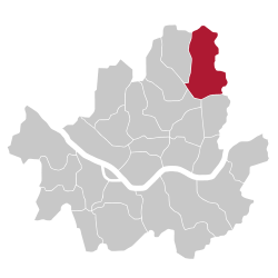
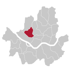
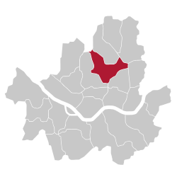
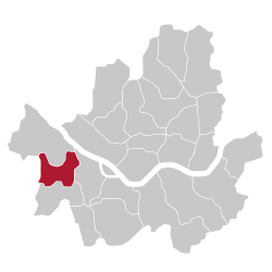
| Eunpyeong-gu | Separated administratively from Seodaemun-gu in 1977, Eunpyeong-gu is located just east of the city of Goyang, and despite being part of Seoul, is partly isolated from the rest of the city by a mountain range on its east side. |
|
 |
 | |
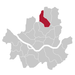
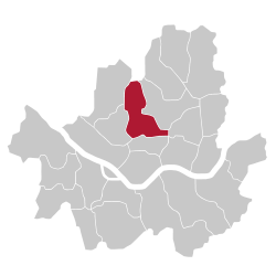
| Gangbuk-gu | Incorporated into Seoul in 1949, Gangbuk-gu is a separate district (from Seongbuk-gu) since 1995. The district is notorious for its proximity with Bukhansan, the tallest mountain near Seoul. The district is mostly residential, although the areas near Miasageori station and Suyu station are very active. |
|
 |
 | |
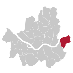
| Gangdong-gu |
|
 |
 | ||
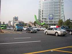
| Gangnam-gu |
|
 |
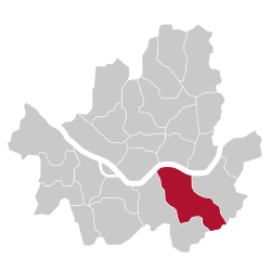 | ||
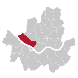
| Gangseo-gu |
|
|
 |
 | |
| Geumcheon-gu |  |
 | |||
| Guro-gu | 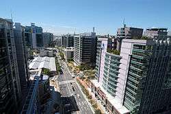 |
 | |||
| Gwanak-gu | Incorporated in 1963, and designated as a distinct district in 1973, Gwanak district is mostly residential, and gets its name from the nearby Gwanaksan mountain. Korea's best university, Seoul National University, is located in the district. | 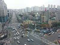 |
 | ||
| Gwangjin-gu |
|
 |
 | ||
| Jongno-gu |
|
 |
 | ||
| Jung-gu | Not subdivided into dongs |  |
 | ||
| Jungnang-gu |
|
 |
 | ||
| Mapo-gu |
|
|
 |
 | |
| Nowon-gu | 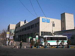 |
 | |||
| Seocho-gu |  |
 | |||
| Seodaemun-gu | 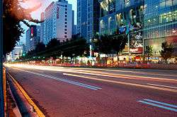 |
 | |||
| Seongbuk-gu | 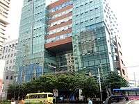 |
 | |||
| Seongdong-gu |  |
 | |||
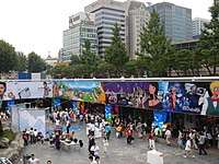
| Songpa-gu |
|
 |
 | ||
| Yangcheon-gu |
|
 |
 | ||
| Yeongdeungpo-gu |  |
 | |||
| Yongsan-gu | 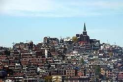 |
 |
See also

References
- ↑ "Area and Number of Administrative Units". Seoul Statistics. Retrieved October 13, 2015.
- ↑ "Administrative areas". Seoul Statistics. Retrieved October 13, 2015.
- ↑ "Seoul Metropolitan City". citypopulation.de. Retrieved October 13, 2015.