Gangbuk District
| Gangbuk 강북구 | |
|---|---|
| Autonomous District | |
| 강북구 · 江北區 | |
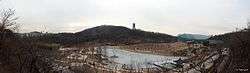 Dream Forest Park in Beon-dong | |
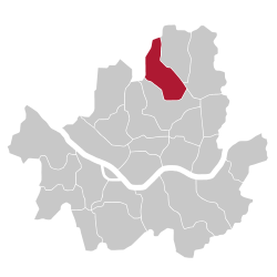 Location of Gangbuk-gu in Seoul | |
| Country | South Korea |
| Region | Sudogwon |
| Special City | Seoul |
| Administrative dong | 18 |
| Government | |
| • Mayor | Park Gyeom-su (박겸수) |
| Area | |
| • Total | 23.6 km2 (9.1 sq mi) |
| Population (2010[1]) | |
| • Total | 324,413 |
| • Density | 14,000/km2 (36,000/sq mi) |
| Time zone | UTC+9 (Korea Standard Time) |
| Postal code | 00000~01299 |
| Website | Gangbuk-gu official website |
Gangbuk District (Gangbuk-gu) is one of the 25 gu which make up the city of Seoul, South Korea. Its name is derived from the fact that it is located at the north of Han river. It was created from neighbouring Dobong District (도봉구) in 1995. The current mayor is Park Gyeom-su(박겸수).
Administrative divisions
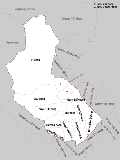
Administrative divisions
- Songjung-dong (송중동; 松中洞); Legal dong is Mia-dong
- Songcheon-dong (송천동; 松泉洞); Legal dong is Mia-dong
- Samgaksan-dong (삼각산동; 三角山洞); Legal dong is Mia-dong
- Samyang-dong (삼양동; 三陽洞); Legal dong is Mia-dong
- Mia-dong (미아동; 彌阿洞);[2] Legal dong is Mia-dong
- Beon-dong (번동; 樊洞); Legal dong is Beon-dong
- Suyu-dong (수유동; 水踰洞); Legal dong is Suyu-dong
- Insu-dong (인수동; 仁壽洞); Legal dong is Suyu-dong
- Ui-dong (우이동; 牛耳洞); Legal dong is Ui-dong
Transportation
Railroad
- (Dobong-gu) ← Suyu — Mia — Miasamgeori → (Seongbuk-gu)
Notable people
- Baek Shin-ji
- Gong Ju-yeong
- Lee Seung-gi
Sister cities
Domestic
International


References
- ↑ Korean Statistical Information Service (Korean) > Population and Household > Census Result (2010) > Population by Administrative district, Sex and Age / Alien by Administrative district and Sex, Retrieved 2010-06-02.
- ↑ "Administrative areas". Gangbuk-gu official site. Retrieved 2008-04-17.
External links
| Wikimedia Commons has media related to Gangbuk-gu, Seoul. |

Coordinates: 37°38′22.60″N 127°1′32.36″E / 37.6396111°N 127.0256556°E
This article is issued from
Wikipedia.
The text is licensed under Creative Commons - Attribution - Sharealike.
Additional terms may apply for the media files.