List of county roads in Ontario

This is a list of County Numbered roads in Ontario. These roads are found only in Southern and Southwestern Ontario (with the lone exception being Greater Sudbury, which is in Northern Ontario), and are listed alphabetically by county, because more than one county can sometimes have the same county road number without connecting across county lines.
By their nature, all county roads in Ontario are numbered, unless noted. This page lists all of the county/district/regional roads by their respective county, district, or regional municipality.
Some counties have been merged in the past, and are known as "United Counties". They will be treated and named as one county.
The county road network has been present for many years, but has only been signed with the flowerpot logos since the early 1970s or 1980s (depending on the area). The signs are usually black text on white, or in some counties are multi-coloured. Previously, the roads simply had road names, such as "Essex Road 42" or "Kent County Road 14", and so on, but had no shields to designate them.
County roads within still-extant counties are strictly rural routes that do not enter towns. However, within regional municipalities, the systems were expanded to follow major streets in the formerly separated cities, or were retained within originally-rural townships that were incorporated as cities following mass suburbanization.
In addition to County Roads, many townships also have Concession roads and Township Roads, such as Colchester South Road 3, and Concession 8. These do not have shields (only names on signs and maps). Some exceptions include former Highway 38 in Eastern Ontario, where the township name appears instead of the county as the township administers the road, or is not signed at all. Former Secondary Highway 620, downloaded to the Peterborough and Hastings County governments, was downloaded further to Wollaston Township (in Hastings County), with a posted sign appearing similar to an Ontario Tertiary Highway.
Glossary
- CR = County Road (or City Road, for those counties that have become City of <name> County, such as the City of Prince Edward County, Ontario)
- DR = District Road (only in Muskoka; similar routes in unincorporated districts are usually provincial Secondary or Tertiary Highways)
- MR = Municipal Road (for Separated Municipalities and Single-Tier Municipalities)
- RR = Regional Road (Not Rural Route)
- CH = County Highway - some counties have the same number designation for two or more County Routes, but some (like Durham RM and the City of Norfolk County) also list routes as County Highways (CR HWY/RR HWY/DR HWY), abbreviated as CH. These are designations for downloaded former provincial highways. A prime example is Durham RR 2, and Durham RR HWY 2.
Counties
Bruce County
Dufferin County
Elgin County
Essex County
Frontenac
Grey County

Haliburton County
Hastings County
Huron County
Lambton
Lanark
Leeds and Grenville
Lennox and Addington
Middlesex
Northumberland
Perth
Peterborough
Prescott and Russell United Counties
Renfrew
Simcoe


Stormont, Dundas and Glengarry United Counties
Wellington County
Regional/District Municipalities
Regional Municipality of Durham
Regional Municipality of Halton
District Municipality of Muskoka
Regional Municipality of Niagara
Oxford County
Regional Municipality of Peel


Regional Municipality of Waterloo
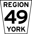
Regional Municipality of York
Single-tier municipalities
Brant
Chatham-Kent
Greater Sudbury
Haldimand County
Hamilton
Kawartha Lakes
Norfolk County
Ottawa
- Main Articles:
- List of numbered roads in Ottawa
- List of roads in Ottawa (includes non-numbered Ottawa roads)
Prince Edward County
References
External links
| County roads | |
|---|---|
| Regional roads | |
| Municipal roads | |
| See also | |